Cimarron River
The Cimarron River is a tributary of the Arkansas River in Oklahoma, United States. It flows 1,123 km through New Mexico, Oklahoma, Colorado, and Kansas. Through a winding route, it crosses in and out of several states. Along the way, it collects minerals and residue left by ancient oceans. Its name comes from the Spanish settlers, who called it Río de los Carneros Cimarrón, meaning River of the Wild Sheep. While the riverbed is dry for much of its flow and not navigable, the Cimarron has played a crucial role in the development of the western United States.
Geography Of The Cimarrón River

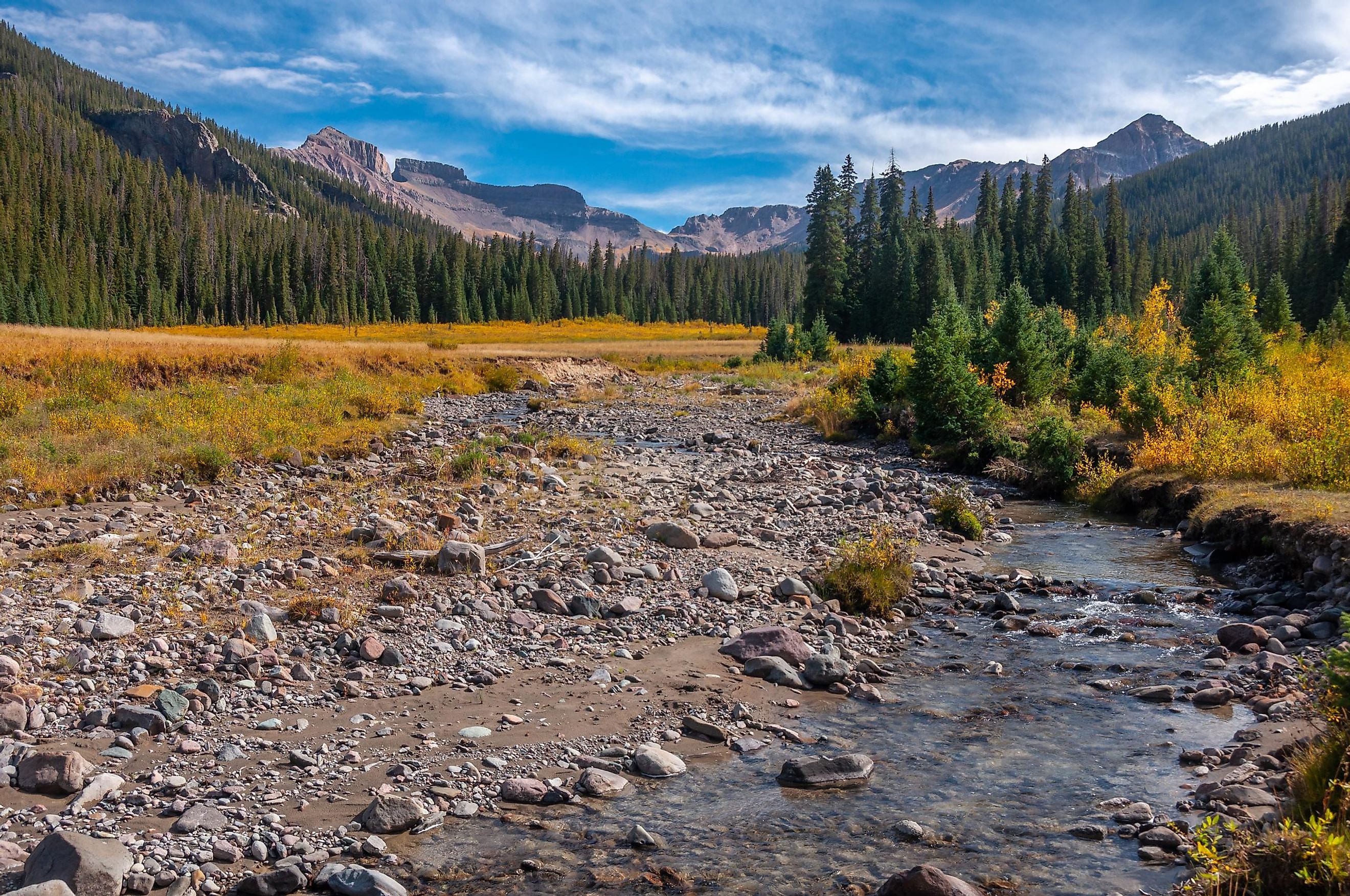
The river's headwaters are located in Johnson Mesa, west of Folsom, in northeastern New Mexico. It enters the Arkansas River in Oklahoma near the city of Tulsa. The main tributaries of the Cimarron River are North Fork Creek and Crooked Creek. The Cimarron flows east from New Mexico through the Oklahoma Panhandle, then turns north into Colorado. As it enters the southeastern corner of Colorado, it splits into two branches and dries for most of the year.
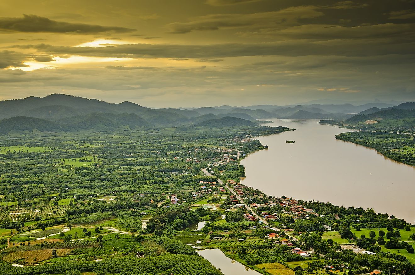
The river's waters dwindle and then disappear from view into springs that flow under the sands of the river bed. It typically runs wet during the spring and early summer and temporarily during occasional floods. The north and south forks of the river reunite in Grant County. From there, the riverbed turns east and slips back into Kansas, then southeast and back into Oklahoma. As it flows from Kansas, near Coldwater, back into Oklahoma, a permanent stream is re-established before emptying into the Arkansas River. As it merges with the Arkansas River, it creates Lake Keystone.
Climate
The climate through the region ranges from humid subtropical (towards the eastern end of its flow near Tulsa) to semi-arid towards its origins in New Mexico. Before the 20th century, the Cimarron River valley was broader and shallow, covered with grass. A number of floods through the early 1900s, including severe flooding in 1914, removed most of the grass cover. By 1939, it was largely barren sand dune. Through the High Plains region (Kansas), the climate of the Cimarron River and its valleys experiences low levels of precipitation overall, with hot summers and mild winters. Winds are strong throughout the year. The climate of the Oklahoma Panhandle can be harsh, with occasional blizzards as well as dust storms. The area was hard hit by the Dust Bowl years of the 1930s, and lost most of its human population due to outward migration.
Ecology
About 12,000 years ago, the last glaciers of the Ice Age retreated, digging out valleys and leaving an assortment of minerals throughout the region. The river flows through areas of red clay in New Mexico, leading to a red color. Historically, it was also called the Red Fork of the Arkansas River because of its color. The river's drainage basin is approximately 18,927 miles. In Oklahoma, the land the river flows through contains significant mineral deposits, along with salt plains and saline springs. The Cimarron brings those dissolved minerals into the Arkansas River.
Much of the Cimarron's route takes it through flat plains, natural grasslands that are home to prairie flowers, woods of blackjack and post oak, and wildlife such as prairie rattlesnake, pronghorn antelope, American bison, golden eagle, and others. Trout run through some of the permanent flow areas in Colorado and elsewhere, subject to water flow levels.
Due to run-off from human activities such as recreation and tourism along with agriculture, pollution is a serious issue in the 21st century.
Brief History

Prior to the arrival of Europeans in the mid-1500s, a number of different Native tribes inhabited the region where the Cimarron River flows, including the Wichita and Caddo. Their history can be traced via archaeological evidence dating back 30,000 years, during or just before the last Ice Age.
About 10,000 years ago, environmental conditions became similar to those experienced in modern Oklahoma and region. Hunter-gatherer societies thrived until temperatures rose to a point where it created extremely dry and hot conditions about 5,000 years ago. The Native populations thinned out and followed herds of bison and other food sources.
The region's population grew again once temperatures cooled approximately 4,000 years ago. The Native population was diversified and included trading groups and traditional hunters. Approximately 2,000 years ago, rainfall increased, leading to the development of agriculture that remains a staple of the region.
Historically, the river went by many names, including Salt River, Salt Fork, and Grand Saline. In 1541, Spaniard Francisco Vásquez de Coronado crossed the river on his way to and from Kansas. The Oklahoma Panhandle was Spanish territory until 1821 and became part of Mexico. Texas also claimed the area along with its independence. However, Texas relinquished the territory because slavery was prohibited in the Panhandle via the Missouri Compromise of 1820.
From the early to mid-1800s, there was friction between the settlers and Natives, including tribes displaced from the southeastern US. The Comanche attacked many of the stagecoaches. Major George Birch attempted to establish a fort near the river's mouth. Named Fort Arbuckle (or Camp Arbuckle), it was constructed in 1834 and served as a forward base for the Dodge-Leavenworth Expedition, an attempt by the military to negotiate with the Comanche and other southern Plains Indian tribes. However, the military abandoned the fort in 1851.
The Santa Fe Trail, a wagon trail from Missouri to Santa Fe, New Mexico, was a significant commercial route from 1820 to 1880. The Santa Fe Trail, along what was called the Cimarron Route, ran from Dodge City, Kansas, to Fort Union, New Mexico. The Trail crossed the Cimarron near Willowbar and, on some runs, used the dry riverbed for about 100 miles through southwestern Kansas. At the time, the Oklahoma Panhandle was known as the "Cimarron Cutoff." Once the Santa Fe railroad was completed in 1880, the wagon trail became obsolete.
In 1886, the Panhandle was declared public domain and subject to squatter's rights. After a few chaotic years where official land claims could not be legally made, the orphaned rectangle of land became part of Oklahoma in 1890.
Because the river is not suitable for travel by boat, no large communities are along its banks. The nearest include Guthrie and Cushing in Oklahoma, and Folsom, New Mexico. The main human activity in the area is agriculture and ranching, much as it was when settlers first began to farm the region in the 19th century.