Maps of Iowa
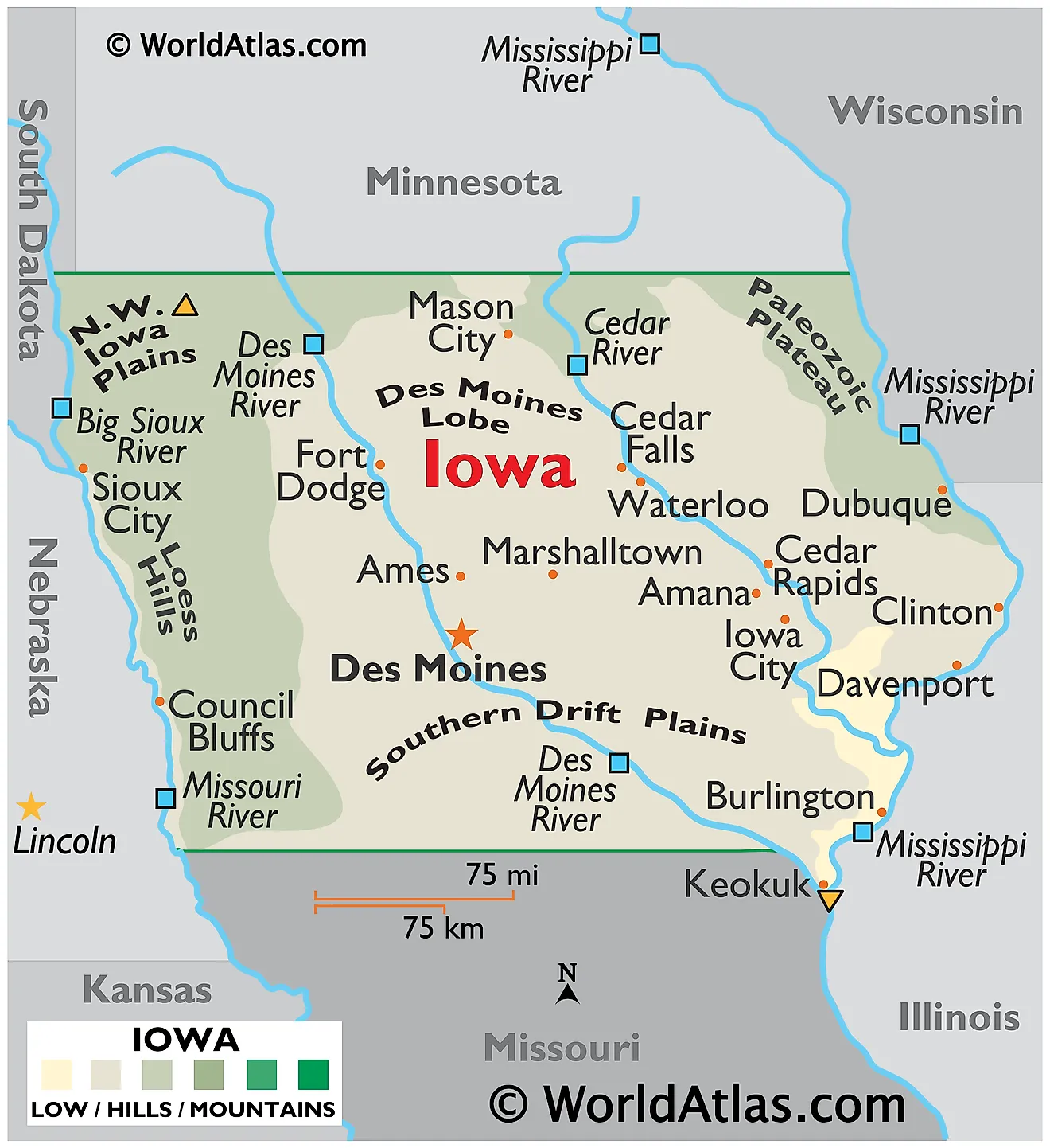
Iowa is a Midwestern state in the United States, framed by the Mississippi River to the east and the Missouri and Big Sioux rivers to the west. It shares its borders with Minnesota to the north, Missouri to the south, Nebraska and South Dakota to the west, and Illinois and Wisconsin to the east. The state spans a total area of about 56,273 square miles (145,746 square kilometers), making it the 26th largest state.

Iowa is the only state in the country whose eastern and western borders are both formed entirely by rivers. That framing is fitting, because water and ice made everything in between. Glaciers advanced across Iowa repeatedly over the past 2.5 million years, each one flattening the land and leaving behind a blanket of debris; winds off the melting ice piled silt into hills along the western edge; and rivers have been carving into all of it ever since. The state's reputation for flatness is only half-earned — the northeast corner was never glaciated at all and is genuinely rugged.
Where Is Iowa?
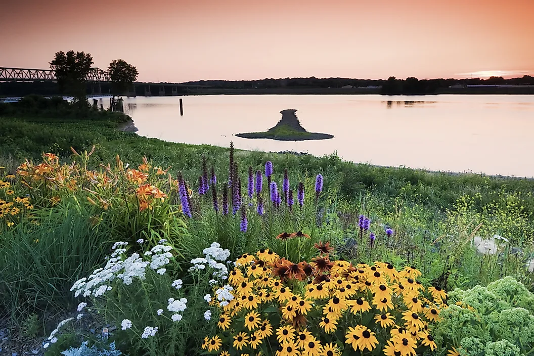
Iowa sits between the Mississippi and Missouri rivers in the upper Midwest, measuring about 310 miles east to west and 200 miles north to south. Its northern and southern boundaries are surveyed lines; everything east and west follows water.
The state's relief is gentle but not negligible. Elevations run from 1,670 feet in the northwest corner down to 480 feet where the Des Moines River meets the Mississippi in the far southeast — a fall of about 1,190 feet across the state. With roughly 3.24 million residents, Iowa is the 31st most populous state, and it is divided into 99 counties. Roughly 85% of its land is farmed, the highest proportion of any state.
The Northwest Iowa Plains

The Northwest Iowa Plains occupy the state's northwestern corner. The landscape is flat to gently rolling, built on glacial deposits far older than those to the east and capped with a thin layer of wind-blown loess. Streams have had longer to work here than on the younger surfaces nearby, giving the region a more evenly drained, open character.
This region — not the Paleozoic Plateau in the northeast — contains Iowa's highest point. Hawkeye Point, in Osceola County about 4.5 miles north of Sibley and only 3.5 miles from the Minnesota line, reaches 1,670 feet (509 meters). It is a rise in a former farm field rather than a hill, with a prominence of just 40 feet, and ranks 42nd among the 50 state high points.
Iowans long believed the high point was nearby Ocheyedan Mound, a genuine glacial hill at 1,655 feet that looks far more like a summit. Surveyors settled the question in 1971 when they found Hawkeye Point 15 feet higher.
The Des Moines Lobe

The Des Moines Lobe is a tongue of land extending down through north-central Iowa nearly to the capital, and it is by far the state's youngest landscape. The last glacier to reach Iowa pushed into this area only about 15,000 years ago and withdrew roughly 12,000 years ago — so recently that streams have not yet had time to organise into proper drainage networks.
The result is a knobby, poorly drained surface pocked with thousands of shallow depressions known as prairie potholes, formed where buried blocks of ice melted out of the till. Before settlement these wetlands covered vast areas; most were tiled and drained for agriculture, but enough survive to make the region a critical stopover on the continental waterfowl flyway.

At the lobe's northern end lie the Iowa Great Lakes, a cluster of deep glacial lakes including Spirit Lake, West Okoboji, and East Okoboji — the only natural lakes of real size in the state.
The Paleozoic Plateau

Northeastern Iowa is the exception to everything else in the state. Known as the Paleozoic Plateau and forming part of the wider Driftless Area shared with Wisconsin, Minnesota, and Illinois, it was bypassed by the most recent glaciations and never received the smoothing blanket of drift that flattened the rest of Iowa.
What remains is a deeply dissected landscape of limestone and dolomite bluffs, narrow valleys, rock outcrops, and cold spring-fed trout streams — terrain that looks nothing like the popular image of Iowa. The soluble bedrock has produced extensive karst: caves, sinkholes, and disappearing streams.

The region also shelters algific talus slopes — north-facing hillsides where cold air vents from ice-filled fissures below, keeping the ground near freezing through summer. These pockets preserve plants and animals left over from the Ice Age, including the Iowa Pleistocene snail, found nowhere else on earth. Effigy Mounds National Monument and Pikes Peak State Park sit atop the bluffs here, several hundred feet above the Mississippi.
The Iowan Surface and Eastern Drift Plains

Between the Des Moines Lobe and the Paleozoic Plateau lies a broad, gently rolling expanse sometimes called the East-Central Iowa Drift Plain or the Iowan Surface. Its distinctive feature is what geologists call erosion surfaces: during intensely cold periods, repeated freezing and thawing stripped away the hilltops and left long, low slopes with scattered boulders — glacial erratics — strewn across them.
Within this belt, the Iowa-Cedar Lowland forms a flat corridor along the Iowa and Cedar rivers, floored with sand and gravel washed out from melting ice. Its alluvial soils and level ground make it some of the most productive farmland in a state full of it. Maquoketa Caves State Park, on the eastern margin, has the largest concentration of caves of any Iowa state park.
The Southern Iowa Drift Plain

The Southern Iowa Drift Plain is the state's largest region, covering most of the southern half. Its glacial deposits are ancient — laid down more than 500,000 years ago — which means streams have had an enormous span of time to cut into them.
The result is the steepest rolling topography in Iowa outside the northeast: a dense network of branching valleys separated by narrow ridges, with only remnants of the original flat upland surviving between them. Slopes here are too steep for row crops in many places, so the region carries more pasture, hay, and woodland than the rest of the state.
The Loess Hills

Running as a narrow band along Iowa's western edge, roughly 200 miles from the Missouri border north into South Dakota, the Loess Hills are the state's most unusual landform. They are built entirely of loess — fine silt ground up beneath the glaciers, carried down the Missouri valley as meltwater outwash, and then blown into dunes by prevailing winds during the Ice Age.
Loess has a peculiar property: it holds near-vertical faces when cut. That gives the hills their sharp ridgelines, steep bluffs, and intricately branched side gullies. Deposits here exceed 200 feet (60 meters) in places, and only one other region on earth — the Loess Plateau of central China — has loess piled this deep.

Because the dry, steep, south-facing slopes are hostile to trees, the hills retain remnants of dry prairie with yucca and other species more typical of the Great Plains hundreds of miles west.
The River Alluvial Plains

Two flat floodplains bracket the state. The Missouri River Alluvial Plain along the western border is the flattest ground in Iowa, a strip of deep silt and sand up to several miles wide. Before channelisation in the mid-20th century, the Missouri wandered freely across it, and the oxbow lakes left behind — including Iowa's largest, Blue Lake — mark abandoned meanders.
On the eastern side, the Mississippi River Alluvial Plain is narrower, hemmed in by bluffs for much of its length. Its backwaters, sloughs, and islands form part of the Upper Mississippi River National Wildlife and Fish Refuge, one of the most heavily used migration corridors in North America. Iowa's lowest point, 480 feet, lies at the southern end of this plain in Lee County.
Rivers and Lakes

Iowa is split by a drainage divide running roughly northwest to southeast. About three-quarters of the state drains east to the Mississippi; the remainder drains west to the Missouri.
The Des Moines River is the longest river within Iowa, running about 525 miles from Minnesota to the Mississippi at Keokuk. The Cedar, Iowa, Wapsipinicon, Turkey, Maquoketa, and Skunk also flow southeast to the Mississippi, while the Little Sioux, Boyer, Nishnabotna, and Big Sioux drain west to the Missouri.

Natural lakes are confined almost entirely to the Des Moines Lobe. Spirit Lake, at about 5,684 acres, is the largest natural lake in the state; West Okoboji, at roughly 136 feet, is the deepest and is often cited as one of only a handful of true blue-water lakes in the world. Elsewhere, the major water bodies are reservoirs — Rathbun, Red Rock, Coralville, and Saylorville — built for flood control on the interior rivers.
Climate

Iowa has a humid continental climate with hot summers and cold winters, and it sits squarely in the middle of the continent with no mountains or oceans nearby to moderate anything. Cold Canadian air, warm Gulf moisture, and dry air from the plains all reach the state freely, which produces both wide temperature swings and volatile storms.
Precipitation falls off sharply from southeast to northwest, from about 38 inches a year in the southeast corner to under 26 inches in the northwest. Most arrives in the growing season, which is what makes Iowa's agriculture possible without irrigation.
The state lies within the northern reach of Tornado Alley and averages roughly 50 tornadoes a year. Flooding along the interior rivers is the other recurring hazard, most severely in 1993 and 2008.
Iowa Geography at a Glance
| Feature | Detail |
|---|---|
| Total area | Approx. 56,273 sq mi (145,746 sq km) — 26th largest state |
| Dimensions | Approx. 310 mi east-west; 200 mi north-south |
| Highest point | Hawkeye Point, 1,670 ft (509 m) — Osceola County, northwest Iowa |
| Lowest point | Mississippi-Des Moines confluence, 480 ft, Lee County |
| Bordering states | Six: Minnesota, Wisconsin, Illinois, Missouri, Nebraska, South Dakota |
| Borders | Only state with both east and west borders formed entirely by rivers |
| Landform regions | Nine, including the unglaciated Paleozoic Plateau and the Loess Hills |
| Longest river in state | Des Moines River, approx. 525 mi |
| Largest natural lake | Spirit Lake, approx. 5,684 acres |
| Farmland | About 85% of the state — highest share in the nation |
| Counties | 99 |
Counties Map
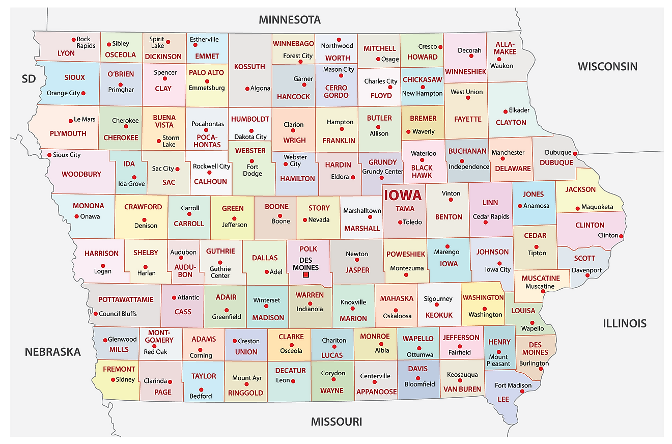
The State of Iowa is divided into 99 counties. In alphabetical order, these counties are: Adair, Adams, Allamakee, Appanoose, Audubon, Benton, Black Hawk, Boone, Bremer, Buchanan, Buena Vista, Butler, Calhoun, Carroll, Cass, Cedar, Cerro Gordo, Cherokee, Chickasaw, Clarke, Clay, Clayton, Clinton, Crawford, Dallas, Davis, Decatur, Delaware, Des Moines, Dickinson, Dubuque, Emmet, Fayette, Floyd, Franklin, Fremont, Greene, Grundy, Guthrie, Hamilton, Hancock, Hardin, Harrison, Henry, Howard, Humboldt, Ida, Iowa, Jackson, Jasper, Jefferson, Johnson, Jones, Keokuk, Kossuth, Lee, Linn, Louisa, Lucas, Lyon, Madison, Mahaska, Marion, Marshall, Mills, Mitchell, Monona, Monroe, Montgomery, Muscatine, O'Brien, Osceola, Page, Palo Alto, Plymouth, Pocahontas, Polk, Pottawattamie, Poweshiek, Ringgold, Sac, Scott, Shelby, Sioux, Story, Tama, Taylor, Union, Van Buren, Wapello, Warren, Washington, Wayne, Webster, Winnebago, Winneshiek, Woodbury, Worth, and Wright.
With an area of 145,746 sq. km, Iowa is the 26th largest and the 32nd most populous state in the USA. Located in the central part of the state, at the confluence of the Des Moines and Raccoon Rivers, is Des Moines – the capital and most populous city of Iowa. The city serves as a major transportation and communication hub and is home to numerous insurance and financial services companies, making it one of the largest insurance centers in the United States.
Where is Iowa?
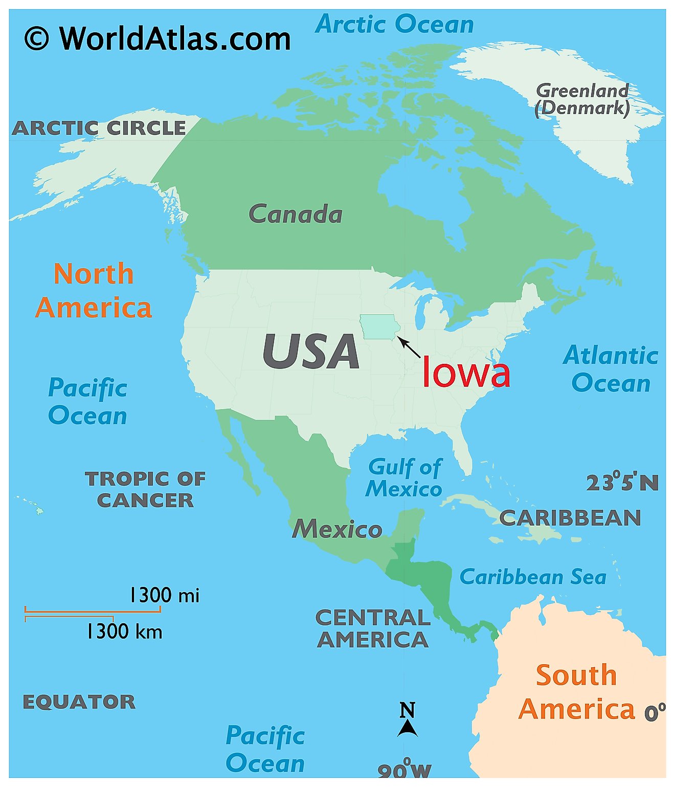
The State of Iowa is located in the north-central (Midwest) region of the United States. Iowa is bordered by the state of Minnesota in the north; by Wisconsin in the northeast; by Illinois in the east and southeast; by Missouri in the south; by Nebraska in the west and by South Dakota in the northwest. It is also bounded by the Mississippi River in the east and the Missouri River along with its tributary – the Big Sioux River in the west.
Regional Maps: Map of North America
Outline Map of Iowa
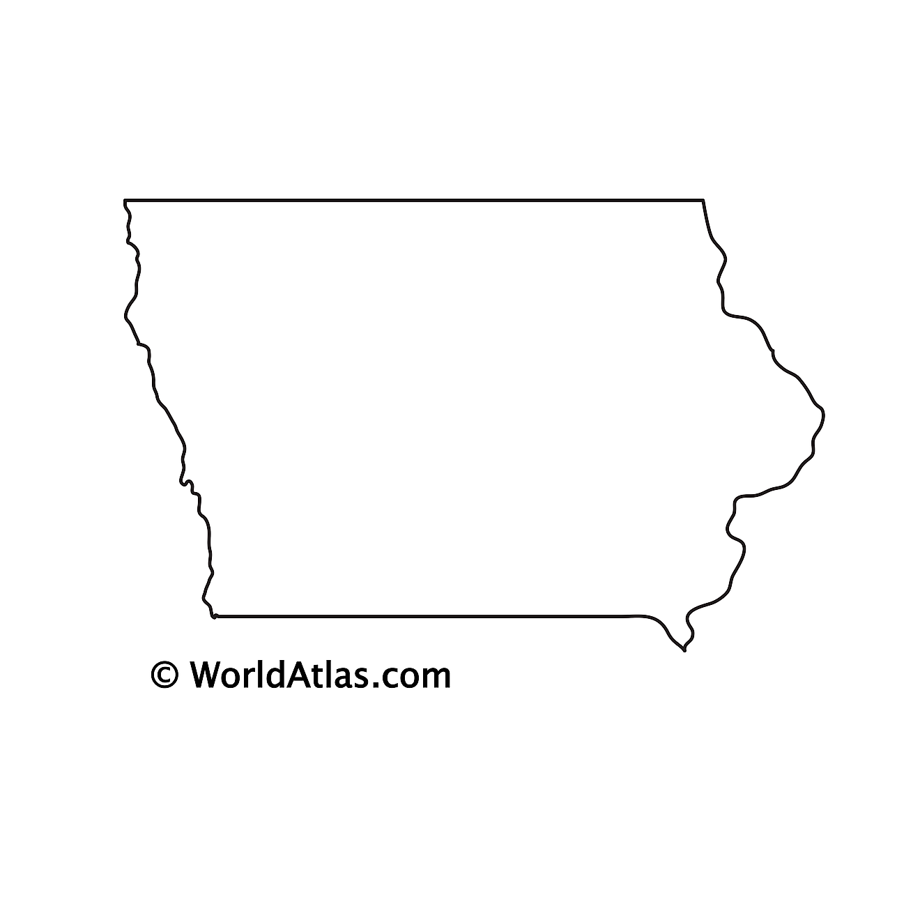
The above blank map represents the State of Iowa, located in the north-central (Midwest) region of the United States. The above map can be downloaded, printed and used for geography education purposes like map-pointing and coloring activities.
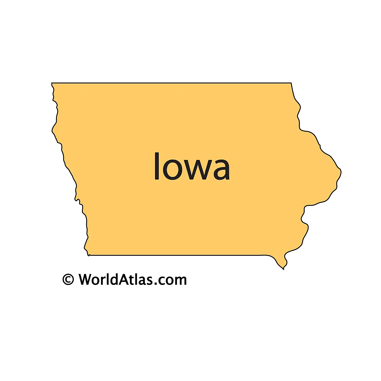
The above outline map represents the State of Iowa, located in the north-central (Midwest) region of the United States. It is the only state in the U.S. that has two parallel rivers (Mississippi and Missouri) delineating its borders.
Key Facts
| Legal Name | State of Iowa |
|---|---|
| ISO 3166 Code | US-IA |
| Capital City | Des Moines |
| Largest City |
Des Moines (566,004) |
This page was last updated on September 19, 2026