Maps of Alaska

Alaska, nicknamed, “The Last Frontier”, is a non-contiguous US state located in the extreme northwest of North America. It has a northern coastline along the Beaufort Sea and Arctic Ocean, a southern coastline bordering the Gulf of Alaska and Pacific Ocean, a western coastline along the Bering Sea, and a northwestern coastline facing the Chukchi Sea. It also borders Canada’s British Columbia Province and Yukon Territory to the east.
Alaska’s capital is Juneau, located in the southeast, on the Alaskan panhandle. The most populous city, however, is Anchorage, in the south-central part of the state, with a population of a little over 290,000 residents.
Settlements in Alaska date back to around 14,000 BCE, when hunter-gatherers arrived in what is now the western part of the state from the Bering Land Bridge. The United States purchased the Alaska territory from Russia in the Alaska Treaty of 1867. However, it did not become a US state until 1959.
Area
With a total land area of 665,384 square miles (1,723,337 square kilometers), Alaska is the largest US state. It surpasses the combined size of the next three largest states—Texas, California, and Montana. Compared to other countries, Alaska is roughly three times larger than France and five times larger than Germany.
Bodies of Water
Alaska has over 12,000 rivers throughout the state, totaling around 365,000 miles (587,411 kilometers). Its rivers are fed by both glacial and non-glacial tributaries, creating a network of water connections across the Boreal Forest region. The major rivers include the Yukon River, which flows from Canada’s Yukon Territory in the east and empties into the Bering Sea in the west, and the Kuskokwim River, slightly south of the Yukon, emptying into Kuskokwim Bay. Iliamna Lake, in the southwest, is the state’s largest body of freshwater, spanning 1,600 square miles (2,590 square kilometers).
Geographic Regions
Alaska can be divided into five distinct physical regions, categorized as the Far North, Interior, Southwest, South Central, and Southeast.
Far North
North of the Yukon River, the Far North includes the Brooks Range, Arctic Circle, and Alaska’s north slope. Due to the extreme arctic tundra climate, the land is sparsely populated, largely only by Inupiaq, Athabascan, and Nunamiut native villages. This area is abundant in parklands, including Gates of the Arctic National Park, Kobuk Valley National Park, and Noatak National Preserve.
Interior
Like the Far North, the Interior region is mostly wilderness and sparsely populated, bordered by the Brooks Mountains to the north and the Alaska Range to the south. The Yukon River runs through this vast area, which is also home to North America's highest peak, Denali, standing at 20,310 feet (6,190 meters) above sea level. Fairbanks, the state's second-largest city, is located in the northern part of the region.
Southwest
The southwest region varies considerably in landscape, from gentle grasslands on the Aleutian islands to volcanic terrain in Katmai National Park. Popular natural tourism spots include the McNeil River State Game Sanctuary, which can see over 100 bears visit its area each day, and the Pribilof Islands to the north of the Aleutian islands, known for bird and seal watching.
Southcentral
Sitting in the south, between the Aleutian Islands and the Alaskan panhandle, Alaska’s southcentral region is the most populated part of the state. It is home to over half its residents, including the most populated city, Anchorage. It is filled with fjords, glaciers, lakes, salmon streams, and clamming beaches.
Southeast
The southeast region consists of the Alaskan panhandle, with a milder maritime climate. Carved by glaciers, this area features deep fjords, snow-capped mountains, and heavily forested islands. A large part of this region is the Tongass National Forest, a massive rainforest spanning 16.8 million acres.
Alaska's Northern Lights
The Northern Lights, or Aurora Borealis, are visible across much of Alaska, especially from late August to late April. The northern regions, including the Far North and the Interior near the Arctic Circle, offer the best viewing spots, with Fairbanks being one of the top cities to experience them. Alternatively, in the Southcentral region, scenic viewing locations include Talkeetna, the Mat-Su Valley, and Anchorage.
Counties Map
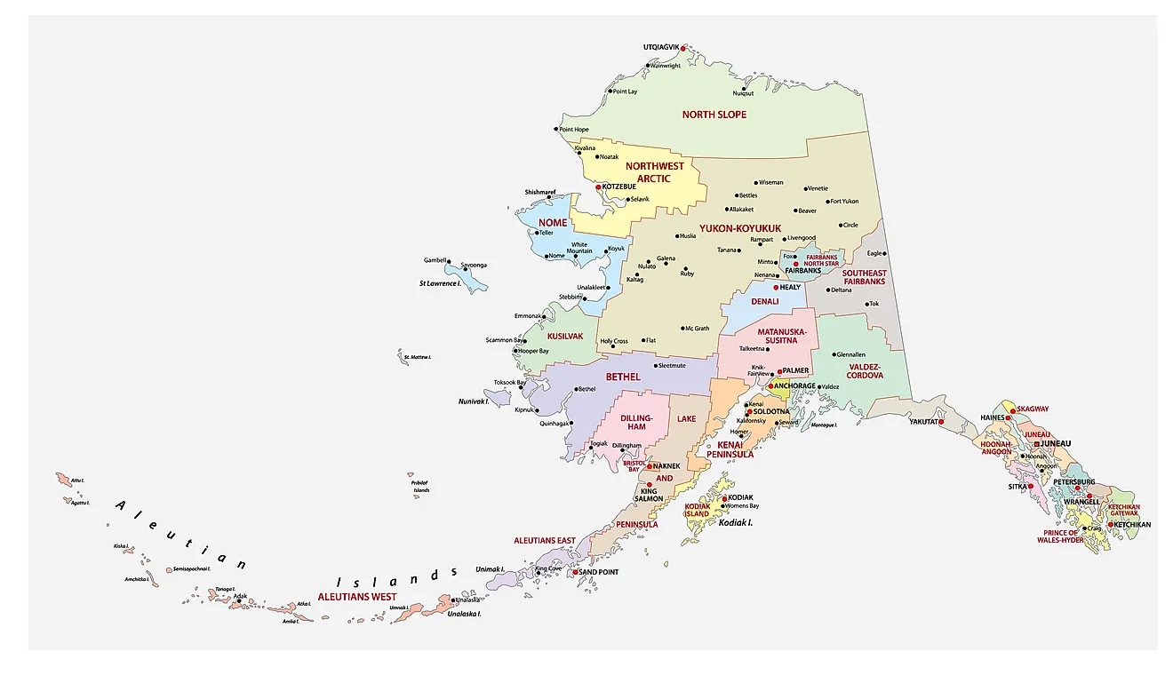
The State of Alaska is divided into 29 counties. In alphabetical order, these counties are: Aleutians East, Aleutians West, Anchorage, Bethel, Bristol Bay, Denali, Dillingham, Fairbanks North Star, Haines, Hoonah Angoon, Juneau, Kenai Peninsula, Ketchikan Gateway, Kodiak Island, Lake and Peninsula, Matanuska Susitna, Nome, North Slope, Northwest Arctic, Petersburg, Prince of Wales Hyder, Sitka, Skagway, Southeast Fairbanks, Valdez Cordova, Wade Hampton, Wrangell, Yakutat, and Yukon Koyukuk.
With an area of 1,717,856 sq. km, Alaska is the largest and the 3rd least populous state in the USA. Located in the extreme southeastern part of the state, at the base of Mount Juneau on the Gastineau Channel is Juneau – the capital city of Alaska. Government services, tourism, and the fishing industry are some of the main contributors to the economy of the capital city. Situated on a peninsula in the south-central part of the state is Anchorage – the largest and the most populous city in Alaska. It also serves as the major commercial and economic center of the state.
Where is Alaska?

The State of Alaska is located in the far northwestern corner of the continent of North America. Alaska is bordered by the Beaufort Sea and the Arctic Ocean in the north; by the Canadian province of British Columbia and the Yukon territory in the east and southeast; by the Gulf of Alaska and the Pacific Ocean in the south and southwest; by Russia (Chukotka Autonomous Okrug), the Bering Sea and Bering Strait in the west and by the Chukchi Sea in the northwest.
Regional Maps: Map of North America
Outline Map of Alaska
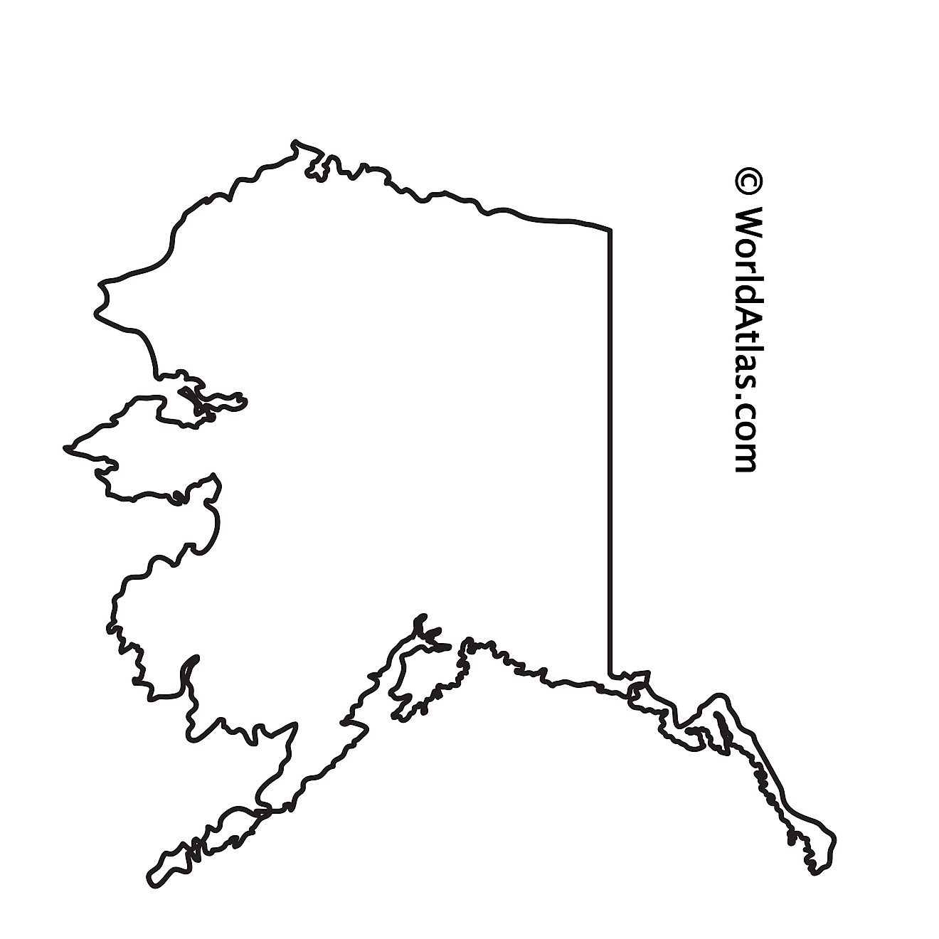
The above blank map represents the State of Alaska, located in the far northwestern corner of the continent of North America. The above map can be downloaded, printed and used for geography education purposes like map-pointing and coloring activities.

The above outline map represents the State of Alaska, located in the far northwestern corner of the continent of North America.
Key Facts
| Legal Name | State of Alaska |
|---|---|
| ISO 3166 Code | US-AK |
| Capital City | Juneau |
This page was last updated on September 18, 2024
