Where Is The Brooks Range?
The Brooks Range is a mountain range in the northern part of North America. The mountain stretches about 700 miles from east to west, across the northern portion of the US state of Alaska and into Canada's Yukon Territory. Additionally, the Brooks Range is situated entirely within the Arctic Circle and is considered the highest mountain range in the polar circle. The range is separated from the Alaska Range tablelands and plains of the Porcupine and Alaska river systems. The range has a maximum width of 200 miles, and its highest point, Moiunt Isto, has an elevation of 8,976 ft.
Naming
The Brooks Range was named in 1925 by the United States Board on Geographic Names (BNG) in honor of American geologist Alfred Hulse Brooks, who served as the United States Geological Survey's (USGS) geologist for Alaska during the early part of the twentieth century. The range is estimated to be 126 million years old, and the Canadian portion of the range is officially referred to as the British Mountains.
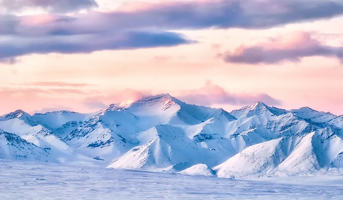
Highest Peaks
The Brooks Range is considered the highest range in the Arctic Circle. Its western peaks have an average elevation of 3,000 ft, while the eastern and central peaks have average elevations of 5,000 ft. The highest peaks, which reach elevations of nearly 9,000 ft, and are primarily located near the Alaska-Yukon border.
Mount Isto is the highest peak in the Brooks Range, which has an elevation of 8,975 ft and is located in the eastern side of the range, about 5 miles from Mount Hubley, the second-tallest peak, which has an elevation of 8,914 ft. The range contains three other peaks with elevations greater than 8,000 ft: Mount Chamberlin (8,898 ft), Mount Michelson (8,855 ft), and Mount Igikpak (8,276 ft).
Other notable peaks include the Gates of Kiev (7,775 ft), which is also the highest peak in the central portion of the range, Mount Doonerak (7,457 ft), and Cockedhat Mountain (7,410 ft).
Ecology
The Brooks Range forms North America’s extreme northern drainage divide, separating the drainage basin that feeds into the Arctic Ocean from the basin that feeds into the North Pacific. It slightly delineates the summer position of the Arctic front and represents the northern extent of the tree line. Tree species that grow in the northern part of the range include the white spruce and trembling aspen, although they are confined to areas impacted by human activity, while the southern slopes are covered by black spruce.
The mountains provide undisturbed habitats and protect some of the richest and most ecologically diversified wilderness areas in the world. For example, the area serves as a habitat for more than 200 bird species and roughly 35 species of land mammals, including wolves, wolverines, musk oxen, and bears.
Notable parks within the Brooks Range include Kobuk Valley National Park, Noatak National Reserve, and Ivvavik National Park.
Petroleum Reserves
The Prudhoe Bay area, located at the northern base of the Brooks Range, contains significant oil reserves, as well as the National Petroleum Reserve of Alaska, which encompasses an area of about 36,500 square miles in western and northern Alaska. The range is crossed by the Trans-Alaska Pipeline at Atigun Pass, which carries oil from Prudhoe Bay to a terminal in Valdez, Alaska.
The Arctic National Wildlife Refuge also contains large reserves of oil, and has become a source of conflict between proponents of oil drilling and environmentalists.


