7 Most Scenic Drives in The Maritimes
The Maritimes region is especially well-suited for scenic drives, with Bay of Fundy tides and Prince Edward Island’s red cliffs making every route feel charming. One drive might trace the coastline below the Skyline Trail on Cape Breton, while another leads toward the red shores and lighthouses of eastern Prince Edward Island. Several scenic routes have been officially designated to highlight the landscapes that make Nova Scotia, New Brunswick, and Prince Edward Island so memorable, turning some of the region’s best coastal scenery into unforgettable drives.
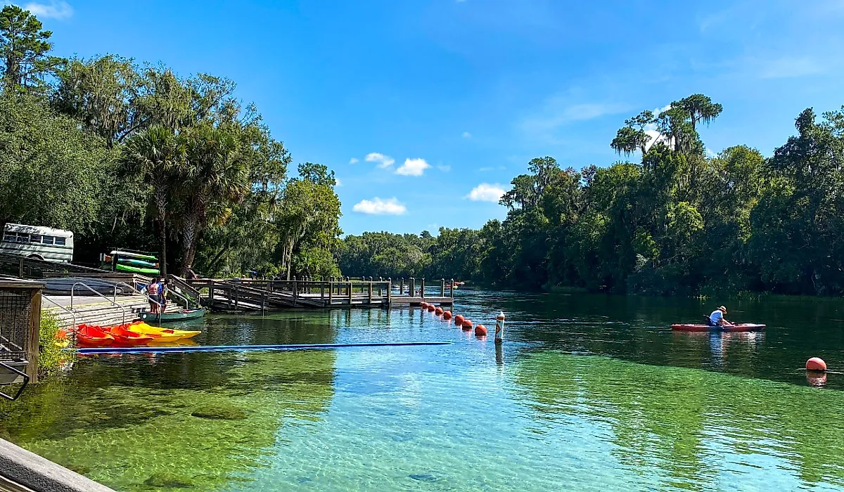
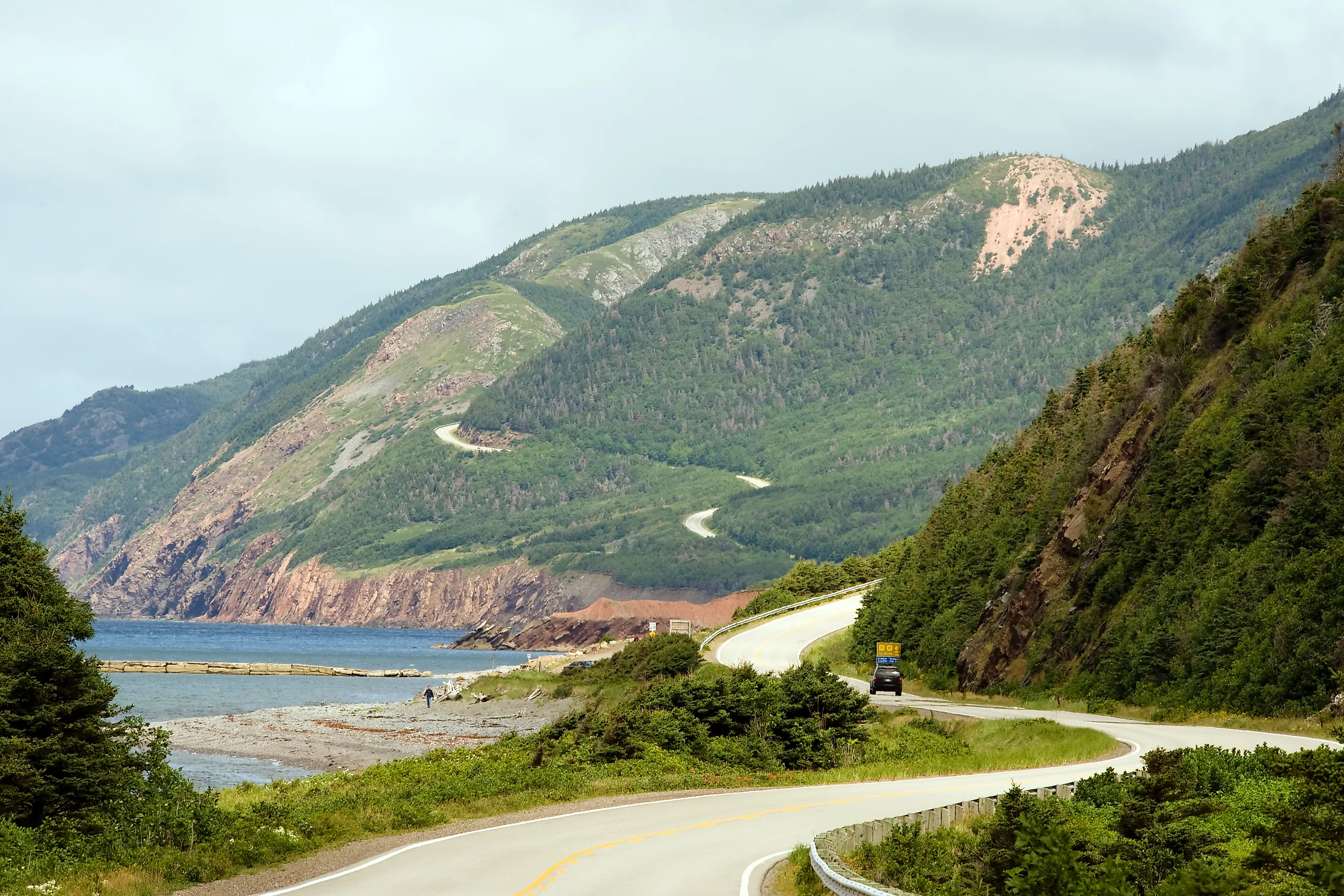
Cabot Trail

Looping around the northern edge of Cape Breton Island, the 298-kilometre Cabot Trail remains one of Canada's most recognizable scenic drives. Driving the full loop without extended stops typically takes five to six hours.
The route passes through Cape Breton Highlands National Park, where the road climbs along the highlands before descending toward the sea. In several places, the highway curves along steep slopes overlooking the Gulf of St. Lawrence, with long coastal views unfolding directly from the roadside.
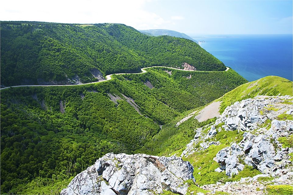
One of the most photographed viewpoints is near the Skyline Trail, where the road can be seen tracing the coastline far below the cliffs. Further north near Pleasant Bay, the mountains recede, and the coastline opens into broad ocean views. Around Cape North, the route passes rugged headlands and forested hills before bending south again along the eastern side of the island. Autumn is widely considered the best time to drive the Cabot Trail, when forests across Cape Breton Island turn deep red and gold.
Travellers should plan ahead before starting the drive. Sections of the Cabot Trail pass through remote parts of Cape Breton Highlands National Park, where mobile service can be limited or unavailable. Gas stations are not frequent along the northern portion of the route, so filling up whenever fuel is available in communities like Baddeck, Cheticamp, or Ingonish is recommended.
Acadian Coastal Drive

Stretching more than 700 kilometres along the eastern coastline of New Brunswick, the Acadian Coastal Drive follows Route 11. The full drive takes roughly eight to nine hours, tracing the Gulf of St. Lawrence through communities shaped by Acadian culture and fishing traditions.
Unlike cliff-lined coastal routes elsewhere in the Maritimes, this drive is defined by open shoreline. Long beaches and low dunes appear repeatedly along the highway, especially around Caraquet, Shippagan, and the northern reaches of Miscou Island. Fishing boats and small harbours line much of the coast, and the road often stays within sight of the water.
Near the northern end of the drive, the road crosses onto Miscou Island, where the Miscou Island Lighthouse stands beside wide coastal marshes facing the gulf. The surrounding landscape is flat and exposed, giving travellers uninterrupted views across the ocean horizon.
Further south, the highway passes the coastal ecosystems of Kouchibouguac National Park, where dunes and barrier islands stretch along the shoreline. Summer offers the most stable conditions for the Acadian Coastal Drive, when the weather along the Gulf of St. Lawrence is generally calm, and coastal towns along the route are fully active.
Fundy Coastal Drive

Following Route 114, Route 111, and sections of the Fundy Trail Provincial Park, the Fundy Coastal Drive runs roughly 460 kilometres between St. Stephen and Sackville in southern New Brunswick. The drive typically takes about seven hours, and its defining feature is the Bay of Fundy’s dramatic tidal range, the highest on Earth. At low tide, enormous tidal flats stretch across the shoreline, while only hours later, the ocean returns and fills the same areas with fast-moving water.
One of the most recognizable landmarks along the drive is Hopewell Rocks, where tall sea stacks rise from the ocean floor. Often called flowerpot rocks, these formations can be seen from viewpoints above the bay, while nearby access points allow visitors to walk along the seabed when the tide is out.
Later in the drive, the route enters Fundy National Park, where forested hills slope toward the coastline. Elevated sections of the Fundy Trail Provincial Park reveal wide views of the bay and rugged shoreline below. Late spring through early autumn offers the clearest conditions for driving the Fundy Coastal Drive, when fog is less common and coastal views across the bay are most visible.
Lighthouse Route

Running along Highway 3 between Halifax and Yarmouth, the Lighthouse Route traces roughly 300 kilometres of Nova Scotia’s South Shore. The drive takes about five hours, and in many sections, the highway runs close to the water, where the Atlantic Ocean meets exposed rock and sheltered coves. Fishing villages appear frequently along the route, marked by wooden wharves and colourful houses facing the harbour.
One of the best-known stops along the drive is Peggy’s Cove, where the Peggy’s Point Lighthouse stands on smooth granite slabs overlooking the open ocean. Waves regularly break across the rock surface below, and the surrounding coastline stretches into low rocky headlands.
Further southwest, the road descends toward Old Town Lunenburg, a historic port town and UNESCO World Heritage Site. Its harbour, lined with brightly painted buildings and tall ships, comes into view as the road curves toward the waterfront. Clear summer and early autumn days offer the best visibility along the Lighthouse Route, when Atlantic views are often uninterrupted.
Points East Coastal Drive

On Prince Edward Island, the Points East Coastal Drive loops through the eastern side of the province along Route 6, Route 16, and connecting coastal roads. Beginning near Charlottetown, the drive heads east toward East Point before looping back through the island’s eastern shore. This route highlights the distinctive geology of Prince Edward Island, where red sandstone cliffs rise above beaches, and farmland stretches inland. The contrast between the island’s red soil and the blue waters of the Gulf of St. Lawrence stands out along exposed coastal stretches near Souris and Basin Head.
At the eastern tip of the island, the road reaches East Point, where East Point Lighthouse marks the meeting of the Gulf of St. Lawrence and the Northumberland Strait. The surrounding shoreline opens to wide views of open water in both directions. Nearby, Basin Head Provincial Park is known for its bright white sand and shallow coastal waters. Summer provides the most reliable weather for exploring the Points East Coastal Drive, particularly when coastal conditions are calm, and visibility across the shoreline is clear.
Sunrise Trail

The Sunrise Trail follows Highway 6 along the northern coast of Nova Scotia, running about 300 kilometres between Amherst and Auld's Cove. The drive generally takes five hours and follows the Northumberland Strait, home to some of the warmest waters in Atlantic Canada. Compared with the cliffs and tides of the Bay of Fundy, the scenery here feels wider and more open. The highway moves between farmland, sandy beaches, and small harbour towns that face directly across the strait toward Prince Edward Island.
Near Cape George, the road climbs slightly above the waterline, revealing sweeping views across the Northumberland Strait. On clear days, the distant outline of Prince Edward Island is visible on the horizon. Summer is the most comfortable time to drive the Sunrise Trail, when clear skies and long daylight hours make the coastal scenery especially easy to appreciate.
Glooscap Trail

Between Truro and Parrsboro, this section of the Glooscap Trail follows Nova Scotia’s Bay of Fundy coast along Highway 2 and Highway 209. The drive covers about 300 kilometres and usually takes five hours. Powerful Bay of Fundy tides transform the landscape throughout the day. When the tide recedes, wide tidal flats appear along the shoreline, exposing large stretches of ocean floor visible from the road.
Near Five Islands Provincial Park, the scenery becomes especially striking. Dark basalt cliffs rise above the bay while a group of rocky islands sits just offshore, clearly visible from viewpoints along Highway 209.
Farther along near Parrsboro, the coastline reveals layered rock formations and cliffs that reflect millions of years of geological history. Late summer and early autumn are particularly good seasons to drive the Glooscap Trail, when stable weather highlights the dramatic coastal formations along the Bay of Fundy.
Explore the Atlantic Coast
From the towering cliffs of the Cabot Trail to the tidal landscapes of the Bay of Fundy, each route reveals a different side of the Maritimes. Together, they show why the region remains one of Canada’s most scenic places for a road trip, with coastal drives that range from dramatic and remote to quiet and easygoing.