9 Best Road Trips To Take In Florida
The Overseas Highway crosses 42 bridges on its way to Key West, including the Seven Mile Bridge over open water. The Tamiami Trail cuts through the Everglades, where alligators bask on the shoulder of US 41. Scenic Highway 30A traces 24 miles of white sand along the Panhandle. North of Orlando, freshwater springs hover near 72 degrees through the hottest weeks of summer. These Florida drives cross swamp, shoreline, and old Spanish stone. Most wrap up inside a weekend.
Beach Scenes And History Route To St. Augustine

This day trip trades theme parks for the oldest continuously occupied city in the country. It starts in Orlando and heads northeast to New Smyrna Beach. A stop at the New Smyrna Sugar Mill Ruins shows the remains of an early 1800s plantation works. I-95 then reaches the Ormond Scenic Loop and Trail. The 34-mile route passes marsh and Atlantic Ocean shoreline.
St. Augustine lies 50 minutes north of Ormond Beach. Pedro Menendez de Aviles founded it in 1565, about half a century after Ponce de Leon sighted the coast and named Florida in 1513. The Castillo de San Marcos still guards the waterfront, the oldest masonry fort in the continental US. Its coquina walls have stood for more than three centuries.
Space Coast Best Coast Route
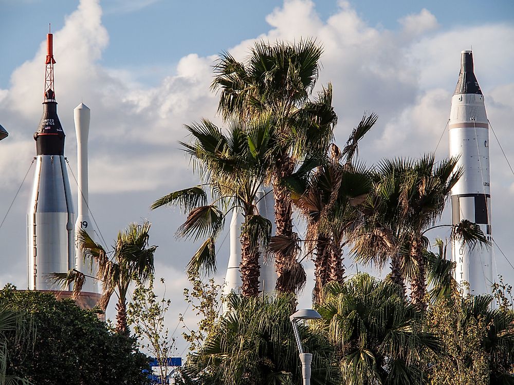
The Space Coast earned its name from America's launch program. The A1A drive puts rocket history beside the surf. Cocoa Beach opens the route an hour east of Orlando. The town is home to Ron Jon Surf Shop, the world's largest at 52,000 square feet. Cape Canaveral comes next. The Kennedy Space Center Visitor Complex offers a bus tour to the launch pads.
Playalinda Beach lies 40 minutes on, an undeveloped strand inside Canaveral National Seashore. The launch towers stand in clear view to the south. Daytona Beach closes the drive. Cars can drive right on the hard-packed sand. The Daytona International Speedway hosts the Daytona 500 each February.
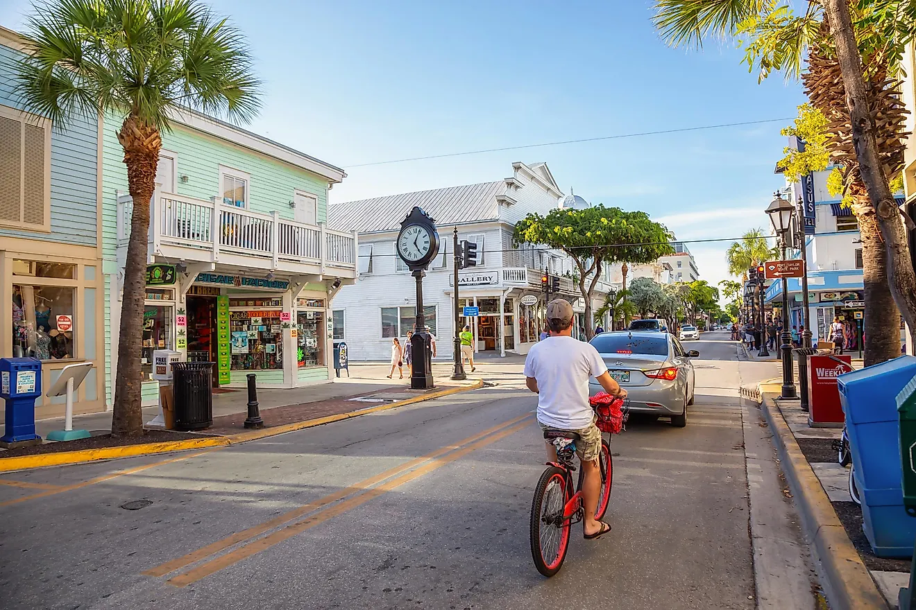
Miami To Key West Route

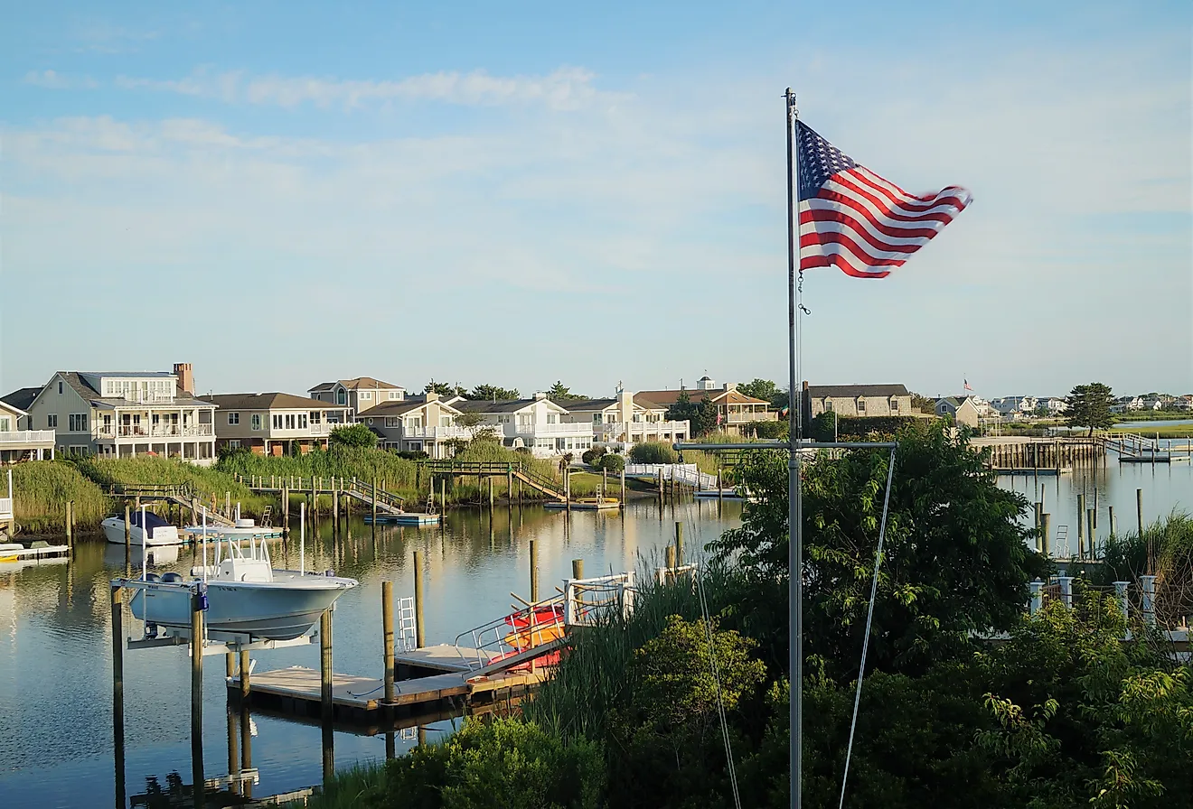
The Overseas Highway feels more like a boat ride than a drive. US 1 links Miami and Key West across 160 miles. The Overseas Highway stretch threads 113 miles of bridges and islands once the mainland ends. Miami Beach and the murals of Wynwood Walls warm up the start.
Key Largo opens the island chain at John Pennekamp Coral Reef State Park and its offshore reefs. Islamorada and the tarpon dock at Robbie's break up the miles. Key West ends the road at the southernmost point of the continental US. Duval Street and the Hemingway House wait at the bottom.
Tamiami Trail Route Naples To Miami

No Florida drive gets closer to wild alligators than the Tamiami Trail. US 41 connects Naples and Miami across the heart of the Everglades. Wetlands crowd both shoulders the whole way. Birds wade the roadside ditches. Gators haul out to sun within a few feet of passing cars. Invasive Burmese pythons have thinned the mammals here in recent years.
The Miccosukee community has a village along the trail, where the tribe adapted to swamp life. Big Cypress National Preserve offers ranger-led swamp walks. Everglades National Park spreads south to Florida Bay. The road empties into Miami. A straight shot takes three hours, but the wildlife rewards a slower pace.
Southwestern Gulf Route

The lower Gulf coast lines up calm, swimmable beaches within two hours of driving. The route starts in Bradenton at the De Soto National Memorial. It drops south to Sarasota, a city built around its art museums and the Ringling estate. Siesta Key comes next, an 8-mile barrier island. Its quartz-sand beach often tops national best-beach rankings.
Venice follows half an hour south. Fossilized shark teeth wash up along the sand near the 700-foot fishing pier. Fort Myers ends the drive at the Edison and Ford Winter Estates, the winter homes and laboratory of Thomas Edison and Henry Ford. A banyan tree planted there in the 1920s now spreads across most of an acre.
Gulf Coast Route To St. Petersburg

Florida's west coast trades Atlantic surf for the calmer water of the Gulf. The route starts at Tampa Bay and heads 45 minutes northwest to Tarpon Springs. Greek immigrants built the town's sponge-diving trade, and the bakeries and sponge boats still work the waterfront. Clearwater Beach lies 35 minutes south, 2.5 miles of soft sand.
The Clearwater Marine Aquarium nearby is the rescue hospital from the movie "Dolphin Tale." It still rehabilitates sea turtles and manatees. South past Treasure Island, the pink towers of the Don CeSar mark St. Pete Beach. Downtown St. Petersburg ends the trip, its walkable arts district and the Salvador Dali Museum a few blocks from the bay.
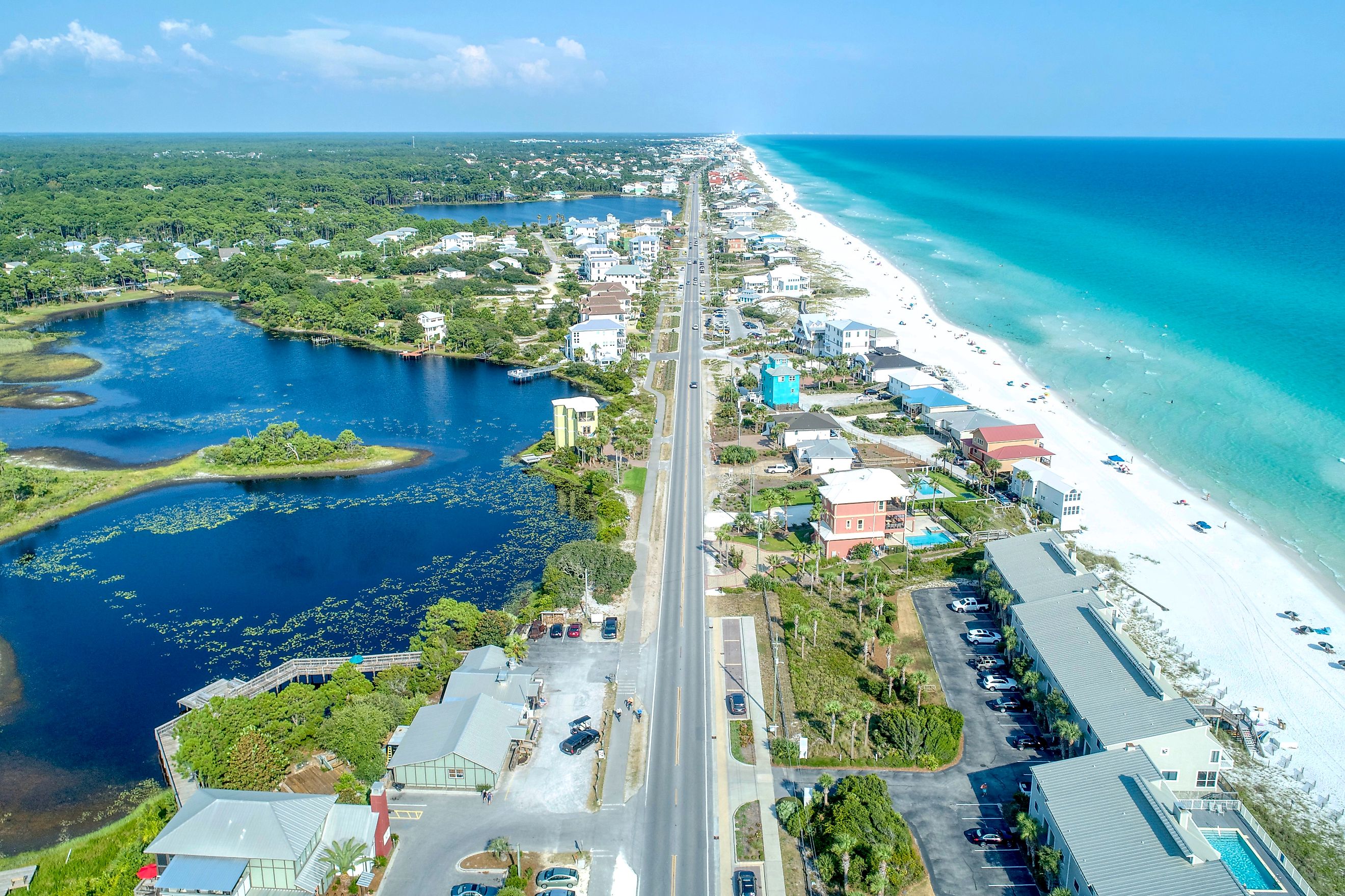
Panhandle And Emerald Coast Route

On Scenic Highway 30A, the quartz sand squeaks underfoot. The Panhandle route starts in Fort Walton Beach, a town known for year-round fishing. It heads east along the Gulf. Destin comes 15 minutes on, a deep-water charter port that hosts the Destin Fishing Rodeo each October.
Panama City Beach follows. Its Conservation Park carries boardwalks through pine flatwoods. Highway 30A then leads to Port St. Joe, 24 miles of state-designated coast past the dune lakes and beach towns of the Emerald Coast.
Florida Springs Route

Beneath Florida lies one of the planet's most productive aquifer systems, a limestone sponge spanning close to 100,000 square miles. It surfaces as springs, more than 1,000 of them across the peninsula. The spring-hopping drive begins northwest of Orlando at Weeki Wachee, where an underwater theater has staged live mermaid shows since 1947. Crystal River lies 35 minutes north, clear enough to watch manatees drift past.
Farther north, tube-friendly springs like Rainbow River and Ichetucknee line the route. The whole loop takes about three hours to drive. Splitting it over two days leaves time to get in the water. The springs hover near 72 degrees year-round, cold relief in a Florida August.
North Central Florida's Forest And Spring Route

The Florida Black Bear Scenic Byway winds through more than 120 miles of forest where black bears outnumber traffic lights. It begins at Silver Springs State Park, an hour and a half north of Orlando. The park has one of the largest artesian springs in the state. Glass-bottom boat tours there date to the 1870s. The Florida National Scenic Trail starts nearby and stretches roughly 1,500 miles.
Ocala National Forest lies just beyond, sand pine and more than 600 lakes instead of the beaches most people picture. Alexander Springs and Juniper Springs lie inside it, both open for swimming and paddling. The drive finishes at Lake George, the state's second-largest lake, where the St. Johns River widens into open water.
Coquina, Rockets, And Quartz Sand
The surprise of driving Florida is how fast the scenery changes. One afternoon can pass the coquina walls of a 1565 fort and the launch towers of the Space Coast without leaving the state. Ocala's pine forest feels a continent away from the mangroves of the Keys. Each route works as a long day or an easy weekend. The short drive times mean the next one is never far off.