Why the Caspian Sea Is Technically a Lake
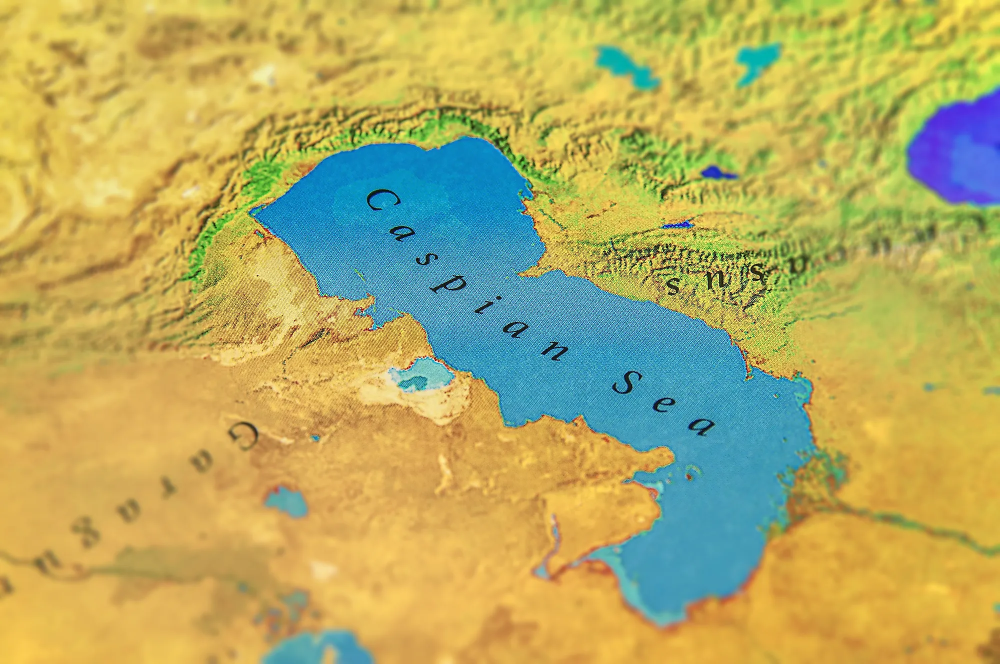
The Caspian Sea is the largest inland body of water on Earth, yet despite its name and its size, geographers classify it as a lake rather than a sea. The distinction typically comes down to one main test: a sea connects to the world ocean, while a lake sits in a closed basin with no natural outlet to it. By that standard the Caspian is a lake, the biggest one on the planet, spread across roughly 143,000 square miles (371,000 square kilometers) between Europe and Asia and bordered by five countries. The question, though seemingly trivial, actually has real world implications. Whether the Caspian counts as a lake or a sea decides how its oil, gas, and fishing rights get divided among those five nations, a dispute that took more than two decades to build a legal framework around. This article explains the criteria that define a lake, why the Caspian meets them, and the one geological wrinkle that keeps the debate alive.
The Ocean Test

The cleanest way to separate a lake from a sea is connectivity. A sea is usually connected to the global ocean, joined to it directly or through straits, so its water rises and falls with global tides and mixes with ocean water. A lake is an inland body of water surrounded by land. The Caspian is landlocked, hemmed in by Russia, Kazakhstan, Azerbaijan, Turkmenistan, and Iran, with no natural strait or river to any ocean. Water leaves it only through evaporation, which is the defining trait of what scientists call an endorheic, or closed, basin. Rivers flow in, most of all the Volga, which supplies about 80 percent of the inflow, but nothing naturally flows out to the sea. On that measure the Caspian is unambiguously a lake.
It Certainly Looks and Behaves Like a Sea

The confusion is understandable, because the Caspian acts the part. It stretches about 750 miles (1,200 kilometers) from north to south, so standing on one shore you cannot see the other, and strong winds whip up rolling waves like those on any coastline. Its water is salty, running near 1.2 percent salinity, which is about a third as salty as the ocean. That is far too briny to call fresh, which is why the Caspian is usually described as brackish rather than a freshwater lake. Ancient peoples who lived along its edges naturally took it for a sea, and the name stuck across every language and map. Its salinity is not even uniform: the north is nearly fresh where the Volga pours in, while some far eastern lagoons can be saltier than the ocean itself.
Why Geographers Still Call It a Lake

Size and salt do not make a sea. Plenty of lakes are salty, including Utah's Great Salt Lake and the Dead Sea, and salinity has more to do with evaporation in a closed basin than with any ocean connection. The Caspian's isolation is estimated to have begun roughly 5.5 million years ago, when tectonic movement and falling sea levels cut it off from the ancient ocean it once belonged to. Since then it has kept its own independent water level, roughly 90 feet (28 meters) below the global ocean level. Its level rises or falls with rainfall over the Volga basin, precipitation, and water usage, among other reasons. A body of water with its own sea level, no outlet, and land on every side fits the scientific definition of a lake, regardless of how large or salty it happens to be.
The Geological Twist That Keeps the Debate Alive

There is one genuine complication, and it is the reason the argument never fully dies: the Caspian's geology. It occupies part of an ancient marine basin associated with seas that once covered large areas of Eurasia. Beneath the deep southern basin, seismic and magnetic evidence indicates unusually dense crust that many researchers interpret as oceanic or transitional rather than ordinary continental crust.
That history helps explain the Caspian’s great depth, salty water, and enduring name. It does not formally disqualify the Caspian from being a lake, because lakes are not defined by the type of crust beneath them. Instead, it shows why the Caspian does not fit neatly into the familiar image of a freshwater lake occupying a simple continental depression.
How It Compares to the World's Other Great Lakes

By surface area, nothing else comes close. The Caspian covers roughly 143,000 square miles (371,000 square kilometers), which makes it about four and a half times larger than Lake Superior, the biggest freshwater lake, at 31,700 square miles (82,100 square kilometers). It holds an astonishing share of the planet's lake water, somewhere between 40 and 44 percent of the world's inland lake water by volume. It is deep, too, plunging to about 3,363 feet (1,025 meters) at its southern end, though that still trails Siberia's Lake Baikal, the deepest lake on Earth at around 5,387 feet (1,642 meters). Put simply, the Caspian outranks every conventional classified lake by area and volume, and only its salt and its unusual seabed set it apart from the familiar freshwater giants.
Why the Lake-or-Sea Question Actually Matters

For most of the 20th century this was a curiosity for geographers. Then the Soviet Union dissolved in 1991, and the label suddenly carried enormous financial weight. Following the dissolution, five countries had to negotiate rules for a body of water previously shared mainly by the Soviet Union and Iran. Their positions differed over territorial waters, fishing grounds, pipelines, and valuable offshore deposits. Some favored modified median lines based broadly on coastlines, while Iran argued for an equal 20 percent share.
The five governments signed the Convention on the Legal Status of the Caspian Sea in 2018 after more than two decades of negotiations. It created a special system rather than simply declaring the Caspian a lake or a sea. Each country may claim territorial waters extending up to 15 nautical miles, followed by a 10-nautical-mile exclusive fishing zone, while a central area remains open to common use. The seabed and its resources are to be divided through agreements among neighboring countries, meaning the convention established a framework without resolving every maritime boundary.
The Bottom Line
The Caspian Sea earns its "sea" name through its scale and its salt water, but by the ordinary geographic usage, it is typically considered a lake: a closed basin with no natural path to the ocean, holding its own water level far below sea level. The single caveat is the ancient oceanic crust beneath its southern floor, which makes it a lake unlike any other. Whatever it is called, it remains the largest body of inland water on Earth, and the rare geographic riddle whose answer shaped treaties, borders, and billions of barrels of oil.