The Lakes That Sit Inside Volcanoes
Some of the most dramatic bodies of water on Earth sit atop a volcano. A volcanic lake forms when rain and groundwater fill a crater or caldera left by an eruption. Crater Lake in Oregon is the deepest lake in the United States at 1,949 feet. Toba in Sumatra fills the basin of a supervolcano and holds a resurgent island in its center. Taal in the Philippines stacks a lake inside a volcano inside a lake. This piece looks at ten of these lakes and how each one formed.
Lake Toba, Indonesia

Lake Toba is the giant of this category. Set in northern Sumatra, it fills the caldera of the Toba supervolcano and is widely described as the world's largest volcanic crater lake. UNESCO lists Lake Toba at about 425 mi2 (1,100 km2), with a maximum depth of about 1,657 ft (505 m) and a surface roughly 2,966 ft (904 m) above sea level.
What makes Toba impressive is not just the lake's size but the scale of the landscape around it. The caldera walls rise all around the water, and Samosir Island sits in the middle as a large resurgent landform pushed up within the old volcanic basin. For travelers, the lake combines big scenery with Batak villages, viewpoints, and ferry rides across water that is hard to take in from the shore alone.
Lake Taupo, New Zealand
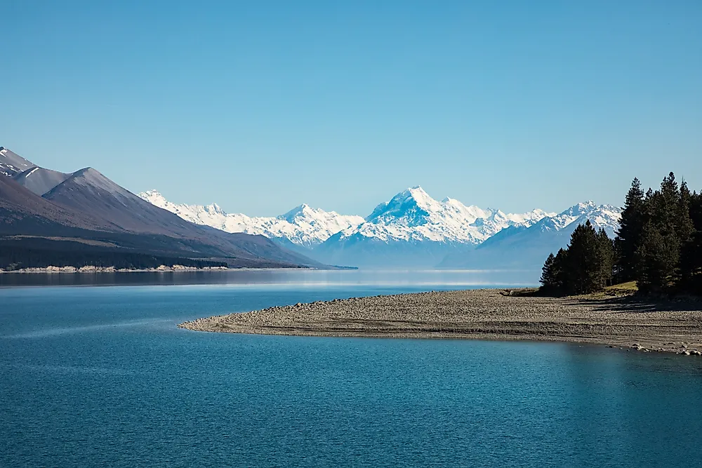
Lake Taupo sits inside one of the world's major volcanic systems and is New Zealand's largest lake. The caldera it now fills largely formed after the huge Oruanui eruption about 25,500 years ago, one of the largest eruptions of the last 100,000 years.
The lake covers about 238 mi2 (616 km2) and reaches a maximum depth of about 610 ft (186 m). Visitors can see geothermal areas, pumice beaches, lakefront towns, boat-access Maori rock carvings, and the Waikato River outlet. The volcanic origin is still visible in the surrounding hot springs, the steaming ground, and the broad caldera shape.
Crater Lake, Oregon

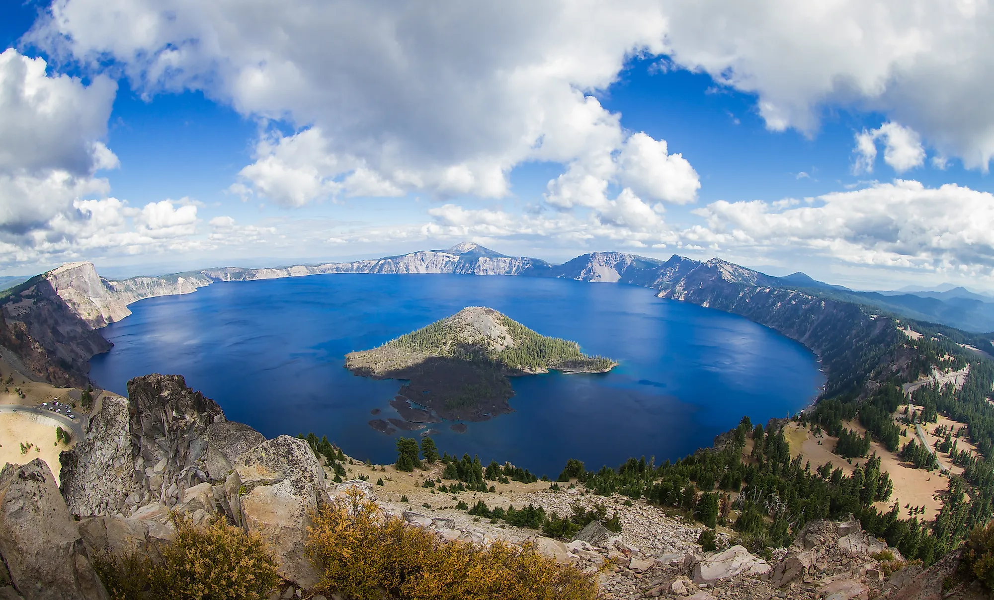
Crater Lake is one of the clearest and deepest volcanic lakes in the world. It fills the collapsed summit of Mount Mazama in southern Oregon, a caldera that formed about 7,700 years ago after a major eruption. The lake reaches 1,949 ft (594 m) deep, which makes it the deepest lake in the United States.
The lake covers about 20.5 mi2 (53 km2) and has no major surface inflow or outlet, which is what gives it such intense blue color and clarity. Wizard Island, a cinder cone rising from the surface, keeps the lake's volcanic history in plain view. Popular ways to experience it include the Rim Drive, overlooks such as Watchman Peak and Cloudcap, boat tours when they run, and winter views when snow highlights the caldera rim.
Taal Lake, Philippines

Taal Lake is one of the most unusual volcanic lakes because it holds an island volcano within a larger lake-filled caldera. The Smithsonian describes Taal as a caldera system in southern Luzon, with the lake sitting inside a 9-by-12 mi (15-by-20 km) caldera and Volcano Island rising in the middle, itself holding a main crater lake.
The lake covers about 90.4 mi2 (234.2 km2) and reaches about 525 ft (160 m) deep, which makes it one of the Philippines' largest and deepest lakes. Its nested geography is the main draw: a lake inside a volcano, Volcano Island inside that lake, and another crater lake inside the island. It is also an active and hazardous system, so access and safety rules can change without much notice. Taal is a reminder that a beautiful volcanic lake is not always dormant scenery.
Lake Atitlan, Guatemala

Lake Atitlan fills part of a large volcanic caldera in Guatemala's highlands, ringed by steep slopes and the volcanoes Atitlan, Toliman, and San Pedro. Volcanic activity in the region goes back millions of years, and the present-day lake occupies part of the most recent caldera.
The lake covers about 50 mi2 (130 km2) and reaches roughly 1,119 ft (341 m) deep, which makes it one of Central America's deepest lakes. What makes Atitlan so memorable is the way villages, coffee-growing slopes, and volcano silhouettes all sit tightly around the water. Visitors move between lakeside towns such as Panajachel, San Pedro La Laguna, San Juan La Laguna, and Santiago Atitlan by boat, which makes the caldera feel like a lived-in place rather than an isolated crater.
Quilotoa, Ecuador

Quilotoa is a smaller but very photogenic volcanic lake in the Ecuadorian Andes. It is a 1.9 mi (3 km) wide caldera holding a turquoise lake about 820 ft (250 m) deep. The caldera formed through collapse events, and it still shows life today, with fumaroles on the lake floor and hot springs on the eastern flank.
Where Toba and Taupo overwhelm with size, Quilotoa is compact and dramatic. The crater rim gives visitors a near-complete view of the water from above, and the green-blue color comes from dissolved volcanic minerals. Hiking the rim, descending to the shore, kayaking when conditions allow, and visiting nearby highland villages are the main ways to experience it. Because Quilotoa sits high in the Andes, even the walk down to the water and back can feel tougher than it looks.
Lake Toya, Japan

Lake Toya sits in a nearly circular caldera in Hokkaido, Japan, within the Toya-Usu volcanic region. It is Japan's third-largest caldera lake and sixth-deepest lake overall, with a maximum depth of about 591 ft (180 m).
The lake covers about 27 mi2 (70 km2) and is known for clear water, the central Nakajima islands, hot springs, and views of nearby Mount Usu, an active volcano. Toya is a good example of a volcanic lake where the experience feels both scenic and easy to reach, with boat cruises, lakeside onsens, forested islands, and volcano-viewing areas all close together. It is gentler than Crater Lake or Quilotoa, but the circular basin and the active volcano on its rim keep the origin visible.
Lake Towada, Japan

Lake Towada is a deep caldera lake in northern Honshu, Japan, straddling the border between Aomori and Akita prefectures. Its maximum depth of about 1,073 ft (327 m) makes it the third-deepest lake in the country.
The lake covers about 23.6 mi2 (61.1 km2) and drains into the Oirase River, one of the most scenic stream corridors in northern Japan. Towada's appeal is quieter than that of the more famous volcanic lakes. Forested shorelines, deep blue water, autumn color, boat cruises, and the nearby Oirase Gorge give it a gentler pace. The steep basin and unusual depth still point to a much more powerful volcanic history beneath the calm surface.
Kelimutu Crater Lakes, Indonesia

Kelimutu is not one lake but three summit crater lakes on Flores Island, Indonesia. The volcano is well known for these three craters, each holding water of a different color that can shift over time.
The individual lakes are much smaller than Toba or Taupo, but their visual impact is outsized. One record describes Tiwu Ata Mbupu, the northwestern lake, as about 2,789 by 1,969 ft (850 by 600 m) wide and 220 ft (67 m) deep. The draw here comes as much from chemistry as from shape, since changing mineral content, volcanic gases, and lake conditions can turn the water blue, green, reddish, brown, or near-black. Visitors usually arrive for sunrise, when the three basins are easiest to see from the summit viewpoints.
Kerid, Iceland

Kerid is much smaller than the other lakes here, but it is one of the most accessible and visually clear volcanic crater lakes in Iceland. Located in the Grimsnes area along the Golden Circle, the crater is about 180 ft (55 m) deep and 558 ft (170 m) wide.
Kerid's appeal comes from its proportions and its color. Red volcanic rock, green moss, and blue-green water sit together in a way that makes the whole crater stand out at first glance. Unlike the giant calderas, Kerid can be walked around in a short visit, with paths along the rim and down near the water. It is a useful reminder that a volcanic lake does not need to be enormous to be geologically interesting, and that a small crater can make the volcanic landscape feel even more immediate.
Why Volcanic Lakes Look So Different
A lake inside a volcano can mean very different things: the steep basins of Crater Lake and Quilotoa, the enormous calderas of Toba and Taupo, the lake-and-island puzzle of Taal, and the shifting colors of Kelimutu. What connects them is the way eruptions, collapses, groundwater, rainfall, and time all gather in one basin. Some grow into major freshwater systems and travel destinations, while others stay small, acidic, brightly colored, or dangerous. Together they show how much a single volcanic process can produce once water settles into the space an eruption left behind.