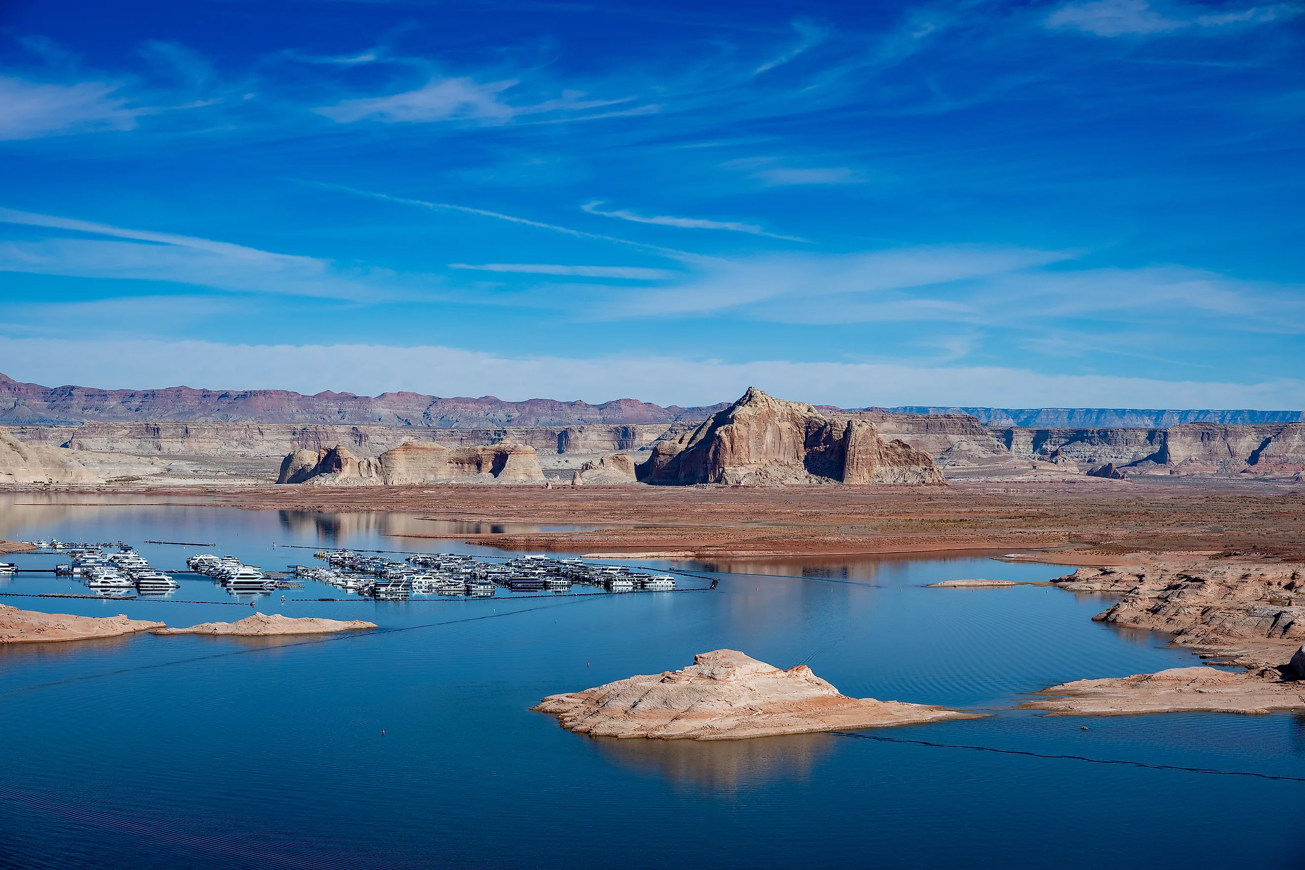
What Happens If Lake Granby Is Drained To Save Lake Powell
Emptying Lake Granby would raise Lake Powell by only a few feet. Granby, a reservoir on the Colorado River in Grand County, is now the biggest body of water in Colorado, because Blue Mesa Reservoir has fallen so low in the drought that Granby holds more water than it does. When federal and state water managers looked upstream for help this year, after Powell hit a record low on September 15, 2026, they judged Blue Mesa too low to contribute and drew on Flaming Gorge, on the Wyoming-Utah line, instead.
Nearly everything it would cost to send Granby's water downstream would be paid in Colorado, well before any of it reached the Utah line.
Emptying Granby Would Take At Least A Year And A Half

Water bound for Powell would have to leave Granby through the dam's outlet works, which are rated at 435 cubic feet per second with the lake full and lose capacity as the lake drops. At that pace, releasing the roughly 465,000 acre-feet above the lowest outlet in a full lake would take at least a year and a half. Reclamation lists 74,190 acre-feet of Granby's 539,758-acre-foot capacity as normal minimum storage, the water left below that outlet, and this year there is far less to release. Storage dropped to 296,400 acre-feet by the end of August 2026, down from 524,500 at the end of June 2025, which left only about 222,000 acre-feet above the outlet.
Granby is the largest storage reservoir in the Colorado-Big Thompson Project, which Congress authorized in 1937 to carry West Slope water to northeastern Colorado, and it is not one of the three reservoirs, Flaming Gorge, Blue Mesa, and Navajo, covered by the federal drought agreements used to prop up Powell.
Lake Powell Would Rise About 8 Feet At Most

When Reclamation released 500,000 acre-feet from Flaming Gorge in 2022 and held back another 480,000 at Glen Canyon Dam, it estimated the two moves together at about 16 feet of elevation at Lake Powell. At that rate, a full Granby's releasable water would raise Powell roughly 8 feet if every acre-foot arrived, and the 222,000 acre-feet above the outlet at the end of August would raise it about 4.
This October, about 600,000 acre-feet ran into Powell after heavy rain in southeast Utah, more than a full Granby could release. The lake rose 9.5 feet off its September 15 record low of 3,516.62 feet and stood at 3,526.1 feet on October 24, about 36 feet above the 3,490-foot minimum power pool at Glen Canyon Dam and 156 feet above dead pool. Powell also loses an estimated 500,000 acre-feet a year to evaporation, according to Reclamation's research office, with other estimates between 336,000 and 386,000, so at the higher figure a year of evaporation would take back more than a full Granby release.
Granby's Marinas Would End Up Far From The Water

A full drain would pull Granby's waterline well below the low it reached in the 2002 drought, away from Indian Peaks Marina, which rents boats and runs a gas dock, and from the two-lane Stillwater ramp and the single-lane Sunset Point ramp on the southwest shore. That 2002 low was already about 63 feet below full pool. The reservoir took in 111,300 acre-feet that water year, the lowest inflow on record at the time, the lake fell about 38 feet to 8,216.56 feet by September, and Reclamation's annual report noted the drop was causing problems for recreationists and marina operators. Even then, the lake held 176,778 acre-feet, more than twice the 74,190 a full drain would leave.
At Flaming Gorge, this year's releases for Powell are projected to lower the reservoir about 35 feet, a drop that could expose 400 feet of shoreline, and by June the ramp at Buckboard Marina was described as buckled, "angling up and down like a pitched roof."
The fishery would shrink into the same remnant pool. Draining the lake to its minimum would leave Granby's lake trout and kokanee salmon in roughly one-seventh of the full reservoir's volume. A Colorado Parks and Wildlife biologist calls the lake trout "the most prolific lake trout population in the state," a wild population the agency does not stock, and it depends on a prey base made up mainly of the kokanee.
Grand Lake Would Stay Within A Foot Of Its Usual Level

Upstream of Granby, the waterfront in the town of Grand Lake would look almost the same. Grand Lake, the largest and deepest natural lake in Colorado, is part of the Colorado-Big Thompson system, and the project's operating criteria limit swings in its level to less than a foot. Shadow Mountain Reservoir, a 37-foot-deep basin between the two lakes, helps keep Grand Lake's surface steady while water flows out through the Adams Tunnel, whose West Portal is on Grand Lake's east shore. Before the project, Grand Lake was clear to about 30 feet, and as of 2023 the state's 12.5-foot clarity goal was met only about half the time, with summer pumping tied to the clouding. That pumping starts at Granby, where the Farr Pump Plant lifts water into the Granby Pump Canal and on to Shadow Mountain, so a drained Granby would leave little water to send uphill during the tourist season.
Front Range Cities Would Lose Their Biggest Mountain Reservoir

On the other side of Rocky Mountain National Park, a drained Granby would leave the Colorado-Big Thompson Project's East Slope storage at Horsetooth Reservoir and Carter Lake, which together contain about 268,900 acre-feet when full, roughly 16 months of average deliveries. The project delivers an average of about 200,000 acre-feet a year through the 13.1-mile Alva B. Adams Tunnel to 32 municipalities and 615,000 acres of irrigated farmland, and more than a million people get part of their water from it.
Northern Water raised the 2026 quota to 80 percent in April, up from a 50 percent initial quota set the previous October, at a time when the project's reservoirs were above their historic average for the date. The newest addition to the system is Chimney Hollow Reservoir, which received its first water on April 21, 2026. Built to firm up supplies from the Windy Gap Project, the 90,000-acre-foot reservoir is expected to take about three years to fill, and since Windy Gap water has long been pumped into Granby before crossing to the East Slope, a drained Granby would slow that fill as well.
The River Below Granby Dam Would Run At 20 Times Its Winter Minimum

Any water headed for Powell would leave through Granby Dam into a reach of the Colorado River that usually gets very little. Minimum releases below the dam are 20 cubic feet per second between September and April, 75 in May, June, and July, and 40 in August, and an estimated 70 percent of eastern Grand County's native water is exported to the Front Range. In 2019, an added 35 cubic feet per second from Granby roughly doubled the flow downstream, and a Colorado River District spokesman said, "There's plenty of water in the river except for in that stretch below Granby."
A steady release at the outlet's 435 cubic feet per second, more than 20 times the winter minimum, would run through the 20 miles of Gold Medal trout water that begin west of Hot Sulphur Springs, where Grand County streams regularly approach 70 degrees in summer, the upper limit for trout. The same water would carry on past Kremmling and through Gore Canyon to the BLM's Pumphouse Recreation Area, the busiest access point on the Upper Colorado between Kremmling and State Bridge, with more than 100,000 visitors a year.
Grand Valley Irrigators Could Divert The Water Before It Reached Utah

Past State Bridge, Granby water without legal protection could be taken by other water users along the way. Under Colorado law, water bound for compact deliveries is difficult to protect from diversion and use by others, and a 2017 analysis concluded such water would need administrative "shepherding" to reach the state line and Lake Powell. In Glenwood Canyon, the Shoshone hydropower plant's 1902 right for 1,250 cubic feet per second runs water through its turbines and back into the river, and administering its senior call moves more than 33,000 acre-feet toward the Utah line. Farther down in the Grand Valley, the irrigation rights behind the Cameo call can divert up to 1,950 cubic feet per second, most years late in the irrigation season, more than four times what Granby's outlet can release and enough to take the entire release if it were unprotected, before any of it reached the 15-Mile Reach near Grand Junction, critical habitat for the endangered humpback chub.
In Utah, the river runs through Cataract Canyon in Canyonlands National Park and slows into Lake Powell's upper reaches near Hite, where river trips through the canyon end. Any Granby water that made it that far would reach a lake that Reclamation's October 2026 forecast puts between about 3,525 and 3,541 feet at the end of September 2027, depending on how much water is released through Glen Canyon Dam.
A slower version of this trade is already being discussed on the Front Range. Water rights perfected after the 1922 Colorado River Compact, including those of the Colorado-Big Thompson Project, authorized in 1937, are junior to it, and in a May 2026 webinar, water consultant Jeff Lukas said he expects Front Range cities to be asked, "whether nicely or not," to reduce their Colorado River diversions. A cut in C-BT diversions would leave more water in the river below Granby, the stretch that gets 20 cubic feet per second through the winter, and that water would reach Powell gradually, year after year, with no reservoir emptied to its lowest outlet for a gain of a few feet. Reclamation's Final EIS for river operations beginning January 1, 2027, imposes no mandatory cuts on the Upper Basin states, and its analysis assumes 200,000 acre-feet a year of voluntary conservation there.