Glenwood Canyon
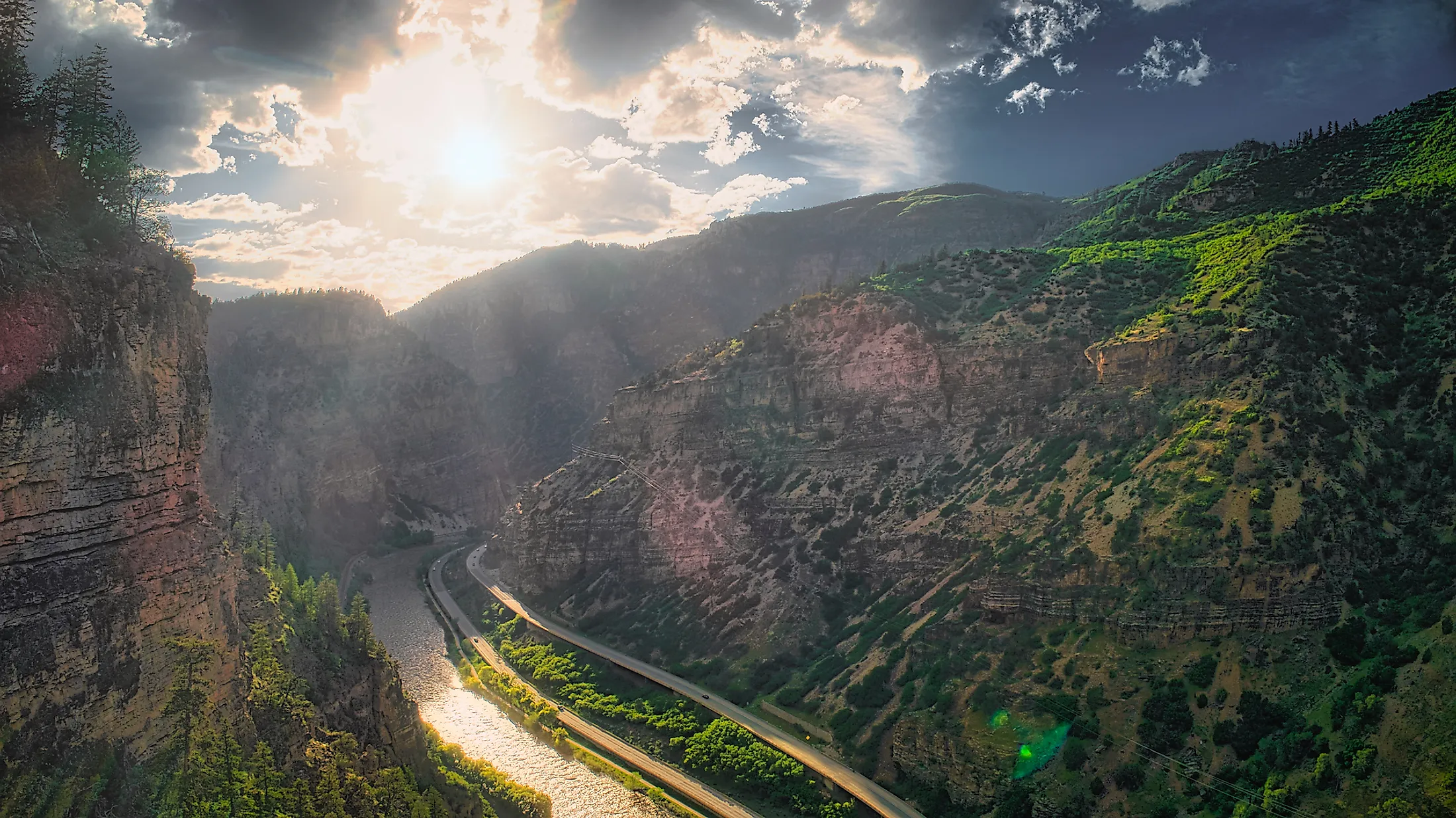
Glenwood Canyon is a 20km rugged canyon situated in the west-central part of the US State of Colorado. The Glenwood Canyon stretches from the unincorporated community of Dotsero, where the Colorado River is joined by Eagle River - its 97.4km long tributary, and extends downstream in the west-southwest direction just to the eastern part of the city of Glenwood Springs, at the mouth of the Roaring Fork River - another 110km long tributary of the Colorado River. The major portion of the Glenwood Canyon forms a part of the state’s Garfield County, while the upper portion of the canyon that is located close to the unincorporated community of Dotsero forms a part of the Eagle County.
About the Canyon

The walls of the Glenwood Canyon above the Colorado River are about 400m high. Geologists believe that the Glenwood Canyon was formed during the Pleistocene epoch due to the fast down-cutting of the Colorado River through the sedimentary rock layers. The upper layers of the Glenwood canyon are made up of sandstone from the two subperiods – Mississippian and Pennsylvanian of the Carboniferous Period. Portions of the lower canyon walls are believed to be made up of rocks from the Cambrian Period. The Mississippian layer in the canyon’s upper rims form a part of the Leadville Formation. As the swift-flowing Colorado River dissolved paths through the Leadville Limestone, it led to the creation of an intricate network of caves which include the present-day Glenwood Cavern as well as several other caves and canyons in the Colorado River Basin.

The dissolution of limestone that led to the formation of the Glenwood Cavern took place in a mixing zone where the hot thermal waters that contain dissolved carbon dioxide and hydrogen sulfide mixes with the oxygenated water close to the Colorado River. These active geological processes also led to the creation of many hot springs including the Glenwood Hot Spring and the Iron Mountain Hot Spring. Also located in the Glenwood Canyon is the Hanging Lake, which is considered one of Colorado’s most popular hiking and tourist destinations. Located at an elevation of 2,232m, the Hanging Lake was formed due to a geologic fault in the area. In 2011, the American politician Kenneth Lee Salazar, who served as the United States secretary of the Interior designated the Hanging Lake as a National Natural Landmark.

The Glenwood Canyon offers several recreational opportunities for its visitors such as hiking, canoeing, whitewater River rafting, kayaking, fishing, and wildlife viewing. The canyon also supports many wild animals including mountain lions, bighorn sheep, coyotes, raccoons, marmots, etc.
Brief History

The Glenwood Canyon is one of the most well-known scenic natural features that is situated on the United States Interstate Highway System. In earlier times, the Glenwood Canyon proved to be quite treacherous to navigate and therefore the indigenous Ute Indians decided to bypass it and travel instead over the Flat Tops. In 1887, a railroad track was constructed through the region that opened the Canyon area for the transportation of goods and people. In 1906, the Glenwood Canyon provided a route of the unpaved Taylor State Road, which served as the first route for the automobiles passing through the Colorado Rockies. In the 1930s, this primitive dirt road was upgraded to a two-lane paved highway and was rechristened as US-6. In the later years, as the automobile traffic increased, the US-6 highway through the Glenwood Canyon became one of the most dangerous highways with high crash and fatality rates. The state’s transportation authorities were then faced with the challenge of building a modern four-lane freeway in the area beside the existing two-lane highway. The Glenwood Canyon Project consisting of a 20km long network of bridges, viaducts, and channels were opened to traffic on October 14, 1992. This project symbolized the completion of the original United States Interstate Highway System as well as linked the final part of the Interstate-70 highway.


