The Shallowest Large Lakes In The United States
Several of the biggest lakes in the United States are barely deep enough to seem believable. This unusual geometry produces expansive marshes, easily stirred sediment, and enormous shallow-water habitats. It also gives travelers a completely different experience from the steep shores of deep mountain lakes. These ten waters lead through coastal Louisiana, the Florida peninsula, the Great Lakes system, the Pacific Northwest, and several major American river basins. All are among the largest lakes in the country by surface area, and all are ordered here by mean depth, shallowest first.
Lake Mattamuskeet, North Carolina - area: 63 mi2, avg. depth: 1.5 ft

Barely 1.5 feet separates the surface of Lake Mattamuskeet from its bottom on average, despite roughly 63 square miles of water spreading across the North Carolina coastal plain. The best place to understand that scale is Mattamuskeet National Wildlife Refuge, where the lake sits at the center of one of eastern North Carolina's great winter birding areas. Tundra swans arrive in large numbers, and bald eagles are frequently seen above impoundments crowded with ducks and geese. The causeway provides long views across the basin without requiring a boat. Nearby, the old Mattamuskeet Lodge is impossible to miss. Its tall central tower belongs to a former pumping station built during efforts to drain the lake. Cooler months offer the richest visit, when migration fills the refuge and its observation areas with both birds and birdwatchers.
Calcasieu Lake, Louisiana - area: 77 mi2, avg. depth: 3.3 ft

Oyster reefs, tidal channels, and marsh rather than a conventional freshwater shoreline define this remarkably shallow Louisiana waterbody. Calcasieu Lake, usually called Big Lake, averages only about 3.3 feet deep across approximately 77 square miles. Its brackish water supports a celebrated inshore fishery, with Hackberry serving as a major launch point for guided trips targeting speckled trout and redfish.
The Creole Nature Trail adds another dimension south of Lake Charles. Its route crosses coastal marshes and wildlife refuges where roseate spoonbills and alligators are regular sightings. Calcasieu is also a working waterway connected to the Calcasieu Ship Channel, so shrimp boats and commercial traffic appear alongside fishing skiffs. Travelers interested in Louisiana's coastal ecology can use Hackberry and the Creole Nature Trail to explore both the open lake and the surrounding wetlands.
Lake Kissimmee, Florida - area: 55 mi2, avg. depth: 7.4 ft

Dense beds of aquatic vegetation announce Lake Kissimmee long before its modest 7.4-foot average depth becomes apparent. Across roughly 55 square miles, marsh and open water interlock in a landscape that supports one of central Florida's classic freshwater ecosystems. Lake Kissimmee State Park is the obvious base, but not simply for lake views. Its trails move through pine flatwoods and oak hammocks before reaching wetland habitat where alligators and wading birds are common. The park's living-history cow camp adds an unexpected glimpse of Florida's early cattle culture. Largemouth bass thrive around submerged vegetation, while airboat excursions reach shallow channels that conventional boats may avoid. Those staying on land can follow park trails through the flatwoods, where white-tailed deer and wild turkeys are often spotted.
Upper Klamath Lake, Oregon - area: 96 mi2, avg. depth: 9 ft

Below the Cascades in Oregon, near Klamath Falls, lies an enormous expanse of water that averages only about nine feet deep at full pool. Upper Klamath Lake covers around 96 square miles, yet its most dramatic feature for many visitors is not its size but the birdlife passing through the basin. Its position on the Pacific Flyway brings American white pelicans and grebes onto the water, while bald eagles patrol wetlands used by migrating waterfowl.
Moore Park provides easy shoreline access near the city. Close by, the Link River Trail follows the short river flowing from Upper Klamath toward Lake Ewauna, giving walkers a closer look at the riparian habitat between the two waters. Birders can continue into nearby refuge country, while Crater Lake National Park is reachable to the north. Spring and fall are particularly rewarding around the basin as migration intensifies.
Lake Okeechobee, Florida - area: 730 mi2, avg. depth: 9 ft

Nothing else in this ranking matches the mismatch between Lake Okeechobee's enormous footprint and its shallow water. Roughly 730 square miles make it one of the largest lakes in the United States, yet the average depth is only about nine feet. The Herbert Hoover Dike makes that unusual geometry easy to grasp. Sections of the Lake Okeechobee Scenic Trail run along the raised embankment, giving cyclists and walkers a higher vantage over water that otherwise seems almost level with the surrounding landscape.
Clewiston works well as a southern gateway. Roland Martin Marina anchors a fishing scene built around Okeechobee's famous largemouth bass, while local guides head into vegetation-rich shallows and canals. Snail kites and large wading birds frequent the marshes. The nearby locks, dike, and canals also expose the immense water-management system built around the largest freshwater lake in the state.
Utah Lake, Utah - area: 151 mi2, avg. depth: 9 ft

The Wasatch Range rises dramatically behind a lake whose vertical dimensions are surprisingly modest. Utah Lake covers about 151 square miles west of Provo in Utah but averages only around nine feet deep. Utah Lake State Park is the simplest place to launch a boat, paddle in calm weather, or sit beside the water with clear views toward the mountains. The Provo River enters nearby through wetland habitat used by pelicans, herons, and migrating birds. Visitors can also follow the Provo River Parkway toward the lake by foot or bicycle, tracing the river through greener sections of the city. Wind deserves attention here because waves can develop quickly across such a wide, shallow basin. The state park marina gives first-time visitors straightforward access to the eastern shore and open water.
Lake George, Florida - area: 72 mi2, avg. depth: 9.8 ft

A journey along the St. Johns River suddenly opens into nearly 72 square miles of water at Lake George, even though the basin averages just 9.8 feet deep. Its river connection lets boats move easily between open lake, narrow channels, and spring-fed tributaries. Silver Glen Springs is the essential detour. Clear blue-green spring water flows toward the darker lake, producing a striking meeting of two very different aquatic environments.
Salt Springs offers another spring-fed swimming area west of the lake within Ocala National Forest. Anglers pursue largemouth and striped bass, while bald eagles and ospreys are frequently seen above the shoreline. Boats traveling the St. Johns pass directly through Lake George, giving the lake a sense of movement absent from more enclosed basins. Silver Glen Springs can be reached by boat from the lake itself.
Lake Dardanelle, Arkansas - area: 54 mi2, avg. depth: 10 ft

From the overlooks at Mount Nebo State Park, the unusual shape of Lake Dardanelle becomes immediately obvious. Instead of occupying a rounded basin, this roughly 54-square-mile reservoir follows the Arkansas River through the valley, yet its average depth is only about ten feet. The elevated view shows long reaches of water winding between wooded banks and developed riverfront areas. Back below, Lake Dardanelle State Park near Russellville provides boat ramps, fishing access, and a visitor center devoted to the river ecosystem. Bass tournaments regularly launch here, while sheltered coves offer paddlers calmer conditions away from the navigation channel. Commercial river infrastructure remains visible along parts of the reservoir, reflecting its place within a working waterway. Mount Nebo remains the standout stop for anyone wanting to understand the reservoir's geography in a single view.
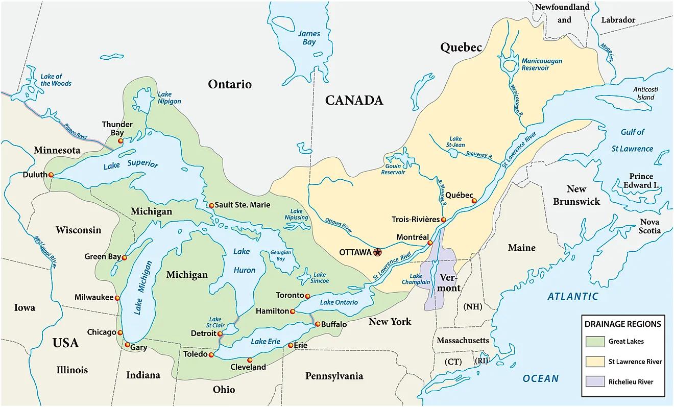
Lake St. Clair, Michigan and Ontario - area: 430 mi2, avg. depth: 11 ft

Between two much deeper Great Lakes sits a vast freshwater connector with unexpectedly little water beneath the surface. Lake St. Clair spans roughly 430 square miles between Lake Huron and Lake Erie but averages only about 11 feet deep. The St. Clair River enters through an intricate freshwater delta, where shallow channels and wetlands support important fish and bird habitat. Lake St. Clair Metropark on the Michigan shore provides a convenient introduction, with a boardwalk crossing marshland before reaching the beach and waterfront paths.
Smallmouth bass and muskellunge have given the lake a national reputation among anglers. Boaters can push farther into the delta, where reed-lined channels contrast sharply with the heavily developed Detroit metropolitan area to the southwest. Exploring those waterways reveals the less urban side of a lake that sits beside one of America's largest population centers.
Robert S. Kerr Reservoir, Oklahoma - area: 68 mi2, avg. depth: 11.3 ft

Wildlife refuge roads and passing barges share the same broad Arkansas River landscape at Robert S. Kerr Reservoir. Covering about 68 square miles, the eastern Oklahoma reservoir averages just 11.3 feet deep and forms part of the McClellan-Kerr Arkansas River Navigation System. Sequoyah National Wildlife Refuge provides its strongest visitor draw, particularly in winter and during migration when bald eagles, white pelicans, and large concentrations of waterfowl gather around the wetlands. Scenic roads through the refuge make much of that habitat accessible without taking a boat onto the reservoir. Anglers have numerous launch points for reaching catfish, crappie, and bass waters, while commercial vessels occasionally pass through the broader navigation channel. Downstream, Fort Smith adds museums and historic sites for travelers continuing along the Arkansas River corridor.
What Shallow Water Builds
Lake Mattamuskeet's 1.5-foot average depth and Lake Okeechobee's 730-square-mile footprint show just how misleading surface size can be. Across this ranking, shallow water has created marshy shorelines, productive fisheries, major bird habitats, and broad basins that respond quickly to wind and changing water levels. That combination is what makes these lakes worth seeing in person, because their scale feels enormous, but their ecology is shaped by surprisingly little water beneath the surface.