The Best Walleye Lakes In The United States
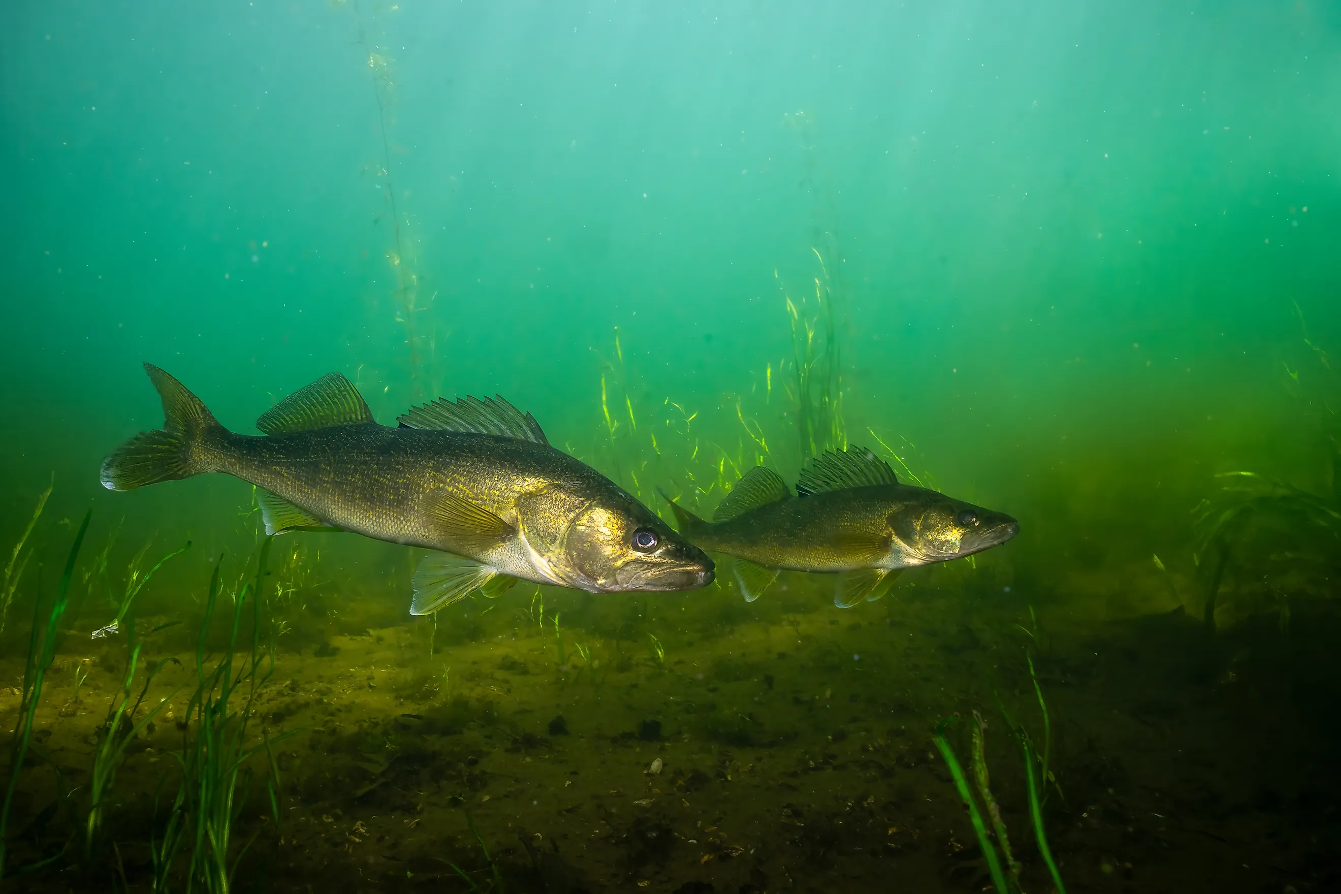
The walleye is one of the most pursued freshwater gamefish across the northern United States, both for dinner and for bragging rights. It is prized for its light flaky fillets and its habit of hiding on a rocky reef or a mudflat until dusk. A great walleye lake needs consistent reproduction or stocking, a strong forage base, and enough structure and open water for both numbers and size. This list covers ten walleye waters spanning the Great Lakes and the Missouri River reservoirs as well as the natural lake country of the Upper Midwest. Walleye fishing alone supports a multibillion-dollar tourism economy that fills resorts and small-town Main Streets every spring and fall. The lakes below are ranked by a blend of angler reputation and hard survey data.
Lake Erie, Ohio, Pennsylvania, New York, and Michigan

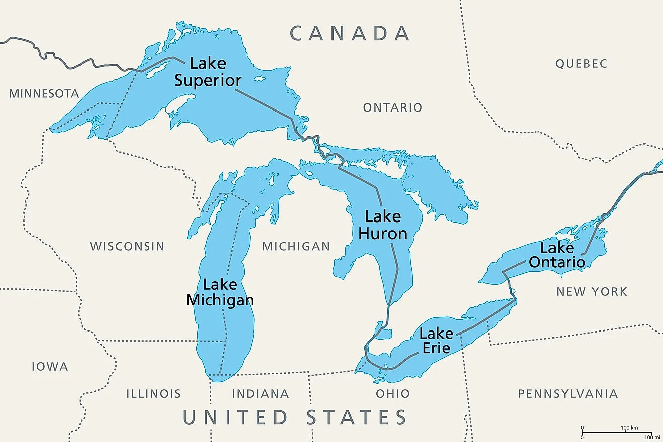
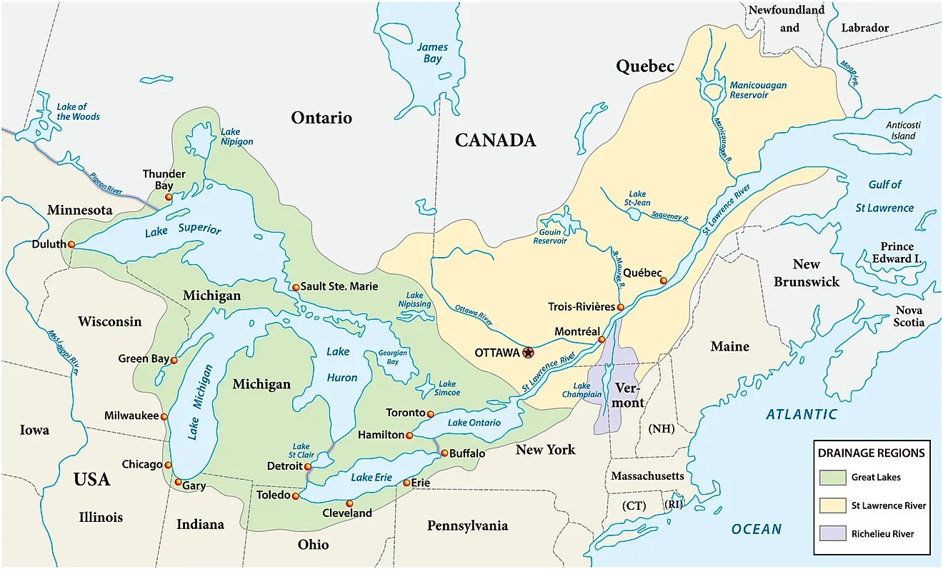
Lake Erie is widely known as the Walleye Capital of the World, and the title is backed by biology as much as bravado. The lake's western basin, fed by the Maumee, Portage, and Sandusky Rivers, is one of the most productive walleye spawning grounds on the continent. Ohio's Division of Wildlife has tracked adult walleye populations in the tens of millions in recent years. Lake Erie covers 9,910 square miles, or 25,667 square kilometers, and ranks as the fourth-largest of the Great Lakes by surface area. It stretches about 241 miles long and up to 57 miles wide. The lake is also the shallowest and warmest of the five, which helps explain why it grows fish so quickly. Port towns like Port Clinton, Oak Harbor, and Marblehead anchor the spring jig-and-reef bite, while summer sends fish east toward Geneva and Ashtabula, where anglers regularly brag of seven-pound-plus whopper walleye. The Marblehead Lighthouse, one of the oldest operating lighthouses on the Great Lakes, and the sandy shoreline of Presque Isle State Park give visiting anglers a reason to stick around beyond the boat ramp. Ohio's state-record walleye, caught in Lake Erie waters, weighed 16.19 pounds.
Lake of the Woods, Minnesota

Lake of the Woods shares the Walleye Capital of the World nickname with Lake Erie, and locals in Baudette will happily argue their case. The lake covers roughly 950,400 acres in total. About 307,000 acres of that, or 1,243 square kilometers, lie on the Minnesota side, and the lake reaches a maximum depth of 210 feet. More than 14,000 islands and countless reefs make it a maze worth hiring a guide for, but the payoff is 50 to 100 catch days that locals consider normal. The South Shore is known for numbers, while deeper reefs and the Rainy River mouth produce the trophy fish. Don't miss Baudette's Willie the Walleye, a 40-foot fiberglass statue billed as the most photographed walleye in the world. Zippel Bay State Park, on the lake's south shore northwest of Baudette, offers camping, a swimming beach, and boat access for anglers working the south end. Bundle up. Ice fishing here runs from early December into spring, and heated, guide-serviced houses make it one of the most accessible hardwater fisheries in the country.
Mille Lacs Lake, Minnesota

Minnesota's second-largest inland lake, Mille Lacs covers 132,516 acres, or 536 square kilometers. Its waters spread across Mille Lacs, Aitkin, and Crow Wing Counties, and it sits roughly 75 miles north of the Minneapolis-St. Paul metro area, which makes it highly accessible. It is shallow for its size, with a maximum depth of just 42 feet. Most of the lake sits between 20 and 30 feet deep, a profile that lets the entire basin stay well-oxygenated and productive for walleye spawning. Billions of walleye eggs are produced here annually, and the lake's gravel bars, mudflats, and rock reefs give anglers a different pattern to chase in every season. The town of Garrison, on the lake's southwest shore, is home to a giant walleye statue and the Garrison Concourse, a National Register of Historic Places site built by the Civilian Conservation Corps. Isle and Onamia round out the lake's main fishing towns, and the southern shore borders the Mille Lacs Band of Ojibwe reservation. Regulations here have tightened in recent years to protect the walleye population, so anglers should check current slot limits before heading out.
Devils Lake, North Dakota

Devils Lake is North Dakota's largest natural body of water and one of the most unusual entries on this list. It is endorheic, meaning it has no natural outlet, so its size has swung dramatically over the past century. In 1940 it shrank to roughly 10 square miles at its lowest recorded point. By June 2011 it had risen to a modern high of about 211,000 acres. The lake fluctuates with precipitation but remains one of the largest walleye fisheries in the region. State test-net surveys have recorded strong numbers of both eater fish in the 15-to-20-inch range and larger trophy specimens. The lake reaches a maximum depth of more than 59 feet. Grahams Island State Park, on the lake's north-central shore near the city of Devils Lake, offers camping, boat access, and cabins, and the Spirit Lake Reservation borders the lake's southern edge. Walleye season on Devils Lake runs 365 days a year.
Lake Oahe, South Dakota and North Dakota

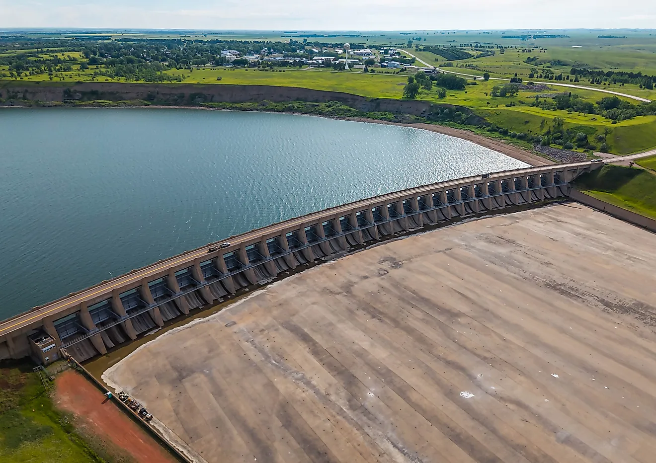
Lake Oahe is a Missouri River reservoir that runs 231 miles between the Pierre area in South Dakota and Bismarck in North Dakota. It has a surface area of about 370,000 acres, or 1,497 square kilometers. Its maximum depth is 205 feet. The construction of the Oahe Dam, one of the largest earth-rolled dams in the world, created the lake, and its cold, oxygen-rich tailwater below the dam is considered one of the premier walleye fisheries in North America. The main lake itself, with its flooded creek arms and points, is both a numbers fishery and a trophy one. Oahe Downstream Recreation Area, just below the dam near Pierre, gives anglers direct access to both Oahe's tailrace and the adjoining Lake Sharpe, along with camping and a marina. More than 1.4 million people visit Lake Oahe's recreation areas annually, making it one of the most-used reservoirs on the upper Missouri River system.
Lake Sakakawea, North Dakota

Named for Sacagawea, the Shoshone woman who guided the Lewis and Clark expedition through this stretch of the Missouri River, Lake Sakakawea is the largest lake entirely within North Dakota and the third-largest reservoir in the country by volume. It covers about 307,000 acres, or 1,243 square kilometers. Behind Garrison Dam it runs 178 miles long and reaches a maximum depth of 180 feet. Walleye are the lake's headline species, supported by a resurgent population of rainbow smelt that serves as the primary forage base. The fishery has rebounded strongly in recent years as water levels have stabilized. Lake Sakakawea State Park, on the south shore near Pick City adjacent to Garrison Dam, anchors the western terminus of the 4,600-mile North Country National Scenic Trail and offers marinas, camping cabins, and deep-water boat access. McKenzie Bay, an isolated arm that fishes more like a natural lake than a river reservoir, is an early-season hotspot for spawning walleye.
Green Bay, Wisconsin and Michigan

Green Bay is technically an arm of Lake Michigan, separated from the main lake by Wisconsin's Door Peninsula, but it fishes like a world unto itself. It covers about 1,600 square miles, or 4,144 square kilometers. The bay stretches roughly 120 miles long and runs 10 to 20 miles wide. It produces some of the largest walleye in the Midwest, with fish in the 28-to-36-inch class showing up regularly each spring near the mouths of the Fox, Oconto, and Peshtigo Rivers. By midsummer, the action shifts to reefs and points along the Door County shoreline, and by fall, anglers work the upper bay toward Michigan's Big Bay de Noc. The city of Green Bay, at the bay's southern tip, anchors the Fox River spawning run, while Sturgeon Bay, on the Door Peninsula, is a base for the trophy fall bite. The bay's size and habitat diversity mean it rarely gets crowded, even with anglers converging from Wisconsin, Illinois, and beyond every spring.
Lake Winnebago, Wisconsin

Lake Winnebago is Wisconsin's largest inland lake, covering 137,700 acres, or 557 square kilometers. Its shoreline touches Winnebago, Calumet, and Fond du Lac Counties, and it measures roughly 30 miles long and 10 miles wide. The lake is shallow, with an average depth of just 15.5 feet and a maximum of 21 feet, which keeps the whole basin mixed and productive. Walleye fishing here is considered among the best in the country, fueled by strong spring spawning runs up the Wolf and Fox Rivers and a scattering of gravel reefs across the lake's center, including the well-known Kelly's Point and Long Point Reef. The cities of Oshkosh, Fond du Lac, Neenah, and Menasha ring the shoreline, and Lakeside Park in Fond du Lac is a popular shore-fishing and picnicking spot for catfish and panfish as well as walleye. Lake Winnebago also holds the largest self-sustaining lake sturgeon population in the world, drawing a dedicated spearing season every February.
Fort Peck Lake, Montana

Fort Peck Lake is Montana's largest body of water by surface area and the fifth-largest reservoir in the United States, covering about 245,000 acres, or 992 square kilometers, behind the Fort Peck Dam on the Missouri River. Built between 1933 and 1940, the dam is the largest hydraulically filled earthen dam in the country and stands as a Depression-era engineering landmark in its own right. The lake stretches 134 miles and reaches a maximum depth of 220 feet. Its shoreline runs more than 1,520 miles, longer than the entire California coast. Walleye were introduced in the early 1950s and have rebounded strongly over the past several seasons, supported by ongoing Montana Fish, Wildlife and Parks stocking programs. The reservoir is almost entirely surrounded by the Charles M. Russell National Wildlife Refuge, more than a million acres of public land good for fishing, hiking, and wildlife-watching between casts. Because Fort Peck sits far from Montana's more crowded western reservoirs, anglers here often have long stretches of shoreline entirely to themselves.
Saginaw Bay, Michigan

Saginaw Bay is a 1,143-square-mile extension of Lake Huron, or about 2,960 square kilometers, forming the gap between Michigan's Thumb region and the rest of the Lower Peninsula. Michigan's Department of Natural Resources has called it the state's walleye factory, and the bay supports one of the densest walleye populations per acre anywhere in the Great Lakes. Fish here typically run 16 to 22 inches, and quality catches over 25 inches show up regularly. The spring spawning run up the Saginaw River, which re-opens on the last Saturday in April, is one of the most reliable jigging bites in the Midwest. The open bay fishes best by trolling from May through fall. Bay City State Park, on the bay's southern shore, protects the Tobico Marsh, one of the largest remaining freshwater coastal wetlands on the Great Lakes. The park also offers camping, a swimming beach, and the Saginaw Bay Visitor Center for anglers looking to fill a non-fishing afternoon. Towns including Bay City, Caseville, and Au Gres line the bay's basin, giving anglers plenty of access points regardless of wind direction.
Cast Your Line Across America's Walleye Country
The reef-studded western basin of Lake Erie and the wide-open Missouri River water behind Fort Peck Dam sit at opposite ends of this list, and together these ten lakes show just how many different shapes a great walleye fishery can take, whether natural glacial lakes, sprawling river reservoirs, or even an arm of a Great Lake. Some reward with sheer numbers, others with the chance at a wall-hanging trophy, and a few, like Lake of the Woods and Lake Erie, offer both in the same afternoon. Whichever one makes the trip list first, check current state regulations, slot limits, and seasonal closures before launching.