Lake Mille Lacs, Minnesota
Lake Mille Lacs and the region surrounding it in central Minnesota have become popular vacation and recreation destinations. The name is French and means "Lake of a thousand lakes." The Dakota people, the original Native American inhabitants, called it Mde Wakan, meaning Wonderful Lake or Spirit. In Ojibwe, it is called Misi-zaaga'igan, or Grand Lake. In particular, the lake is renowned for recreational and trophy fishing, boating, and family-friendly beaches. In winter, the lake turns into a top ice fishing destination. Some restrictions are, however, applied at specific times of the year to manage the lake and its fish populations.
Geography Of Lake Mille Lacs

The lake covers about 335 square km, making it the second largest of Minnesota's inland lakes. It is located about 145 km north of Minneapolis-St Paul in central Minnesota. It extends into Mille Lacs, Aitkin, and Crow Wing counties.
The beach area of the shore is located in Father Hennepin State Park, a 1.3 sq. km park that includes the lake's rocky shore and the hardwood forest farther inland. There are smaller beach areas on the lake's west, northeast, and southern shores. Rum River has its headwaters in Mille Lacs Lake, along with numerous smaller streams.
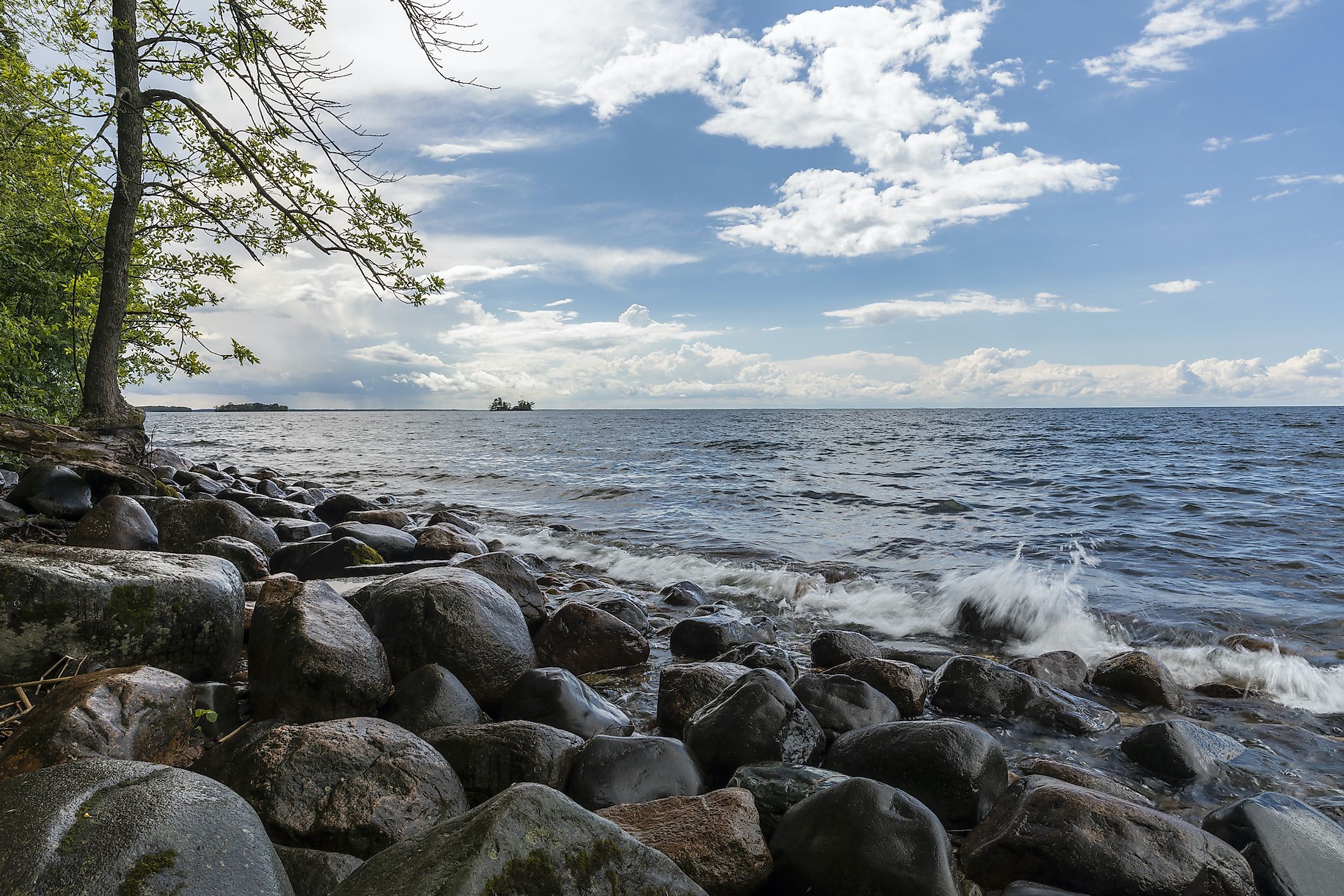
Geology
Mille Lacs Lake formed about 15,000 years ago at the end of the last Ice Age. A large piece of ice, called a lobe, flowed into the area from what is now the Lake Superior basin. About 3,000 years later, another lobe of ice drifted into the area from the north. Their combined meltwaters created a large shallow lake.
The terrain is hilly and rocky country to the north of the lake, a landscape that transitions to gentler hills as it moves south. Sand and gravel ridges rise above the soil, which is made up of layers of sediment from the melting glacial ice. There are more than a dozen islands within the lake waters, many privately owned.
The lake is shallow, with maximum depths of about 12 m, much of it falling between 6 m and 10 m. The lake bed varies from north to south. The northern portion consists of mud flats, gradually revealing gravel and rock beds towards the south.
Climate
The coldest month of the year in the Mille Lacs Lake area is January when average daily temperatures range from lows of -17.5 °C to highs of -6 °C. On average, there are just under 40 days a year when the nighttime low temperature falls below -18 °C. The hottest month is July, with average daily temperatures ranging from 27 °C to about 13 °C. Snow is common throughout the winter, from late October until mid-April, with an average of 1,105 mm of snow annually. The snowiest month is typically December, with an average snowfall of about 230 mm. June is the wettest month, with an average rainfall of 112 mm. Autumn is the wettest season overall, and spring is the driest.
Flora And Fauna Of Lake Mille Lacs

The lake's cold waters are an ideal habitat for fish, including smallmouth bass, along with northern pike, muskie, perch, whitefish, and walleye. The lake is well-oxygenated, and its large size provides a variety of environments that create shallow reefs, creating an ideal spawning ground for many fish species. The smaller species feed on the abundant plant growth of the shallows, while the larger fish, such as walleye, prey on the smaller varieties.
The forests that surround the lake are home to diverse creatures, including whitetail deer, bear, and grouse. Ducks and other waterfowl thrive on the grasses and other vegetation that grows in the shallows. The Ojibwe, who lived in the area for more than a century, thrived by hunting, fishing, gathering wild rice, and harvesting the maple sugar of the forests.
Brief History

There is archaeological evidence of habitation along the lake shores from about 3,000 BCE, with many copper tools dating from about 1,000 BCE. From prehistoric times until the mid-1700s, the region around Lake Mille Lacs in Minnesota was home to the Dakota people.
According to oral history, the Ojibwe, an Anishinaabe people, migrated west from the Atlantic coast, eventually clashing with the Dakota. It is believed this took place in the early 18th century. The Dakota lost a battle at Cormorant Point on Lake Mille Lacs, forcing them to emigrate to the west and south.
Daniel Greysolon, Sieur Du Luth, arrived in the area in 1679, the first European to reach the area. He made contact with the Dakota at a large settlement on Mille Lacs Lake and later claimed the place in the name of France. There was friction with the new arrivals, and the Dakota captured Father Hennepin and two other settlers. Du Luth came back to the area in 1680 to rescue them.
After the Ojibwe took over the region as fur-trapping territory to trade with the European settlers in about 1745, the Lake Mille Lacs Band inhabited the region around the lake on land that was granted as a reservation by the US federal government. In 1854 and 1855, the American government offered new treaties, which essentially took away much of the Native American lands in northern Minnesota. A much smaller version of the Lake Mille Lacs Reservation still exists south of the lake.
In 1855 and 1856, roads and schools were constructed, linking the small towns around the lake. Mille Lacs County was established in 1860, with the Lake at the north boundary. It has been a favorite tourist and recreational destination since the late 19th century.


