The 10 Largest Lakes in Minnesota
Minnesota has 11,842 lakes covering at least 10 acres. The ten on this list span roughly 1,133 square miles combined. The list follows Minnesota DNR's ordering for lakes that lie entirely within state lines. International and interstate border waters are excluded to ensure a consistent comparison. Areas come from the DNR's statewide table and are presented in imperial units first, with metric equivalents.
Red Lake (Upper and Lower)

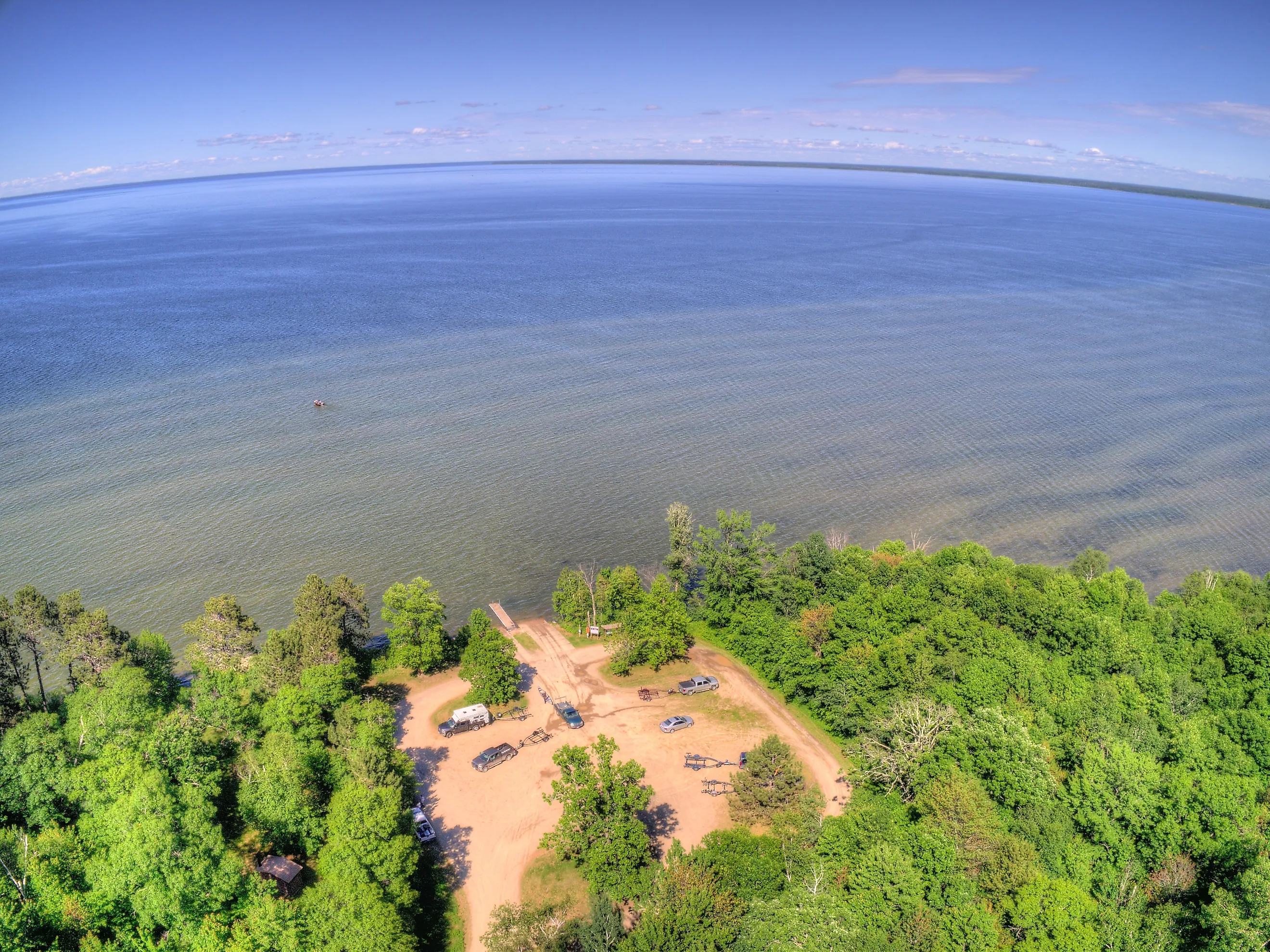
Upper and Lower Red Lake in northern Minnesota together form the largest lake system located entirely within the state, covering about 451.3 mi² (1,168.7 km²) across its Upper and Lower basins. A wide channel links the two basins, which are remnants of ancient glacial Lake Agassiz. Despite its size, Upper Red Lake has a maximum depth of only about 18 ft (5.5 m). Walleye drive much of the fishery, and the Minnesota DNR manages the public portion jointly with the Red Lake Nation. Visitors can access the eastern side of Upper Red Lake near Waskish via the Big Bog Public Water Access, locally known as Homestead Park. All of Lower Red Lake and much of Upper Red Lake lie within the Red Lake Indian Reservation, where nonmembers need specific tribal authorization.
Mille Lacs Lake

Wind can turn Mille Lacs Lake into a gray, open sweep that feels larger than its 207.1 mi² (536.3 km²). Father Hennepin State Park has a lovely quarter-mile natural sand beach, complete with two piers and the Pope's Point Trail along the southeast shore. On the southwest side, Mille Lacs Kathio State Park sits beautifully, with its interpretive center and a 100-foot observation tower perched above the old glacial moraine. Between these two parks, Mille Lacs Lake is almost perfectly round. On average, it's about 28.5 feet deep but can hit 42 feet at its deepest spots, so weather can quickly alter conditions for boating. The area is home to gravel reefs, sandbars, and rocky shorelines that support a well-managed walleye fishery and fantastic smallmouth bass fishing.
Leech Lake

North of Minnesota's central resort belt, Leech Lake spreads through large bays, narrow passages, and long wooded points rather than forming one simple bowl. Walker sits on the western shore, with much of the rest inside Chippewa National Forest and the Leech Lake Reservation. It's roughly 175.0 mi² (453.2 km²), making it the state's third-largest basin entirely within Minnesota. The lake depth changes quickly around Walker Bay, reaching nearly 150 ft (45.7 m), even though about 80 percent of the lake is less than 35 ft (10.7 m) deep. That mix of deep and shallow water helps support walleye, muskellunge, northern pike, perch, and bass through the seasons.
Lake Winnibigoshish

Crossing Lake Winnibigoshish on a breezy day makes its shallow spread and long fetch immediately obvious. A dam on the Mississippi River raised the level in the late nineteenth century, creating today's reservoir-like shore and broad sandy shoals. Big Winnie sits inside Chippewa National Forest, where the Third River Boat Ramp leads in through Third River Flowage. Its 58,544 acres cover about 91.5 mi² (236.9 km²), but the average depth is only 15.1 ft (4.6 m). The maximum depth is 70 ft (21.3 m). Cut Foot Sioux Lake connects to it on the northeast side, and Battle Point Research Natural Area protects old-growth northern hardwoods nearby. Anglers frequently pursue walleye, yellow perch, and northern pike here.
Lake Vermilion

Lake Vermilion covers 40,557 acres, about 63.4 mi² (164.1 km²), and stretches 37 mi (59.5 km) from end to end. Soundings reach 76 ft (23.2 m), and hundreds of islands divide the surface into sheltered bays and rocky channels. Towns of Tower and Cook provide access from opposite sides of the lake, and Lake Vermilion-Soudan Underground Mine State Park offers plenty of activities, including shoreline access, camping, hiking, and tours of Minnesota's oldest iron-ore mine. Even on a short outing, the branching shoreline makes a navigation chart useful.
Lake Kabetogama

At Lake Kabetogama, water is basically the main road. It's the biggest lake sitting entirely within Voyageurs National Park. The Kabetogama Lake Visitor Center serves as a hub with a launch, a dock, exhibits, and seasonal ranger assistance. From here, guided tours fan out along the network of connected waterways, and if you head out by boat about 5 miles, you'll find Ellsworth Rock Gardens. The permit-only campsites require advance planning, and most are reached by water. For this ranking, the DNR's statewide table lists Kabetogama at 25,760 acres, equivalent to about 40.3 mi² (104.2 km²). Soundings reach 80 ft (24.4 m). The lake has rocky shores and forested islands, while broad wetlands spread along its western side. Walleye, sauger, pike, perch, and smallmouth bass support the fishery.
Mud Lake (Marshall County)
Cattails, open pools, and low wetland horizons differentiate Mud Lake from the recreational waters elsewhere in this ranking. The DNR lists its footprint at 23,700 acres, or about 37.0 mi² (95.9 km²), but fluctuating water levels and emergent vegetation make the open area variable. This wetland sits within Agassiz National Wildlife Refuge, which was established in 1937 as the Mud Lake Migratory Waterfowl Refuge. Managers use dikes and control structures to maintain pools and mudflats for ducks, shorebirds, sandhill cranes, and other wildlife. The refuge's auto tour drive and designated hiking trails generally operate from May through mid-October during daylight hours.
Cass Lake
Cass Lake occupies a busy junction in the Upper Mississippi River watershed. The entire shore lies within the Leech Lake Reservation and Chippewa National Forest, giving it cultural significance and opportunities for public forest recreation. Its 15,596 acres cover about 24.4 mi² (63.1 km²), with deep bowls separated by bars and wide shallow areas. Water reaches 120 ft (36.6 m), while the average is roughly 25 ft (7.6 m). Norway Beach Recreation Area has campgrounds, a swimming beach, a paved bicycle route, and a launch. Farther north, the Turtle River Canoe Route enters Cass after passing through smaller waters. Walleye, perch, and muskellunge are leading angling targets.
Lake Minnetonka

Lake Minnetonka, the largest lake in the Twin Cities metropolitan area, is located just west of Minneapolis. Wayzata and the city of Excelsior are two of the lake's many cities and offer visitors and residents a chance to take a nice walk to the lake, while the quieter western coves show how varied the system can feel within a short distance. Lake Minnetonka Regional Park in Minnetrista has one of the few public launches, an accessible pier, picnic areas, and about 3.5 mi (5.6 km) of hiking trails. Across its linked sections and bays, Minnetonka covers about 21.9 mi² (56.7 km²) and reaches 113 ft (34.4 m) at its deepest point. It feeds Minnehaha Creek, which runs east toward the Mississippi River.
Otter Tail Lake

Otter Tail Lake closes the ranking at 13,725 acres, or about 21.4 mi² (55.5 km²), only slightly smaller than Lake Minnetonka. Riviera, Sportsman's, Pelican Bay, and Riverside provide DNR entry points, while a pier at Pelican Bay offers a shore-based option. From the lake, the Otter Tail River route continues downstream toward historic Phelps Mill County Park. Beneath that open, oval surface, the floor descends to a surprising 120 ft (36.6 m), deeper than several lakes ranked far above it by area. Walleye are a major target for anglers, while northern pike and sunfish also appear on state fishing maps. Its simple shape and unusual depth set it apart from the island-dotted lakes farther north.
Beyond the Acreage
For anyone visiting these lakes, the acreage is probably the least interesting part. Once you are there, you notice the shoreline, the water, the crowds, and how easy it is to get around. They are easy places to spend a day without needing much of a plan. You can fish, walk, paddle, stop somewhere for lunch, or simply stay by the water for a while.