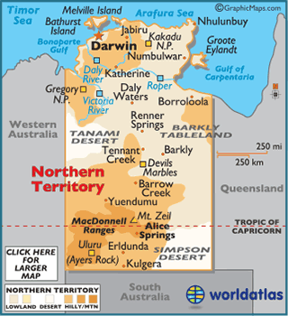
Home
Countries
Australia
Northern Territory
Northern Territory
Flag
Symbols
Location
Geography
Geography Statistics
Facts
Description
NORTHERN TERRITORY MAPS:
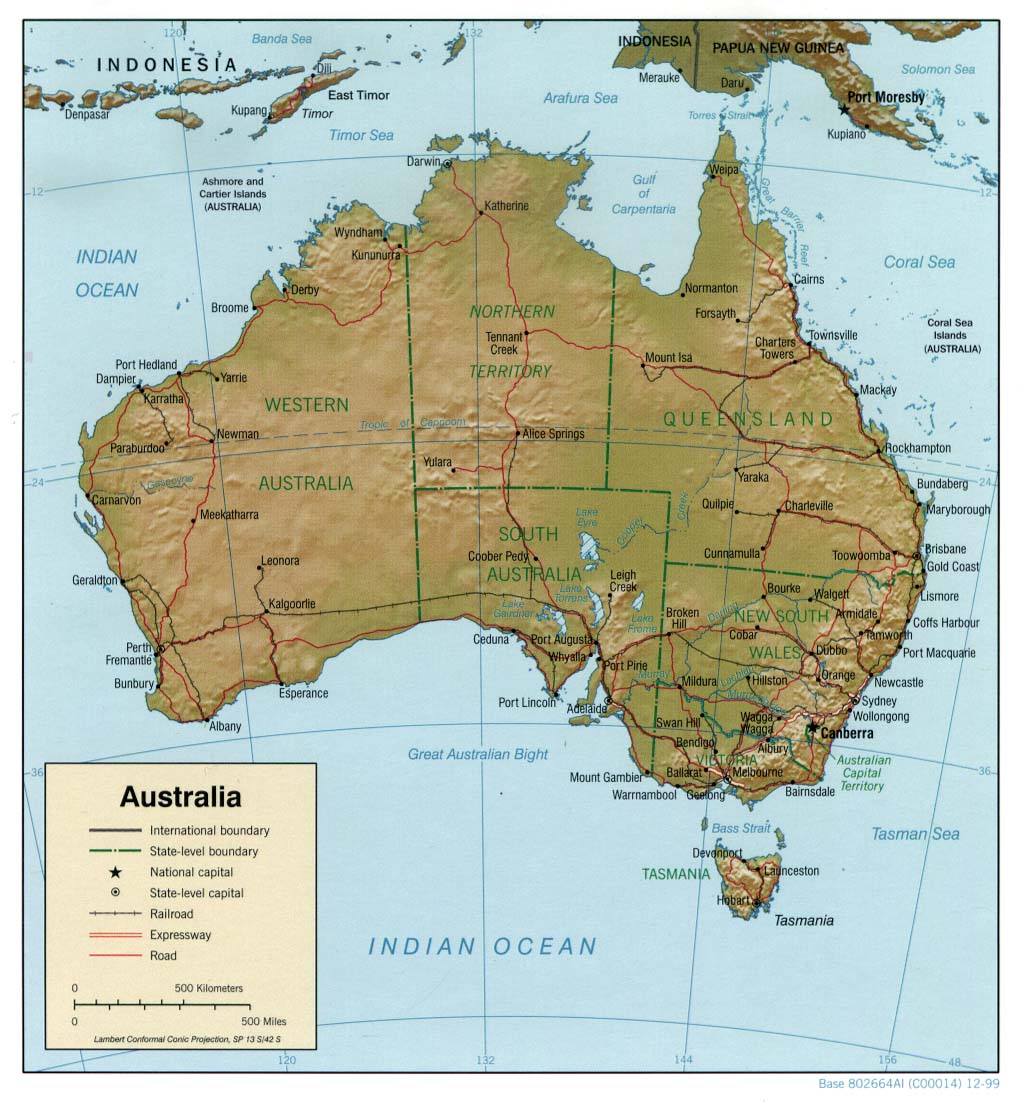
Northern Territory Map
(large color)
Northern Territory Outline Map
AUSTRALIA MAPS:
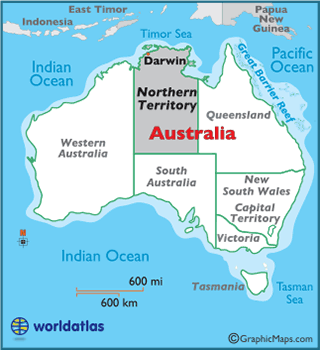
Australia Map
(large color)
Australia Landforms Map
Australia Outline Map
(with political borders)
Australia State and Territory Outline Maps
Australia Time Zones Map
(with political borders)
Kangaroo Island Map
Australia Relief Map
at UT
AUSTRALIA/OCEANIA MAPS:
Oceania Outline Map
AUSTRALIA/OCEANIA REGIONAL MAPS:
Christmas Island
Heard and McDonald Islands
Norfolk Islands
WORLD MAPS:
Outline Maps
(printable)
Timezone Map
CUSTOM IMAGES & MAPS:
Custom Maps
created by Graphic Maps
Map Clip Art
(free)
Latest by WorldAtlas
4 Most Snake-Filled Bodies Of Water In Vermont
7 Serene Finger Lakes Towns For A Weekend Retreat
7 Must-See Historic Forts In Maine
10 Stunning Small Towns In The Maritimes
10 Best Road Trips in the United States
The Most Wolf-Dense Regions in the United States
Cities With The Worst Air Quality In North America
10 Best Cities To Retire In Portugal
Inside the London Cathedral Chapel Honoring 28,000 American War Dead
7 Most Hospitable Towns In Netherlands
Why The Search For Planet Nine Picked Up Again
The Truth About Gladiators In The Roman Empire
Continents
All Continents
North America
Caribbean
Central America
South America
Europe
Africa
Middle East
Asia
Oceania
Arctic
Antarctica
Countries
All Countries
US Maps
China Maps
Russia Maps
Philippines Maps
Egypt Maps
Geography
Bodies of Water
Landforms
Places
Nature
All Geography
Education
History
Science
Social Science
Society
Economics
Politics
About Us
Contact Us
Privacy
Copyright
Search WorldAtlas