- Coastline:
6,805 miles (10,953 km)
- Land Area:
(land) 520,902 sq miles (1,349,129 sq km)
(water) 27,737 sq miles (71,839 sq km)
(TOTAL) 548,640 sq miles (1,420,970 sq km)
To convert sq km (kilometers) to sq mi (miles)
use our converter - Land Area: (all countries)
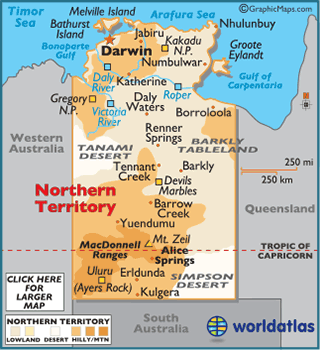
- Land Divisions: There are 5 counties in Northern Territory. They are Disraeli, Malmesbury, Palmerston, Roseberry, and Gladstone.
- Horizontal Width: 194.59 miles (3,13.17 km) from Daly Waters east to Borroloola
- Vertical Length: 898.99 miles (1,446.79 km) from Jabiru south to Kulgera
Note: Lengths and widths are point-to-point,
straight-line measurements from a Mercator map projection, and will vary
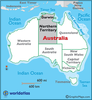
some using other map projections - Bordering Countries: (3) Queensland, South Australia, Western Australia
- Geographic Center: About 104.33 miles (167.90 km) south of Tennant Creek
- Highest Point: Mount Zeil 5,023 ft (1,531 m)
- Lowest Point: Timor Sea 0 m
- Latitude and Longitude
- Relative Location