Northern Territory
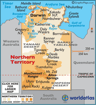
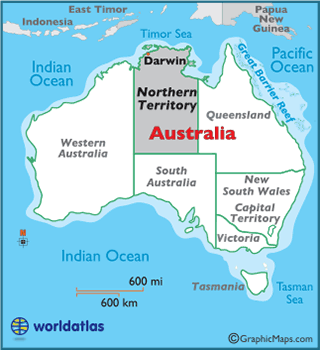
Located in the north central region of Australia, the Northern Territory covers an area of 520,902 sq. miles (1,349,129 sq. km).
Much of the region is flat, but a few disconnected ranges dot the landscape, including the MacDonnell Ranges, Petermann Ranges and Harts Range.
The best known landform in the Northern Territory is Ayers Rock (known as Uluru) in the southern part of the territory. Ayers Rock, a national symnol of Australia, is a large sandstone rock formation very sacred to the Aboriginal people of the area - the Anangu - and rises 1,142 feet (348 m).
Wetlands dominate Kakadu National Park, located in the northern part of the territory, wetlands running to the edges of the Arafura Sea.
The Northern Territory boasts an extensive series of small river systems in its northern reaches that include the Alligator, Daly, Finke, McArthur, Roper, Todd and Victoria Rivers.
The highest point of the territory is Mount Zeil at 5,023 ft (1,531 m); the lowest point is on the edge of the Gulf of Carpentaria (0m).