Maps of Northern Territory
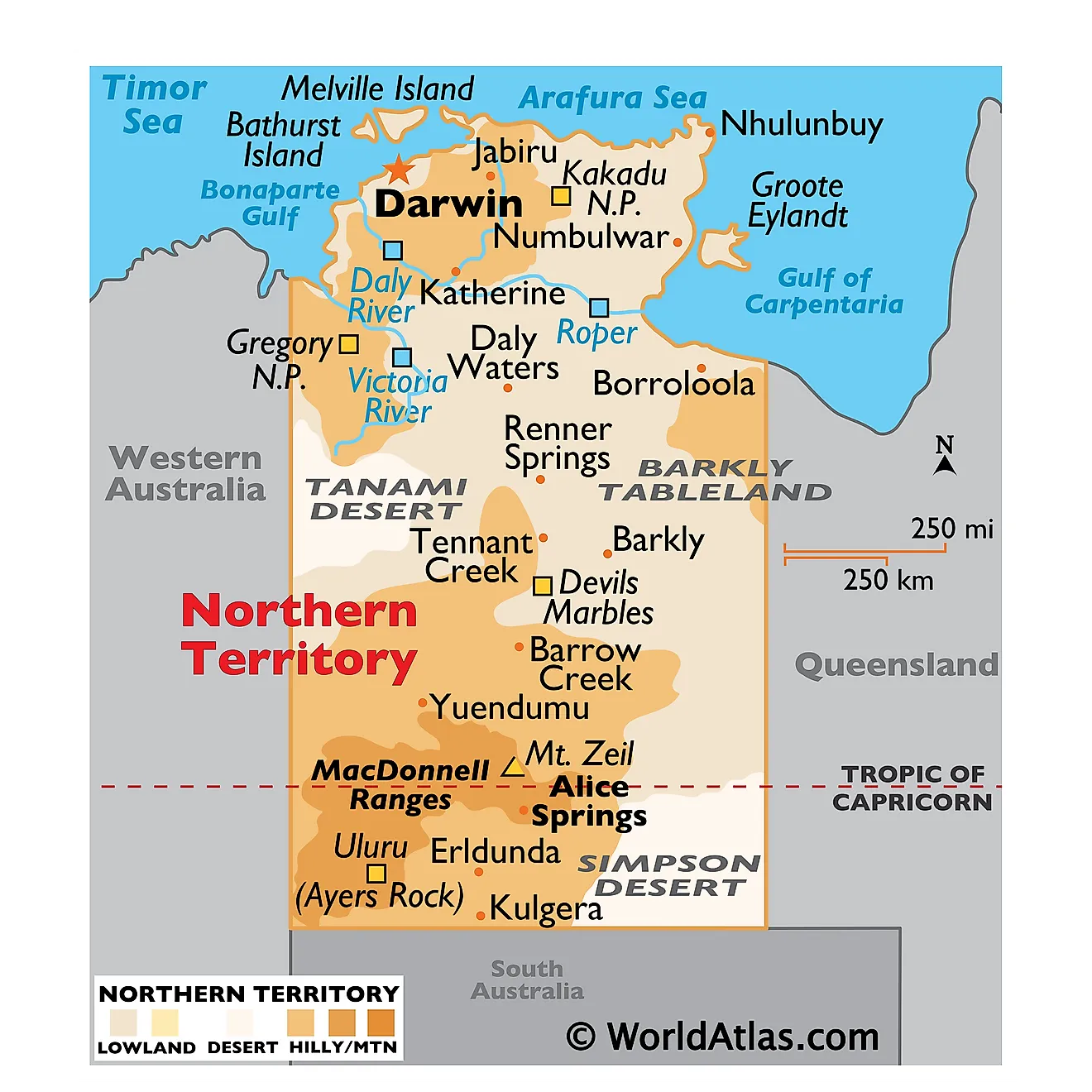
The Northern Territory, a federal territory in Australia, shares its borders with Western Australia to the west, South Australia to the south, and Queensland to the east. To the north, it faces the Timor Sea, Arafura Sea, and the Gulf of Carpentaria. Covering an area of approximately 520,902 square miles), the Northern Territory encompasses diverse geographical regions, notable bodies of water, and significant river systems.
The Northern Territory hosts two magnificent landforms: one is the Ayers Rock (Uluru) – a large sandstone monolith that rises to an elevation of 348m in the southern part of the territory. The other one is the Kata Tuja (Olgas) - a group of large 36 domes that are also located in the southern part of the territory. These two major landmarks form a part of the Uluru-Kata Tjuta National Park and are regarded as a sacred site for the indigenous Aborigine people of the area.
The geography of the Northern Territory divides into three main regions: the Central Region, the Top End, and the Arnhem Land Plateau.
The Central Region comprises the semi-arid and arid desert landscapes of the Red Centre, characterized by vast plains, rugged mountain ranges, and the iconic Uluru (Ayers Rock) and Kata Tjuta (The Olgas) rock formations. The Simpson Desert, Tanami Desert, and Great Sandy Desert stretch across the southern and western parts of the region, with the MacDonnell Ranges running east to west in the center.
The Top End, in the northern part of the territory, features a tropical climate and diverse ecosystems, including savannas, monsoon forests, and coastal wetlands. The region's major rivers, such as the Daly, Adelaide, and Mary, flow through the Top End, providing essential water sources and habitats for various plant and animal species.
The Arnhem Land Plateau, situated in the northeastern corner of the Northern Territory, boasts a rugged terrain with deep gorges and escarpments. It serves as a significant cultural area for Indigenous Australians and contains the Kakadu National Park, a UNESCO World Heritage Site. This park features extensive wetlands which run along the edges of the Arafura Sea. The territory also comprises several offshore islands including Bathurst, Groote Eylandt, Melville, etc. The Simpson Desert occupies the extreme southeastern corner of the state while the grassy Barkly Tableland is located to the north of the Simpson Desert.
Major bodies of water in the Northern Territory include the Timor Sea, Arafura Sea, and the Gulf of Carpentaria. The Timor Sea, located along the territory's northwestern coastline, connects Australia to the Indian Ocean and Southeast Asia. The Arafura Sea, situated to the north, separates the territory from the Indonesian archipelago and Papua New Guinea. The Gulf of Carpentaria, which forms the northeastern coastline of the Northern Territory, is a large, shallow sea enclosed by the Cape York Peninsula in Queensland and the Arnhem Land in the Northern Territory.
The Northern Territory's most prominent river systems are the Daly River, Adelaide River, and Mary River. The Daly River, approximately 220 miles long, originates in the Territory's northwest and empties into the Timor Sea. The Adelaide River, stretching over 148 miles, flows through the Top End and discharges into the Van Diemen Gulf. The Mary River, extending over 181 miles, flows across the northern part of the territory, draining into the Arafura Sea. These rivers provide essential water sources for agriculture, wildlife, and human populations while also shaping the territory's diverse ecosystems.
Counties Map
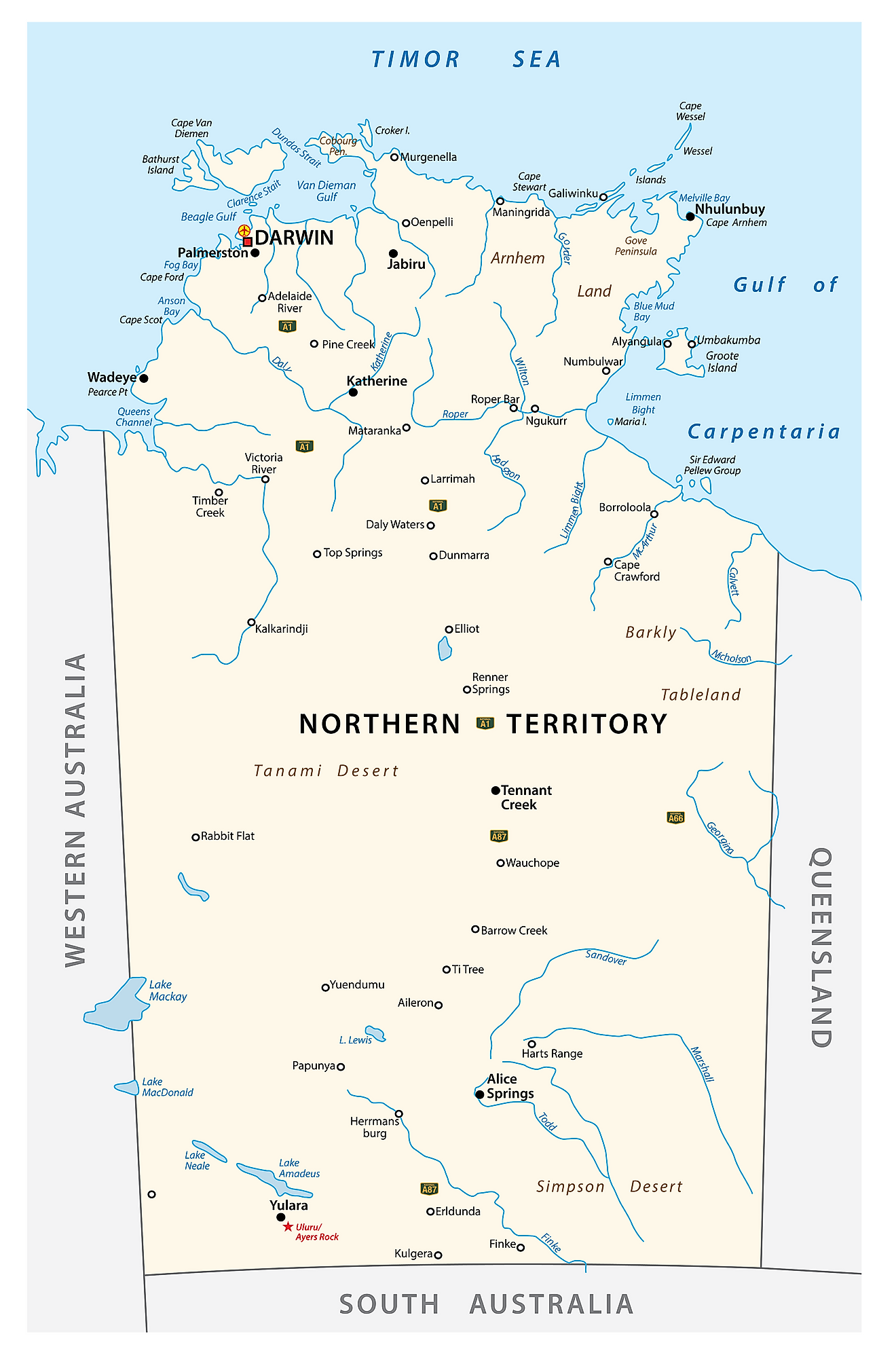
The self-governing Northern Territory of Australia is divided into 5 counties. In alphabetical order, these counties are Disraeli, Gladstone, Malmesbury, Palmerston, and Roseberry. In addition to the counties, the Territory is also divided into 17 local government areas and contains 5 municipalities and 11 shires.
Covering an area of 1,349,129 sq. km, the Northern Territory is the 3rd largest federal division in Australia and the world’s 11th largest country subdivision. Located on the Timor Sea coast is Darwin, the capital and the largest city in the Northern Territory. It is the smallest and the northernmost of Australia’s state and territorial capital cities. Due to its strategic location near Southeast Asia, the city of Darwin serves as a connection between Australia and other nations such as Indonesia and East Timor.
Where is Northern Territory?
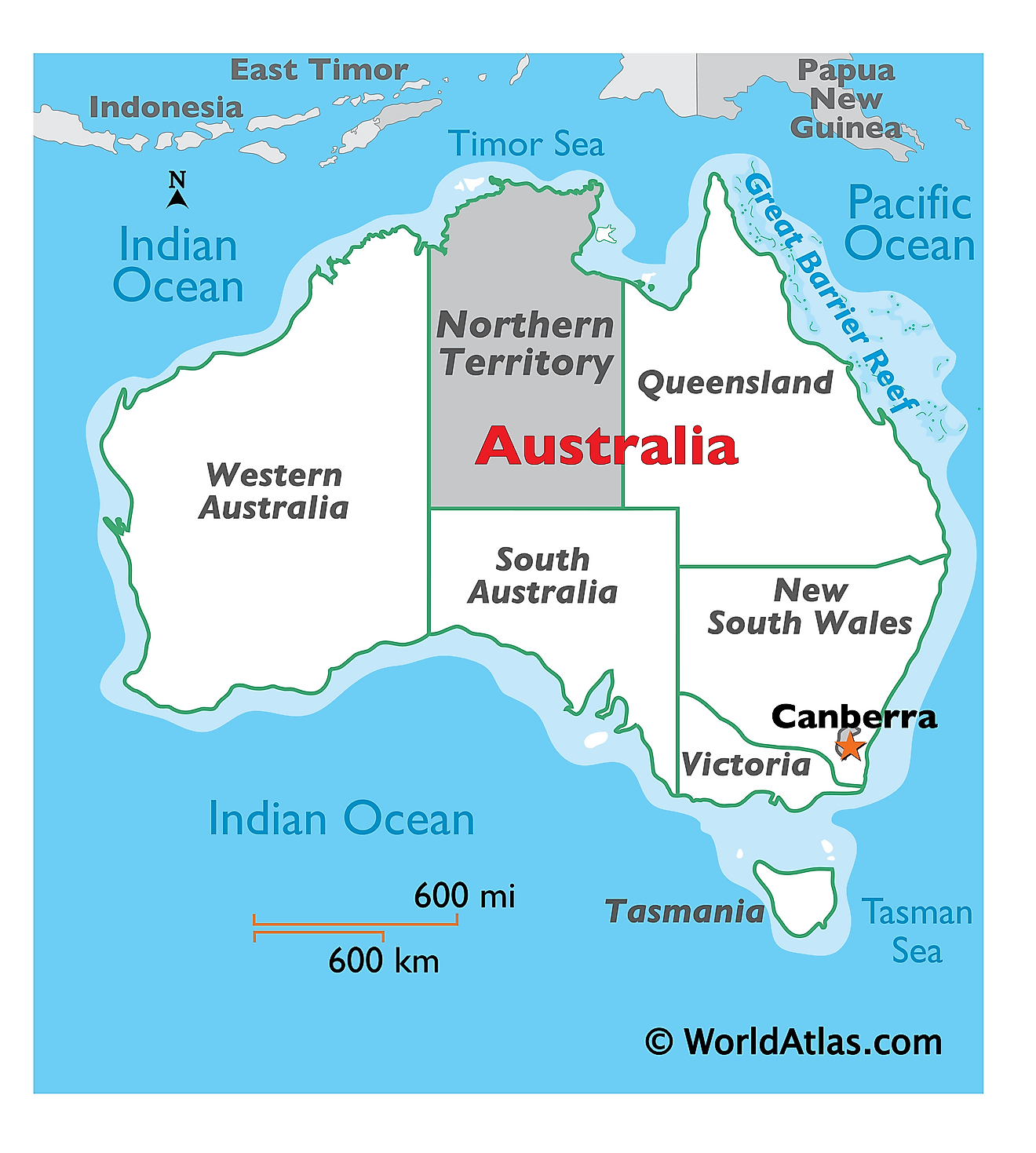
Northern Territory is a large territory located in the central northern part of Australia. It is geographically positioned in the Southern and Eastern hemispheres of the Earth. Northern Territory is surrounded by the states of Western Australia in the west; South Australia in the south; by Queensland and the Gulf of Carpentaria in the east. It is bounded by the Timor Sea, the Arafura Sea, and the Bonaparte Gulf in the north.
Regional Maps: Map of Oceania
Outline Map of Northern Territory
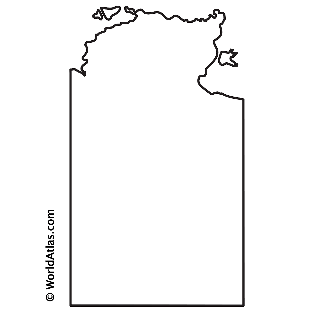
The above blank map represents the Northern Territory, located in the central northern part of Australia. The above map can be downloaded, printed, and used for geography education purposes like map-pointing and coloring activities.
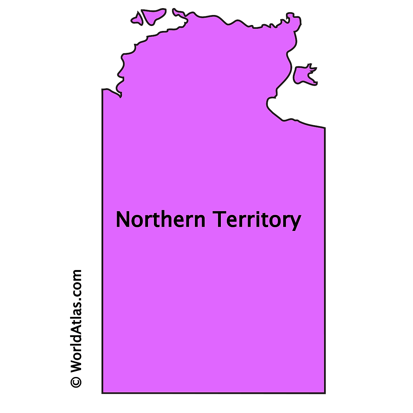
The above outline map represents the Northern Territory, located in the central northern part of Australia.
Key Facts
| Legal Name | State of Northern Territory |
|---|---|
| ISO 3166 Code | AU-AU_NT |
| Capital City | Darwin |
This page was last updated on April 10, 2023
