Maps of Arkansas
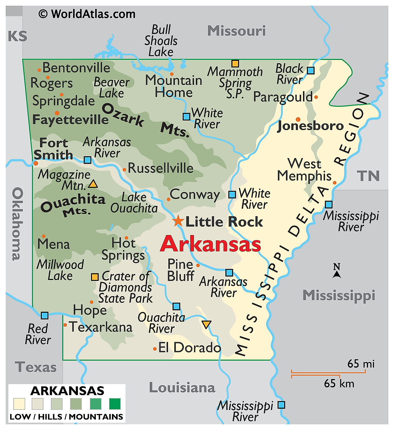
Arkansas is bordered by Missouri to the north, Tennessee and Mississippi to the east, Louisiana to the south, Texas to the southwest, and Oklahoma to the west. It encompasses a total area of approximately 53,179 square miles (137,732 square kilometers), making it the 29th largest state.

Arkansas is split almost exactly in half by a diagonal line running from the northeast corner to the southwest. Northwest of it lie the Interior Highlands, the only substantial mountain country between the Rockies and the Appalachians. Southeast of it lie the Gulf Coastal Plain and the Mississippi floodplain, flat ground built from sediment. Almost every difference in the state, in rock, soil, forest, farming, and settlement, follows that single boundary.
Where Is Arkansas?

Arkansas measures roughly 260 miles across in each direction, giving it a compact shape. Its eastern boundary follows the Mississippi River, its southwestern edge partly follows the Red, and the remaining borders are survey lines.
Elevations run from 2,753 feet at Mount Magazine down to about 55 feet where the Ouachita River crosses into Louisiana. With roughly 3.1 million residents, Arkansas is the 33rd most populous state, and it is divided into 75 counties.
The Ozark Mountains

The Ozarks cover northern Arkansas and form part of the U.S. Interior Highlands, the only major mountainous region between the Rocky Mountains and the Appalachians. Despite the name they are not a folded range but an uplifted dome of flat-lying limestone, dolomite, and sandstone that water has since carved apart. The ridgetops are remnants of an old plateau surface, which is why they rise to roughly the same height across large distances.
Three sections make up the Arkansas Ozarks. The Salem and Springfield plateaus in the north are limestone country, riddled with caves, sinkholes, and springs. The Boston Mountains along the southern edge are the highest and most rugged, capped with resistant sandstone and cut by valleys up to 1,400 feet deep.

The Buffalo National River runs 135 miles through this country beneath limestone bluffs rising over 500 feet. In 1972 it became the first waterway in the United States designated a national river, protected undammed along its entire length.
The Arkansas Valley

Between the Ozarks to the north and the Ouachitas to the south lies the Arkansas Valley, a broad lowland following the Arkansas River across the state. Its floor carries fertile alluvial soil and most of the state's east-west transport.
The valley is not uniformly flat, and this is where a common error creeps in. Mount Magazine, the highest point in Arkansas at 2,753 feet (839 meters), stands in the Arkansas Valley, not in the Ozark Mountains. It is one of several isolated flat-topped mesas rising abruptly from the valley floor, along with Mount Nebo and Petit Jean Mountain. These are erosional remnants: a cap of resistant sandstone protected them while thousands of feet of softer rock around them wore away.

Mount Magazine is also the highest point of the entire U.S. Interior Highlands, and with about 2,143 feet of prominence it is among the most topographically isolated summits in the country. It has no sharp peak at all; the summit is a broad plateau rimmed by cliffs.
The Ouachita Mountains

The Ouachita Mountains lie south of the Arkansas Valley rather than west of it, occupying west-central Arkansas and continuing into Oklahoma. They are genuine folded mountains, unlike the Ozarks: sedimentary rock compressed and buckled during the Ouachita Orogeny roughly 300 million years ago, when the ocean between North America and Gondwana closed.
That compression left the range with a distinctly east-west orientation, unusual in North America, where most ranges run north-south. Long parallel ridges of resistant sandstone alternate with valleys eroded from softer shale, a pattern closely resembling the Ridge and Valley Appalachians.

The folding also drives the region's thermal springs. Rainwater sinks along steeply tilted rock layers to depths of about 8,000 feet, is heated by the earth, and returns to the surface at Hot Springs at around 143 degrees Fahrenheit, taking roughly 4,400 years to make the round trip. The springs were set aside as a federal reservation in 1832, forty years before Yellowstone, making them the oldest federally protected natural area in the country.
The Ouachitas also produce quartz crystals of exceptional quality, formed in veins opened during the same mountain-building, and the Ouachita National Forest covers more than 1.8 million acres of the range.
The West Gulf Coastal Plain

Southern Arkansas belongs to the West Gulf Coastal Plain, which continues into Texas and Louisiana. The land is gently rolling rather than truly flat, sloping south toward the Gulf across unconsolidated sand, gravel, and clay laid down in shallow seas.
Loblolly and shortleaf pine forest dominates, and timber is the region's principal industry. Beneath it lie the deposits that have made this corner economically distinctive: the Smackover formation holds oil and one of the richest bromine brine reserves in the world, and recent attention has turned to the lithium dissolved in those same brines. At Murfreesboro, a volcanic pipe reaches the surface at Crater of Diamonds State Park, the only diamond-bearing site anywhere in the world open to the public, where visitors keep what they find.
The Mississippi Alluvial Plain

Eastern Arkansas lies within the Mississippi Alluvial Plain, known locally as the Delta. This is the flattest ground in the state, built from silt deposited by thousands of years of flooding by the Mississippi and its tributaries.
Abandoned meanders have left oxbow lakes scattered across it, including Lake Chicot, the largest natural lake in Arkansas at about 5,000 acres. Bayous, backswamps, and bottomland hardwood forest fill the lower ground, and the soils are among the most productive in the country, supporting rice, soybeans, and cotton. Arkansas grows roughly half of all rice produced in the United States, nearly all of it here.
The northeastern corner of this plain sits within the New Madrid Seismic Zone, and the earthquakes of 1811 and 1812 reshaped the landscape, creating sand blows and sunk lands still visible today.
Crowley's Ridge

Running through the middle of the Delta is one of the most unusual landforms in the country. Crowley's Ridge is a narrow band of high ground extending about 150 miles from the Missouri border south to Helena on the Mississippi River, rarely more than 12 miles wide, and standing 250 to 550 feet above a plain that is otherwise almost perfectly level.
Its core is erosion-resistant rock left standing between the ancient channels of the Mississippi and Ohio rivers, later capped with a thick layer of windblown loess. The loess gives the ridge fertile, well-drained soil that holds vertical faces when cut, so roads carve steep-sided gullies through it. It also supports a hardwood forest of beech, tulip poplar, and oak more typical of the Appalachians than of the surrounding Delta, making the ridge a biological island.
Rivers

Every river in Arkansas drains eventually to the Mississippi, which forms the entire eastern boundary. The Arkansas River crosses the state from northwest to southeast, and the McClellan-Kerr Navigation System has made it a commercial waterway as far as Tulsa.
The White River rises in the Boston Mountains, loops north into Missouri, then returns and runs south through the Delta. Its upper reaches are cold, clear tailwaters below Bull Shoals Dam that support one of the finest trout fisheries in the country, and the Buffalo is its principal tributary.
The Ouachita rises in the mountains that share its name and flows south into Louisiana, passing the state's lowest point on the way. The Red River clips the southwestern corner, and the St. Francis, Black, Cache, and Saline complete the network.
Lakes
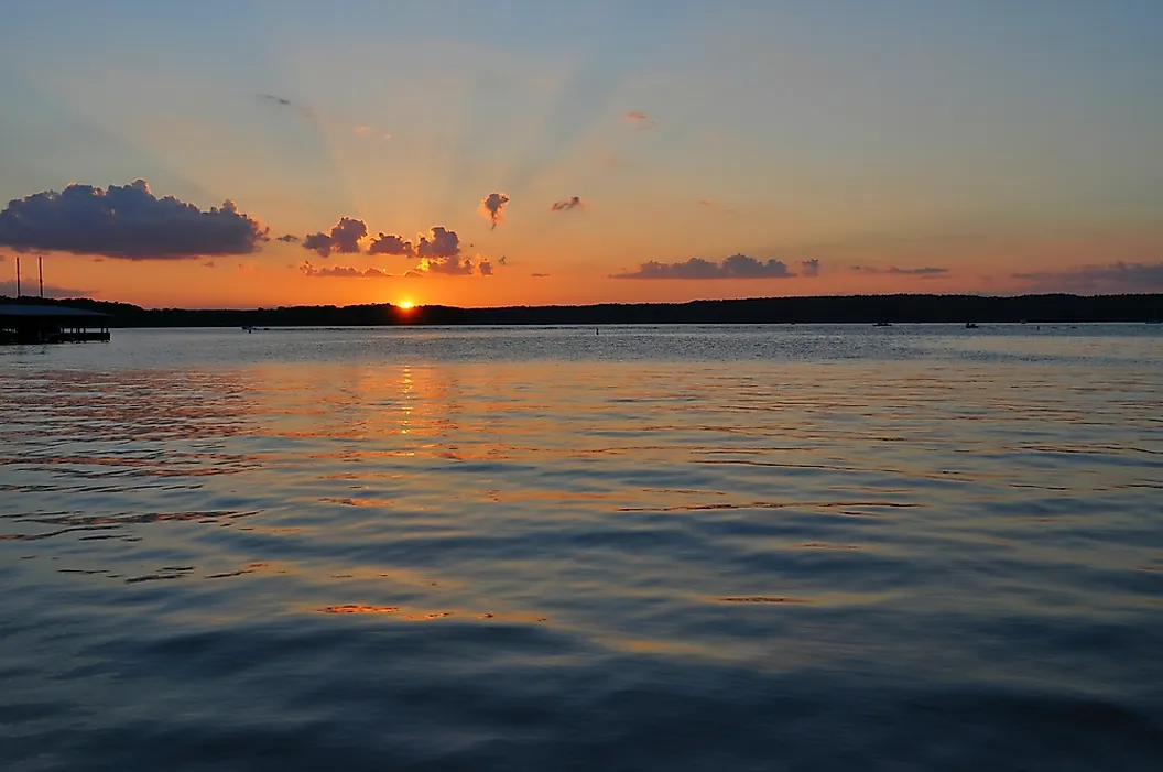
Arkansas has few natural lakes of size, and almost all of them are oxbows in the Delta. Its large water bodies are reservoirs, most built between the 1940s and 1960s for flood control and hydroelectric power in the Ozarks and Ouachitas.
Lake Ouachita, impounded behind Blakely Mountain Dam on the Ouachita River, is the largest lake lying entirely within the state at roughly 40,000 acres. Surrounded almost completely by national forest, it is also among the clearest lakes in the country.

Bull Shoals Lake on the White River is larger overall at about 45,000 acres but is shared with Missouri. Greers Ferry, Beaver, Norfork, DeGray, and Nimrod round out the major impoundments, and Lake Chicot in the Delta remains the largest natural lake.
Climate

Arkansas has a humid subtropical climate throughout, with hot summers, mild winters, and no dry season. The nickname "The Natural State" reflects a landscape that is roughly 56% forested, one of the higher proportions in the country.
Rainfall is generous, running from about 40 inches a year in the northwest to more than 55 inches in the south, and the mountains add a few inches more through orographic lift. Snow is light and mostly confined to the Ozarks.
The state sits at the eastern edge of the corridor where tornadoes are most frequent, and it averages around 40 a year. Because the terrain is wooded and storms often arrive at night, these are more dangerous than their counterparts on the open plains. Flooding along the Delta rivers is the other recurring hazard.
Arkansas Geography at a Glance
| Feature | Detail |
|---|---|
| Total area | Approx. 53,179 sq mi (137,732 sq km), 29th largest state |
| Highest point | Mount Magazine, 2,753 ft (839 m), Logan County, Arkansas Valley |
| Lowest point | Ouachita River at the Louisiana line, about 55 ft |
| Bordering states | Six: Missouri, Tennessee, Mississippi, Louisiana, Texas, Oklahoma |
| Natural divisions | Six: Ozark Mountains, Arkansas Valley, Ouachita Mountains, West Gulf Coastal Plain, Mississippi Alluvial Plain, Crowley's Ridge |
| Mountain system | U.S. Interior Highlands, the only major highlands between the Rockies and the Appalachians |
| Eastern boundary | Mississippi River |
| Largest lake in state | Lake Ouachita, approx. 40,000 acres (reservoir) |
| Largest natural lake | Lake Chicot, approx. 5,000 acres (oxbow) |
| Forest cover | About 56% of the state |
| Counties | 75 |
Counties Map
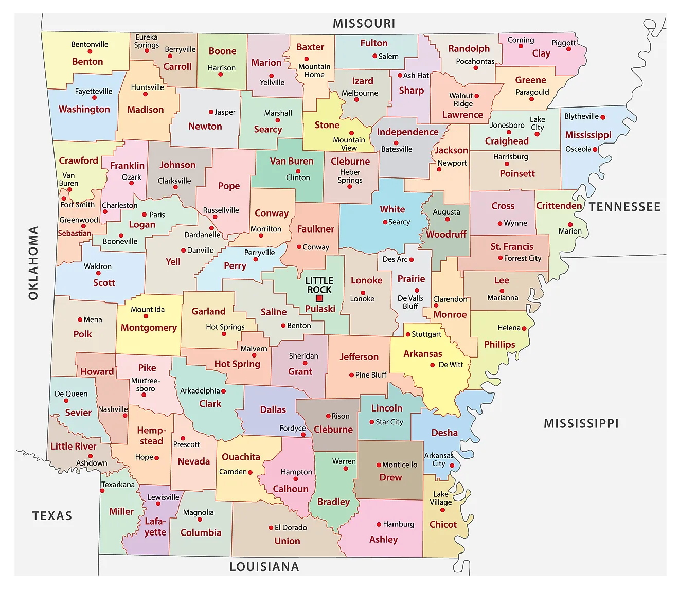
The State of Arkansas is divided into 75 counties. In alphabetical order, these counties are: Arkansas, Ashley, Baxter, Benton, Boone, Bradley, Calhoun, Carroll, Chicot, Clark, Clay, Cleburne, Cleveland, Columbia, Conway, Craighead, Crawford, Crittenden, Cross, Dallas, Desha, Drew, Faulkner, Franklin, Fulton, Garland, Grant, Greene, Hempstead, Hot Spring, Howard, Independence, Izard, Jackson, Jefferson, Johnson, Lafayette, Lawrence, Lee, Lincoln, Little River, Logan, Lonoke, Madison, Marion, Miller, Mississippi, Monroe, Montgomery, Nevada, Newton, Ouachita, Perry, Phillips, Pike, Poinsett, Polk, Pope, Prairie, Pulaski, Randolph, St. Francis, Saline, Scott, Searcy, Sebastian, Sevier, Sharp, Stone, Union, Van Buren, Washington, White, Woodruff, and Yell.
With an area of 137,732 sq. km, the State of Arkansas is the 29th largest and the 33rd most populous state in the USA. Located in Pulaski County, in the central part of the state on the Arkansas River, is Little Rock – the capital and most populous city of Arkansas. The city takes its name from la Petite Roche, a rock outcrop on the river that marked the boundary between the Ouachita foothills and the Delta. Little Rock also serves as the administrative, cultural, economic, and transportation center of Arkansas.
Where is Arkansas?
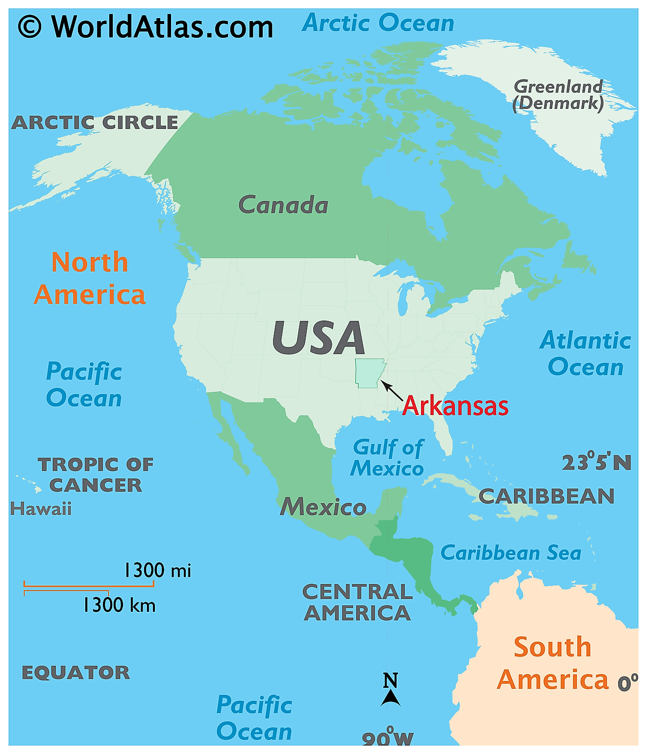
The State of Arkansas is located in the south-central region of the United States. It is bordered by the state of Missouri in the north; by Tennessee and Mississippi in the east, by Louisiana in the south, by Texas in the southwest and by Oklahoma in the west.
Regional Maps: Map of North America
Outline Map of Arkansas
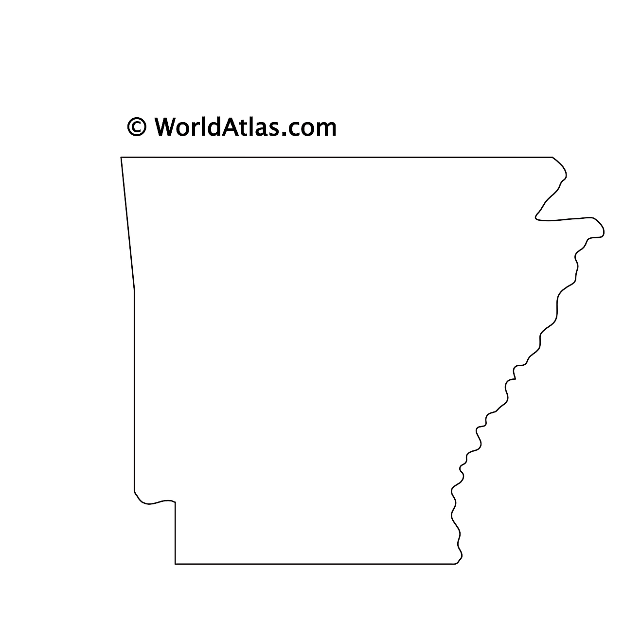
The above blank map represents the State of Arkansas, located in the south-central region of the United States. The above map can be downloaded, printed and used for geography education purposes like map-pointing and coloring activities.
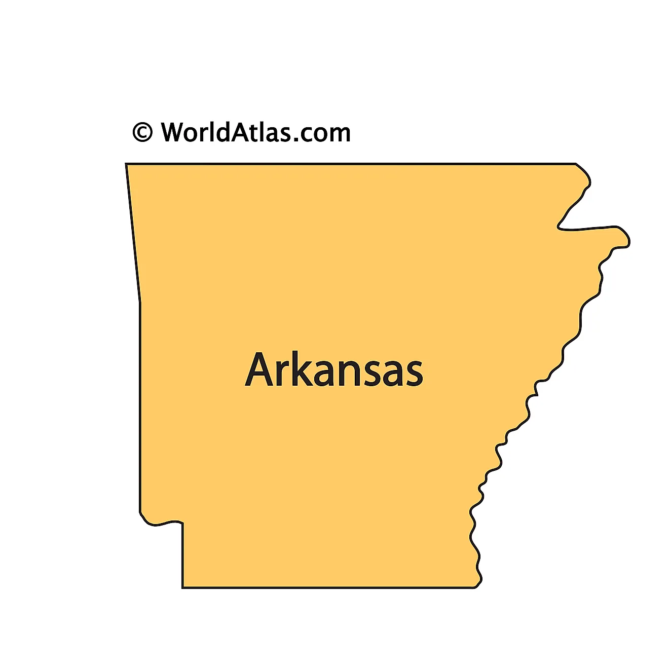
The above outline map represents the State of Arkansas, located in the south-central region of the United States.
Key Facts
| Legal Name | State of Arkansas |
|---|---|
| ISO 3166 Code | US-AR |
| Capital City | Little Rock |
| Major Cities |
|
This page was last updated on September 22, 2026