The Most Underrated State Parks In The West
The American West, spanning from the Rockies to the Sierra Nevada, features far more state-run parks than its famous national parks, yet many receive comparatively little attention. These parklands include Montana's Makoshika State Park, the state's largest state park, and California's Castle Crags State Park, where otherworldly rock formations rise thousands of feet above the surrounding landscape. Moreover, Utah's Kodachrome Basin contains dozens of distinctive sedimentary "pipes," while Washington's Sun Lakes-Dry Falls State Park protects the remains of one of the biggest waterfalls ever to exist. But wherever you head off to for your next outdoor adventure, whether around volcanic peaks in Arizona or Idaho's alpine lakes, these seven destinations provide highly varied scenery to explore, as well as usually smaller crowds, too.
Castle Crags State Park - California

Castle Crags State Park could be easy to overlook while driving Interstate 5, but its geology makes it one of California's more distinctive state parks. Sitting beneath none other than the "Castle Crags," a cool collection of granite spires more than 170 million years old, many of which rise to roughly 6,000 ft (1,829 m). The surrounding Klamath Mountains further contain much older ultramafic rocks, creating a sharp geological contrast around these natural formations that any geology fan could fawn over.
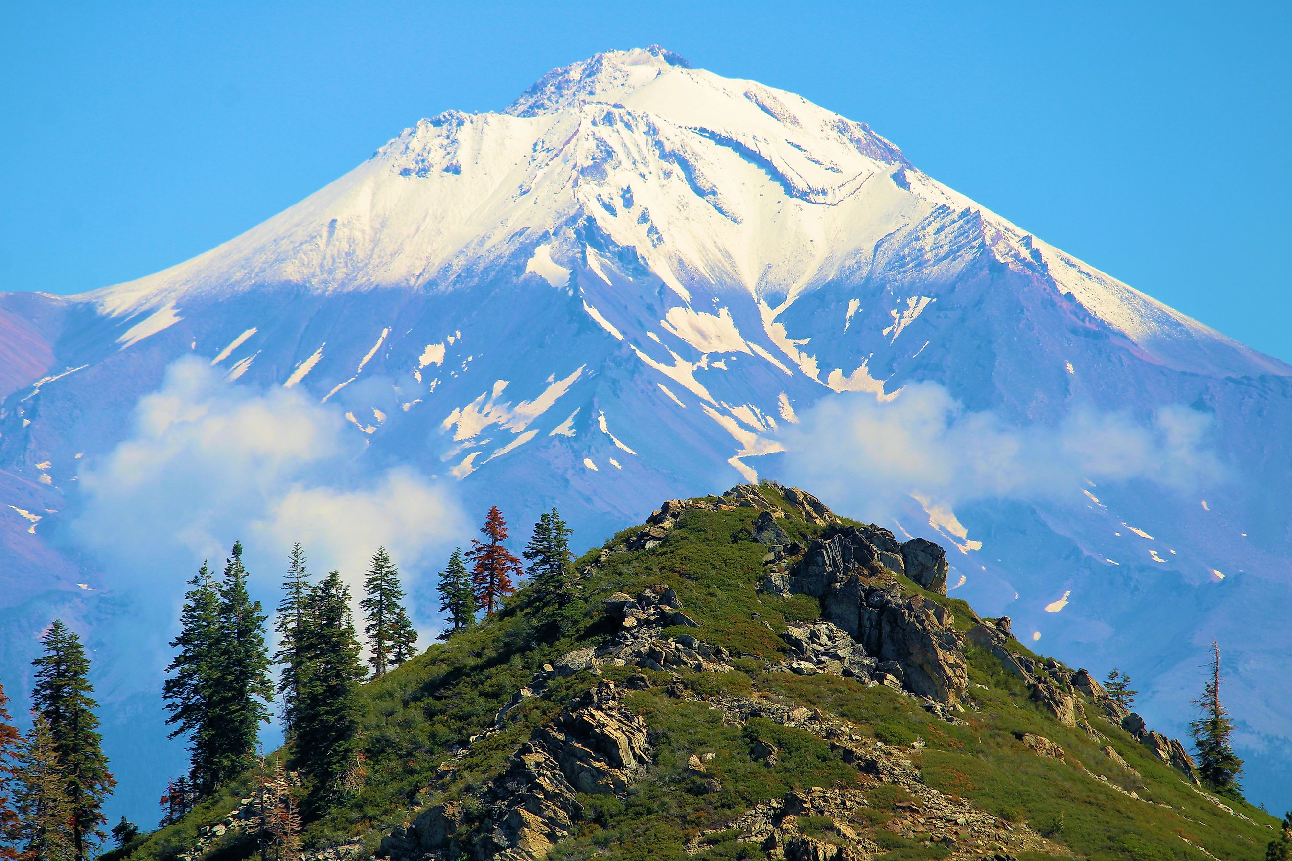
To most, however, hiking is the main draw here, with 28 miles (45 km) of trails ranging from accessible walks to strenuous climbs. The Crags Trail climbs upwards of 2,150 ft (655 m) toward Castle Dome, while the easier Vista Point Trail rewards you with views of the crags and Mount Shasta. The Pacific Crest Trail notably passes through the park, too.
Down along the Sacramento River, visitors can also fish, hike the banks, and camp, with 76 developed campsites available to spend the night in should you wish to.
Sun Lakes-Dry Falls State Park - Washington

Sun Lakes-Dry Falls State Park centers on an incredible geological feature created by Ice Age floods roughly 15,000 years ago. But if you don't know what you're looking at, you might not even realize it's there at all.
Dry Falls is the remnant of a colossal waterfall that once stretched an enormous 3.5 miles (5.6 km) across and plunged 400 ft (122 m). At its peak, the waterfall carried enough water to make it roughly four times the width of Niagara Falls. Today, the dry cataract overlooks a chain of lakes, basalt cliffs, and arid plains in eastern Washington's Channeled Scablands.
This 3,774-acre park now contains more than a dozen miles of walking trails, along with opportunities for boating, kayaking, swimming, fishing, and camping. Park Lake and Deep Lake provide the best access to the water, while Dry Falls Lake draws in anglers, as it is regularly stocked with trout. The park is also part of the Ice Age Floods National Geologic Trail and has since been designated a National Natural Landmark.
It would generally be recommended to drop by the well-curated Dry Falls Visitor Center to learn more about this impressive yet underrated destination, but the building is closed for renovations through the end of 2026.
Milo McIver State Park - Oregon

Milo McIver State Park covers a relatively small 950 acres along the Clackamas River, but packs a big punch in terms of easily accessible outdoor activities. Conveniently located just outside Portland, it is where the northern Willamette Valley meets the Cascade foothills, presiding over a nicely varied landscape that includes forest, meadows, river terraces, and access to Estacada Lake.
The park is particularly notable for its 27-hole disc golf course, which winds through rolling terrain and lush forests near the riverbanks. But for a simple walk, 14 miles (22.5 km) of trails accommodate hikers and horseback riders, too, while the Clackamas River provides spaces for fishing, canoeing, kayaking, and rafting. Milo McIver also contains the Clackamas Fish Hatchery, where more than 1 million Chinook salmon are raised and released each year, allowing anglers to often find Chinook salmon, as well as steelhead, in the river.
Even if you're just passing through, an idyllic viewpoint near the park entrance provides sightlines toward Mount Hood, Mount Adams, and Mount St. Helens. For those looking to stay for a night or two, however, Milo McIver State Park also has seasonal camping with 44 electrical sites, several tent sites, group camping areas, and hiker/biker sites.
Kodachrome Basin State Park - Utah

Kodachrome Basin State Park stands apart from Utah's better-known red-rock destinations because its defining formations are not arches or hoodoos, but 67 monolithic stone spires (known as sedimentary pipes) instead. Rising from layers of sandstone, these towers range from 6 to 170 ft (2 to 52 m) and record roughly 180 million years of geological history. The National Geographic Society named the area "Kodachrome" in 1948 after the Kodak color film (on which the park was originally photographed for the rest of the world to see).
This remote park sits on the Colorado Plateau at a lofty elevation of about 5,800 ft (1,768 m), with plenty of more exposed rocks dating from the Jurassic to Cretaceous periods. Explore it for yourself on Kodachrome's network of trails, most providing routes for hiking, mountain biking, and horseback riding, including Panorama Trail and Angel's Palace Trail. The park also provides access to nearby Grosvenor Arch, a striking double arch about 13 miles (21 km) away.
Picacho Peak State Park - Arizona

Picacho Peak State Park is dominated by its namesake 3,374-ft (1,028-m) volcanic peak, which rises sharply above the Sonoran Desert between Phoenix and Tucson. It is more specifically the remnant of an ancient volcanic plug and stands dramatically above the surrounding desert floor, making for a scenic backdrop to any landscape photo. In fact, its steep profile is visible for miles and has long served as a landmark for travelers crossing southern Arizona.
The main attraction these days is the 4-mile (6.5-km) round-trip Picacho Peak Trail, which climbs through rugged wilderness before heading toward the barren summit. The upper section uses cables and metal rails to assist you across the steep, exposed rock. Beyond the peak, different trails lead through other desert terrain populated by saguaro cacti, ocotillos, creosote bushes, and palo verde trees.
History buffs should check out the site of the 1862 Battle of Picacho Pass as well, the westernmost engagement of the American Civil War. The park also has a campground with 85 sites, including sites with electric hookups.
Makoshika State Park - Montana

As the largest state park in Montana, Makoshika State Park is surprisingly not talked about very much. While yes, it is eclipsed in conversation by the state's national parks, namely Glacier, this spot in flat, "empty," eastern Montana covers a sizable 11,538 acres of badlands near the city of Glendive.
Its terrain belongs largely to the Hell Creek Formation, a Late Cretaceous rock layer famous for its dinosaur fossils. More than 10 dinosaur species have actually been identified within the park, including Tyrannosaurus rex, Triceratops, Edmontosaurus, and Thescelosaurus. A nearly complete Thescelosaurus skeleton discovered at Makoshika in 1997 was considered the largest and most complete specimen of its kind at the time. The park also houses a geological boundary marking the end of the Cretaceous Period and the beginning of the Tertiary, from about 65.5 million years ago, a true playground for those who love natural history.
Hoodoos, caprocks, pinnacles, and juniper- and pine-covered formations further dominate the landscape today, with eleven designated hiking trails, a number of scenic drives, camping areas, and a visitor center with fossil exhibits providing ways to help you learn more about the park. Don't miss the 5.5-ft (1.7-m), 600-lb (272-kg) juvenile Triceratops skull displayed in said visitor center, discovered here in 1991.
Heyburn State Park - Idaho

Heyburn State Park is Idaho's oldest state park, and the oldest state park in the Pacific Northwest for that matter, established in 1908 on lands and waters transferred from the Coeur d'Alene Indian Reservation. It covers over 8,000 acres, including a huge 2,332 acres of water spread across Chatcolet Lake, Benewah Lake, and Hidden Lake. Its forests wonderfully transition between ponderosa pine, Douglas fir, western red cedar, grand fir, and other species depending on which elevation you're at, with equally lively wetlands surrounding sections of the lakes, too. Furthermore, the St. Joe River runs along the park's eastern edge, while the 73-mile (117-km) Trail of the Coeur d'Alenes similarly passes directly through.
Hiking, cycling, horseback riding, fishing, boating, swimming, and paddling are among the main activities here, with Heyburn also boasting substantial Civilian Conservation Corps construction from the 1930s, including roads, bridges, trails, campgrounds, picnic areas, and the historic Rocky Point Lodge.
See Another Side of the West
These underrated state parks of the West perfectly showcase how much lies beyond the region's much more renowned national parks. Ancient volcanic plugs, Ice Age flood channels, dinosaur-bearing badlands, granite spires, and high-desert rock formations are all to be discovered, and often with fewer crowds too. For travelers seeking quiet, as well as a number of different landscapes you may not have ever even known existed, these locales definitely deserve a place on the itinerary.