State Parks With National Park Scenery and No Permit Line
Most travelers picture a national park long before they picture the state park down the road. Yet the same water and rock carved canyons and waterfalls inside its boundaries. The first thing a visitor notices is the open parking lot and the absence of a permit line. The second is how close many of these parks lie to the national parks in the same region. The ten below each earn a short detour off a route plenty of travelers already drive.
Valley of Fire State Park, Nevada

Drivers on Interstate 15 between Las Vegas and Utah roll past nearly 46,000 acres of red Aztec sandstone at Valley of Fire State Park. Nevada dedicated the ground in 1935, making it the oldest state park in the state. The rock formed from Jurassic sand dunes about 150 million years ago, and iron oxide gives it the deep color behind the name.
The park sits about 50 miles northeast of Las Vegas, close enough for a half-day trip before travelers push on toward Zion. Short trails reach the striped Fire Wave, the natural arch at Elephant Rock, and petroglyphs carved into the stone more than 2,000 years ago. A paved road ties the overlooks together, so a visitor can see the highlights without a backcountry hike.
The desert sets the terms in summer. Daytime highs top 100 degrees, and rangers close many trails from May 15 through September 30 for safety, including the Fire Wave and White Domes loops. Anyone hiking in the warm months should carry water, start early, and plan around the limited shade.
Kodachrome Basin State Park, Utah

Sixty-seven stone spires rise from the desert floor at Kodachrome Basin State Park, some reaching 170 feet. Geologists call these columns sand pipes, and they occur in few other places on Earth. Ancient springs or geysers appear to have filled vertical tubes with sediment that hardened, after which the softer Entrada sandstone around them wore away.
The park covers 2,240 acres near Cannonville, about 20 miles southeast of Bryce Canyon. National Geographic photographers named the spot Kodachrome Flat in 1948 for the film they used to capture its reds and oranges. Utah made the basin a state park in 1962 but called it Chimney Rock, wary of borrowing a Kodak trademark. The state switched to Kodachrome Basin a few years later, once the company gave its permission.
A day is enough time to walk the Panorama and Grand Parade trails and drive out to Chimney Rock. The compact size and certified dark skies make it an easy addition to a southern Utah route without the trailhead congestion at Bryce. Utah State Parks handles camping and cabins, and visitors should confirm fees and seasonal conditions before arriving.
Palo Duro Canyon State Park, Texas

The second-largest canyon system in the country opens south of Amarillo, where the flat Panhandle gives way to 800-foot walls. The Prairie Dog Town Fork of the Red River carved Palo Duro Canyon over roughly a million years, exposing rock that records some 240 million years of geologic time. The state park protects 29,182 acres of the deepest northern stretch.
The Lighthouse, a 300-foot rock column, stands at the end of the park's signature trail, a round trip of about six miles. Layered walls of red claystone, white gypsum, and lavender mudstone give the canyon its striped look. Beyond the Lighthouse, more than 30 miles of trails carry hikers, mountain bikers, and horseback riders across the canyon floor.
Wildlife here includes mule deer, wild turkeys, and roadrunners, along with western diamondback rattlesnakes near rocky outcrops. Temperatures on the canyon floor run well above the rim, so summer visitors should hike in the morning and watch conditions closely. The Civilian Conservation Corps built the cabins and roads still in use, some more than 80 years old.
Tettegouche State Park, Minnesota

The High Falls of the Baptism River drops about 60 feet, the tallest waterfall lying entirely within Minnesota. The falls sit inside Tettegouche State Park, which spreads across 9,346 acres of forest, six inland lakes, and a rugged stretch of Lake Superior shoreline. A boardwalk and suspension bridge on a short trail carry visitors to the base.
Drivers on Highway 61 reach the park between Duluth and the Canadian border, about an hour up the North Shore. Many stop at the Shovel Point and Palisade Head overlooks, then leave without walking the trails to the waterfalls inland. Climbers work the rhyolite cliffs at Palisade Head, which rise straight out of the lake.
More than 20 miles of trails cross the park, including a stretch of the Superior Hiking Trail along the ridgelines. Winter brings skiers and snowshoers to the interior, with rentals at the visitor center. Four hike-in cabins on Mic Mac Lake stay open year-round for anyone wanting a night in the backcountry.
Silver Falls State Park, Oregon

The Trail of Ten Falls passes exactly that, ten waterfalls along a 7.2-mile loop through a forested canyon. Four of them, including the 177-foot South Falls, have a path carved behind the water. Silver Falls State Park protects 9,200 acres of old-growth forest and basalt canyon, making it the largest state park in Oregon.
The park lies about 25 miles east of Salem and roughly 75 minutes from Portland, within easy reach of the Willamette Valley. The South Fork of Silver Creek cuts through ancient lava flows to form the falls, which run hardest in spring after the rains. A stone-and-timber lodge built by the Civilian Conservation Corps in the 1930s still stands near the South Falls trailhead.
Most visitors hike the waterfall loop and leave, but more than 35 miles of additional trails carry mountain bikers and equestrians deeper into the park. Bigleaf maples turn gold along the canyon in autumn, when the crowds thin and the water returns to fuller flow. Dogs stay off the Canyon Trail for safety, so hikers set on the full loop should leave pets at home.
Watkins Glen State Park, New York
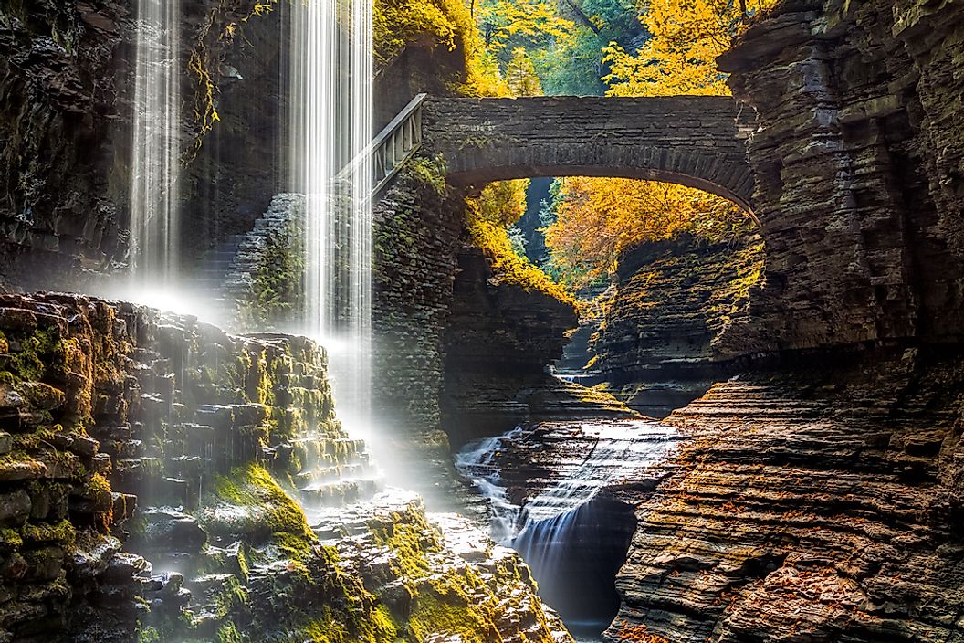
Nineteen waterfalls fill a two-mile gorge at Watkins Glen, at the southern tip of Seneca Lake. Glen Creek descends 400 feet past 200-foot cliffs, and the Gorge Trail runs over, under, and alongside the water on more than 800 stone steps. Hikers pass through the Spiral Tunnel and behind Cavern Cascade on the way up.
The glen opened to the public in 1863 as a privately run tourist resort, and New York State bought it in 1906, making it one of the older holdings in the state system. A 1935 flood washed out the earlier walkways, and a Civilian Conservation Corps crew rebuilt the trail in native stone, replacing the concrete and iron that came before. The arched bridges and stairways date to that work.
More than a million visitors come each year, so the lower lot fills early on summer weekends. A weekday morning in spring is the quieter window, before the crowds build. Seneca Lake and its wineries sit minutes away, and the Southern Rim and Indian trails run the wooded rim for anyone wanting the views without the gorge steps.
Custer State Park, South Dakota

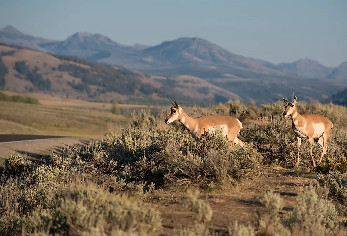
Roughly 1,300 free-roaming bison make Custer State Park feel like a national park in everything but name. The herd grazes across 71,000 acres of the Black Hills, one of the larger state parks in the country. Prairie dogs, bighorn sheep, pronghorn, and a band of begging burros share the grasslands and granite.
The 18-mile Wildlife Loop Road runs from the visitor center near the east entrance around to the Blue Bell entrance, a drive of an hour and a half or more when bison block the road. The Needles Highway threads past granite spires and the Needle's Eye tunnel near Sylvan Lake. Iron Mountain Road connects the park to Mount Rushmore, its tunnels framing the monument on the approach.
President Calvin Coolidge spent the summer of 1927 at the State Game Lodge, which he used as a working retreat. Five lakes draw swimmers, paddlers, and trout anglers through the warmer months. Rock climbers work the Needles, and the Bison Center that opened in 2022 lays out the herd's history for visitors.
Cloudland Canyon State Park, Georgia

A 1,000-foot gorge cuts into the western edge of Lookout Mountain at Cloudland Canyon State Park, a landscape closer to the Rockies than the Deep South. Sitton Gulch Creek carved the canyon through sandstone and shale over millions of years. The 3,485-acre park runs along the rim, with the widest views near the picnic-area parking lot.
The Waterfalls Trail descends roughly 600 metal stairs into the gorge to reach Cherokee Falls and Hemlock Falls, a strenuous two-mile round trip. The West Rim Loop, rated among the best hikes in Georgia, tracks the canyon edge past overlooks that reach for miles. More than 60 miles of trails cover the rim, the canyon floor, and Sitton's Cave.
The park sits about 30 miles west of Chattanooga near the point where Georgia, Tennessee, and Alabama meet. Black bears, timber rattlesnakes, and peregrine falcons live along the canyon walls. Cottages line the rim, and walk-in tent sites and yurts give overnight visitors a quieter option below the crowds.
Hocking Hills State Park, Ohio

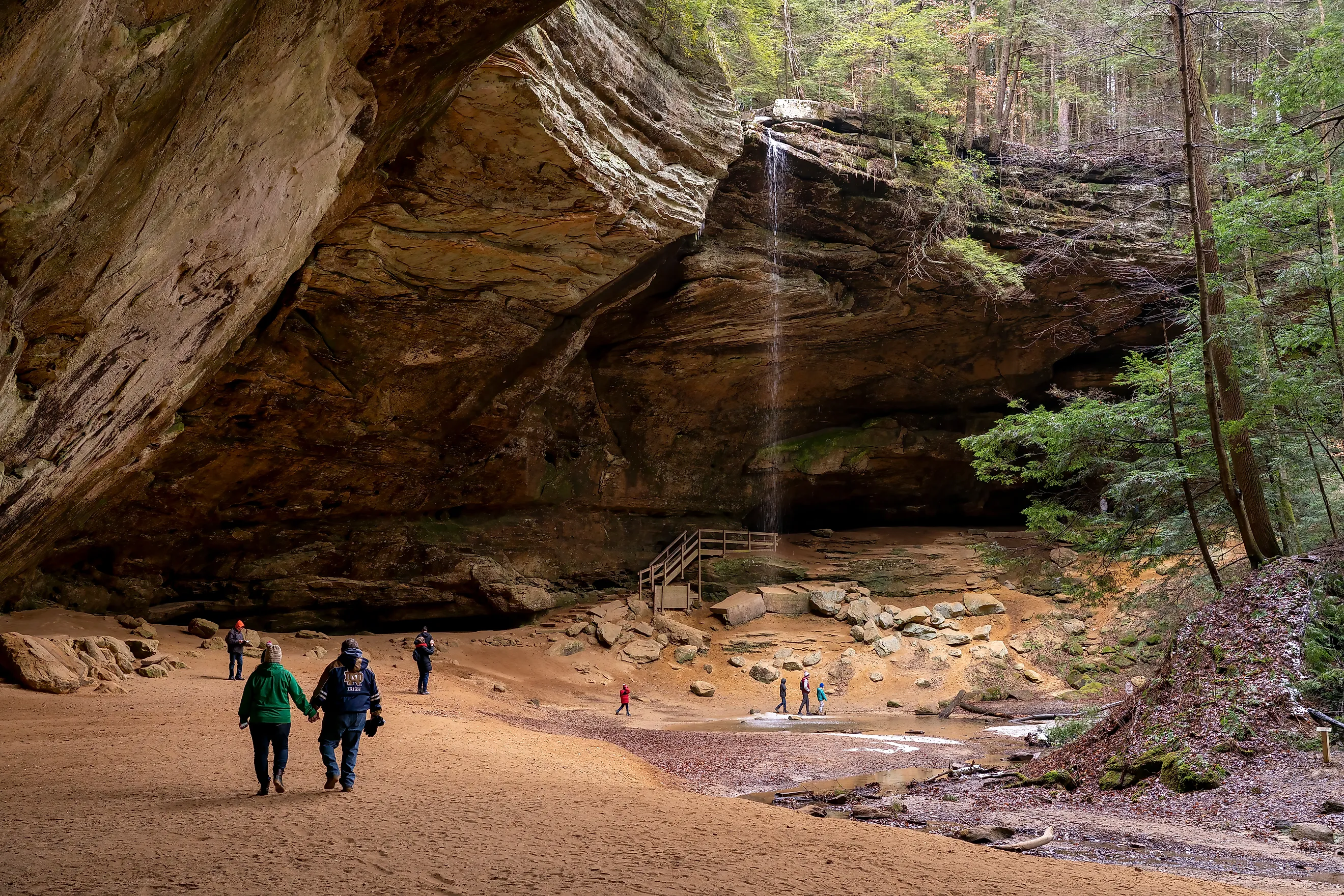
Ash Cave forms the largest recess cave in Ohio, a sandstone overhang 700 feet wide and 90 feet high with a seasonal waterfall spilling over the rim. It is one of seven scenic areas at Hocking Hills State Park, all carved from Black Hand sandstone laid down more than 350 million years ago. Erosion widened cracks in the softer middle layer to shape the caves, gorges, and cliffs.
Old Man's Cave is the busiest area, a gorge of waterfalls, stone tunnels, and rock formations like the Devil's Bathtub. A hermit named Richard Rowe lived in the main recess cave in the 19th century, and the site carries his name. The Grandma Gatewood Trail runs six miles from Old Man's Cave through Cedar Falls to Ash Cave.
The park lies in southeastern Ohio, a couple of hours from Columbus, and millions of visitors come each year. Hemlock-shaded gorges hold ice formations in winter and wildflowers in spring, with the recess caves cool through the summer heat. The trail connects to the Buckeye Trail and the North Country Scenic Trail for hikers ready to go farther.
Dead Horse Point State Park, Utah

The overlook at Dead Horse Point stands 2,000 feet above a gooseneck bend of the Colorado River, one of the most photographed vistas in the West. The mesa-top park covers 5,362 acres of high desert next to Canyonlands National Park. Its name comes from 19th-century cowboys who used the point as a natural corral, driving wild mustangs across the narrow neck of land.
The point sits about 30 miles from Moab, and many travelers drive to Arches or Canyonlands without making the turn. A nine-mile loop trail on the East and West Rim edges the mesa, with overlooks down to the river and out to the La Sal Mountains. The Intrepid Trail System adds about 17 miles of single-track for mountain bikers.
The park's isolation is part of the draw and part of the risk, with gas, food, and medical care more than 30 miles away in Moab. Certified dark skies make the mesa a strong spot for stargazing after sunset. Yurts and two campgrounds put visitors on the rim for sunrise and sunset, when the cliffs glow deepest.
Trading the Gates for the Back Roads
National parks hold a firm grip on the American imagination, and the crowds and permit systems reflect it. The parks on this list ask for less planning and deliver much of the same reward, whether that reward is the sandstone spires of Kodachrome Basin or the bison herds of the Black Hills. A brown sign and a short detour are often all that separate a driver from a canyon rim, a walk behind a waterfall, or a mesa above the Colorado River.