Mount St. Helens
Mount St. Helens is an active stratovolcano in the Cascade Volcanic Arc of the Pacific Ring of Fire. The composite volcano, one of the major natural landmarks in Skamania County, Washington, is famous for the May 18, 1980, eruption, which is one of the most destructive and deadliest volcanic events ever recorded in North America. The eruption also reduced the peak’s summit from 2,950 meters to 2,549 meters above sea level, creating a horseshoe crater. According to the geologists, the mountain’s future eruptions will cause even more destruction since the lava dome will only erupt under more pressure. Despite the pending danger, Mount St. Helens is a popular hiking destination.
General Description

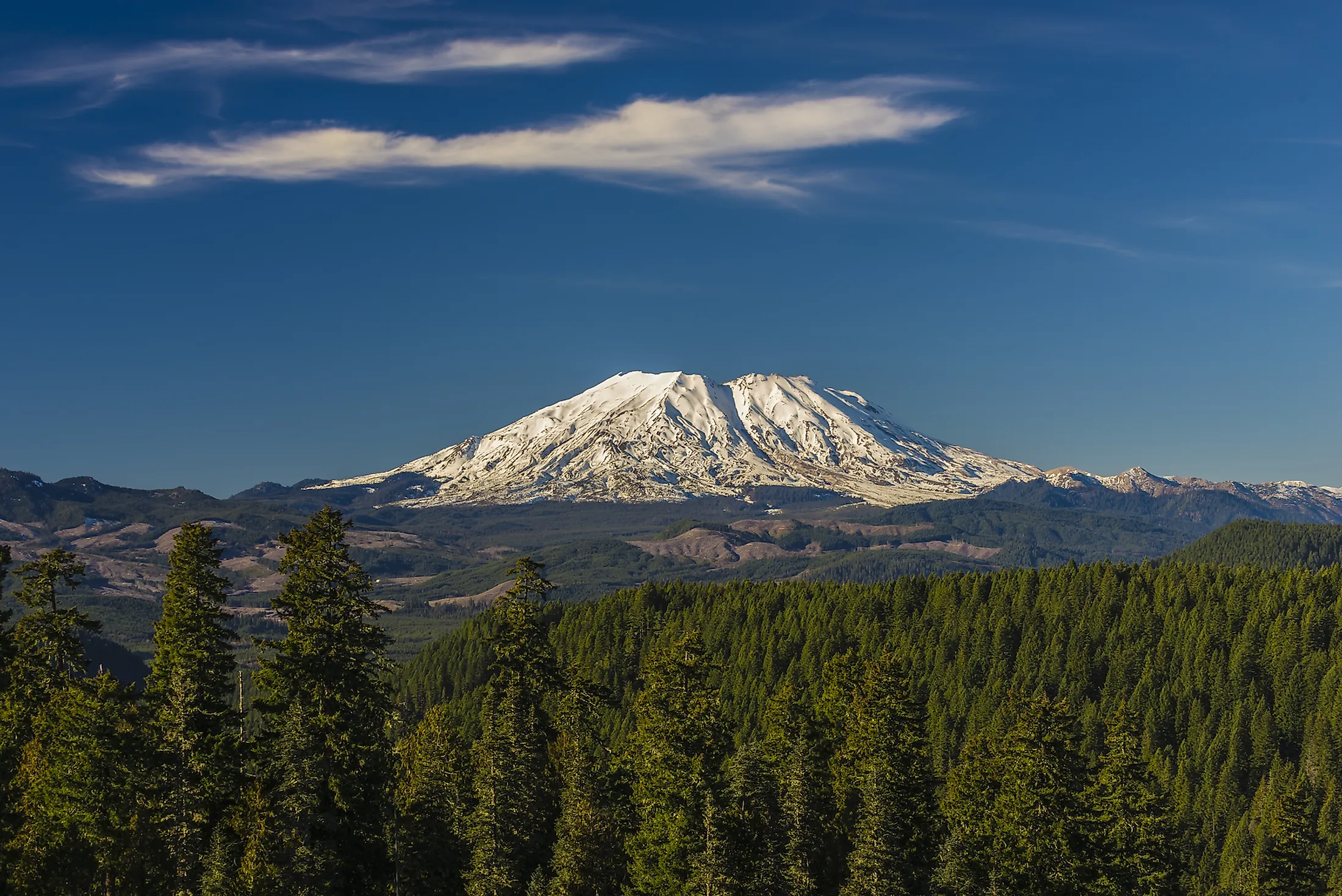
Mount St. Helens is located in the Pacific Northwest region, specifically Skamania County in Washington, US. It is approximately 83 kilometers from Oregon and 158 kilometers from Seattle. Mount Adams, another Cascade volcano, is located 55 kilometers to St. Helens’ east. Mount Rainier, Cascade’s highest volcano, is located about 80 kilometers from the two “brother and sister” volcanoes. The US Forest Service administers about 445 square kilometers around the mountain as Mount St. Helens National Volcanic Monument.

Before the 1980 eruption, St. Helens was Washington’s 5th highest peak, at 2,950 meters above sea level. The snow-capped symmetrical mountain was nicknamed “Fuji-san of America.” However, the eruption reduced the peak’s elevation to 2,549 meters above sea level. The mountain was named in honor of Alleyne Fitzherbert, known by the title “Baron St. Helens.” Commander George Vancouver named the mountain St. Helens as he surveyed the northern Pacific coast between 1792 and 1794.
Geology
Mount St. Helens is a relatively young volcano compared to the major Cascade volcanoes. Although it was formed during the Cascade Range’s four eruptive stages that began approximately 275,000 years ago, it is younger than 40,000 years. The cone that graced the summit before the 1980 eruption was approximately 2,200 years old. Mount St. Helens is the Cascade Range’s most active volcano in the Holocene.

Mount St. Helens is one of the Cascade volcanoes, which stretches between British Columbia and North Carolina. The subduction beneath the Cascade Volcanic Arc causes water molecules stored in solid rock minerals to escape under high pressure and temperature. The rising water vapor above the subduction plate causes the mantle to melt, with the magma rising upwards to form the Cascade Volcanic Arc. The Cascade volcanoes are part of the Pacific Ring of Fire, a region characterized by earthquakes and volcanic eruptions.
Eruptive Activities

Since its formation, Mount St. Helens has erupted several times, with eruptive activities divided into stages. The ancestral eruptive stage includes Ape Canyon Stage, Cougar Stage, and Swift Creek Stage. The modern eruptive activities occurred from 2500 BCE, with the stage known as Spirit Lake Stage. The Ape Canyon Stage, an eruptive stage around 40,000-35,000 years ago, marked the start of the mountain’s growth and was characterized by hot ash and pumice eruption. After 17,000 years of dormancy, the Cougar Stage of eruption began, lasting about 2,000 years and followed by 5,000 years of relative quiet. The summit cone formed during the Castle Creek eruptive period that began around 400 BCE.
The 1980 Eruption
Mount St. Helens experienced an earthquake of magnitude 4.2 on March 20, 1980, followed by steam emission one week later. It experienced a second earthquake with a magnitude of 5.1 on May 18, triggering the collapse of the northern face. The pyroclastic flow of magma from the mountain flattened everything on its path, including trees and buildings, up to 600 square kilometers. The eruption, which continued for several days, damaged over 200 homes, killing 57 people and 7,000 game animals. The collapse of the northern flank reduced St. Helens’ height by about 400 meters.


