Why The Missouri Is Longer But The Mississippi Got The Name
The Missouri is the longest river in the United States. It beats the Mississippi by about 200 miles. Yet where the two meet just north of St. Louis, the longer river drops off the map, and the shorter one keeps its name all the way to the Gulf of Mexico.
Length had nothing to do with it. The Mississippi already had its name when French explorers paddled down it in 1673, long before anyone could measure either river, and the muddy Missouri looked to them like a side stream pouring in from the west. They were right about one thing: the shorter river still carries more water.
The Missouri's Extra Miles Depend on Where the Measuring Starts

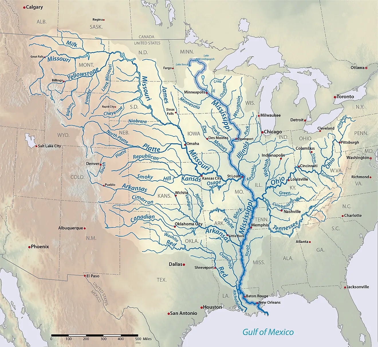
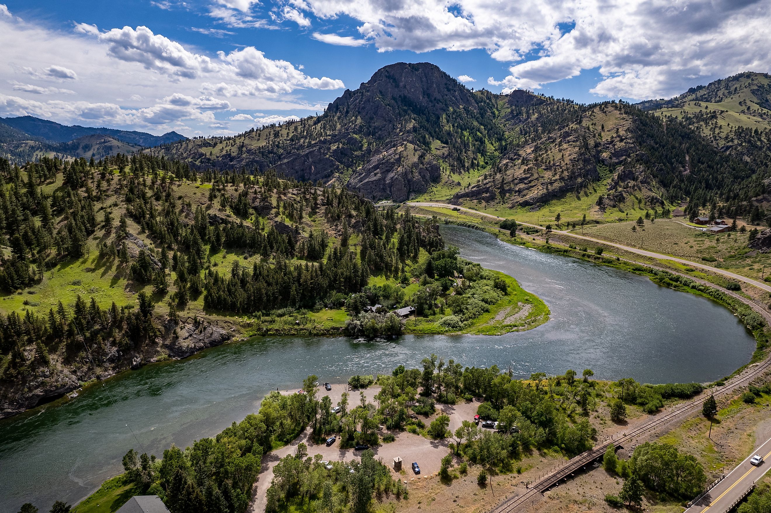
The Missouri officially begins at Missouri Headwaters State Park near Three Forks, Montana, where the Jefferson and Madison rivers join and the Gallatin comes in close by. By the Army Corps of Engineers' count, the Missouri runs 2,341 miles below that point. Published lengths for the Mississippi range between 2,300 and 2,350 miles, so measured this way, the two rivers are practically tied.
The USGS table follows the Missouri past Three Forks to its most distant headwater, which adds the extra miles and lists Red Rock Creek as the source stream. Traced that way, the river continues up the Jefferson, then the Beaverhead and the Red Rock, into Hell Roaring Creek high in the Centennial Mountains of Beaverhead County, Montana.
The Missouri Lost About 200 Miles to Dams and Channel Work

The Missouri measured 2,546 miles in an 1895 report by the Missouri River Commission. Over the following century, the upper river was dammed, and bends along the lower river were cut off as the Corps of Engineers narrowed the channel for barge traffic. About 127 miles of river below Sioux City, Iowa, disappeared to channelization alone, and the total loss came to roughly 200 miles. The Mississippi has lost length to cutoffs, too. Eighteen of them, some natural and some man-made, removed 218 miles between Cairo, Illinois, and New Orleans during the years 1766 through 1885.
In 1721, the Jesuit Pierre de Charlevoix wrote that the Missouri gives "its color to the Mississippi which it never loses again." Much of that color has faded since the dams went in. Six large dams now stand on the Missouri's main stem, all of them Corps of Engineers projects, with Fort Peck in Montana the farthest upstream and Gavins Point on the South Dakota and Nebraska line the farthest downstream. Their reservoirs trap much of the silt that gave the river its old nickname, the Big Muddy. Before the 1950s, roughly 142 million tons of sediment moved past Sioux City in an average year, and after the dams closed, the yearly load there fell to about 4 million tons.
French Travelers Carried the Name Down the River

The word Mississippi comes from an Algonquian name meaning "Great River," rendered in Ojibwe as Misi-ziibi. Among the French missionaries and traders around the Great Lakes, it was in use as Missisipi before any of them had traveled the river's length.
Jolliet and Marquette left the mission at St. Ignace in mid-May 1673 and reached the Mississippi by way of the Wisconsin River on June 17. A few weeks later, near present-day St. Louis, a second river came in from the west, carrying "large and entire trees, branches, and floating islands" so fast that the party could not pass through it "without great danger." Marquette added that the water "was very muddy, and could not become clear."
The Pekitanoui, in Marquette's words, was "a river of considerable size, coming from the Northwest, from a great distance." The party stayed on the river it was already following and kept going south past that muddy junction to about 33 degrees north latitude, near the mouth of the Arkansas River, before turning back. The Missouri's own name is a French adaptation of Wimihsoorita, the Illinois-language name for the Missouria people who lived along it, which translates as "one who has dugout canoes."
Explorers Found the Sources Long After the Rivers Were Named

Meriwether Lewis and William Clark reached Three Forks in late July 1805 and named the three streams there for President Thomas Jefferson, Secretary of State James Madison, and Treasury Secretary Albert Gallatin. In 1832, Henry Schoolcraft identified Lake Itasca as the Mississippi's source and built the lake's name from the Latin words veritas and caput, meaning "true head." Nobody reached the Missouri's farthest source until the 1890s, when Jacob V. Brower, a Minnesota writer and explorer best known for his work at Itasca, followed the Jefferson to a spring in the Centennial Mountains and left a copper plate there. In his 1896 book, published 223 years after Marquette's journey, Brower called the spring the Missouri's "utmost source."
The Upper Mississippi Brings More Water to the Confluence

At Grafton, Illinois, a short way upstream of the Missouri's mouth, the Mississippi averaged about 133,000 cubic feet per second between 1987 and 2024. The Missouri at Hermann, Missouri, about 98 miles above its mouth, averaged about 93,000 over the same years. The upper Mississippi carried the larger flow in all but two of those years.
Above the Hermann gauge, the Missouri drains about 522,500 square miles, roughly three times the area above Grafton, yet per square mile it delivers less than a quarter as much water. The 100th meridian, the traditional line between the arid West and the humid East, runs through the middle of its basin, and much of Montana and the Dakotas receives little rain.
The Upper Missouri Once Drained Toward Hudson Bay

Before North America was first glaciated, about two million years ago, the rivers of the Dakotas and eastern Montana flowed northeast into Canada and on to Hudson Bay, and none of their water reached the Mississippi. Advancing ice blocked those valleys and diverted the water along the glacier's western edge. In North Dakota, lakes that ponded against the ice overflowed and carved new trenches southward, including the valley just north of Bismarck and Mandan, which may have formed about 25,000 years ago. The river's loop near New Town is younger still, at about 14,000 years.
The Ohio Carries More Water Than Either

The Ohio joins the Mississippi at Cairo, Illinois, with more water, on average, than the Mississippi itself carries there. The Ohio at Metropolis, Illinois, averaged about 281,000 cubic feet per second over 1934 through 2014. The Mississippi at Thebes, just upstream of Cairo, averaged about 214,000, a figure that already includes the Missouri. Counted up the Allegheny River to its source in Pennsylvania, the Ohio runs 1,310 miles in the USGS table, about half the Missouri's length. By volume, the main stem of the whole system runs up the Ohio and the Allegheny.
One Channel to the Gulf
Taken as one channel down to the Gulf of Mexico, the Missouri and the lower Mississippi run about 3,710 miles, the longest continuous river channel in the United States and the fourth-longest river system in the world. The Missouri accounts for about 2,540 of those miles. The name covering the rest was already in French use in 1673, when travelers who knew it kept to the river they were following past the Missouri's mouth, 132 years before Lewis and Clark stood at Three Forks. Much of the Missouri's enormous basin lies in the dry country west of the 100th meridian, which is why the upper Mississippi, much shorter above the junction, still brings the larger flow. At Confluence Point State Park, just north of St. Louis, a short trail ends at the spot where the Missouri enters from the west.