The Cleanest Rivers In America
Park Service crews pull water out of the Merced River in Yosemite and test it for bacteria, nutrients, and petroleum. They do the same in Glacier, on the North Fork of the Flathead. Idaho's regulators keep an eye on the Middle Fork of the Salmon. Maine checks the bugs living on the bottom of the Machias. Year after year, the results come back the same. These ten rivers are as clean as they look.
Smith River, California

Far northern California gives the Smith River an unusually good water-quality record. A US Geological Survey assessment described its water as excellent and generally within objectives established for beneficial uses. California's 2026 Integrated Report adds a recent measure. Across 257 dissolved-oxygen samples in the Smith River estuary, none fell below the applicable warm-water habitat threshold.
The entire river system also remains undammed, a distinction highlighted by the federal Wild and Scenic Rivers program. Its protected forks cut through the Klamath Mountains before the channel broadens near Crescent City. Summer water can reveal pale stones several feet below the surface, especially around the long pools between gravel bars. Winter storms produce a very different river, with powerful flows attracting experienced whitewater paddlers. Some tributaries in the wider watershed have documented problems, so conditions are not identical everywhere. The main Smith still stands apart for its combination of excellent monitoring results and limited development.
Middle Fork Salmon River, Idaho

The Middle Fork Salmon spends roughly 100 miles inside the Frank Church-River of No Return Wilderness, and Idaho's Department of Environmental Quality describes its watershed as essentially one of the most pristine in the state. The river was included in the original Wild and Scenic Rivers system in 1968. Federal management has kept development scarce along much of its corridor. A multi-day float can run for hours beneath steep canyon walls before reaching another developed site. Hot springs emerge beside parts of the route, while quiet beaches offer breaks between stretches of fast water. Idaho has approved temperature TMDLs for several tributaries where reduced streamside shade contributes to warming. The main river remains in much stronger condition. Few large American rivers combine this much protected land with so little settlement along the water itself, and the state's assessment reflects that advantage.
Merced River, California

Yosemite measures the Merced instead of judging it by appearance. National Park Service crews test for E. coli and nitrogen compounds. They also track phosphorus and petroleum hydrocarbons. The park reports that water quality in both the Merced and Tuolumne remains far above applicable EPA standards.
Ordinary regulatory thresholds are almost too coarse for the job here. Managers compare new readings with each river's own long-term averages, allowing them to spot small declines before legal limits are approached.
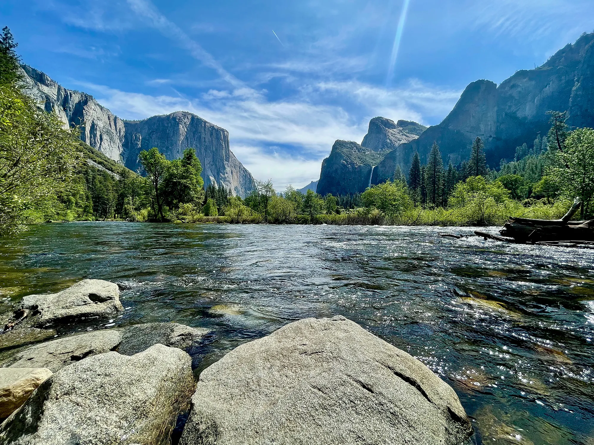
Eighty-one miles of the Merced are protected under the Wild and Scenic Rivers system. In Yosemite Valley, its broad summer channel passes beneath sheer granite walls and carries slow sections suitable for paddling when conditions permit. The river later leaves the national park and enters a much more developed part of California, where conditions change. Inside Yosemite, repeated chemical and bacterial sampling gives the clear mountain water a substantial scientific record behind it.
Tuolumne River, California

The upper Tuolumne begins near Tuolumne Meadows, more than 8,000 feet above sea level. Fifty-four miles inside Yosemite are protected as Wild and Scenic before the river reaches Hetch Hetchy Reservoir. Around the meadow, shallow water moves over gravel through open high-country terrain. The channel soon becomes rougher as it drops toward Glen Aulin and the Grand Canyon of the Tuolumne. National Park Service crews regularly check this water for bacterial contamination, nutrient levels, and petroleum hydrocarbons. Yosemite reports results far above the EPA standards that apply to the river.
Conditions become more complicated after the Tuolumne leaves the high Sierra and enters California's heavily managed water system. The Yosemite section has escaped much of that pressure. Little development reaches its banks, and a large share of the surrounding watershed remains federally protected. The clarity visible around Tuolumne Meadows comes with unusually reassuring monitoring results.
Upper St. Croix River, Minnesota and Wisconsin

The upper St. Croix has an advantage that can be measured. National Park Service monitoring between Norway and Nelson's Landing found sections relatively unimpacted and close to EPA reference conditions. Scientists use reference waters to represent streams and rivers that have experienced little disturbance. Wisconsin classifies the upper St. Croix as an Outstanding Resource Water, and Minnesota provides comparable high-level protection on its side of the border. Life beneath the surface is equally notable. More than 40 native mussel species occur within the wider St. Croix-Namekagon system, alongside over 100 native fish species. Many aquatic species react quickly when sediment, nutrients, or other pollutants alter their habitat. Farther south, the St. Croix faces greater pressure and documented pollution concerns. The northern reaches remain much quieter. Wooded banks dominate long sections, giving paddlers miles of river without the dense shoreline development found around many Midwestern waterways.
Namekagon River, Wisconsin

Recent Wisconsin monitoring gives the Namekagon a particularly useful piece of evidence. The Department of Natural Resources rated an 11.84-mile upper segment in excellent condition after monitoring through 2023. Another nearby segment earned a good rating, showing that water quality can change even within the same river.
Much of the upper watershed remains forested. Wetlands occupy another substantial portion of the surrounding land, leaving fewer paved surfaces and developed areas feeding runoff toward the channel. The National Park Service has also described water quality across the Namekagon and St. Croix riverway as excellent.
The Namekagon is wonderfully suited to a canoe. Long, easy sections pass beneath wooded banks before the current picks up for short bursts. Shallow water often exposes the gravel below, and fallen logs remain visible beneath the surface. On the best-monitored upper reach, Wisconsin's highest recent condition rating gives that clarity real weight.
Upper Machias River, Maine

Maine reserves its Class AA designation for its highest-quality fresh waters, and the upper Machias carries that classification below Fifth Machias Lake. It continues almost to the Route 1A bridge in Whitneyville. State law requires naturally occurring dissolved oxygen and aquatic communities in Class AA waters. Bacterial limits are strict, and direct pollutant discharges face severe restrictions. Maine's Department of Environmental Protection found supporting biological evidence in 2021. Macroinvertebrate sampling at a Machias River station met the statutory standard assigned to the site. These small aquatic animals can expose long-running water problems that a single chemistry sample might miss. Development remains sparse along much of the upper river, where paddlers travel through eastern Maine forest with few large structures along the banks. Below Whitneyville, the Machias changes to Class B. The AA section upstream carries the strongest combination of legal protection and biological evidence.
Allagash River, Maine

A long stretch of the Allagash has Maine's Class AA status, beginning below Churchill Dam and continuing toward Gerald Brook. The state's 2024 Integrated Water Quality Report placed two major sections here in Category 1. Together they cover about 59.5 miles, and both were found to attain all designated uses assessed by Maine. Class AA standards require naturally occurring dissolved oxygen levels and aquatic communities. Strict E. coli limits apply as well. Beyond the measurements, the surrounding geography removes many common sources of pollution. The Allagash Wilderness Waterway runs through an enormous tract of northern forest where towns rarely interrupt the river corridor. Canoe trips can continue for days through broad water and occasional rapids with remarkably little development in sight. The first 1,000 feet below Churchill Dam carry a different classification, as does the river below Gerald Brook. Between those points lies nearly 60 miles with some of Maine's strongest documented freshwater protections.
Little River, Alabama

Little River flows across the top of Lookout Mountain before cutting deeply into sandstone at Little River Canyon. Alabama designated it an Outstanding National Resource Water in 1991. That status brings some of the strongest antidegradation safeguards available under the state's water-quality system. The National Park Service describes the river's water quality as high and connects those conditions with its diverse aquatic community.
Monitoring continues when conditions change. The national preserve measures E. coli and issues recreation guidance when bacterial counts rise. Heavy rain and runoff can temporarily affect even a well-protected river.
The protected corridor runs for 27 miles through canyon country in northeastern Alabama. Waterfalls enter the river along the way, and calm summer pools become popular swimming spots when monitoring shows safe conditions. Higher flows bring demanding whitewater instead. Few rivers in the Southeast pair such a dramatic canyon with formal Outstanding National Resource Water protection.
North Fork Flathead River, Montana

The North Fork Flathead follows Glacier National Park's western boundary, where National Park Service monitoring has produced reassuring bacterial results. E. coli measurements on the North and Middle Forks were well below human-health standards. NPS described the findings as indicative of clean water.
Aquatic insects provide a longer view. Years of monitoring show a diverse North Fork community with many pollution-sensitive species. Their continued presence is important because several groups decline when water chemistry deteriorates or stream habitat becomes degraded.
Scientists have detected another change here. Water temperatures have risen, accompanied by an increase in insects that tolerate warmer conditions over roughly 15 years. The river nevertheless remains part of the federally protected Flathead Wild and Scenic River system. Broad gravel bars line a cold, fast channel along Glacier's western edge. Its bacterial testing and biological monitoring both show a river still in unusually good condition.