Merced River
The Merced River is a 233 km long tributary of the San Joaquin River that flows from the Sierra Nevada into the San Joaquin Valley, at the heart of the US State of California. The river is well recognized for its brisk and treacherous course through Yosemite National Park's southern region, where it serves as the main waterway for Yosemite Valley. The Merced River flows past breathtaking scenery as it travels from its origins in Yosemite Park, including several glaciated peaks, alpine lakes, meadows, and rocky foothill canyons covered with spring wildflowers.
Course Of The Merced River

The Merced River begins its journey at the base of the Clark Range, close to the meeting point of the Triple Peak Fork and Merced Peak Fork. From its source, the river travels northwards and receives the Lyell Peak Fork as a tributary. The Merced River then flows northwestwards, passing through a steep-walled canyon, until it meets the Red Peak Fork and pours into Washburn Lake at an elevation of 2,320 m. The river then continues its northwestward journey and joins Merced Lake.
After exiting Merced Lake, the river flows for 3.7 km in the west-northwest direction meandering through the Echo Valley. The Merced River then flows through a spectacular gorge between huge granite cliffs. The gorge opens up after Bunnell Point and Sugarloaf Dome, confining the river to form Bunnell Cascade. The river then turns southward, passing through the Lost Valley of the Merced, and spills over a granite cliff in the Little Yosemite Valley.

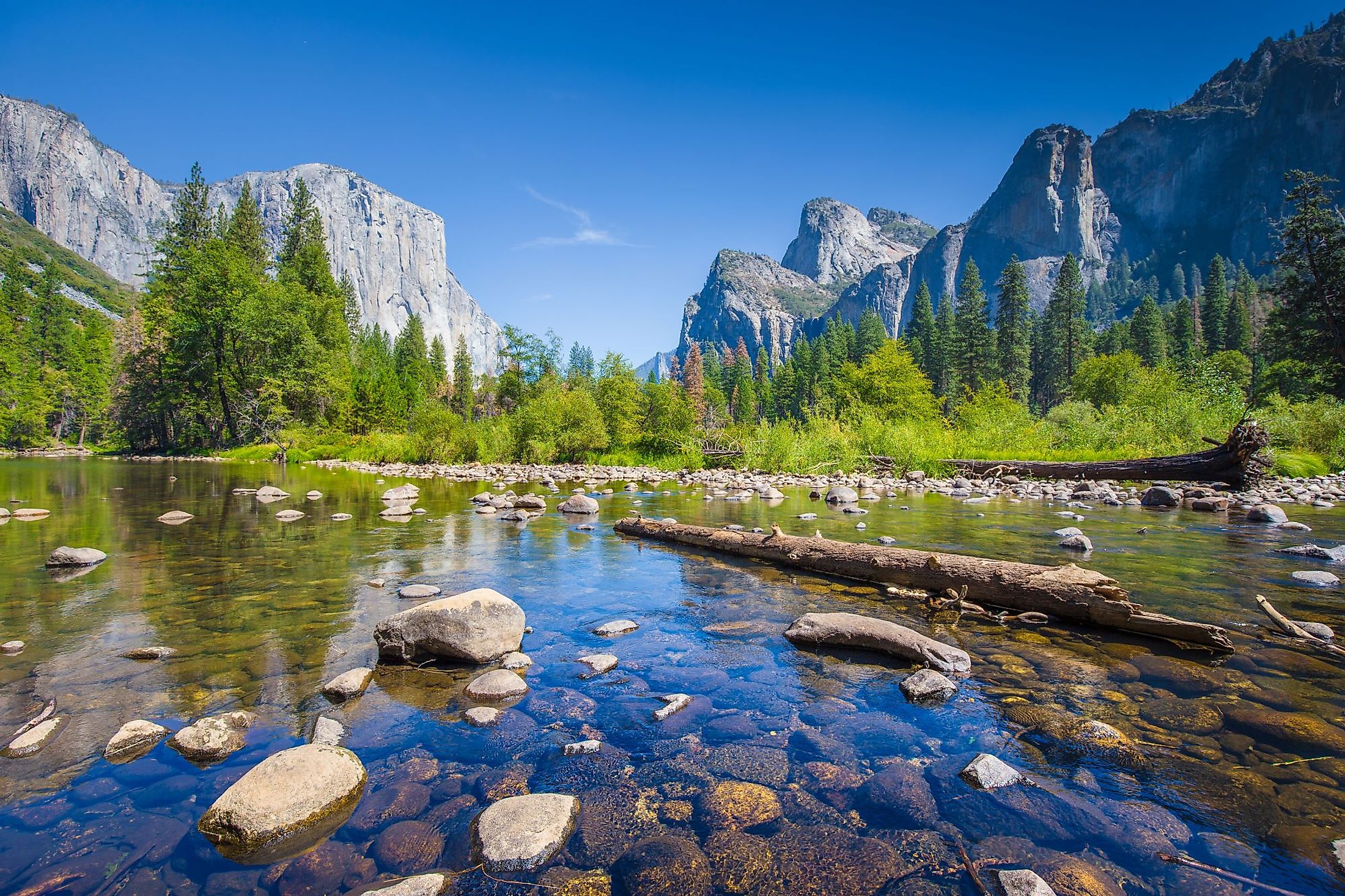
The Merced River then plunges over the Nevada Falls and Vernal Falls together, referred to as the Giant Staircase. Tenaya, Yosemite, Bridalveil, and Pigeon Creek join the Merced River in Yosemite Valley after it receives the Illilouette Creek. At the valley's western end, the River flows through the Merced River Canyon, where it is joined by the Cascade Creek. State Route 140 parallels the River as it leaves the national park's west gate. The South Fork Merced River, the River's biggest tributary, then enters from the left. The Merced River arcs northwestwards to receive the North Fork before entering Lake McClure, created by the New Exchequer Dam. After passing through the Central Valley, the River turns westwards and merges with the San Joaquin River near Hills Ferry.
Geology Of The Merced River
Geologic and hydrologic processes that continue to sculpt the landscape over thousands of years gave rise to the Merced River. The Merced River follows routes that were carved out by glaciation, river erosion, and the impact of bedrock cracks. These processes are also responsible for the river's varying slopes and abrupt variations in water volume and speed. The river travels over alluvial terrain in Yosemite Valley, through a traditional boulder bar near El Portal, over high cliffs, and through stair-step river morphology.
History Of The Merced River

Along the Merced River, several Native American tribes have resided, including the Miwok, Paiute, and Ahwahneechee. Along the lower Merced River's lowlands, the Plains Miwok made their home. Spanish colonists from coastal California conducted military expeditions into the Central Valley at the beginning of the 19th century. The colonists landed thirsty and short on supplies on the river's southern banks during one of these expeditions, led by lieutenant Gabriel Moraga. Because the river supplied much-needed water, it was given the name "Rio de Nuestra Senora de la Merced." In 1987, the Merced and the South Fork Merced in Yosemite Park and the Sierra National Forest were added to the federal system by the US Congress.
Ecology Of The Merced River

The Bureau of Land Management (BLM) administers lands covering several acres of limestone salamander habitat along the Merced River and its tributaries. The limestone salamander, a federal Category 2 candidate and a threatened species on the state's list of endangered species, only inhabits 15 population sites along a 20-mile section of the Merced River between the headwaters of Lake McClure, close to the town of Bagby, and the mouth of Sweetwater Creek, close to Briceburg. Moreover, with self-sustaining populations of rainbow, eastern brook, and brown trout, the river's South Fork is home to one of the few remaining pristine Sierra Nevada fisheries.
Recreation In The Merced River

The Merced River rushes headlong through glacially sculpted gorges, rocky mountains, and foothills before entering the San Joaquin Valley from the highlands of Yosemite National Park. At the height of around 900 feet, the river runs in a sequence of rapids to Lake McClure. Outstanding whitewater rafting, camping, and hiking options all contribute to Merced's exceptional entertainment, which is made even more extraordinary by the area's natural terrain, tall granite cliffs, and towering waterfalls.


