The Most Crooked Coastline In America
Before determining which state in America has the most crooked coastline, it is necessary to define what "crooked" means. For the purposes of this article, crooked refers to extreme fractal geometry, or the degree to which a coastline is irregular and complex. Using that definition, Alaska stands apart from all other American coastlines. Its countless tidal inlets, islands, bays, peninsulas, and fjords create a remarkably complex coastline. Alaska has 6,640 miles of coastline, far exceeding Florida, which ranks second at 1,350 miles, and California, with 840 miles.
Coastline vs. Shoreline

Alaska's impressive coastline becomes even more remarkable when shoreline measurements are considered. A coastline generally refers to the outline of the landmass, whereas shoreline measurements include boundaries where the water and land meet. If you also include the shoreline of Alaska's 2,670 named islands, there is a total shoreline of 33,904 miles. Including tidal shorelines increases that figure to 47,300 miles. No other state comes close to matching this immense extent of shorelines.
Why Alaska's Coastline is Crooked

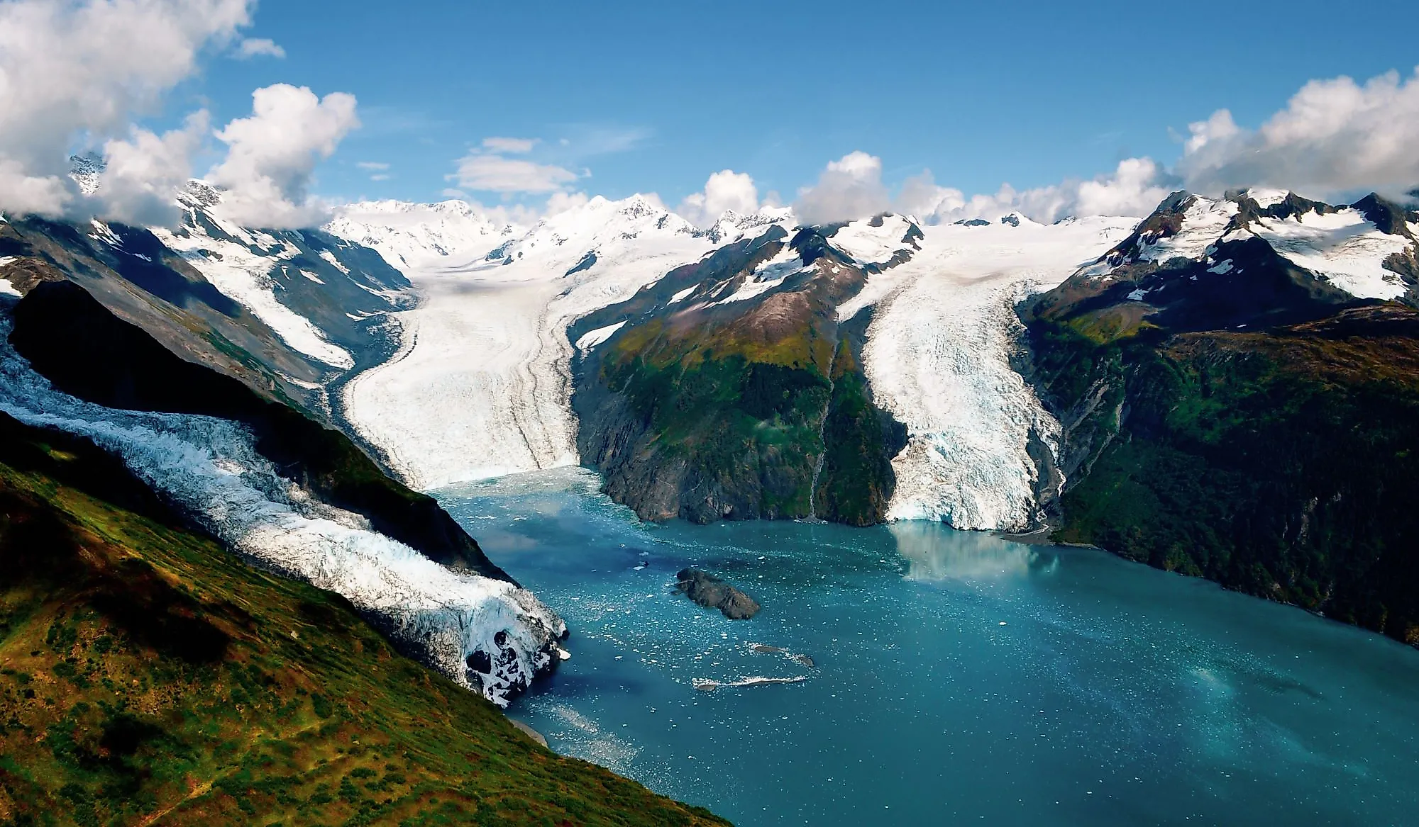
Alaska's convoluted coastline is the product of millions of years of geologic activity. Glaciers have carved deep fjords and valleys, while tectonic forces have uplifted and fractured the land. Volcanic activity, sea-level changes, and river deposition have also contributed to the coastline's complex shape. These processes have produced an extraordinary number of bays, coves, fjords, straits, and islands, thus creating an intricate coastal pattern that makes Alaska's shoreline more irregular than that of any other state. In addition, the process is ongoing. Storms, thawing permafrost, landslides, volcanic activity, declining sea ice, and erosion continue to alter sections of Alaska's coastline today.
The Waters That Surround Alaska

Alaska is surrounded by several major bodies of water. The Beaufort Sea lies to the north, the Chukchi Sea to the northwest, the Bering Sea to the west, and the Gulf of Alaska to the south. The state also has the Arctic Ocean to the north and the North Pacific Ocean to the south. The varying temperatures, currents, sea ice conditions, and weather patterns associated with these waters have played an important role in shaping Alaska's coastlines.
Diversity of Alaska's Coastlines

When many people think of coastlines, they picture sandy beaches interrupted by occasional rocky stretches. Alaska, however, contains one of the most diverse coastal environments in the world. Its Arctic and sub-Arctic shores feature estuaries, barrier islands, river deltas, glacial fjords, permafrost bluffs, volcanic coasts, and rocky bluffs. This diversity is one reason why Alaska's coastline is so irregular. Rather than following a relatively smooth path, the coast is broken into countless inlets, islands, channels, and embayments. Sea ice, storms, erosion, and changing environmental conditions continually reshape many portions of the coast, especially the barrier islands. The scale of these features is equally impressive. Alaska is home to 52 active volcanoes. It also contains river deltas of extraordinary size, including some that dwarf better-known deltas elsewhere in America, such as the Mississippi Delta.
Kenai Fjords National Park

Few places better illustrate Alaska's coastal complexity than Kenai Fjords National Park. Here, glaciers carved dramatic fjords surrounded by steep cliffs, narrow coves, rocky spires, and rugged shorelines. The landscape demonstrates how glacial activity and tectonic forces can create highly irregular coastal features. The park provides a striking example of the same geological processes that have shaped much of Alaska's coastline.
The Changing Shoreline of Alaska

The extreme forces that created Alaska's coastline continue to modify it. Because of the state's ecological importance and vast coastal extent, numerous organizations, scientists, and universities are involved in observing and mapping shoreline changes. Several ongoing projects are collecting data to better understand coastal processes and track environmental changes. Attention is being given to how warming temperatures, declining sea ice, permafrost thaw, and increased erosion may affect Alaska's coast in the future.
If crookedness is measured by the complexity and irregularity of a coastline, Alaska stands in a class by itself. No other states contain such a vast network of fjords, channels, islands, tidal waterways, and peninsulas. The same powerful forces that created this remarkable coastline continue to reshape it today, ensuring that America's most crooked and fascinating coastline remains a work in progress.