How Lake Michigan Holds More Water Than Lake Huron Despite Being Smaller
Lake Huron covers about 59,600 square kilometers and Lake Michigan covers about 57,800, which makes Huron the larger of the two by roughly 1,600 square kilometers. Lake Michigan nonetheless holds 4,918 cubic kilometers of water against Huron's 3,540, a surplus of 1,378 cubic kilometers, or 39 percent more. The extra water Michigan has over Huron is itself nearly three times the entire volume of Lake Erie. The explanation is a single number almost nobody quotes, and once you have it the whole thing stops being a paradox and starts being arithmetic.
Average Depth Is The Whole Answer
Lake Michigan averages 85 meters deep. Lake Huron averages 59. That is a gap of 26 meters, which makes Michigan about 44 percent deeper across its entire surface.
Multiply each lake's area by its average depth and you get almost exactly the published volumes, within about one percent either way. There is no other factor doing any work here. Huron's 2.8 percent advantage in area is simply overwhelmed by Michigan's 44 percent advantage in depth.
The number people normally cite is maximum depth, where Michigan also wins at 281 meters to Huron's 229. But a maximum depth is one spot on a lakebed. An average depth describes the entire basin, and the entire basin is what holds water.
One Lake Is A Trough, The Other Is A Platform
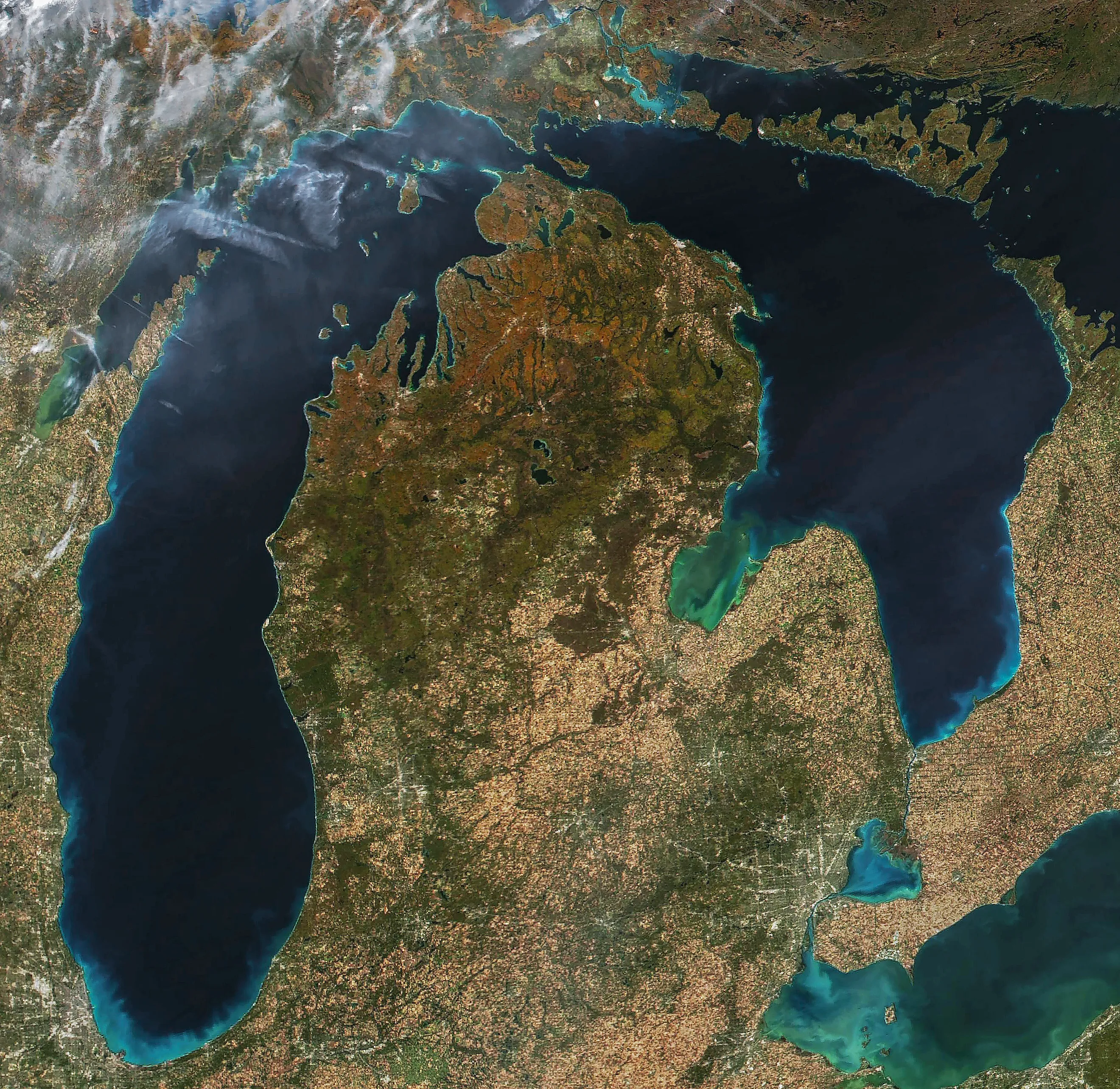
The shapes of the two basins are completely different, and that is where the depth difference comes from. Michigan is long and narrow, running roughly 494 kilometers from north to south and 190 at its widest. Its floor is dominated by elongated troughs with comparatively steep shelves at the margins, and the Chippewa Basin in the north holds the deep water that dominates the lake's total volume.
Huron is shorter and much wider, about 332 kilometers by 295. Its floor is characterized by broad shallow platforms, and outside a handful of deep pockets the depths rarely exceed 100 meters. Spreading a similar area across shelves rather than troughs produces a much smaller number when you add it all up.
Saginaw Bay Drags The Average Down

Huron's surface area includes several enormous appendages, and none of them is deep. Saginaw Bay protrudes southwest into Michigan and is notably shallow throughout. Georgian Bay and the North Channel add still more surface to the northeast. All of that counts toward Huron's area and almost none of it counts for much toward its volume.
Lake Michigan has Green Bay and not a great deal else. It is a far more consolidated body of water, which is precisely why its average holds up.
The Rock Underneath Decided It

The reason one basin is a trough and the other is a platform goes back to what the ice was cutting into.
Geologists studying the origin of the lake basins note that the southern part of the Michigan basin is underlain by relatively soft and homogeneous bedrock, which let advancing ice gouge a smooth, deep channel. The Huron basin, by contrast, is irregular and complicated by resistant bedrock layers.
Those resistant layers are visible above water. Manitoulin Island, the Bruce Peninsula and the dolomite ridges that separate Georgian Bay and the North Channel are all hard rock the glaciers could not remove. Where the ice met resistant dolomite it went around or over rather than through, leaving shallow platforms behind.
Same ice sheet, same era, different rock underneath. That is the entire explanation.
It Shows Up In How Fast The Water Moves

There is a second consequence of the depth difference, and it has nothing to do with volume and everything to do with how each lake behaves. Water passes through Lake Huron faster than through any other Great Lake, with a retention time of only 22 years. Lake Michigan holds its water for far longer, because there is simply more of it sitting in deep troughs that exchange slowly.
That matters for pollution, for temperature and for ecology. A shallow lake responds quickly to whatever enters it, and a deep one takes decades.
They Are Technically The Same Lake

The comparison carries an asterisk that is worth knowing, because strictly speaking there is only one lake here.
Michigan and Huron meet at the Straits of Mackinac and sit at precisely the same elevation, which makes them hydrologically a single body of water. Treated as one, Lake Michigan-Huron is the largest freshwater lake in the world by surface area, with a combined volume of roughly 8,460 cubic kilometers and an average depth around 72 meters.
A sill at about 30 meters depth in the Mackinac channel does restrict deep-water exchange between them, so the two deep basins remain largely separate even though the surfaces are continuous. They share a water level and not much else below it.
Where Each One Ranks

Set the five lakes side by side and the ordering changes depending on which column you read, which is the real lesson here. By surface area it runs Superior, Huron, Michigan, Erie, Ontario. By volume it runs Superior, Michigan, Huron, Ontario, Erie. Michigan and Huron swap places, and so do Erie and Ontario, because Ontario is small but deep while Erie is larger and extremely shallow at 19 meters average.
Erie is the clearest version of the same effect. It covers more than three times Ontario's area and holds less than a third of Ontario's water.
Why Area Gets Quoted Anyway

If average depth explains everything, the obvious question is why surface area is the number that appears in every reference book.
Area is easy. It can be taken from a map, a satellite image or a shoreline survey, and it has been known accurately for a very long time. Volume requires bathymetry, meaning somebody has to sound the entire lakebed and integrate the result, which is far more work and far more recent.
So the familiar rankings reflect what was measurable first rather than what is most meaningful. For almost any question involving water, volume is the number that matters.
The Short Version

Lake Huron is bigger on a map and Lake Michigan is bigger in every sense that involves water, because Michigan averages 85 meters deep against Huron's 59 and a 44 percent depth advantage comfortably beats a 2.8 percent area deficit.
Underneath that is a difference in bedrock. The ice carved Michigan a deep narrow trough through soft rock and spread Huron across broad shallow platforms it could not cut into. One lake got depth and the other got shoreline, and only one of those holds water.