The Place In The Lower 48 Farthest From Any Road
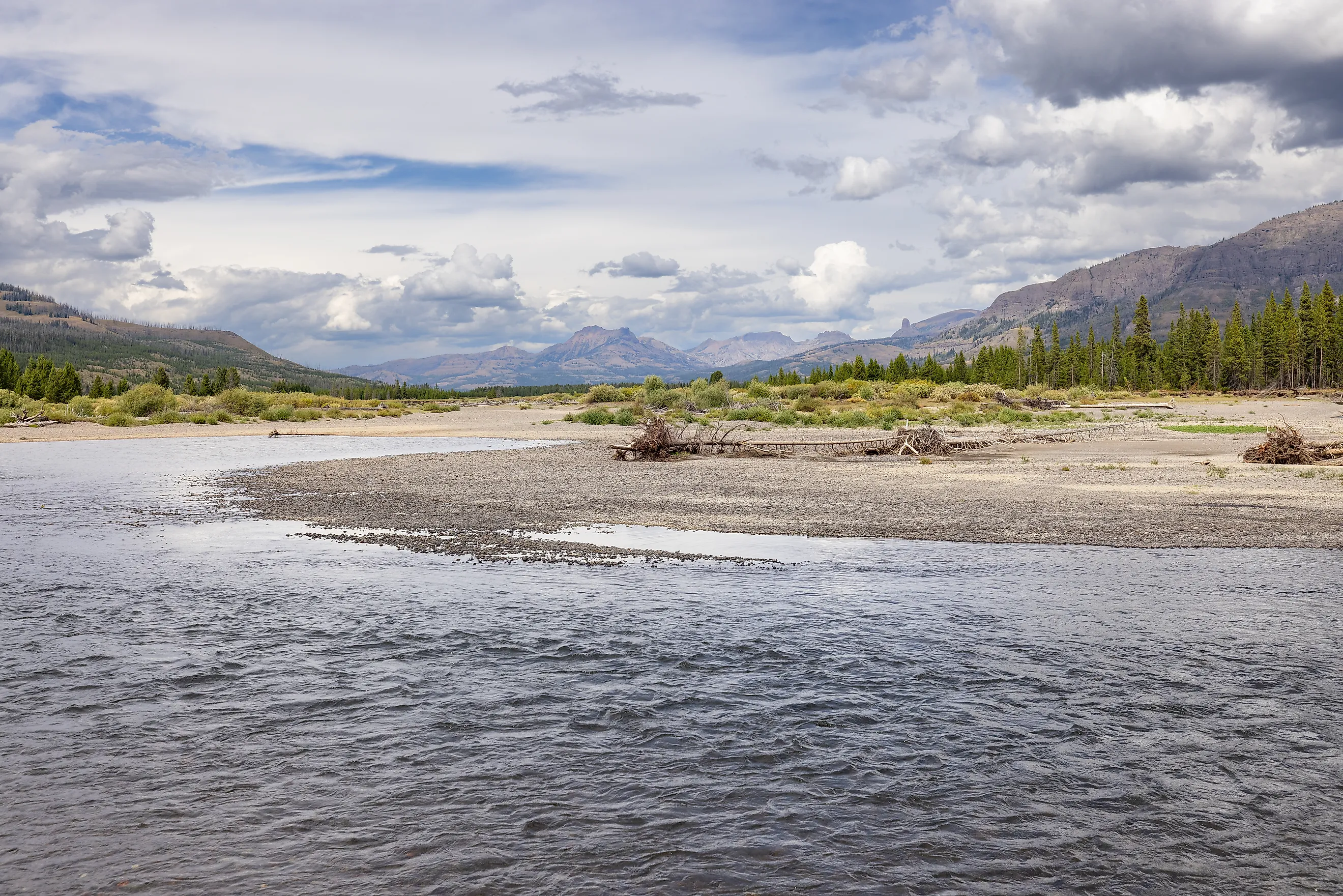
About 20 miles from the nearest road, Yellowstone's Thorofare region occupies the southeastern corner of Yellowstone National Park. In a 2020 article, the US Geological Survey (USGS) identified this area as the place in the Lower 48 farthest from a road. The Yellowstone River flows through the region toward Yellowstone Lake, while elk use the valley to move between the park and lands farther south. Reaching this remote area requires a long journey on foot or horseback, but people still explore and work on the land. Backcountry trails connect remote parts of the region, and patrol cabins give park staff a place to stay while working there. The Thorofare's geography, wildlife, and history reveal what it takes to preserve and work in a landscape far from a network of roads.
Geography

The Thorofare lies southeast of Yellowstone Lake, where the Yellowstone River enters the park from the south. The river begins outside Yellowstone on the slopes of Younts Peak in the Absaroka Mountains, then flows north through the Thorofare toward the lake. Along the river, broad meadows open between stretches of forest, with mountains rising beyond the valley. The roadless country around the Thorofare extends beyond Yellowstone's boundary into the neighboring Teton Wilderness, part of Bridger-Teton National Forest.
Although the nearest road is about 20 miles away, the hike into the Thorofare is longer. The National Park Service (NPS) lists the Thorofare Trail as 33.1 miles long, one way, starting at Nine Mile Trailhead on the eastern side of Yellowstone Lake. The trail follows Yellowstone Lake's eastern shore before continuing south into the Thorofare valley. The journey takes hikers from the lakeshore into country shaped by the Yellowstone River and its tributaries, with forests giving way to open meadows. Along the way, creek crossings interrupt the overland route, requiring hikers to enter the water where there are no bridges.
History

Indigenous people used the Thorofare as a route between the Yellowstone Plateau and Jackson Hole, Wyoming. The wider Yellowstone region was home to the Tukudika, a band of Mountain Shoshone who traveled along rivers and streams to hunt, gather plants, and build seasonal camps. The route through the Thorofare followed the Yellowstone River to Atlantic Creek, crossed Two Ocean Pass, and continued down Pacific Creek into Jackson Hole. These connected waterways and the mountain pass provided a route between the plateau and the valley to the south. Trappers and prospectors later used this region as a travel route, a history reflected in its name.
The US Army built the Thorofare Patrol Cabin in 1915 as part of a network of backcountry outposts for soldiers patrolling Yellowstone for poachers. The Army spaced these cabins about 16 miles apart, about a day's travel at the time. They gave troops a place to sleep, cook, and take shelter from cold weather during long patrols. The Thorofare cabin has two rooms and a large covered porch.
The NPS backed a 1919 plan for a road from Jackson, Wyoming, through the Thorofare and down the South Fork of the Shoshone River to Cody. The route would have brought automobile tourism and roadside businesses into the region. According to historian Jeremy Johnston of the Buffalo Bill Center of the West, strong opposition led Stephen Mather, the National Park Service's first director, to reconsider. The proposed highway would have reshaped the region. Mather's 1920 annual report warned that building the road "would mean the extinction of the moose." Although Mather promoted road construction elsewhere in the national parks, he recognized the potential harm here. The highway never went through.
Wildlife

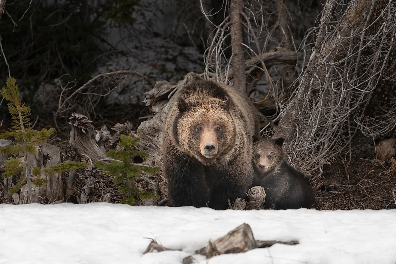
The broader Thorofare country, including land outside Yellowstone's southern boundary, is home to elk, bison, deer, moose, bighorn sheep, grizzly bears, coyotes, and gray wolves. Elk use the Thorofare as a migration route between Yellowstone and the lands south of the park. Eagles and sandhill cranes appear in the region, too.
Yellowstone cutthroat trout are common in the valley's streams and lakes. These native fish play a central role in the Yellowstone food web, feeding animals such as river otters, ospreys, and grizzly bears. Unlike introduced lake trout, a species that spends most of its time in deep water, cutthroat trout enter shallow streams to spawn, where birds and mammals can catch them.
Field journals kept by Wyoming Game and Fish Department staff give a closer look at these animals. During a March 2007 survey, staff watched river otters catch fish at beaver ponds along Thorofare Creek. The team found tracks of snowshoe hares, red squirrels, coyotes, and ermine.
Working In The Thorofare

Wildlife surveys and equipment maintenance bring game wardens, biologists, and researchers into the Thorofare. Outside Yellowstone, the Wyoming Game and Fish Department built its own cabin in 1955 to house wardens and biologists. Workers transported building materials by boat across Yellowstone Lake to Trail Creek Camp, then loaded them onto packhorses for the remaining 20 miles to the cabin.
Winter fieldwork requires a different approach. Three Wyoming Game and Fish Department staff members skied into the region in March 2007 to do a forest carnivore survey. They placed motion-triggered cameras near meadows and animal remains, recording wildlife sightings and tracks. Their trip covered 143 miles, in and back out.
Scientific equipment requires its own trips to remote sites. A 2020 USGS article described a University of Utah seismometer on Hawks Rest, in the adjoining Teton Wilderness just southeast of Yellowstone. The instrument records ground motion for earthquake monitoring. Servicing it requires multiple days of travel on horseback.
Access

Reaching the Thorofare by foot or on horseback requires supplies for a multiday trip. One approach begins at Nine Mile Trailhead on the eastern side of Yellowstone Lake. The NPS warns hikers to prepare for creek crossings and biting insects. Snowmelt can make crossings dangerous, and lingering snow can make backcountry travel difficult into early summer.
Overnight stays within Yellowstone require a backcountry permit year-round. The permit specifies campsites and dates for the trip, so campers must plan each day's travel around their assigned sites. Campsite availability can affect the route and the time needed to complete it.
The Thorofare Trail passes through or near three bear management areas, where restrictions help protect bears and reduce encounters with humans. Restrictions and trail conditions change, so checking them before setting out matters. The NPS recommends carrying bear spray, traveling in groups of three or more, and securing food and scented items in approved containers or on campsite food poles.
Where The Roads Stop
The highway proposed through the Thorofare never materialized, and reaching the valley still means following trails instead of roads. Elk and grizzlies continue to move through it, and wardens and researchers make long trips to study wildlife and maintain equipment. The region's remoteness shapes both the landscape and the work of caring for it. Supplies arrive by packhorse, field surveys can take days, and a creek crossing can determine how far a person can travel. Even within Yellowstone, the Thorofare follows its own rhythm.
.jpg)
.jpg)
.jpg)