How Lake Erie Holds Less Water Than Lake Ontario Despite Being Larger
Lake Erie looks as though it should hold more water than Lake Ontario. Erie covers 9,910 square miles, compared with Ontario's 7,340 square miles. Yet Erie contains only 116 cubic miles of water, while Ontario holds 393 cubic miles. In other words, Ontario holds about 3.4 times as much water despite covering about 26% less surface area.
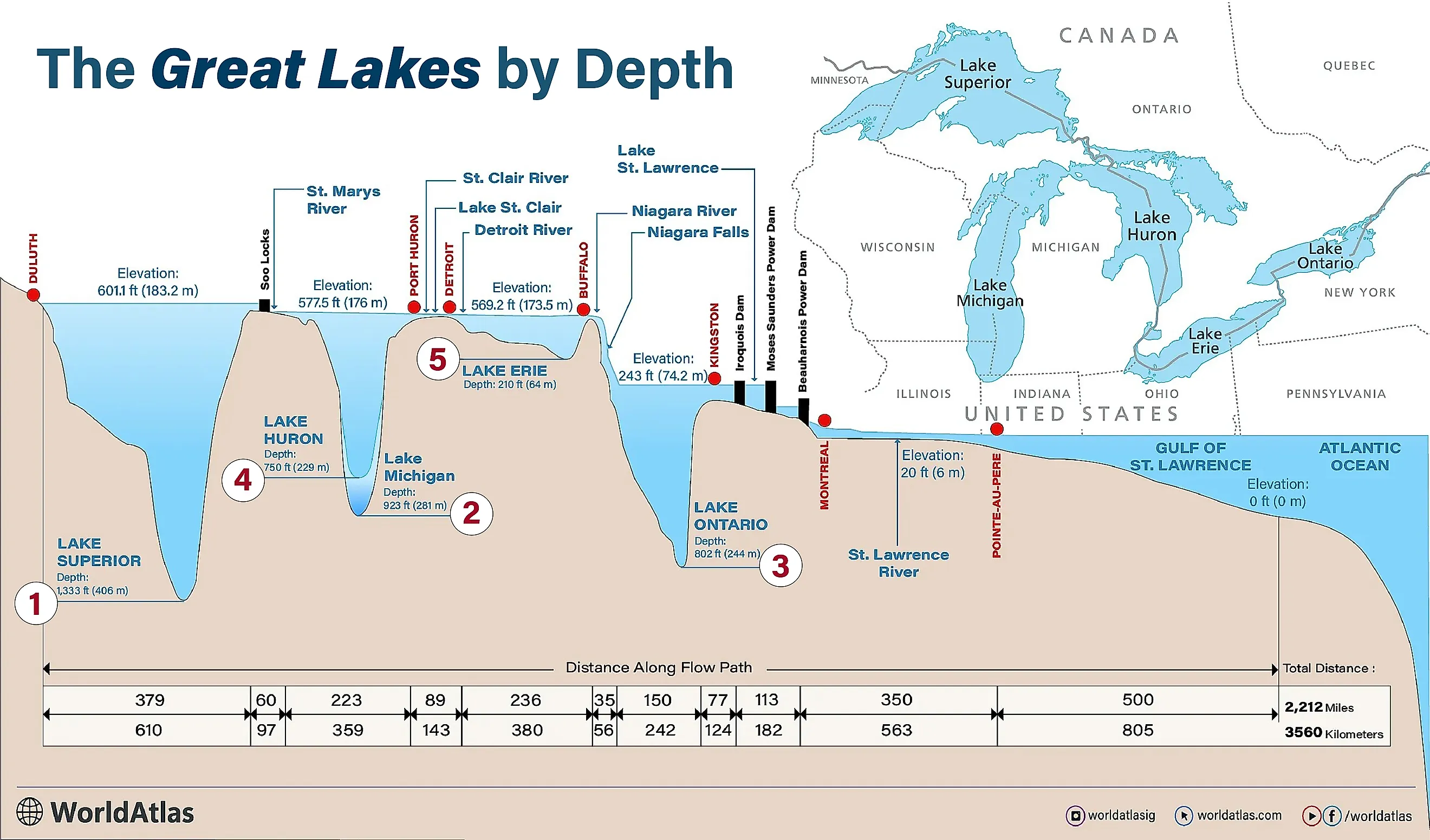
The explanation is hidden below the surface. Lake Erie averages just 62 feet deep. Lake Ontario averages 283 feet, more than four times Erie's average, and plunges to 802 feet at its deepest point. Their very different underwater shapes were inherited from older landscapes and then heavily reworked by glaciers. The result is a broad, shallow Erie and a much deeper Ontario basin.
The difference becomes obvious below the surface

Surface area is only a lake's footprint, not the space that exists beneath it. Lake Erie is the fourth-largest of the Great Lakes by surface area, but it is easily the smallest by volume. Its maximum depth is only 210 feet. Lake Ontario, although the smallest Great Lake by surface area, reaches 802 feet and is second only to Lake Superior in average depth.
The contrast is large enough that even Lake Ontario's average depth of 283 feet exceeds Lake Erie's deepest point by more than 70 feet. A map, therefore, is a misleading guide to how much water each one can hold. Erie spreads across more land, while Ontario has far more room downward. To understand how two neighboring lakes ended up with such different profiles, the better place to start is with the shape of Erie itself.
Lake Erie spreads outward instead of downward

Lake Erie is not equally shallow from end to end. Its floor is divided into three major basins that deepen toward the east. The western basin is extraordinarily shallow, averaging only about 23 feet in depth. Islands and shoals break up part of its floor, while mud and other sediments cover large areas. The much larger central basin averages roughly 62 feet before the lake drops into the eastern basin, where the deepest water reaches 210 feet southeast of Long Point.
Those differences trace back to a landscape much older than the lake now covering it. Beneath Erie are sedimentary rocks including shale, limestone, and dolostone, along with buried valleys and deposits left by repeated glaciations. The modern lake floor is not simply a hole excavated during one pass of an ice sheet. For roughly two million years, advancing and retreating ice repeatedly eroded rock, moved sediment, filled depressions, and altered drainage across the region. Later erosion and sediment deposition continued modifying the basin after the ice withdrew.
What those processes ultimately left behind was a wide depression without the enormous central depths seen farther east. Lake Ontario had a different geological starting point.
Lake Ontario inherited a much deeper hole

Long before the modern Great Lakes existed, a river system had already cut a valley through the relatively weak sedimentary rocks beneath what is now Lake Ontario. When continental glaciers moved across the region, they followed and enlarged that existing low ground. Instead of beginning with the same kind of broad, shallow basin seen beneath much of Erie, the ice was working over a landscape that already contained a substantial valley.
Glacial erosion deepened and widened that depression. Today, Lake Ontario averages 283 feet deep and bottoms out at 802 feet in its southeastern portion. That deepest water lies below sea level, even though the lake's surface sits about 243 feet above it.
The lake floor is complicated rather than bowl-shaped. Ridges, smaller basins, sediment deposits, and changes in the underlying rock produce substantial differences in depth across Ontario. Its northeastern end near the St. Lawrence River is comparatively shallow, while much deeper water occupies the main basin. That irregular terrain is one reason the outline of each lake is a poor guide to how much water it can hold.
What the glaciers actually changed

The Laurentide Ice Sheet repeatedly covered the Great Lakes region during the Pleistocene, but the glaciers did not carve five identical basins. They encountered different bedrock, existing valleys, drainage routes, and topography. Ice erosion enlarged some depressions dramatically while glacial sediment partly filled others. The modern lakes are the result of those interactions, not just the thickness of ice at a particular latitude.
Lake Erie's postglacial history was especially eventful. As the last ice retreated roughly 13,000 years ago, a succession of larger precursor lakes occupied parts of the basin. One was glacial Lake Maumee, which covered the western Erie basin and extended beyond the present shoreline. Changing ice barriers and outlets repeatedly raised and lowered water levels. At one stage, early Lake Erie stood tens of feet below its modern level, exposing portions of the basin that were then reshaped by erosion.
Ontario's basin held its own sequence of glacial lakes as retreating ice continued to block the St. Lawrence Valley. Glacial Lake Iroquois once stood substantially higher than modern Ontario and drained east through a different route. As the ice disappeared and the land adjusted after being compressed by its weight, drainage shifted again. By the time the modern Great Lakes system emerged, Erie and Ontario occupied neighboring basins with radically different dimensions.
Erie's shallow basin still changes the lake today

Erie's lack of depth is not merely a geological curiosity. With much less water to heat and cool than the deeper Great Lakes, Erie warms and cools quickly with the seasons. That is one reason Erie can become unusually warm in summer and freeze over extensively during a cold winter.
The shallow western basin is also the center of Lake Erie's best-known water-quality problem. Phosphorus entering the lake, much of it associated with agricultural runoff, can fuel large cyanobacterial blooms when conditions are favorable. The warm, nutrient-rich water of the western basin is especially productive ground for them. In 2014, a bloom near Toledo contaminated the city's drinking-water supply with the toxin microcystin, leaving hundreds of thousands of people under a do-not-drink advisory for roughly two days. The shallow western basin, quick to warm, is exactly the setting in which these blooms take hold.
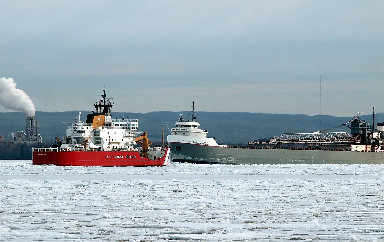
The opposite is true in winter. In early February 2026, ice covered more than 95% of Lake Erie, while Lake Ontario was only about 37% covered at the same point. Erie does not reach those levels every winter, but its shallow water freezes far faster than the deeper lakes once prolonged cold sets in.
How can both lakes claim to be the smallest Great Lake?

The Erie-Ontario comparison has one final twist. Lake Ontario is the smallest Great Lake when measured by surface area, at 7,340 square miles. Lake Erie is the smallest when measured by water volume, at 116 cubic miles. Ontario contains 393 cubic miles despite occupying a noticeably smaller patch of the map.
That is the answer to the original puzzle. Erie's extra 2,570 square miles of surface add up to little when the lake averages only 62 feet deep. Ontario's basin drops much farther below its surface, leaving room for well over three times as much water. What looks like a contradiction on a map disappears as soon as the third dimension is added.