How Lake Superior Holds More Water Than The Other Four Great Lakes Combined
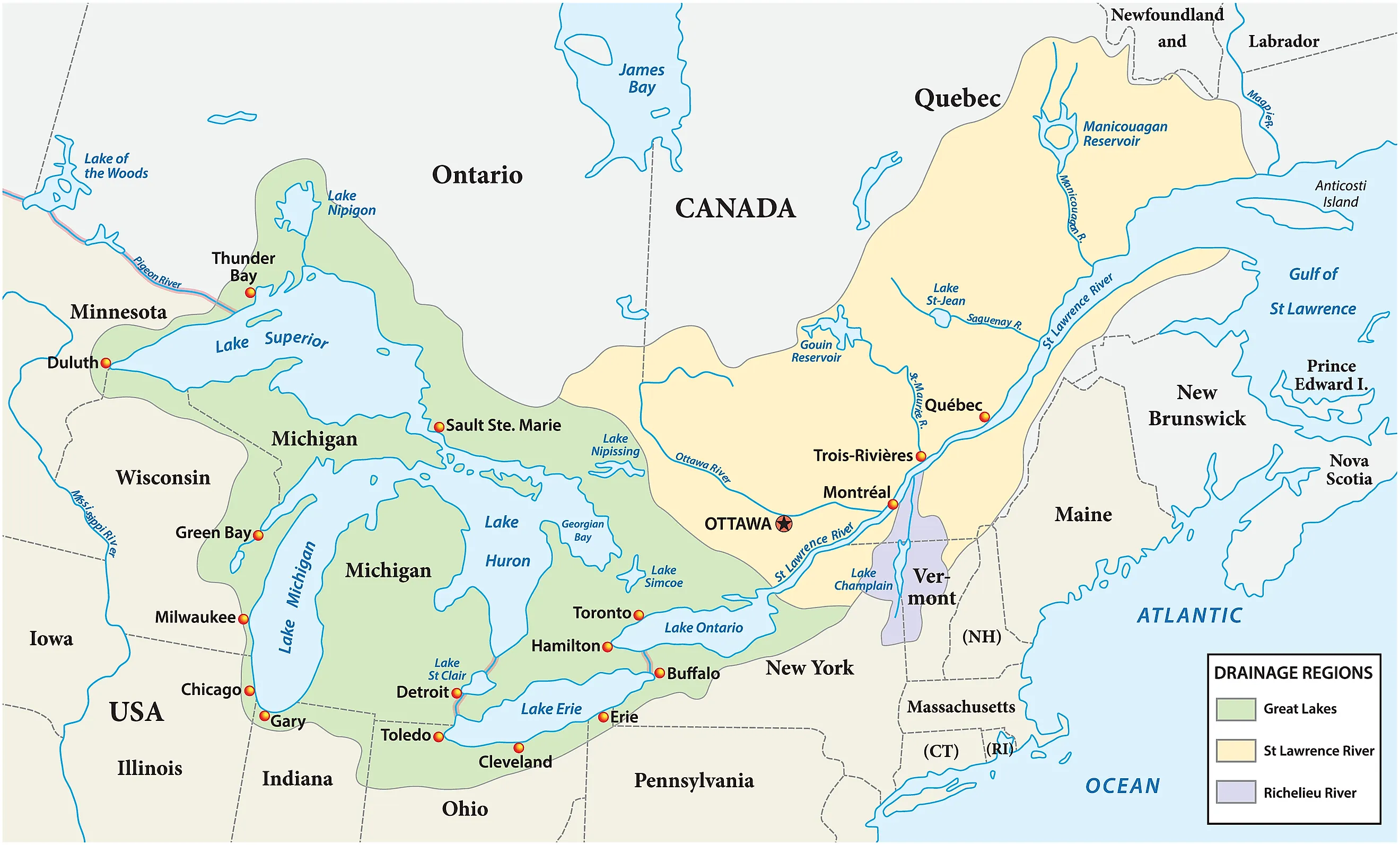
Lake Superior covers only about half the area of the other four Great Lakes put together. It still contains more water than all of them combined. The reason is not width but depth. Superior sits over hundreds of feet of water across a footprint the size of South Carolina, and its deepest floor drops below sea level.
Once the lake is treated as a three-dimensional basin rather than a shape on a map, the numbers stop being surprising. Lake Superior contains about 2,900 cubic miles of water, roughly 12,100 cubic kilometers. Lakes Michigan, Huron, Erie, and Ontario together contain about 2,539 cubic miles. The gap of about 361 cubic miles gives Superior roughly 53 percent of all the water in the five Great Lakes.
The US Environmental Protection Agency records a surface area of about 31,700 square miles for Lake Superior, an average depth of 483 feet, and a maximum depth of 1,332 feet. Those measurements come out of a geological history that reaches back more than a billion years. Continental rifting shaped the underlying basin, and much younger ice sheets enlarged it during the Pleistocene.
2,900 Cubic Miles of Water

The volume figures show how unusual Superior is. Lake Michigan contains about 1,180 cubic miles of water, Lake Huron about 850, Lake Erie about 116, and Lake Ontario about 393. Their combined volume reaches approximately 2,539 cubic miles. Superior exceeds that total by roughly 14 percent.
The other four Great Lakes cover about 62,550 square miles together. Superior spans only about half that area. Depth is what changes the calculation so dramatically. A lake's total volume depends on the area of its surface and the shape of the basin beneath it, and Superior combines a huge surface with hundreds of feet of water underneath it.
483 Feet Deep on Average
Superior's average depth is 483 feet. Michigan averages 279 feet, Huron 195 feet, Erie 62 feet, and Ontario 283 feet. Dividing the combined volume of those four lakes by their total surface area gives an area-weighted mean depth of about 214 feet. Superior averages more than twice that.
A simple calculation gets surprisingly close to the official volume. Multiplying 31,700 square miles by 483 feet, then converting feet to miles, produces approximately 2,900 cubic miles. Real lake bottoms are irregular, so bathymetric surveys supply the actual basin geometry, but the arithmetic makes the main point immediately.
Lake Erie shows why depth matters so much. Erie covers about 9,910 square miles yet contains only 116 cubic miles, because its mean depth is just 62 feet. Superior contains roughly 25 times as much water.
A Rift Opened Here 1.1 Billion Years Ago

The basin under Lake Superior began taking shape during one of the largest tectonic events in the interior of North America. About 1.1 billion years ago, the crust started pulling apart along what geologists call the Midcontinent Rift System. The rift runs for roughly 1,800 miles, about 3,000 kilometers, through the central part of the continent.
Faulting dropped sections of crust and opened a major depression. Volcanic eruptions poured out enormous volumes of basalt, and sediments accumulated in the sinking basin. Uranium-lead dating of the volcanic rocks places much of that activity near 1.1 billion years ago. The rifting stopped before the continent split apart completely.
The present lake formed vastly later. What the rift left behind was a broad structural basin of faults, volcanic rocks, and thick sedimentary deposits. Later erosion cut through that region along a path the old geology had already prepared.
Ice Sheets Deepened the Basin

Repeated Pleistocene glaciations reshaped the Great Lakes region over the past several million years. During the latest glacial cycle, the Laurentide Ice Sheet covered much of Canada and the northern United States. Ice thousands of feet thick moved across the Superior basin, grinding bedrock, carrying sediment away, and enlarging older depressions.
National Park Service geologic studies describe how glaciers cut into the ancient Midcontinent Rift. Some sedimentary rocks within the rift eroded more easily than the harder volcanic rocks around them, and ice advanced again and again along those weaker zones. The last major ice retreat around the Lake Superior region came roughly 10,000 years ago, and meltwater filled a basin that successive glacial advances had deepened.
The Deepest Floor Sits About 732 Feet Below Sea Level

Lake Superior's surface sits close to 600 feet above sea level. Its deepest measured point reaches about 1,332 feet below the water surface. Subtracting one figure from the other places the deepest lake floor around 732 feet below sea level.
NOAA bathymetric mapping shows deep water across large sections of the basin. Superior does not owe its volume to one isolated trench. Broad offshore zones reach hundreds of feet down. NOAA's Great Lakes bathymetric archive draws on sounding records collected over roughly 150 years, later assembled into detailed digital models of the lake floor.
That spread of depth is the crucial part. A single narrow trench would add relatively little water to a lake this large. Superior carries substantial depth across tens of thousands of square miles.
Why the Water Stays for About 191 Years

EPA data give Lake Superior a retention time of about 191 years. The figure is the lake's volume divided by its average rate of outflow. Michigan comes in at about 99 years, Huron at 22, Erie at 2.6, and Ontario at 6.
Water leaves Superior mainly through the St. Marys River into Lake Huron. The annual outflow is small next to the 2,900 cubic miles stored in the basin. A lake this large changes slowly, because only a small fraction of its total water volume leaves in an average year.
Water Levels Move, but the Volume Lead Remains Huge

Superior's volume is not fixed to the last gallon. Precipitation, evaporation, runoff, and river outflow raise and lower the water surface through the year. U.S. Geological Survey work has estimated that seasonal water-level changes can alter Superior's stored volume by about 6 cubic miles.
Six cubic miles is small beside the roughly 361-cubic-mile gap between Superior and the other four Great Lakes combined. Engineers have also regulated water levels at the St. Marys River since around 1914. USGS analysis found that this regulation has not substantially changed the overall range of natural lake-level fluctuations. Nearly all of Superior's enormous storage capacity comes down to the basin itself.
A Billion Years of Geology Explains the Numbers

Lake Superior's 2,900 cubic miles of water trace back to the physical dimensions of its basin. A 31,700-square-mile surface sits above water averaging 483 feet deep, with parts of the floor descending more than 700 feet below sea level.
The basin began with continental rifting about 1.1 billion years ago. Faults, subsidence, lava flows, and sediment built the structural foundation. Pleistocene glaciers arrived much later and excavated those preexisting weaknesses. By the time the last major ice retreated roughly 10,000 years ago, North America had a basin wide enough and deep enough to hold more water than Michigan, Huron, Erie, and Ontario put together. The 191-year retention time, the immense volume, and the modern bathymetry all follow from that geometry.