Geography Of The World
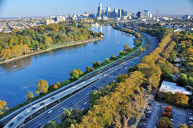
Schuylkill River
Schuylkill River is a 217km long river that flows from the northwest to southeast direction in the eastern portion of the US state of Pennsylvania.
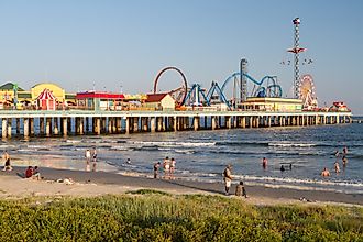
Galveston Island
Galveston Island is a barrier island offshore from Texas, on the Gulf Coast of the United States. This charming beach town is known for its beautiful beaches.
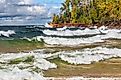
How Were The Great Lakes Formed?
Also referred to as the Laurentian Great Lakes, the Great Lakes is a series of five large interconnected deep freshwater lakes that occupy the east-central portion of the continent of North America.
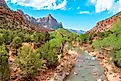
Virgin River
The Virgin River is a 261km long river that serves as one of the tributaries of the mighty Colorado River.
Lake Worth Lagoon
Lake Worth Lagoon is a 34km long lagoon situated on the Atlantic Coast in the Palm Beach County of the US State of Florida.
Green River
The headwaters of the Green River originate on the western side of the Continental Divide in the Wind River Range and the Bridger-Teton National Forest.
Little St. Simons Island, Georgia
Little St. Simons Island is a barrier island. It is one of the least developed of Georgia’s Golden Isles. The Berolzheimer family privately owns the island.
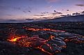
The 5 Volcanoes Forming The Big Island Of Hawaii
Nicknamed the “Aloha State,” the State of Hawaii is situated about 3,200km to the southwest of the contiguous United States in the Pacific Ocean.
Great Salt Lake
Covering an area of approximately 4,400 sq. km, the Great Salt Lake is the world’s eighth-largest terminal lake and the largest saltwater lake in the Western Hemisphere.

Man-Made Islands Of Dubai
A collection of artificial islands have been under construction in Dubai, the most populous city in the UAE, and the destination for the wealthy.
Everglades
The Everglades is a unique and complex wetland ecosystem comprising a vast, intricate network of forests and tropical wetlands spread across Florida.
Arkansas Delta
The Arkansas Delta is one of the 6 natural regions in Arkansas. The Delta region extends along the Mississippi River for some 402.34 km in length.
Kohala, Hawaii
The Kohala District occupies the northmost land area of the island of Hawaii, United States of America. It is separated into "North Kohala" and "South Kohala."
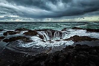
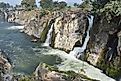
Thor’s Well
Also referred to as the “Drainpipe of the Pacific,” Thor’s Well is a natural wonder situated on the edges of the Pacific coast of the US State of Oregon.
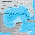
Campeche Bank
The Campeche Bank is a marine region of the Gulf of Mexico and is an underwater bank that runs from the Yucatan Straits in the east to the Tabasco-Campeche basin in the west.
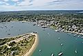
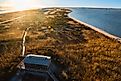
Martha’s Vineyard, Massachusetts
Martha's Vineyard is an island situated off the southern coast of the US state of Massachusetts, of which it is part. The island is home to a few small towns.
Gulf Of Mexico Basin
The Gulf of Mexico Basin is an underwater area, or basin, in the Gulf of Mexico. It sits northwest of the Campeche Bank and Yucatan Platform.
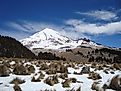
Sierra Madre Oriental
The Sierra Madre Oriental is a mountain range located in the northeast of Mexico. It is part of a much larger range that forms a near-continuous line of mountains and peaks through North America,
Danube Delta
The Danube Delta is the second-largest and the best-preserved river delta in the continent of Europe. The Danube Delta covers a total area of 5,165 sq. km.
Apalachicola River
The large watershed of the Apalachicola River is referred to as the ACF River Basin that drains a vast area of about 50,505 sq. km.
Arctic Vs. Antarctic
The Arctic is the northernmost region of the Earth that features a large ocean covered by a thin layer of perennial sea ice and is almost entirely surrounded by land.

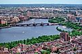
Charles River
Also referred to as River Charles, the Charles River is a 129 km long river that flows in the eastern portion of the US State of Massachusetts.
Mongol Empire
The Mongol Empire was the most extensive, contiguous empire in human history. At its height, it controlled most of Asia and a large part of Europe.
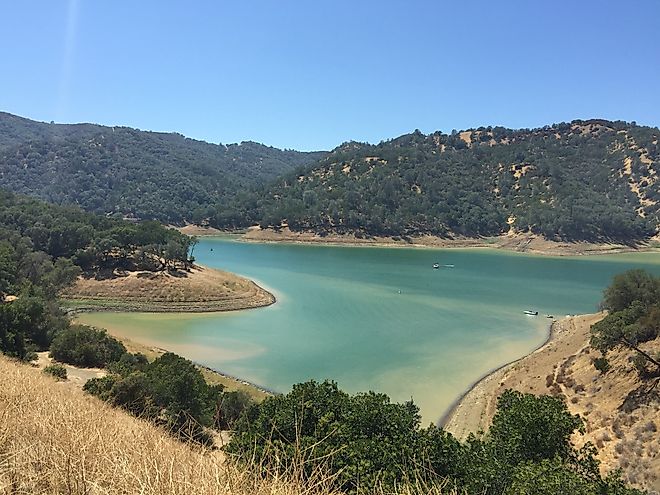
Vaca Mountains
The Vaca Mountains are part of the inner North Coast Ranges of California forming the Napa Valley's eastern boundary.
Second French Colonial Empire
The Second French Colonial Empire consisted of the colonial territories seized by France from 1830 until the mid-20th century.
Florida Strait
The Florida Strait is a water channel, or stream, which connects the Gulf of Mexico to the more expansive Atlantic Ocean.
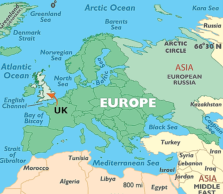
Is The United Kingdom A Part Of Europe?
The United Kingdom of Great Britain and Northern Ireland that together makeup the United Kingdom is almost universally considered part of Europe.
What Are The Finger Lakes?
The Finger Lakes are a group of eleven lakes in upstate New York, United States, named for their long, narrow shape.
Gulf Stream
The Gulf Stream is a warm and relatively fast-moving current in the Atlantic Ocean that starts at the tip of Florida, United States.
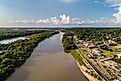
Yazoo River
The Yazoo River is located in Louisiana and Mississippi, in the United States. It is generally thought to mark the southern border of the Mississippi Delta floodplain.
Fire Island
Fire Island is one of the outer barrier islands that runs parallel to the south shore of Long Island, New York. The island continues to have an active tourist and recreational industry.
Kaveri River
Also referred to as “Cauvery”, the Kaveri River is an 805km long river that flows through the Indian States of Tamil Nadu, Karnataka, Kerala, and the Union Territory of Puducherry.

Limnic Eruptions: When Lakes Explode
A limnic eruption is defined as "a rare type of natural disaster in which dissolved carbon dioxide suddenly erupts from deep lake waters.
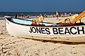
Jones Beach Island
Jones Beach Island is an outer barrier island off the southern coast of Long Island in New York State, United States of America.