Boise River
The Boise River is a tributary of the Snake River that flows through the southwestern part of Idaho, United States. The Boise River rises as three separate forks: the North Fork, the Middle Fork, and the South Fork, in the Sawtooth Range of the Rocky Mountains at an elevation of 3,497m. The mainstream of the Boise River is formed by the confluence of the river’s North and Middle Forks.
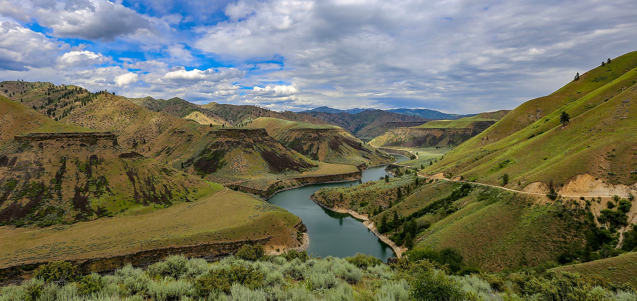
Geography

The 80km long North Fork of the Boise River rises in the Sawtooth Wilderness Area along the Boise-Elmore County line about 100km to the northeast of the city of Boise. The North Fork then flows in the southwest direction through the remote mountains of the Boise National Forest. The 84km long Middle Fork of the Boise River rises in the southern part of the Sawtooth Wilderness Area. The Middle Fork then flows in the west-southwest direction and joins the North Fork, forming the mainstream of the Boise River, close to the town of Atlanta about 24km to the southeast of Idaho City. The 163km long South Fork which rises in the Soldier and the Smoky Mountains of the Sawtooth National Forest, joins the mainstream of the Boise River, as the southern extension of the Arrowrock Reservoir, about 32km to the east of the city of Boise.

After its confluence with the South Fork, the mainstream of the Boise River then flows in the westward direction and passes through the Lucky Peak Dam. The river then flows over many irrigation diversion dams including the Boise River Diversion Dam, Eckert Diversion Dam, etc. The Boise River drains into the Snake River at the boundary between Idaho and Oregon at an elevation of 640m. The drainage basin of the Boise River covers an area of about 11,000 sq. km.
Recreation

The Boise River is a popular destination for floating and the Barber Park serves as the starting point for the Boise River floaters and tubers. Water skiing is a popular recreational activity that is mainly practiced above the dam at the Lucky Peak Reservoir. The Boise River is also well known for fishing and the lower course of the river supports several fishes such as the largemouth bass, channel catfish, mountain whitefish, rainbow trout, steelhead, brown trout, smallmouth bass, etc.
Brief History

In the early 19th century, the Boise River was known as the “Reed’s River”, which was named after John Reed, an employee of the Pacific Fur Company, who had explored parts of the river during 1813 and 1814. The Reed’s River was later rechristened as “Boise River”, where the name “Boise” has been derived from the French term “boisé” which means “wooded”. In the later years, several dams such as the Boise River Diversion Dam, Arrowrock Dam, Anderson Ranch Dam, and Lucky Peak Dam have been constructed on the Boise River as a part of the “Boise Project” of the United States Bureau of Reclamation. These dams were constructed to provide water for irrigation, drinking water, hydroelectric power generation, and controlling floods in Boise and the Treasure Valley.


