Labrador Sea
The Labrador Sea is the North Atlantic Ocean’s northwestern arm separating Greenland on the northeast and Canada’s Labrador Peninsula on the southwest. It was formed from the separation of the Greenland Plate and North American Plate about 60 to 40 million years ago. The sea is connected with Hudson Bay (on the west) via the Hudson Strait and Baffin Bay (on the north) through the Davis Strait. Labrador Sea contains a large turbidity current channel system and is a major source of North Atlantic Deep Water. It contains numerous icebergs, restricting major shipping routes to the eastern part.

Geography
The Labrador Sea, a marginal sea of the Atlantic Ocean, covers an area of approximately 841,000 square kilometers between the Labrador Peninsula and Greenland. It has a maximum length of 1,000 kilometers and is 900 kilometers wide at its widest point, the point at which it enters the North Atlantic Ocean. Labrador Sea has an average depth of 1,898 meters and a maximum depth of 4,316 meters. The region near Baffin Bay is much shallower than where the sea joins the ocean. Continental shelves flank the Labrador on the northeast, northwest, and southwest.

Labrador has a large turbidity current channel system, which runs from its center to the Atlantic Ocean. The underwater current, known as the Northwest Atlantic Mid-Ocean Current, is 100-200 meters deep, 3,800 kilometers long, and 2-5 kilometers wide and resembles a submarine riverbed with several tributaries.
Hydrology
Seawater is characterized by counterclockwise circulation. The West Greenland Current and East Greenland Current, which are warmer, more saline water currents, flow northwards on the coast of Greenland; while the Labrador Current and Baffin Island Current, which are colder and of lower salinity, move southwards on the Canadian coast. These currents contain numerous icebergs, hindering gas exploration and navigation. The water temperature ranges from -1 to 6 degrees Celsius, while salinity ranges between 3.1to 3.4%. In winters, the temperatures fall below 0 degrees Celsius, resulting in the ice covering of the sea. The Labrador Sea Water is one of the three parts of the North Atlantic Deep Water, characterized by low salinity of about 3.5%, high oxygen content, low vorticity, and water temperature of 3.3 to 3.4 degrees Celsius.
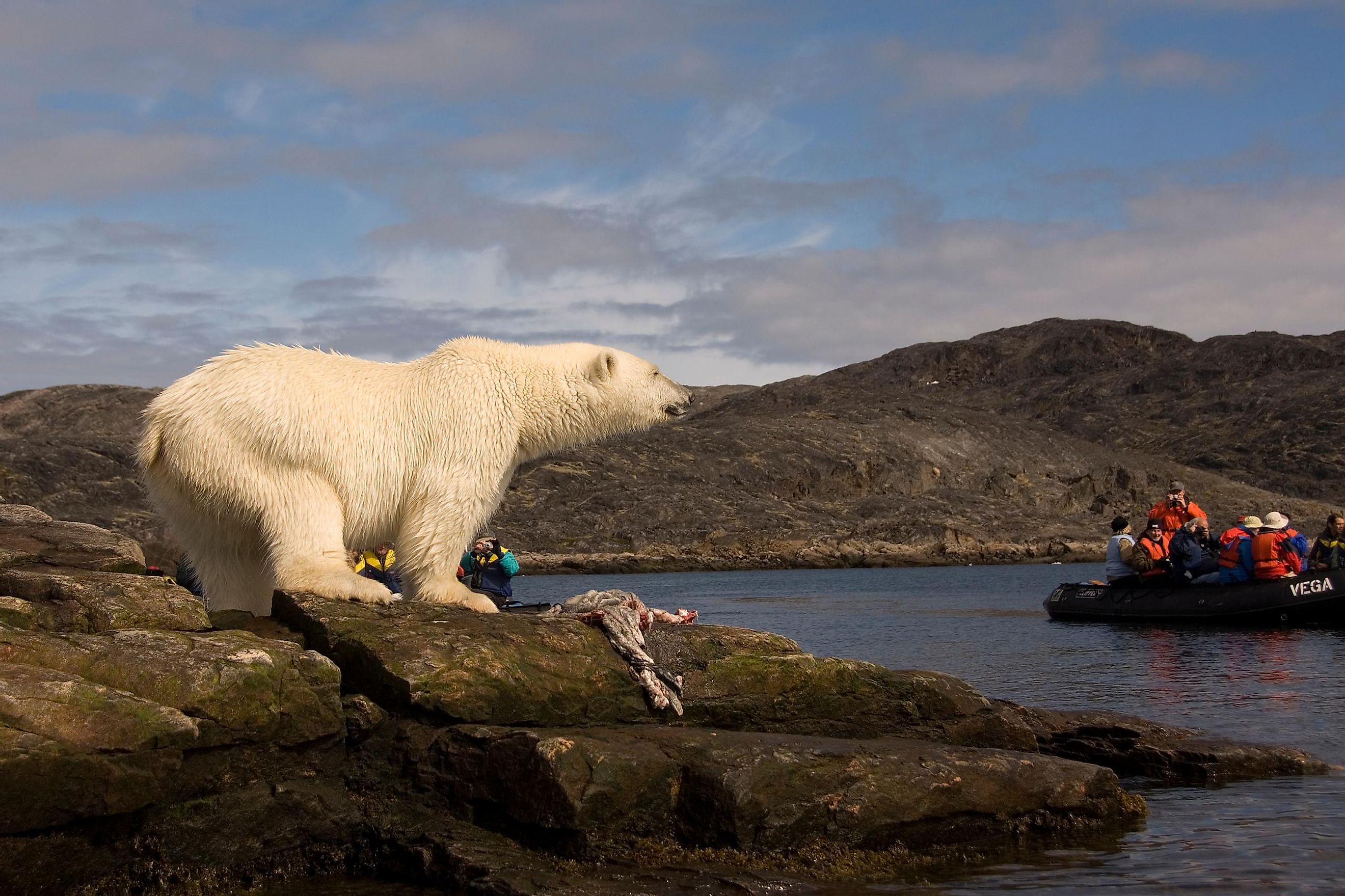
Flora and Fauna

Coastal vegetation common on the Canadian and Greenland coast includes tamarack, black spruce, white spruce, aspen, dwarf birch, cottongrass, willow, moss, lichens and the Labrador tea. The sea is also home to several animal species, including seals that breed in drift ice covering Labrador’s western and northern parts during winter. Common fish species include shrimps, Atlantic salmon, Atlantic herring, flatfish, haddock, lobster, and pelagic fish. The whale species found in Labrador include minke, Sei, and bottlenose whales.


