Geography Of The World
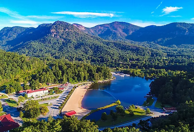
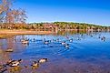
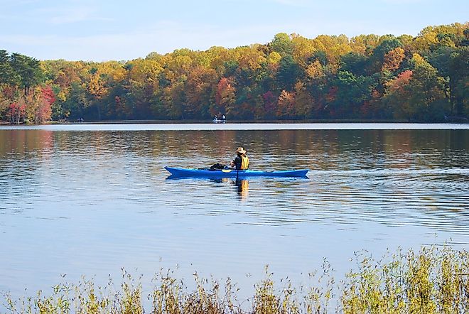
9 Most Beautiful Lakes In North Carolina
From bustling Lake Norman to the more humble Greenfield Lake, North Carolina offers an array of ecosystems where visitors can fish, boat, and camp.
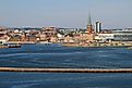
Firth of Clyde
The Firth of Clyde, an example of Scotland's firths, is situated along the country's western coast, stretching from the Irish Sea to the North Atlantic Ocean.
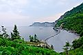
Gulf of Saint-Malo
Extending from the Bréhat archipelago to Normandy’s Cotentin Peninsula in the east, the Gulf of Saint-Malo has a maximum width of about 60 miles.
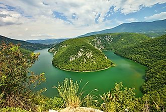
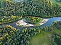
Drava River
The Drava River is a 440-mile-long river that flows in south-central Europe through Italy, Austria, Slovenia, and Croatia.
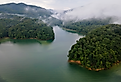
Gauja River
The Gauja River in Latvia is part of that economic tradition because of its utility for human settlements and the adjacent ecosystems that also rely on it.
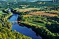
Dordogne River
Referred to as “La Dordogne” in French, the Dordogne River is a 300.2 miles-long river that flows in the south-central and southwestern parts of France.
10 Most Beautiful Lakes In Alabama
These artificial waterways provide drinking water, flood mitigation, and lovely places to splash around or just unwind alongside other carefree visitors.
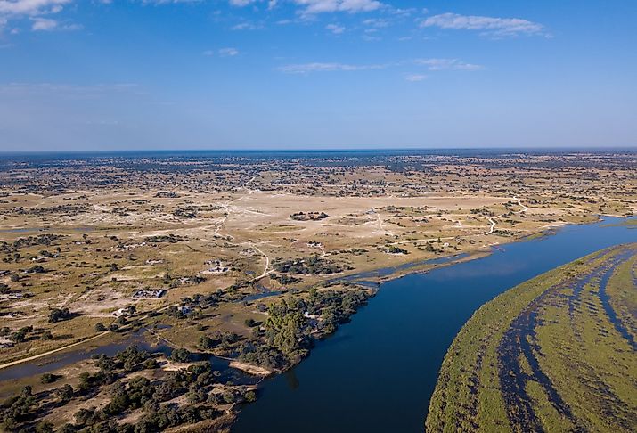
Cubango River
This Cubango River flows through Namibia, Botswana, and Angola. It is one of Africa's longest rivers–the fourth longest in southern Africa
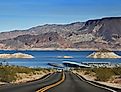
11 Most Beautiful Lakes In Arkansas
With crystal-clear blue waters and several miles of shoreline, these waterbodies offer ample recreational opportunities.
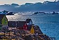
Baffin Bay
Baffin Bay is an arm of the North Atlantic Ocean and one of the most substantial bodies of water in the Arctic, largely covered by ice for much of the year.

Douro River
The Douro River is the third-longest river in the Iberian Peninsula, with a length of 475 miles. It spans the Sierra de Urbión, flowing across Northern Spain.
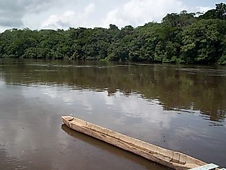
Corantijn River
The Corantijn River meanders through northern South America, covering a length of 450 miles, and spanning the countries of Suriname and Guyana.
9 Most Beautiful Lakes In New Jersey
The state's lakes offer visitors a variety of recreational activities which they can enjoy with their loved ones in serene natural surroundings.
Chari River
The Chari River is in Central Africa. It has a total length of more than 800 miles and spans three countries; Cameroon, Chad, and Central African Republic.
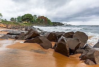
Cestos River
The Cestos River is one of the largest rivers in Liberia. River Cess Town is near where the river empties into the ocean.
10 Most Beautiful Lakes In Oklahoma
With more than 200 lakes formed due to the construction of dams, Oklahoma has the highest number of artificial lakes among all the US States.
Gulf of Ob
The Gulf of Ob, an expansive inlet of the Kara Sea, is situated in the Arctic region of Siberia, Russia. The Gulf is fed primarily by the Ob River.
Gulf of Sidra
The Gulf of Sidra has impacted history due to its unique climate, geography, and the various animal and plant species that populate the region.
10 Most Beautiful Lakes In Tennessee
Placed at the meeting point of three significant geographic regions, Tennessee is home to several long rivers and beautiful lakes.
Carmarthen Bay
Carmarthen Bay is a shallow bay that lies off the South Wales coast. It is a coastal inlet and forms part of the Pembrokeshire Coast National Park.

Gulf of St. Lawrence
The Gulf of St. Lawrence is bordered by the provinces of Quebec, Newfoundland and Labrador, New Brunswick, Prince Edward Island, and Nova Scotia.
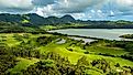
9 Most Beautiful Lakes In Hawaii
If you are ready for a break from the surfing scene, then branch out and explore the following most beautiful lakes in Hawaii.
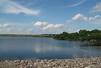
9 Most Beautiful Lakes In North Dakota
North Dakota, known for its picturesque landscapes and diverse ecosystems, is home to a myriad of beautiful lakes, ideal for fishing, boating, and swimming.
Cavalla River
The Cavalla River flows 320 miles across western Africa through the nations of Guinea, Cote d'Ivoire (Ivory Coast), and Liberia.
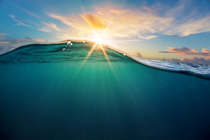
Ocean Heat and Nutrient Transport
A significant amount of sunlight reaching the Earth’s surface is stored in our oceans, while heat from the atmosphere is also absorbed by the oceans
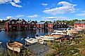
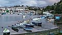
Clyde River
The Clyde River, or River Clyde, is a massive body of water that flows in the Firth of Clyde in Scotland. This stunning river is important.
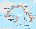
World's Major Bodies Of Water
Important and/or Significant Bodies of Water - Including bays, canals, channels, falls, gulfs, lakes, oceans, rivers, seas and straits
Yellow River (Huang He)
The Yellow River sources from the Bayan Har Mountains adjacent to the eastern edge of Qinghai’s Yushu Tibetan Autonomous Prefecture and drains into the Bohai Sea.
Sea Of Japan (East Sea)
Covering an area of 978,000 km2, the Sea of Japan, also known as the East Sea, is a marginal sea of the western Pacific Ocean.
Bothnian Sea
The Bothnian Sea, known in Finland as Selkämeri and in Sweden as Bottenhavet, is a sub-basin of the Baltic Sea and a sea in the Gulf of Bothnia.
Big Black River
The Big Black River is an American river in Mississippi and a tributary of the Mississippi River that stretches for 330 miles.
Caernarfon Bay
The geography, history, flora & fauna, recreation, and economy of the Caernarfon Bay significantly impact the lives of those who live nearby.

Andaman Sea
Countless millions of people live and depend on the Andaman Sea, and with proper conservation efforts, the area's future will continue to be prosperous.