Truckee River
The Truckee River (Upper and Lower) flows for about 232 km through the US States of California and Nevada. The Truckee River has been crucial to human settlement along its banks. Along with providing drinking water, it irrigates agricultural lands as well as generates hydroelectricity. The slower-moving sections of the Truckee River have become popular spots for recreational boating, rafting, and other water sports. Other sections have fast-moving whitewater rapids, popular with adventure sports fans.
Course Of The Truckee River

The Truckee River's headwaters begin in the highest peaks of the Sierra Nevada mountains in California. Fed largely by snow melt followed by rainfall in early spring, the Upper Truckee River begins on the western slope of Red Lake Peak, flowing for about 37 km into Lake Tahoe. The Lower Truckee River (often simply called the Truckee River) emerges on the western edge of Lake Tahoe. From Tahoe City, as it flows northwest for about 16 km, the river is slow moving and can be navigated by boat, kayak, or river raft, and it is safe for family boating.
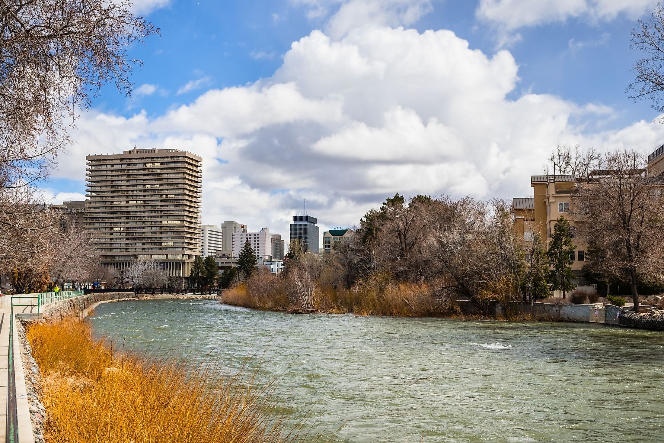
Sluice gates at Tahoe City, beneath the Fanny Bridge, control the flow in this area. The Lower Truckee continues its flow downhill to the Truckee River Canyon, picking up speed to Class II and III rapids which can be run throughout the summer months. It crosses into Nevada, reaching the Reno metropolitan area, and then flows through the high desert region. The river flows from east to west through an area called Truckee Meadows in western Nevada. The Truckee River ends its run northeast of Reno, where it flows into Pyramid Lake.
Climate Along The Truckee River

The alpine region around Lake Tahoe experiences a dry-summer continental climate, as per the Köppen Climate Classification. Summers are warm and dry, and winters are chilly, with significant snowfall. Due to high elevations, temperatures can swing wildly from day to night. In summer, the average high is about 26°C, with an average low of only 4°C.
In the winter, average temperatures range from highs of 4°C to lows of -8°C. The water temperature of Lake Tahoe ranges from 4°C in the winter months to over 21°C in the summer. Average annual precipitation is about 760 mm, with an average of just under 550 cm of snow in the mountains. In the Reno area, in a highland desert valley, the temperatures are higher, up to an average high of 34 °C in the summer, down to a daily low of 13°C. In the winter, highs average 8 °C to lows of -5 °C. It is also considerably drier, with an average annual rainfall of just over 190 mm.
Ecology Of Truckee River

The Truckee River's headwaters are located on high slopes covered by alpine forests. The Truckee River is fed by melting snowfall in the Sierra Mountains, and during years of heavy snow, flooding has followed. Early spring rains are also common in the area, fluctuating between flooding and drought conditions. Because the river flows downhill quickly in many sections, it causes a high level of runoff which historically has eroded the soil and clogged streams. In extreme conditions, it can kill off many fish stocks in the river. From the Lake Tahoe area into Nevada, the river runs through forests that are home to black bears, mule deer, and mountain lions, among others. Trout, including brown, rainbow, and cutthroat trout, are common in the river, along with mountain whitefish and largemouth bass in the lower river. Flyfishing is popular along sections of the river near Reno.

The Truckee River is an endorheic drainage basin – one that is self-contained and does not flow out into the ocean or a large body of water but instead converges into a lake or seeps away into the soil. The Donner, Prosser, Boca, Stampede, and Independence reservoirs have been constructed along the river and its tributaries from Lake Tahoe to the Derby Dam in order to stabilize the water flow. The Derby Dam captures the river's flow, releasing most of its into Pyramid Lake and diverting the rest through the Truckee Canal to Lahontan Reservoir. Into the 21st century, a combination of drought and suppressed natural wildfires have created an environment where tree growth is dense and dry, unusually susceptible to unnatural and high-intensity fires throughout the forested areas of the Truckee's headwaters.
Brief History Of Truckee River

The Washoe lived in the area of Lake Tahoe and its surroundings about 2,000 years ago, according to archaeological evidence drawn by abundant fishing in the lake and river. The name Lake Tahoe is thought to come from the Washoe name da ow ga, which translates simply as "the lake." The silver strike of 1859 at Lake Tahoe resulted in an enormous influx of European and American settlers eager to mine. Between 1848 and 1863, the Washoe were effectively driven from their territory by encroaching mining settlements.
Archaeological evidence of prehistoric human occupation in Truckee Meadows in Nevada dates back about 12,000 years. Truckee Meadows was once a meadow and wetland but was developed in the late 19th century for agriculture and later as part of the Reno metropolitan area. As the silver and gold boom slowed in Nevada during the late 1800s, farming and ranching began to take hold in earnest. Carson Valley, just east of Lake Tahoe, offered fertile land but lacked a stable water supply. The construction of the Derby Dam began in 1902, followed by the Truckee Canal, which links the Truckee and Carson Rivers. Over the decades, residential development has taken over from agriculture in the region, particularly in the area around Reno.


