The 10 Flattest Countries In The World
People love this planet. Every nook and cranny has been measured to the Nth degree through sonar, satellites, and even pulsing lasers. Nearly 2,200 years ago, old Eratosthenes had the drive to use gigantic poles, sundials, and footsteps to figure out the Earth's circumference. That same curiosity lives inside each of us, as we pore over geographical articles about the highest mountains and the deepest oceans. There is another extreme; it is commonly stated that straight lines do not exist in nature, which in topographical terms would equate to a country shaved flat. The countries on this list inch frighteningly close to that impossibility. Considering that the tallest building, the Burj Khalifa, is twice as tall as the elevation variance of these countries, it is safe to say it doesn't get smoother than this. Here are the 10 flattest countries based on the difference in elevation between their highest and lowest points:
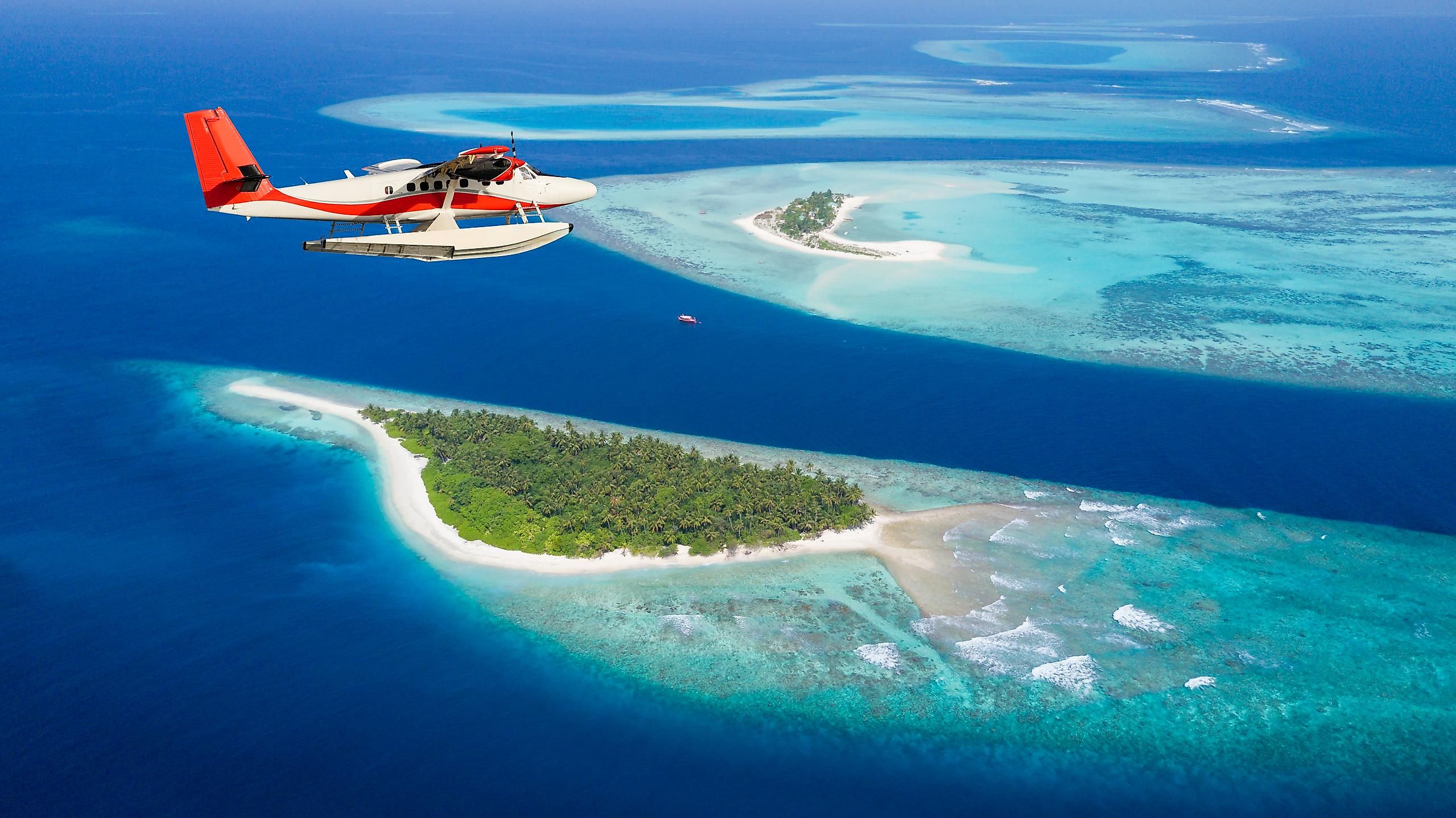
1. Maldives (5m to 0m = 5m)

The Maldives ranks as the flattest country in the world, with an elevation difference of only 5 m between its highest and lowest points. This extremely popular tropical vacation destination is an archipelagic state in the Indian Ocean and among the world's most climate-change-vulnerable nations. With sea levels rising due to global warming, many islands in the Maldives are threatened with going underwater in the coming decades. With little high ground to seek shelter, the inhabitants of these islands remain highly prone to natural disasters like tidal floods and cyclones.
1. Tuvalu (5m to 0m = 5m)

The Polynesian island country of Tuvalu is comprised of three reef islands and six atolls dotting the Pacific Ocean in Polynesia between Hawaii and Australia. This speck of a nation has an area of only 26 sq. km with a difference of only 5 m between its highest point at 5 m above sea level and lowest at sea level, making it the tie with the Maldives to become the world's flattest country. Like the Maldives, Tuvalu is also on the frontline of global warming. Two of its islands are nearly under the sea, while the island of Fongfale, which houses most of Tuvalu's population, is also losing land to rising sea levels.
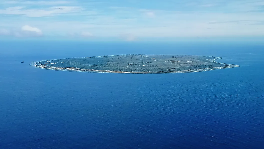
3. Marshall Islands (10m to 0m = 10m)

This island country in the Pacific Ocean in Micronesia ranks third on this list, with a difference of only 10 m between its highest and lowest points. The Marshall Islands is made up of 5 islands and 29 coral atolls scattered across the ocean northeast of Australia. According to the US Geological Survey, some of this nation's islands will go under the sea by 2035. Worse still, many islands will be left without suitable drinking water due to saltwater contamination of the aquifers forcing the inhabitants to leave their homes in search of more livable destinations.
4. Vatican City (75m to 33m = 42m)

An enclave nestled within Rome, Vatican City, takes up a jaw-dropping tiny area of 0.49 sq. km while housing a population of less than 500. In 1929, Vatican City gained independence from Italy through the Lateran Treaty as a resolution to concerns over state interference and land control. The treaty also limited the church's ability to influence political decisions within Italy. St. Peter's Basilica is a natural highpoint on Vatican Hill, at 75 m above sea level, a mere 42 m variation from the lowest point at 33 m. The Pope makes his residence here, which might bring the average elevation closer to the heavens.
5. The Gambia (53m to 0m = 53m)

The smallest country in mainland Africa, the Gambia, is the continent's flattest one as well. Spread on both sides of the Gambia River's lower reaches as it drains into the Atlantic, this small and narrow country is surrounded on three sides by Senegal. The Gambia has sea level as its lowest elevation and the Red Rock at 53 m above sea level as the highest point.
6. The Bahamas (63m to 0m = 63m)

Another chain of islands located just east of Florida, The Bahamas is a commonwealth known for luxurious resorts and a devastating hurricane season. Having a high point of only 63 m is partly to blame for that, and many have speculated that the low elevation will one day allow it to disappear entirely. The Grand Bahama town of Freeport is where tourists gather after cashing out on vacation days; in this region, stumbling across a serene cerulean beachside is the busiest an afternoon can get. Tourism has waned in the Bahamas after endless waves of hurricanes, but efforts to rebuild are relentless.
7. Nauru (71m to 0m = 71m)
The world's smallest island country, Nauru, located in the Central Pacific Ocean, is the 7th flattest country. Its highest point is at 71 m above sea level, and the lowest is sea level. Nauru, like most other island nations with flat topography, is highly susceptible to climate change. Also, the coral reefs that have protected this island nation for so long are on the verge of dying due to high rates of coral bleaching, a result of rising sea temperatures.
8. Republic of Kiribati (81m to 0m = 81m)

With whimsical town names such as "Banana," London," and "Poland," the Republic of Kiribati is a quirky place located near-to-nowhere. With over 3 thousand miles between it and the nearest visible continent, the Pacific island country of Kiribati is a premier destination for people trying to disappear. One of the islands, Banaba, has a high point of 81 m which comes close to scraping the bottom of the barrel. Despite the distance between member islands, the republic hosts over 100 thousand citizens, many of which live on Tarawa atoll. Kiribati is also one of the most threatened countries of the world at risk of disappearing due to sea level rise in the coming decades.
9. Qatar (103m to 0m = 103m)

Desert and more desert; the arid lands of Qatar earned the ninth spot on this list through sweat and hard work. While much of the region being a sand-covered low barrel plain, a hill with an elevation of 103 m pokes out in the southeast called "Qurayn Abu al Bawl, making it the highest point in Qatar." The lowest point of this Middle Eastern nation is at sea level on the shores of the Persian Gulf.
10. Bahrain (122m to 0m = 122m)

Qatar's neighbor, the Kingdom of Bahrain, a small archipelagic country in the Persian Gulf, ranks 10th on this list. Bahrain is made of 50 natural and 33 artificial islands with mostly flat and arid terrain. The Jabal Ad Dukhan (or the 'Mountain of Smoke') is the country's highest point at 122 m, while the lowest point is at sea level.
People who are sick of walking up hills can rejoice because this list demonstrates that there are at least ten paradises designed specifically for them. While the marshes and forests of the Gambia appear less appealing than the tropical islands of the Bahamas, it is worth remembering the last time a hurricane sunk mainland Africa, never. Meanwhile, the arid flatlands of Qatar appear to be begging for a drop of rain. Regardless, each country on this list is beloved by its citizens, proving that Earth really is our home through thick and thin.