The National Forests Hiding Waterfalls
Congress allowed the creation of a national forest for three reasons in 1897, and scenery was not among them. The law named improving and protecting the woods, furnishing a continuous supply of timber, and securing favorable conditions of water flows. That third purpose handed federal foresters whole watersheds, and a waterfall is the loudest thing on a watershed. Ten of the country's better ones, Kootenai Falls and Whitewater Falls among them, stand on public timberland for exactly that reason. The agency was assigned the water. The view came with it.
Gifford Pinchot National Forest, Washington

Trail 152A climbs beside Falls Creek for about a mile and a half through what the agency describes as a 30- to 60-year-old forest. That figure says more than it looks. Anyone walking to one of southern Washington's better waterfalls crosses a forest younger than many of the people crossing it. Partway along, a cable suspension bridge spans a rock gorge above the white water. The restrictions on that bridge indicate the trail's purpose. No stock is allowed across it, and the route is closed to motorized use entirely.
Another seven tenths of a mile of climbing reaches the base of the drop, and the path simply stops there. A creek crossing comes before that point, and flows early in the season make it hard going. The season runs April 1 to December 1, and the trailhead off Wind River Road carries a day-use fee.
Willamette National Forest, Oregon

Salt Creek drops 286 feet into a canyon in the Middle Fork Ranger District. Agency literature ranks that single plunge second in Oregon among falls of its kind. The observation platform stands 50 yards from the parking lot, with railings set for wheelchair sight-lines. A steep path descends from there to the base by way of many stairs. The site closes for winter, when visitors leave their cars at the Salt Creek Sno-Park and walk 0.4 miles up the road.
The drop is not the most telling thing on this ranger district. Five miles east of Oakridge, Salmon Creek once supplied the town's water. Agency records note that remains of the old wooden, wire-wrapped pipes can still be seen. One district carries both the waterfall and the plumbing, which summarizes the job neatly.
Umpqua National Forest, Oregon

The North Umpqua River cuts a narrow gorge through basalt at Toketee and falls twice, 40 feet and then 80 feet down a sheer wall. A 0.4-mile trail reaches a viewing platform above the slot. The route leaves Highway 138 at milepost 58.6 onto Forest Road 34. Water arriving at the lip is managed water. Toketee Lake upstream is a reservoir held by a dam, and the Wild and Scenic North Umpqua pauses there before dropping into the canyon.
A congressionally designated wild river, a working reservoir, and a two-tier waterfall all sit within a few miles of one another on this one forest. Watson Falls stands south of the highway on Fish Creek Road, and agency literature calls it the tallest in southwest Oregon. Neither drop explains why the Umpqua was set aside. Both arrived with the drainage.
Shasta-Trinity National Forest, California

In California, Champion International Corporation owned the upper McCloud River until the spring of 1989 and managed it for timber. The government traded for it. In that exchange the agency gained 2,626 acres, 13 miles of river, and two waterfalls. The 50-acre Bigelow Meadow came with them, and scattered parcels went the other way. Federal records describe the corridor as a long-standing acquisition priority for its recreation and scenery.
The McCloud is therefore the exception here, a waterfall bought on purpose rather than one that came with a watershed. Three drops now line the same reach. Middle Falls runs over 50 feet high and 100 feet across, an easy 1.3 miles upstream of the 15-foot Lower Falls. The Winnemem Wintu name for the lower drop is Nurunwitipom, falls where the salmon turn back. Ownership still alternates between public and private along the river, and bank access below the reservoir thins out to almost nothing.
Kootenai National Forest, Montana

Water gathers speed through China Rapids and then loses 90 feet in less than a mile, with a 30-foot main drop at the center of Kootenai Falls, in northwestern Montana. Most people watch it from a swinging bridge, and that bridge had a job before it had an audience. The Civilian Conservation Corps built the first one in 1937 to move firefighters across the Kootenai River. Flooding destroyed it in 1948. Concrete towers carried its replacement through the 1950s, the crossing was rehabilitated again in 1993, and a safety inspection in 2015 sent it back for a full rebuild finished in 2019.
Reaching it takes roughly half a mile on foot, including an overpass above the railroad tracks and a three-tier metal staircase of 64 steps. Agency guidance asks visitors to treat the ground as sacred to the Kootenai Tribe of Idaho and the Confederated Salish and Kootenai Tribes. The rock below is quartzite and limestone of the Belt Supergroup, roughly 1.5 billion years old. Slight folds in those layers produce the stair-step shape, and fossil algal mounds called stromatolites survive near the bridge.
Uinta-Wasatch-Cache National Forest, Utah

Nine million visits a year land on this Utah forest, which the agency counts among the heaviest use anywhere in the system. Stewart Falls shows what that arithmetic does to a trail. The route, catalogued as Stewarts Cascade, runs just over 4 miles round trip from the Mount Timpanogos trailhead. Access is by the Alpine Loop, and federal material warns plainly about the volume of use the path receives.
The path enters the Mount Timpanogos Wilderness, a designated area inside the national forest rather than a separate holding, so groups are held under 15 people. The walk finishes at the water. Informal paths climbing around the falls are steep and dangerous. Parking requires a recreation pass. No measured height for this drop appears in the agency record.
Ozark-St. Francis National Forest, Arkansas

The Ozark mountains are not mountains. Agency geology describes them as plateaus, lifted as a unit with few folds or faults, and credits their ruggedness to swift rivers eroding down through them. Richland Creek is one of those rivers. Its waterfalls exist because the cutting never stopped. Rock bluffs above 100 feet run for over a mile along each side of the creek.
The Richland Creek Wilderness covers 11,801 acres in the Boston Mountains under the 1984 Arkansas Wilderness Act. The wilderness holds no developed trails at all, and a network of old logging roads crosses it instead. Second and third growth oak and hickory cover most of the ground, with shortleaf pine standing in old fields the government bought in the 1930s and 1940s. Two separate Forest Service projects address the gravel route up Falling Water Creek, one stabilizing a landslide and one moving the roadbed out of the stream.
Cherokee National Forest, Tennessee

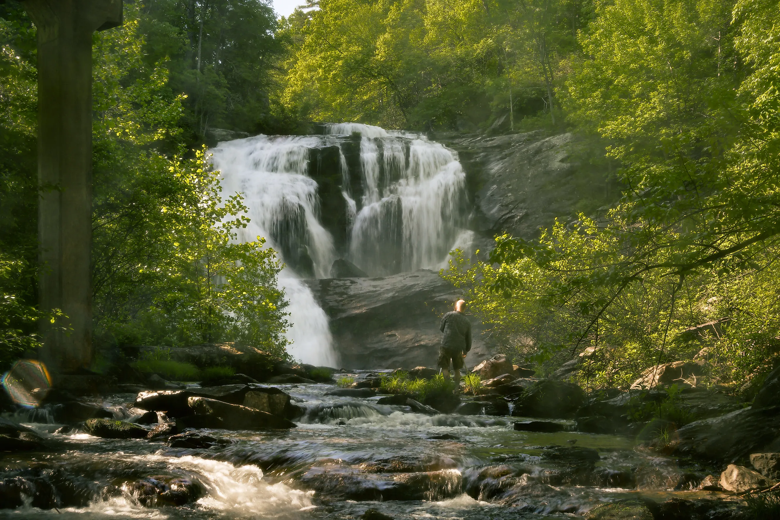
Bald River pours 90 feet just upstream of a road bridge, in full view of anyone who drives across. Bald River Falls is 6 miles up Forest Road 210 from the ranger station outside Tellico Plains, Tennessee, and current agency listings show it open with high visitation. Parking is limited and weekends are the worst of it, so the recommendation runs toward weekdays.
Trail 88 follows the river upstream into the gorge for about 5.6 miles from the same lot. The bridge itself explains how federal managers think about a site like this one. When the replacement was approved, the design put a sidewalk on the downstream side and a combined sidewalk and viewing platform on the upstream side, facing the water. A piece of road infrastructure was rebuilt as an overlook.
Nantahala National Forest, North Carolina

Whitewater Falls exists because of the Blue Ridge Escarpment, a sharp step down from the mountains to the Piedmont. Published figures put the North Carolina plunge at 411 feet. Agency material ranks it the highest drop east of the Rockies, with a second fall of another 400 feet across the South Carolina line. Much of the escarpment stays lightly visited, on account of the rugged country around it. The overlook is another matter, since volume peaks around midday and on holidays, and morning or evening is the published suggestion.
A steep mile of trail drops to a river bridge and continues toward the Foothills Trail, with a long flight of wooden steps on the return. Congress created this forest in 1920 under a 1911 statute written to acquire land for watershed protection, timber, and the regulation of navigable streams. Nantahala is a Cherokee word for land of the noon day sun.
George Washington and Jefferson National Forest, Virginia

Two waterfalls in the southern Appalachians answer to the name Crabtree, and only one remains federal timberland. The Virginia falls lie off State Route 56, past the community of Vesuvius. A moderate 2.7-mile trail passes five major cascades dropping 1,200 feet in total, with overlooks along the way. Potable water is not available, a fee covers the day-use area, and the lower section of trail is wheelchair accessible in dry conditions.
Crabtree Falls in North Carolina is a different place on Blue Ridge Parkway land. Park Service records show that Parkway planners called for acquiring 1,000 acres at Crabtree Creek from the Forest Service in the 1936 master plan. Their description of the site named a grassy meadow with a good water supply in rugged country. One department kept its Crabtree Falls. The 1936 Parkway plan marked the other for transfer.
What The Water Was For
None of these ten was protected because somebody thought it beautiful. The 1897 law made water flow a legal reason to create a forest. A 1911 statute extended the idea to buying land outright. The waterfalls came inside the drainages that qualified. What got built afterward is the tell: a firefighting bridge, a road overlook, a wheelchair railing. Each went up because the water was already public, and people turned out to want a look.