Kootenay River
The Kootenay River is a 781km long river that flows in the Pacific Northwest region in the western part of North America. The river is referred to as “Kootenay” by the members of the Ktunaxa Nation in Canada and as “Kootenai” by the members of Idaho’s Kootenai Tribe and the Confederated Salish and Kootenai Tribes in the United States. The Kootenay River is mainly fed by snowmelt and glaciers and forms one of the significant uppermost tributaries of the large Columbia River. The Kootenay River drainage basin extends into the Canadian Province of British Columbia and the US States of Montana and Idaho, covering an area of 50,298 sq. km.
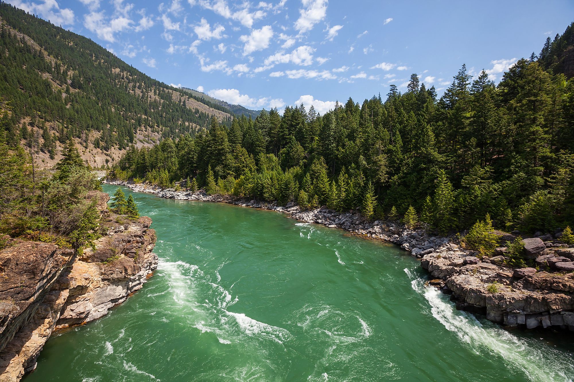
Course Of Kootenay River

The Kootenay River originates from its source on the northeastern side of the Beaverfoot Range in the Canadian Rocky Mountains, located in the southeastern part of British Columbia. The river initially flows in the southeast direction through a swampy valley in the Kootenay National Park. Close to the Kootenay Crossing, the Kootenay River becomes significantly larger after merging with the Vermilion River. The river then continues in the southeast direction, where it receives the Palliser River and flows into a gorge where the White River joins it.

The Kootenay River then flows within 2km of Columbia Lake at the small town of Canal Flats. Close to the eastern foothills of the Selkirk Mountains, the Kootenay River merges into the Rocky Mountain Trench. The Kootenay River receives a number of its tributaries in this region, including the Lussier River, St. Mary River, Wild Horse River, and Bull River. It then widens into Lake Koocanusa reservoir that has been formed by the construction of the Libby Dam on the Kootenay/Kootenai River. Within the Canadian territory, the 220km long Elk River, which is the largest tributary of the Kootenay River, joins it at the northern portion of Lake Koocanusa.

Lake Koocanusa extends about 130km southwards and is joined by the Fisher River after crossing the US-Canada international boundary. The river then turns westwards, forming the “Big Bend” as it flows towards the city of Libby in the northwestern part of the US State of Montana. Just below Libby, the Kootenai River drops about 15km over the Kootenai Falls, which is considered one of the country’s largest waterfalls by flow rate. The river then turns in the northwest direction at the city of Troy, where the Yaak River joins it. The Kootenai River then continues its journey in the northern part of the US State of Idaho, where it is joined by the Moyie River close to the city of Moyie Springs.

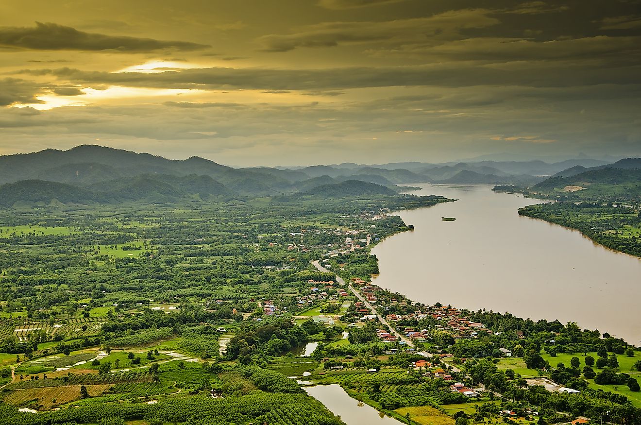
After passing through the Kootenai Valley and past the city of Bonners Ferry, the Kootenai River exits Idaho and re-enters Canada at the south of the town of Creston in the Canadian Province of British Columbia. The Kootenay River then flows through a swampy area called Kootenay Flats before broadening out into the 100km long Kootenay Lake. Here, the Kootenay River is joined by its highest volume tributary - the 206km long Duncan River. The Kootenay River drops in elevation from 2,261m at the headwaters to 420m at the confluence of Kootenay Lake. The river exits via the western arm of the lake just below the Corra Linn Dam. The Kootenay River flows through a deep canyon forming many waterfalls in its final stretch. It then creates a small inland delta and eventually merges with the Columbia River close to the city of Castlegar. The Kootenay River has an average annual discharge of 782 cubic meters per second at its mouth.
The Watershed Of Kootenay River
The Kootenay River drains an area of 50,298 sq. km and is considered one of the largest sub-basins of the Columbia River drainage basin. The Kootenay River Basin covers parts of southeastern British Columbia, northwestern Montana, and northern Idaho. The Basin measures approximately 400km from north to south and 250km from east to west, roughly defining the Kootenay region in the Canadian province of British Columbia. About 70% of the river’s watershed area is located within Canada, whereas around 23% is in Montana, and only 6% is in Idaho. A significant part of the river basin’s eastern boundary is formed by the Continental Divide, the western boundary by the Selkirk Mountains, and the southern boundary by the Cabinet Range. It has been recorded that approximately two-thirds of the 781km long river and three-quarters of its watershed area is located in the Canadian Province of British Columbia, whereas about 210km of the river is located in the United States. Similar to the Milk River, Souris River, and Kettle River, the Kootenay River is also North America’s one of the few significant rivers that starts its journey in one country, continues into another country, and returns to the country from where it had originated.
Ecology And Recreation In Kootenay River

The Northwest Power and Conservation Council have divided the Kootenay River watershed into six biomes. These biomes include aquatic, wetlands, moderately wet forests, riparian zones, grasslands, and dry forests. The alpine reaches of the watershed are dominated by the forested zones, while grasslands dominate the lower regions. Due to several rapids, the Kootenay River is considered an excellent river for whitewater rafting.
Several protected areas lie partially or entirely within the Kootenay River watershed. The Canadian portion of the watershed includes the Kootenai Falls County Park, the Bugaboo Provincial Park, Kokanee Glacier Provincial Park, Kootenay National Park, Creston Valley Wildlife Management Area, etc. About 447 species of terrestrial vertebrates have been reported from the Canadian portion of the Kootenay River watershed. Some of these notable species include caribou, elk, deer, moose, and wolves. The protected areas located in the US portion of the Kootenay River watershed include the Kaniksu National Forest, Kootenai National Forest, etc. These protected areas offer many recreational activities for visitors, including hiking, cross-country skiing, snowshoeing, camping, and boating. The mid stretches of the Kootenay River and the Kootenay Lake serve as perfect places for fishing. Some of the significant fishes found in the Kootenay River include kokanee salmon, white sturgeon, Westslope cutthroat trout, rainbow trout, bull trout, and many other fish species. While canoeing in the numerous sloughs and distributaries of the Kootenay River that passes through the Kootenay Flats, one can also get a chance to view several birds and other animal species in the surrounding marshy areas.
Brief History Of Kootenay River

It is believed that before the arrival of the Europeans, the Kootenay River valley was inhabited by the native Ktunaxa people. However, the origin and meaning of the name “Kootenai” are quite uncertain. In the early 19th century, the fur trappers of the Hudson’s Bay Company were the first to call these indigenous people “Kootenai,” which meant “water people” in the native Algonquian language. In 1807, the British-Canadian fur trader David Thompson explored the Kootenay River and established many trading posts throughout the region. In 1858, the explorer John Palliser reached the headwaters of the Palliser River, which is a tributary of the Kootenay River. Palliser conducted a series of expeditions in the area that later became officially known as the “British North American Exploring Expedition.”
In the East Kootenay region, a gold strike at the meeting point of the Kootenay and the Wild Horse rivers led to the Wild Horse Gold Rush that drew numerous miners and settlers to the region. A gold rush town named Fisherville was established, and the successive settlements were officially known as “Wild Horse” and “Kootenai.” To facilitate the movement of many prospectors and merchants, Galbraith’s Ferry was created, which was later rechristened as Fort Steele. In due course, gold rushes in the other tributaries of the Kootenay River and the discovery of silver and galena mines in the Kootenay Lake and Slocan River Valley areas led to their rapid settlement and creation of many silver cities. This was soon followed by the Canadian Pacific Railway and the plying of steamboats in the Columbia and Kootenay rivers that helped transport trade items throughout the region. The Doukhobors - who were members of a Russian religious sect, settled in the “Brilliant” colony at the mouth of the Kootenay River. The Doukhobors soon dispersed into several settlements and helped establish many timber and agricultural industries in the region. To protect the area against floods and droughts and to generate hydroelectricity, many dams were built on the Kootenay River in the 20th century.