The United States Towns In A Permanent Rain Shadow
Some United States towns have essentially become deserts due to mountain ranges block nearly all of the rainfall required for plants to grow.
This phenomenon, called a rain shadow, sees prevailing winds push up warm and moist air from a large body of water towards a mountain range. When it reaches the mountain slopes, it rises up, expanding and cooling as it goes along. During this process, the air mass drops most of the moisture as snow or rain. When the air crosses the mountain summit, water vapor is all but gone, and when it descends on the leeward side, the now-dry air compresses and warms up. This prevents clouds from forming, creating an arid climate.
Some of the most famous mountain ranges responsible for rain shadows include the Sierra Nevada, Cascade, Rocky, and Pacific Coast ranges.
Death Valley Junction, California, is considered to be the driest American community (also something of a ghost town) that falls within a rain shadow. It receives only up to two inches of rain every year, just a little bit less than the average of 2.2 inches that falls on Furnace Creek.
Death Valley Junction, California

With only two or three permanent residents, the ghost town of Death Valley Junction is a sweltering dot on the dust of the Mojave Desert. It sits in the shadow of the Sierra Nevada and Panamint mountain ranges, and does not receive more than two inches annually.
The lack of rain is due to the air being forced to rise over the mountains. As it does, it drops its moisture on only one side. By the time it gets to the basin, the moisture in the air is all but gone.
To the west of Death Valley Junction lies the Death Valley National Park, which also receives less than two inches of rain every year. The park is the driest and hottest national park in the country.
Furnace Creek, California

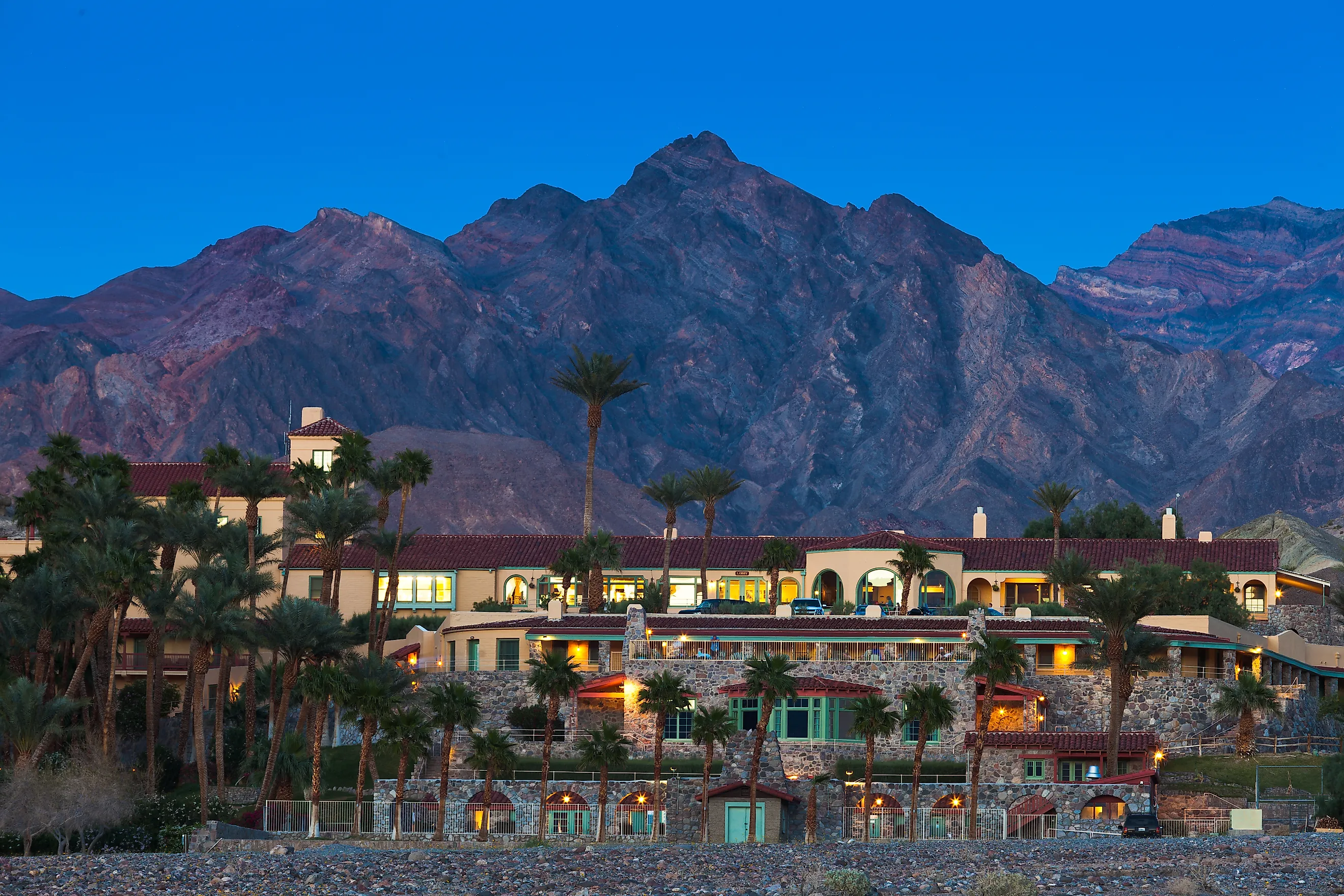
Furnace Creek also lies in Death Valley and holds the record for the highest air temperature of 134°F recorded in 1913. Today, temperatures still hover around the 90s°F (mid-30s°C) overnight, and the village's average rainfall is 2.2 inches.
Furnace Creek sits in the middle of Death Valley National Park and is home to the main visitor center for the park at 190 feet below sea level. Its rain shadow comes from the Transverse, Coast, Sierra Nevada, and Panamint Ranges. The air mass drops its water content before travelling down the eastern face.
Residents and park staff focus on heat management every day, with Furnace Creek getting its water from natural springs and aquifers. Air conditioning does most of the work to keep residents cool when the power supply is stable. As the mercury rises, staff start working earlier, especially when tasked with mowing and picking up dead trees. Constant hydration is a given, particularly for rangers who spend only 10 minutes per hour working in the heat, and cooling down indoors for the rest of the hour.
El Centro, California

The rain shadow cast by the Santa Rosa Mountains and the San Jacinto Mountains in the Colorado Desert means El Centro gets less than three inches of rain every year. More of a city than a town, El Centro does not benefit from the air masses that rise over the Southern California mountain ranges, receiving only the warm, dry air.
As such, it is one of the driest places in the entire country and gets more than 350 days of sunshine. It sits 50 feet below sea level, and the farmers in the area get their water from canals, which in turn get water from the Colorado River. There are exceptions to the precipitation pattern in El Centro, particularly when storms hit. In 2023, for instance, Hurricane Hilary dumped a lot of rain across the region.
Borrego Springs, California

The rain shadow of the Pinyon/San Ysidro Mountains and the Peninsular Ranges block the Pacific Ocean air from reaching Borrego Springs. The town is completely surrounded by the Anza-Borrego Desert State Park and sits up to 780 feet above sea level.
It receives around five inches of rainfall every year. Snow is extremely rare, with 6.5 inches falling in December 1967. Overall, the climate is exceptionally hot, with more than 176 days where the temperature reaches 90°F. Conversely, there is only about one day a year that the temperature drops to 32°F.
Lone Pine, California

The western peaks of the Sierra Nevada mountain range get the snow and rain that would have fallen on Lone Pine otherwise. Instead, the town, which is also flanked by the Inyo Mountains to the east, receives up to six inches of rain per year and an average of five inches of snowfall.
While summers are very hot, up to the upper 90s°F, the winters in Lone Pine can get very cold. In January, the temperatures drop into the 20s°F. The town is not only well-known for its dry climate, but also for Western films, with the desert and nearby Alabama Hills used as filming locations.
Bishop, California

The eastern Sierra Nevada mountains tower over Bishop just an hour from Lone Pine. As such, the town gets only up to six inches of rain every year, and it is sunny up to 335 days.
The high-desert ecosystem present in Bishop is created by the Sierra Nevada and the Inyo Mountains. When the limited rainfall does arrive, it is typically brought by winter storms or river events. The town also has a cold desert climate, which means the winters can get very cold with up to 6.8 inches of snow.
Fields, Oregon

The Pacific Northwest has its own arid rain shadow that affects several places, including the tiny town of Fields, Oregon. Steens Mountain and the Pueblo Mountains rise over Fields, essentially blocking its rainfall.
The town receives only up to seven inches of rainfall, making it one of the driest areas in the state. Sometimes, it gets very cold in Fields, with temperatures dropping to -20°F. The nearby Alvord Desert is drier than Fields, with some zones in the basin receiving less than four inches of precipitation. Fields gets cloudy a lot more than some other towns, however, with only up to 218 sunny days a year.
Winslow, Arizona

Winslow is just an hour from Flagstaff, but while it gets more than 20 inches of rain annually, Winslow gets less than a third of that. This small town falls under a severe rain shadow cast by the Mogollon Rim and the San Francisco Peaks.
Only compressed, dry, and warm air reaches the leeward side into the Little Colorado River Valley, so less than seven inches of rain falls every year, along with 8.1 inches of snow. Sometimes, Winslow experiences severe thunderstorms and even supercells.
Alamosa, Colorado

Colorado's Alamosa is encircled by the San Juan Mountains and the Sangre de Cristo Mountains as it sits in the center of the San Luis Valley along the Rio Grande River. The town essentially has a double-sided mountain barrier, giving it a unique cold desert climate.
The rainfall here is at an average of seven to eight inches every year. One storm that lasts three days can provide up to 20 percent of that total in one go. The wettest months are typically July, August, and September, with snow falls up to 27.6 inches per year.
Alamosa is famous for a record weather day experienced on July 10, 2020. The temperature increased from 37°F to 92°F in less than twelve hours.
Sunnyside, Washington

Sunnyside also sits in a valley, the Yakima Valley in this case. The town is to the east of the Cascade Mountain Range and does not receive more than eight inches of rain per year.
Winter sees the most moisture, around 40 percent, while July and August are the driest and hottest months. Winter also sees around ten inches of snowfall. The town features a semi-arid climate that includes dry and hot summers and sometimes very cold winters. Despite the heat and cold, Sunnyside has a thriving agricultural sector, growing tree fruits and vineyards.
The Power of Rain Shadows
These towns are powerless to stop the natural processes that force them to exist in nearly rainless conditions. Yet, the communities have made the best of the situation, so that their preferred homes still thrive, whether it be thanks to agriculture or tourism.