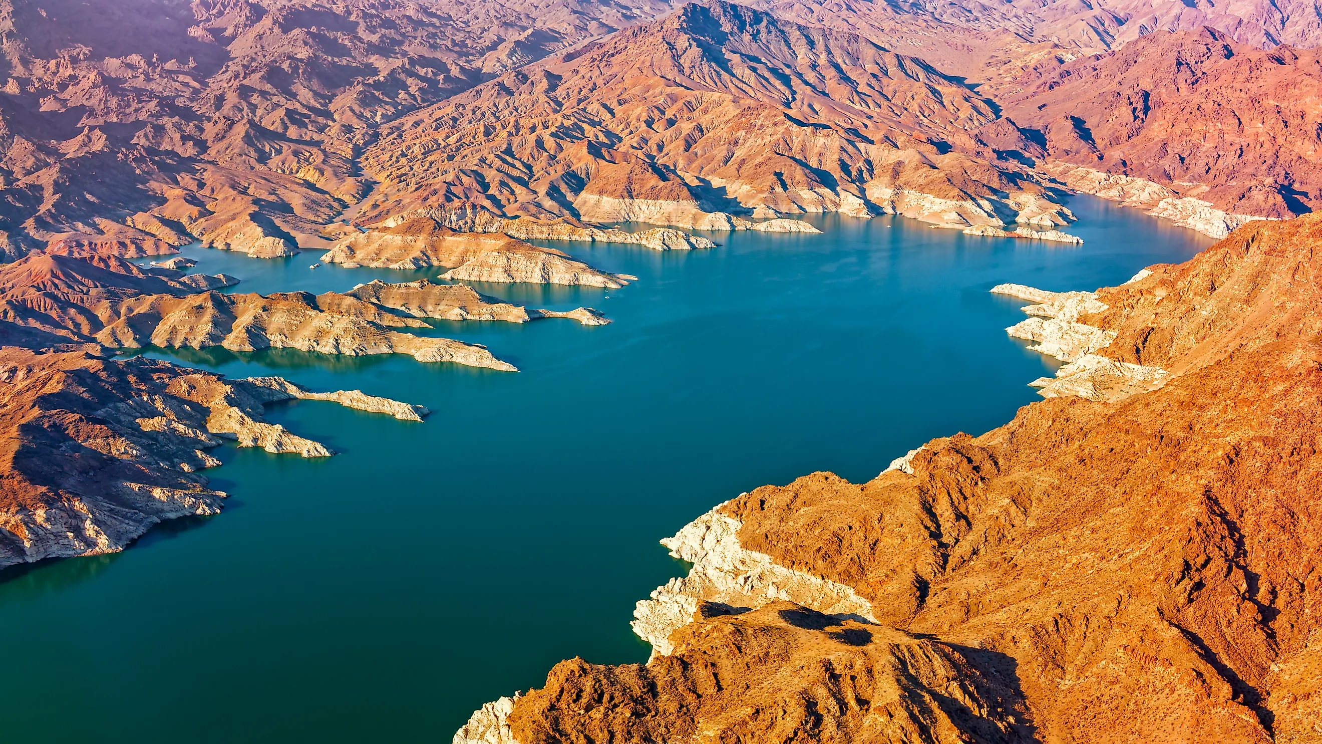
The Reservoirs Out West That May Never Refill
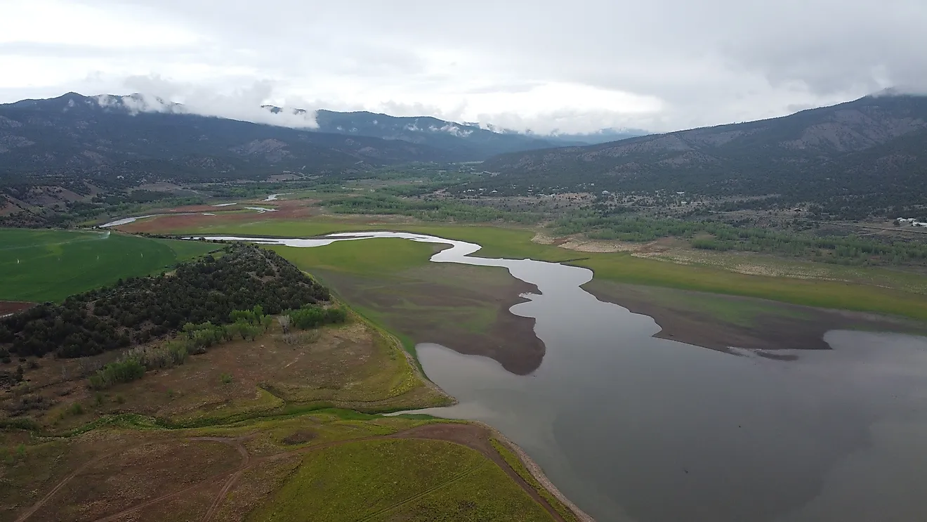
Lake Powell and Lake Mead, the two largest reservoirs in the country, sat near a quarter full through the summer of 2026. That is the famous version of a problem visible on smaller lakes all over the West, and the smaller ones are often in worse shape. Some have not reached full pool in decades. A few never have, not once since the dam was built. Drought is only part of the reason. Runoff is down, evaporation is high, sediment fills the storage behind the dam, and water use across these basins runs past what the inflow can supply. A run of freak storms can lift any of these lakes fast. Even so, the shoreline on an old map is no longer a reliable guide to where the water sits now.
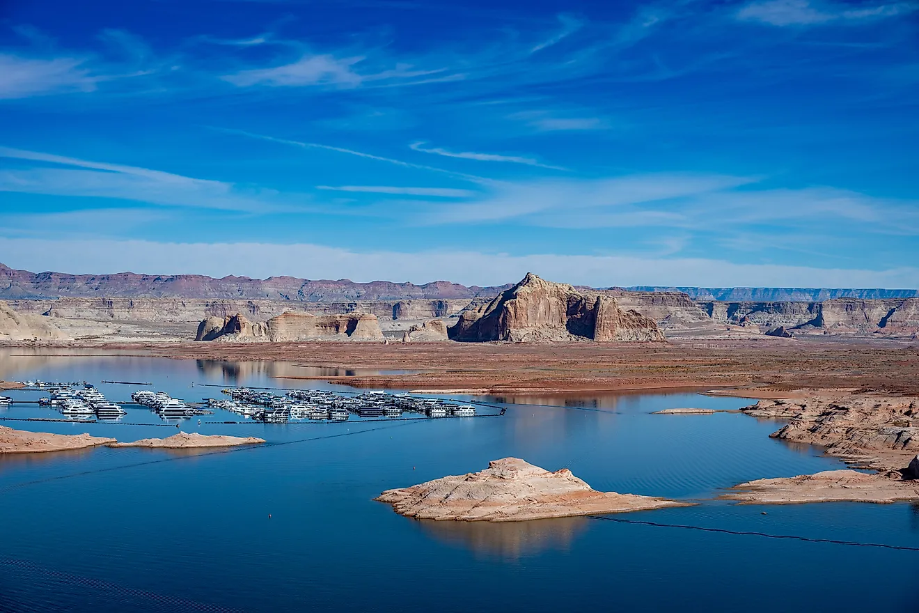
Lake Powell, Utah and Arizona

At Lake Powell, the numbers are now as striking as the exposed canyon walls. The Bureau of Reclamation reported about 5.4 million acre-feet in storage at the end of July 2026, roughly 23% of live capacity. July's unregulated inflow was only 9% of average, and storage kept dropping through August. Research published through the U.S. Geological Survey found that refilling Powell and Lake Mead without reducing Colorado River Basin consumption would take roughly four to five unusually wet years in succession.
Warmer temperatures make that run of wet years harder to count on. Heat increases evapotranspiration and dries soils before spring snowmelt arrives, so less mountain precipitation ultimately reaches the Colorado River. The same research estimated that basin water use may need to fall roughly 13% to 20% below recent levels simply to stabilize reservoir storage and allow a sustained recovery. Powell can gain millions of acre-feet after an excellent snow season, but returning all the way to its historic full-pool shoreline takes considerably more than one snowy winter.
Lake Mead, Nevada and Arizona

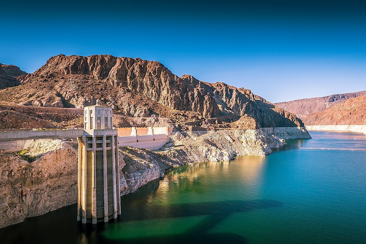
Engineers built Hoover Dam to hold a reservoir capable of storing more than 26 million acre-feet. In August 2026, Lake Mead contained only about 6.9 million acre-feet, with its surface near elevation 1,039 feet. The Bureau of Reclamation logged another record-low elevation that month. Around Black Canyon, the broad white mineral band above the water marks elevations that boaters once crossed without a second thought.
Reclamation's five-year projections offer little sign of an immediate return to those levels. Federal modeling put the probability of Mead remaining in some level of shortage at 93% in 2027, 97% in 2028, 90% in 2029, and 87% in 2030.
A snowy Upper Colorado Basin can still push Mead upward, especially when managers release more water downstream from Lake Powell. The scale of the deficit is enormous, though, and agricultural and urban withdrawals continue throughout the system even during good runoff years. Restoring the late-20th-century shoreline would take an extended stretch of favorable hydrology alongside lower water consumption across the basin.
Twin Buttes Reservoir, Texas

The last time Twin Buttes Reservoir spent much time at or near full pool, Gerald Ford was president. Texas Parks and Wildlife records show that the reservoir, completed in 1963, stayed below 10% of capacity until heavy rain in the early 1970s finally pushed it upward. Water held at or near full pool from 1974 through 1977. It has not reached that mark since.
Storage at Twin Buttes has rebounded sharply more than once along the way. Major rainfall events in 1986, 2004, and 2018 sent the level climbing, a reminder of how quickly a West Texas reservoir can change when storms fall over the right part of its watershed.
Those rebounds never matched the 1970s high-water period. Water Data for Texas recorded about 11,721 acre-feet on August 25, 2026, just 6.4% of the reservoir's 182,454-acre-foot conservation capacity. Nearly half a century now separates the lake from its last full stretch, despite several substantial rises in between.
E. V. Spence Reservoir, Texas

E. V. Spence Reservoir has spent its entire operating life below conservation pool. Texas Parks and Wildlife records show the reservoir never filling to that level since impoundment began in the late 1960s. By August 25, 2026, Water Data for Texas measured roughly 52,000 acre-feet in storage, about 10% of its conservation capacity of more than 517,000 acre-feet. The surface stood almost 55 feet below conservation-pool elevation. Wetter periods have added substantial amounts of water at times, but more than five decades of shifting rainfall have never carried the lake across its intended upper threshold. Even the unusually wet years of the 1980s fell short. The reservoir still provides water and recreation when conditions allow, though the full shoreline envisioned when the dam was finished remains a level E. V. Spence has never actually held.
Elephant Butte Reservoir, New Mexico

Elephant Butte has recovered from severe lows before. Following the harsh mid-20th-century drought, the Bureau of Reclamation records roughly 25 years passing before water supplies recovered enough to restore full irrigation allocations. Then came a much wetter era, and the reservoir filled and spilled from 1985 through 1988 and reached spilling conditions again in the mid-1990s. On the Rio Grande, a long drought has not always ruled out a later recovery.
The river feeding today's reservoir carries less water under higher temperatures. Reclamation reported only about 27,500 acre-feet in Elephant Butte on August 24, 2026. NOAA-supported research on the Upper Rio Grande found that the decline in runoff efficiency since the 1980s was unprecedented across a 445-year reconstruction. Hotter conditions increase water loss and leave soils able to soak up more snowmelt before it reaches a channel. Another great refill remains possible, but the wet conditions that held Elephant Butte near full pool in the late 1980s now face a higher hydrologic hurdle.
San Carlos Reservoir, Arizona

Storage at San Carlos Reservoir swings wildly from one stretch of years to the next. U.S. Geological Survey records document major high-water episodes around 1979, 1980, 1983, and 1985, while other years left almost no usable water behind Coolidge Dam. On August 25, 2026, the USGS measured only about 1,991 acre-feet in storage. Decades of sediment accumulation have also reduced usable capacity, gradually reshaping the reservoir as material carried downstream settles behind the dam.
Mountain watersheds farther upstream are changing too. A 2026 USGS study of the nearby Fort Apache region examined six streamgages and found that average annual runoff at every one declined by at least 50% between 1980 and 2023. Researchers also documented falling precipitation and snowpack, along with earlier spring snow disappearance. Those gauges do not predict San Carlos Reservoir's future level, and Arizona floods can arrive with extraordinary force. They do show why filling a reservoir that depends on eastern Arizona runoff may become less frequent, even when occasional flood years still produce spectacular rises.
O.C. Fisher Reservoir, Texas

O.C. Fisher Reservoir reached an extraordinary low during the 2011 to 2013 Texas drought, when it dried out entirely. By October 2013, state officials discussing Texas water shortages could stand on the former reservoir bed. Rain eventually brought water back behind the dam, ending the dry spell without restoring anything close to the lake's designed capacity.
On August 25, 2026, Water Data for Texas reported approximately 13,629 acre-feet in conservation storage. That came to only 11.8% of the reservoir's 115,742-acre-foot conservation capacity.
Thirteen years after the empty-bed images, almost nine-tenths of that storage space was still vacant. O.C. Fisher can jump after heavy rainfall, as reservoirs across the Concho River country sometimes do, but its recovery since the early 2010s has stopped far short of a refill. The contrast is sharper in the numbers than in the photographs: going from completely dry to holding water again is not the same as returning to a full reservoir.
Lake Meredith, Texas

Lake Meredith stands apart from the nearly empty Panhandle reservoirs farther east. Water Data for Texas placed it at about 41.6% full in late August 2026, a substantial improvement over the extreme lows of the early 2010s. Meredith is proof that a reservoir can climb sharply after years of retreat, particularly when major storms send water down the Canadian River.
What has not recovered is the amount managers can reliably expect the lake to supply. The Canadian River Municipal Water Authority puts Meredith's estimated firm yield at around 126,000 acre-feet per year to begin with, then about 76,000 in the 1980s, and only 16,700 in a more recent engineering study. Annual production averaged roughly 75,000 acre-feet during the 1990s but about 16,000 over a recent eight-year span, deepening the region's reliance on groundwater. The authority also estimates that evaporation alone can lower Meredith about 5.5 feet in an average year. The lake may climb higher again, but its dependable water output is already a fraction of what planners once expected.
Reading The New Shoreline
These eight reservoirs sit at different points on the same problem, and the split between them is instructive. Powell and Mead carry a basin-scale deficit that only years of heavy snow and lower consumption together could close. The West Texas and Panhandle lakes face a narrower version of the same math, where fierce evaporation, leaky geology, and thin inflow keep the conservation pool out of reach even after a wet spell. Meredith is the trickier case, because its surface can rebound while the water managers can dependably draw from it keeps sliding. A single wet winter can still redraw any of these shorelines fast. What it cannot do is restore the assumption, built into the older maps and the original yield estimates, that the water will reliably come back to where it used to be.