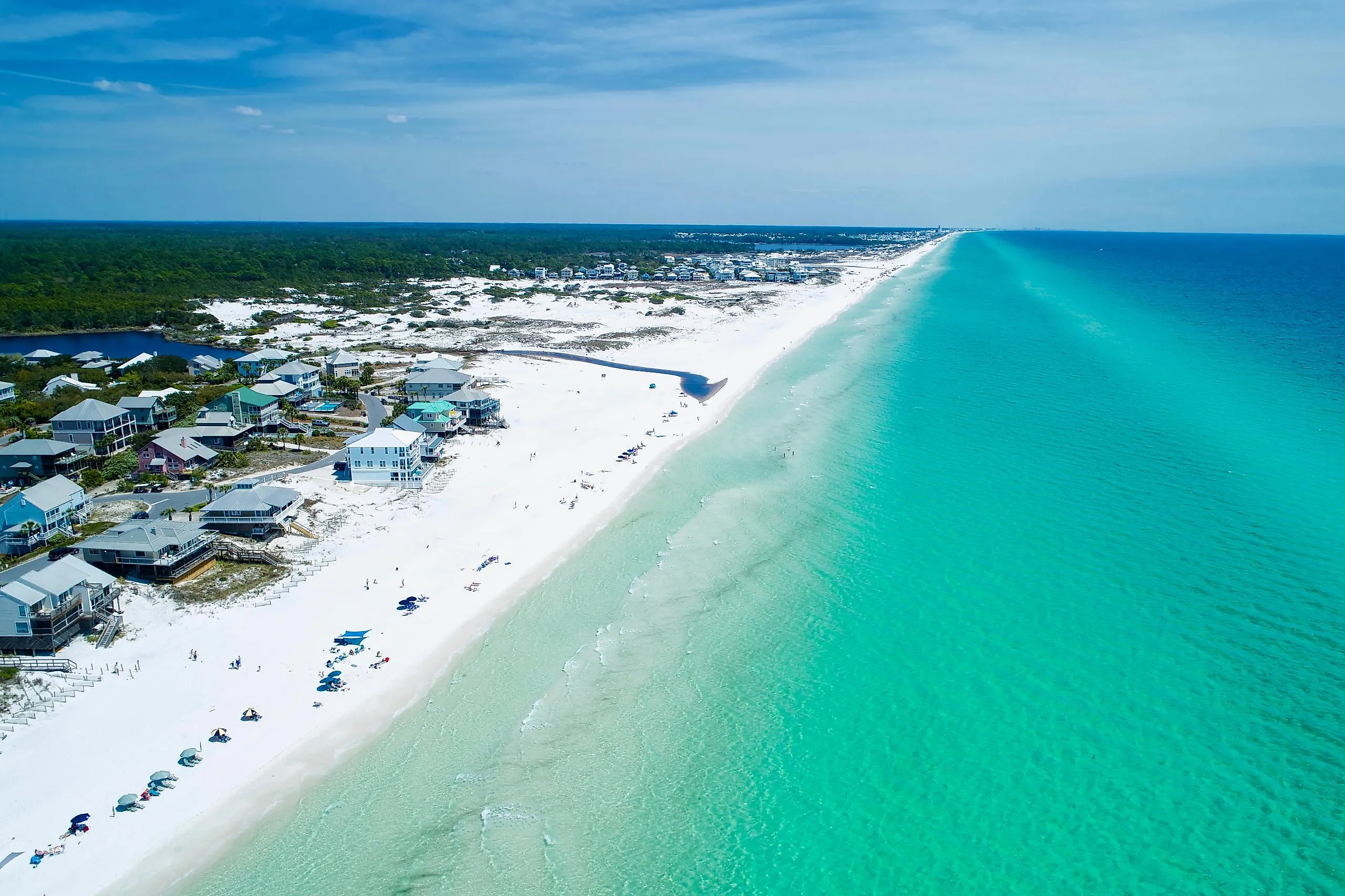
11 Most Peaceful Small Towns On Florida's Emerald Coast
On Florida's Emerald Coast, the calmest water usually waits behind the surf. Western Lake at Grayton Beach takes only boats launched by hand. Turkey Creek in Niceville allows no gas engines at all, and Perdido Key shares its dunes with a beach mouse found nowhere else on Earth. Sounds, bayous, and coastal dune lakes shape the stillest corners of this coast, and public land backs most of them rather than rows of buildings. Even a Florida beach town can move slowly, as long as a visitor knows which side of the dune keeps the still water. These 11 peaceful towns offer a nice reprieve to those who seek it.
Perdido Key

The paved road into the Perdido Key Area of Gulf Islands National Seashore runs about 1.5 miles and then stops at a turnaround. Past that point, the Florida end of this barrier island, in Escambia County, belongs to walkers and to campers who arrive by boat. Rosamond Johnson Beach carries the name of a 17-year-old from Escambia County who died in the Korean War in 1950. The Perdido Key Discovery Trail loops across the dunes on an accessible boardwalk.
Those dunes shelter the Perdido Key beach mouse, federally protected since 1985 and found only on Perdido Key. Only about 9 miles of its habitat survive, in fragments, from a historic range of about 16.9 miles. Perdido Key State Park guards just under 2 miles of beach on the Gulf of Mexico. Boardwalks lead out from its parking lots on State Road 292. On the mainland, Big Lagoon State Park borders the Intracoastal Waterway. Its 5 miles of trails reach an observation tower by way of boardwalks over the marsh.
Pensacola Beach

At the western end of Santa Rosa Island, the Fort Pickens Area keeps the island's old coastal defenses, including Battery Cooper and Battery Worth. Swimmers use Langdon Beach. Nearby trails carry the northern end of the Florida National Scenic Trail.
Pensacola Beach, an Escambia County community, fills the island between that western tract and a second piece of the seashore to the east. Highway 399 runs out of town through the Santa Rosa Area, where Opal Beach keeps parking and pavilions on both sides of the island. One set faces the Gulf. The other faces the flat water of Santa Rosa Sound. The Florida Trail follows the beach here for about 7 miles, one of two Gulf-front stretches of the route inside the seashore.
Gulf Breeze

Eighteen miles of waterfront wrap Gulf Breeze, the only city in south Santa Rosa County, and the city counts three protected bayous. The Bob Sikes Bridge links it to Pensacola Beach, a drive of 2.7 miles across Santa Rosa Sound. The city keeps 105 acres of undeveloped waterfront parkland. It has also held the Tree City USA designation for over 30 years.
East of downtown, the Naval Live Oaks Area dates to 1828, when President John Quincy Adams established it as the first national tree farm. Live oak from reserves like this one went into the hulls of warships. The USS Constitution, launched in 1797, was built of live oak, and Pensacola-area timber later went into its 1920s restoration. The tract covers a peninsula between Pensacola Bay and Santa Rosa Sound. More than 7 miles of footpaths run beneath the oaks, and the accessible Brackenridge Nature Trail accounts for 0.8 miles of them. The oaks came first. The name Gulf Breeze arrived later, from a post office that opened in 1936 at the Gulf Breeze Cottages and Store.
Navarre

Navarre Beach covers 4 miles of the same barrier island. Santa Rosa County governs it directly. Its population is small. The 2020 Census counted 1,123 residents on Navarre Beach, against 40,817 in mainland Navarre across the water. The sound runs along its northern edge, while the open Gulf breaks along the southern one.
Navarre Beach Marine Park turns the Gulf side into an easy walk, with a boardwalk built for wheelchairs, three pavilions, and an observation platform. The park opened those additions in 2019 with Deepwater Horizon restoration money, along with more than 200 new parking spaces. The Navarre Beach Fishing Pier gives anglers a long reach over open water. West of town, Highway 399 enters Opal Beach, the national seashore tract between Navarre Beach and Pensacola Beach.
Niceville

No gas engine ever cuts across Turkey Creek, so canoes, kayaks, and inner tubes have the tannic water to themselves. Turkey Creek Park follows the stream on a boardwalk a mile long, with a kayak launch at its north entrance. The Florida Fish and Wildlife Conservation Commission (FWC) lists the 175-acre park on its birding trail. Mississippi kites circle overhead in summer. From there the creek drains to Boggy Bayou, then on to Choctawhatchee Bay, here in Okaloosa County.
A second bayou frames the city's state park. Fred Gannon Rocky Bayou State Park stands on Rocky Bayou, a trailing arm of Choctawhatchee Bay. Three nature trails pass steephead streams and longleaf pines, some more than 300 years old. Those pines grow on ground that served as a gunnery and bombing range during World War II. The bayou itself forms the 367-acre Rocky Bayou Aquatic Preserve, the smallest of Florida's 43 aquatic preserves.
Point Washington

In 1897, William Henry Wesley built a house near his sawmill at Point Washington, a Walton County settlement on Choctawhatchee Bay. That house now centers Eden Gardens State Park, a park of about 163 acres with Tucker Bayou on its north side. Lois Maxon bought the property in 1963 and donated it to the state in 1968. The house holds the second-largest known collection of Louis XVI furniture in the US.
Camellias and azaleas bloom outside from October to May, with the show peaking around March. A heritage rose garden, a butterfly garden, and a reflection pond with koi round out the grounds. Tucker Bayou is shallow and sheltered. Visitors can launch their own canoes or kayaks from the park. Anglers can fish from the dock or the seawall. At the peak of the timber trade, three mills worked this bayou. Production dwindled in the 1920s. A few pilings in the water are all that remain.
Santa Rosa Beach

About 1,600 acres make up Topsail Hill Preserve State Park, on the western stretch of County Highway 30A in Santa Rosa Beach. From Point Washington, the drive runs 8.9 miles. This Walton County preserve holds roughly 3 miles of undeveloped beach. The dune that gives the park its name rises 25 feet above sea level.
Campbell Lake counts among the preserve's freshwater dune lakes, a habitat Florida State Parks calls extremely rare worldwide. The park bans private canoes and kayaks from its dune lake water, a rule aimed at keeping exotic plants away. The 1.6-mile Morris Lake Trail passes iron tracks left by the first American missile program of World War II. Pitcher plants and old turpentine pines, still scarred with "cat-face" cuts, grow beside its paths. Getting to the sand takes a little effort, since the beach sits 0.8 miles from parking by foot, bicycle, or tram.
Grayton Beach

Grayton Beach ranks among the oldest townships on the Walton County coast, and Grayton Beach State Park wraps Western Lake right next door. The town is 8.3 road miles from Santa Rosa Beach. Western Lake covers 100 acres. Boats go in by hand launch only, and the park prohibits jet-propelled craft.
Walton County counts 15 named coastal dune lakes along 26 miles of shoreline. Their connections with the sea, called outfalls, pour lake water out as needed. Western Lake shares the state park with two other dune lakes, Alligator Lake and Little Redfish Lake, all three mostly inside its boundary. Walkers have three marked choices on the current park map. The Western Lake Loop runs 0.7 miles. The Dune Lake Trail covers a mile. The Flatwoods Trail stretches 4 miles through the pines.
Seagrove Beach

High water decides when Deer Lake breaks through the dune. Once the lake rises far enough, the park's management plan explains, an outlet erodes through the sand and the lake spills into the sea. Seagrove Beach is 3.3 miles down 30A from Grayton. Along the same road, Deer Lake State Park protects the lake and its Walton County shoreline.
A quarter-mile boardwalk crosses the dunes to a beach where visitors picnic, swim, and fish. Across the highway, a forest loop runs a full mile, and a half-mile trail ends at an overlook above the northern part of the lake. Rare plants grow in the park, including Gulf coast lupine, spoonflower, and Curtiss' sandgrass. The park often reaches capacity on busy days and closes its gate until space opens. Day visitors pay $3 per vehicle at an honor box.
Inlet Beach

Early settlers knew the land inside Camp Helen State Park, across the line in Bay County, as Inlet Beach. The community that kept the name sits in Walton County, 8 miles from Seagrove along 30A. Next door, the park covers 180 acres and stays open for day use only. Lake Powell curls around its north and east sides.
Lake Powell is among Florida's largest coastal dune lakes. A channel called an outfall connects it with open water, and saltwater can slip in while that channel is open. Walton County lists a public boat ramp on the lake. On shore, the Lodge dates to 1932. From 1945 until 1987, Avondale Mills, an Alabama textile company, ran the property as a resort for its workers. Middens and mounds show people living here over 4,000 years ago.
Mexico Beach

Thirty-two feet is as tall as a house can rise in Mexico Beach, a Bay County city of 916 residents at the 2020 Census. The tallest commercial districts are limited to 48 feet under the city's land development code. The city's shoreline runs 3.1 miles of white sand facing the Gulf.
Sunset Park fronts the beach along Highway 98, and city officials point visitors there for the best sunset views on the beach. The city asks beachgoers to watch sea turtles from at least 30 feet away. Offshore, Mexico Beach keeps building differently. In 2017, the FWC reported 471 concrete reef modules placed in three permitted areas off Mexico Beach, in water 20 to 80 feet deep. The Mexico Beach Artificial Reef Association, formed in 1997, has added more than 300 reefs of its own.
Calm Water, Close To Shore
The Emerald Coast saves its stillest water for the places behind the beach. Tucker Bayou and Turkey Creek carry paddlers inland. The dune lakes at Topsail Hill and Grayton, along with Deer Lake itself, wait just behind the sand. Public land covers long stretches of that shoreline, from Perdido Key to Camp Helen. Mexico Beach reaches the same calm by another route, with height limits written into its code.