The Largest Freshwater Spring In America
Wakulla Spring, south of Tallahassee, Florida, is recognized by the International Union of Geological Sciences as the largest individual spring in the United States. Missouri's Big Spring is a leading rival. Florida's Silver Springs and Idaho's Snake River springs enter the discussion as well, but their combined flows come through multiple outlets.
Wakulla's advantage over Big Spring becomes clear when their average flows are compared over the same period. Between October 23, 2004, and December 31, 2019, Wakulla's estimated discharge averaged about 372 million gallons a day. Big Spring averaged about 315 million gallons daily over those dates, putting Wakulla about 18% ahead. That comparison measures water leaving each spring, with Wakulla's figure excluding additional inflows farther down its river.
That huge flow rises through one submerged opening beneath a pool where swimmers gather and riverboats begin their tours. Beyond the pool, flooded limestone passages connect the spring to water entering the ground miles away. Those connections account for its enormous flow and why its clear water sometimes turns brown.
One Opening Releases Hundreds Of Millions Of Gallons

Wakulla's main vent is about 185 feet below the water surface. Water rises through this deep opening into the pool, then flows out toward the Wakulla River. Its single-vent designation concerns one outlet. Spring groups combine water emerging through multiple openings, sometimes spread across a much larger area.
Wakulla's average flow across the full record, 1907 through 2019, was about 310 million gallons per day, according to the International Union of Geological Sciences. At that rate, about 3,600 gallons would pass through the vent every second. The daily figure describes water continually moving through the spring, not the amount stored in the visible pool. Rainfall and groundwater conditions can change that flow a great deal. Downstream, the Wakulla River joins the St. Marks River, and the combined river carries its freshwater into Apalachee Bay.
The Water Arrives Through Miles Of Flooded Caves

Rain falling well beyond the park helps supply Wakulla. Its estimated 975-square-mile drainage area reaches into southern Georgia, with water entering the ground across northern Florida as well. Some seeps through the ground, and some takes a faster route through openings where surface streams disappear underground. These stream-swallowing openings are called swallets. Dye tracing has confirmed connections between four major swallets and Wakulla Spring.
Underground, the water moves through the Upper Floridan aquifer, the water-bearing limestone beneath the region. Slightly acidic water gradually dissolves the rock, enlarging cracks into passages. By January 2023, divers had explored about 45 miles of the connected Wakulla Springs cave system. More than 30 entrances were known, and over 22 miles of mapped passages lay deeper than 190 feet. Water reaching the spring can include older groundwater mixed with surface water that entered the aquifer much more recently.
Mastodon Bones Were Found Beneath The Pool

Wakulla's depths have preserved evidence of animals that lived in Florida long before the park's swimming platforms existed. Mastodon bones were recognized in the spring in 1850. Florida Geological Survey staff recovered the mastodon known as Herman in 1930, and its skull was reconstructed after the bones were brought up. The spring and Wakulla River have yielded mammoth and giant-sloth remains as well. Some extinct-mammal remains have been found about 1,180 feet inside the main underwater passage.
Clear water allowed people at the surface to look into this submerged landscape. By 1875, local boat operators were showing sightseers the spring through a windowpane fitted into a rowboat's hull.
The Same Water Cools Swimmers And Shelters Manatees

Fed by groundwater, Wakulla's temperature varies little through the year. During Florida's summer, water near 70 degrees feels cool to swimmers. That same discharge becomes a warmer refuge for Florida manatees in winter, when surrounding waters cool. Farther downstream, the freshwater reaches Apalachee Bay, an estuary with habitat for fish and oysters.
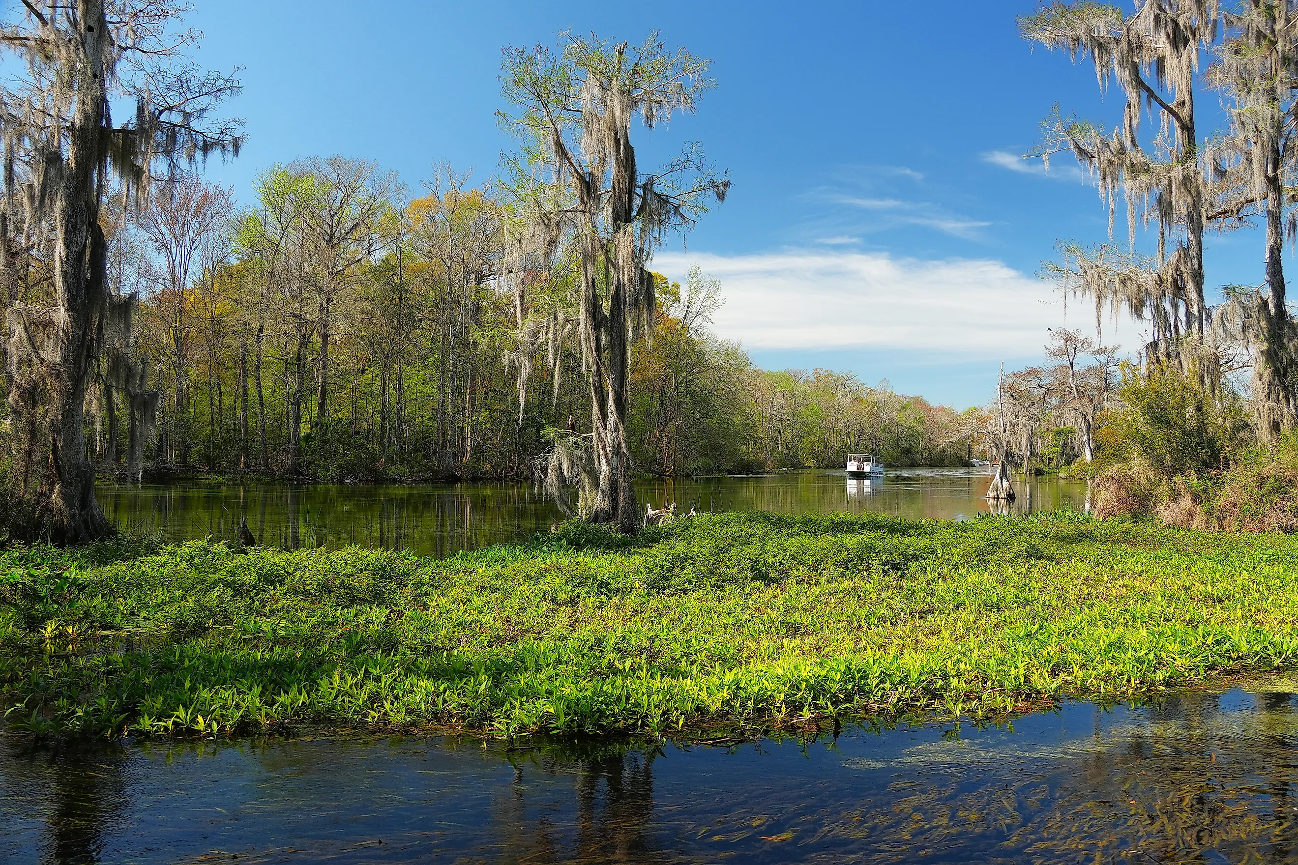
Boat tours show the river without anyone entering the deep spring. Guided boat tours follow a two-mile loop downstream and back, usually taking 45 to 55 minutes. Bald cypress trees grow beside the route, and alligators and wading birds are among the animals passengers may see. Manatees appear as well, although sightings are not guaranteed. Swimming is confined to a designated portion of the spring pool, with a diving platform beside the water.
Why The Spring Sometimes Turns Brown

Wakulla's water can shift between clear blue and a darker, tea-colored appearance. Surface water carries dissolved organic material, including tannins released by decaying vegetation, into the aquifer. Underground passages can then deliver that stained water to the spring. Research published in 2018 traced much of the colored water to passages draining the Apalachicola National Forest southwest of the spring. Water arriving through northern passages was clearer. Dark-water periods limit glass-bottom boat excursions because passengers cannot see into the spring's depths.
Tannin staining and excess nutrient loading have different causes. Excess nitrogen entering the aquifer can promote unwanted plant and algal growth. Permeable soils in southern Leon County allow pollutants near the surface to reach groundwater connected to Wakulla. The county's Primary Springs Protection Zone addresses this vulnerability.
Protecting The Land That Feeds Wakulla Spring

Some of Wakulla's protection work happens in the forest above its underground passages. Parts of the neighboring Wakulla State Forest lie within the spring's groundwater recharge area. Earlier land uses replaced native habitats there with pine plantations, and restoring those habitats and protecting water resources are now management priorities. Florida's Wakulla Springs Protection Zone land-acquisition project targets land above the caves north and west of the spring as well. Its goals include connecting the state park with the Apalachicola National Forest. Conserving these parcels protects places where water enters the ground and travels toward Wakulla's vent. That water then joins the river where manatees shelter in winter.