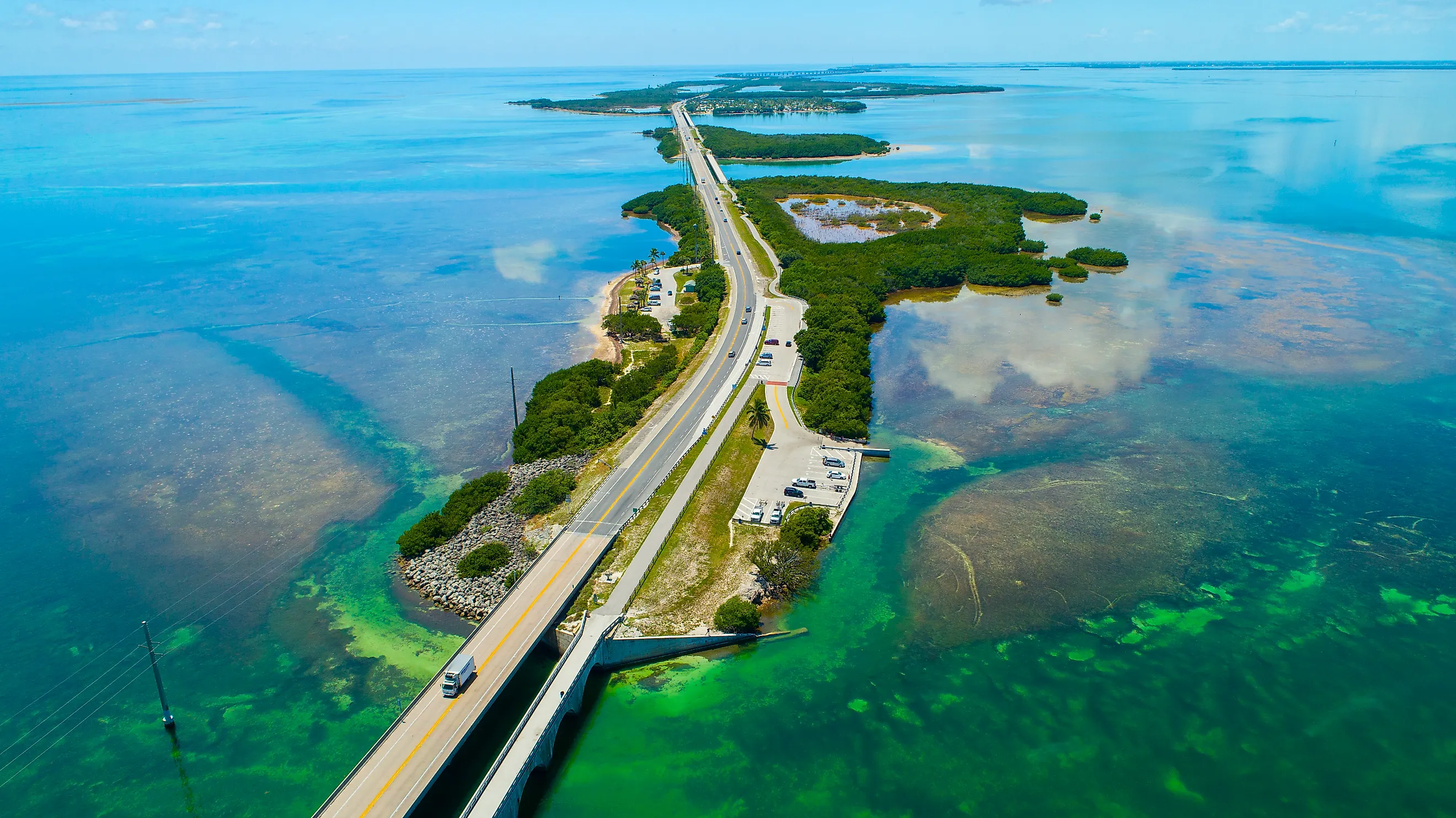
Where The Atlantic Meets The Gulf Of Mexico
Drive across the Seven Mile Bridge in the Florida Keys, and you are riding along the edge of two great bodies of water. Look north, and the shallow, green water belongs to the Gulf of Mexico. Look south, and the deeper blue water flows into the Straits of Florida and the open Atlantic Ocean. That line is not just a matter of opinion, because mapmakers have drawn it officially through the island chain. There is one twist, though. The Gulf of Mexico is not a separate ocean at all but a nearly enclosed sea on the edge of the North Atlantic, so where the two "meet," the Atlantic is really meeting a piece of itself.
The Official Line Through The Florida Keys

The boundary comes from the International Hydrographic Organization, the body that sets the official limits of the world's oceans and seas, and NOAA uses the same definition. On the Florida side, the line starts at the eastern end of Florida Bay, near the mainland, and runs southwest through the Florida Keys and their shoals to Rebecca Shoal, a lonely reef between Key West and the Dry Tortugas. From there it swings south along a line of longitude all the way to the northwestern coast of Cuba.
The rule includes a neat detail. All the narrow, shallow waters between the Dry Tortugas and Florida Bay count as part of the Gulf. In practice, that means the Keys themselves are the dividing wall. The bay side of the islands is Gulf water, and the ocean side faces the Atlantic.
Key West And The Seven Mile Bridge

Few places let you see the boundary as clearly as the drive down the Overseas Highway. The Seven Mile Bridge, which links Marathon to the Lower Keys, runs right along the divide, and right beside it stand the remains of the old bridge built for Henry Flagler's Overseas Railroad in the early 1900s. The water on either side often looks different. The Gulf side tends to be shallower and greener, while the Atlantic side drops off toward deeper reefs and the Gulf Stream.
In Key West, the same split plays out in a single town. Crowds gather at Mallory Square to watch the sun set over the Gulf side of the island, while the famous Southernmost Point buoy, which marks the spot about 90 miles (145 km) from Cuba, looks out over the Straits of Florida and the Atlantic.
The Dry Tortugas, A National Park In The Gulf

About 70 miles (113 km) west of Key West, the remote islands of Dry Tortugas National Park sit at the far western end of the boundary. Because the official line passes just to their east and south, the park's coral reefs and the massive brick walls of Fort Jefferson lie in Gulf of Mexico waters. The islands guard one of the most strategic spots in the region. Ships traveling between the Gulf and the Atlantic have always had to pass nearby, which is exactly why the US Army built a fortress here in the 1800s.
The Other Door, The Yucatán Channel

The Gulf has a second opening, and it connects to another arm of the Atlantic. Between Cape San Antonio, at the western tip of Cuba, and Cape Catoche, on Mexico's Yucatán Peninsula, the IHO draws the line between the Gulf of Mexico and the Caribbean Sea. Like the Gulf, the Caribbean is a sea within the Atlantic, so this boundary separates two parts of the same ocean. Together, the Yucatán Channel and the Straits of Florida are the only two doors in and out of the Gulf.
Where The Water Really Goes

The lines on the map are fixed, but the water is always moving between them. According to NOAA, warm water from the Caribbean pours into the Gulf through the Yucatán Channel, swings around in a great loop known as the Loop Current, and then exits through the Straits of Florida as the Florida Current. Off the southeast coast of Florida, that flow becomes part of the Gulf Stream, one of the most powerful currents on Earth, which carries warm water up the US East Coast and across the North Atlantic. The Gulf and the Atlantic are not just neighbors. They are part of one connected circulation system.
One Ocean, Many Names
The meeting point of the Atlantic and the Gulf of Mexico is easy to visit and easy to see, whether on the Seven Mile Bridge or the beaches of Key West. In 2025, an executive order directed US federal agencies to use the name "Gulf of America," and NOAA now lists the same body of water under that name, with exactly the same boundaries. Whatever name appears on the map, the geography hasn't changed. The line still runs through the Florida Keys, and on both sides of it lies the Atlantic Ocean.