The Largest Lakes In The Southeast
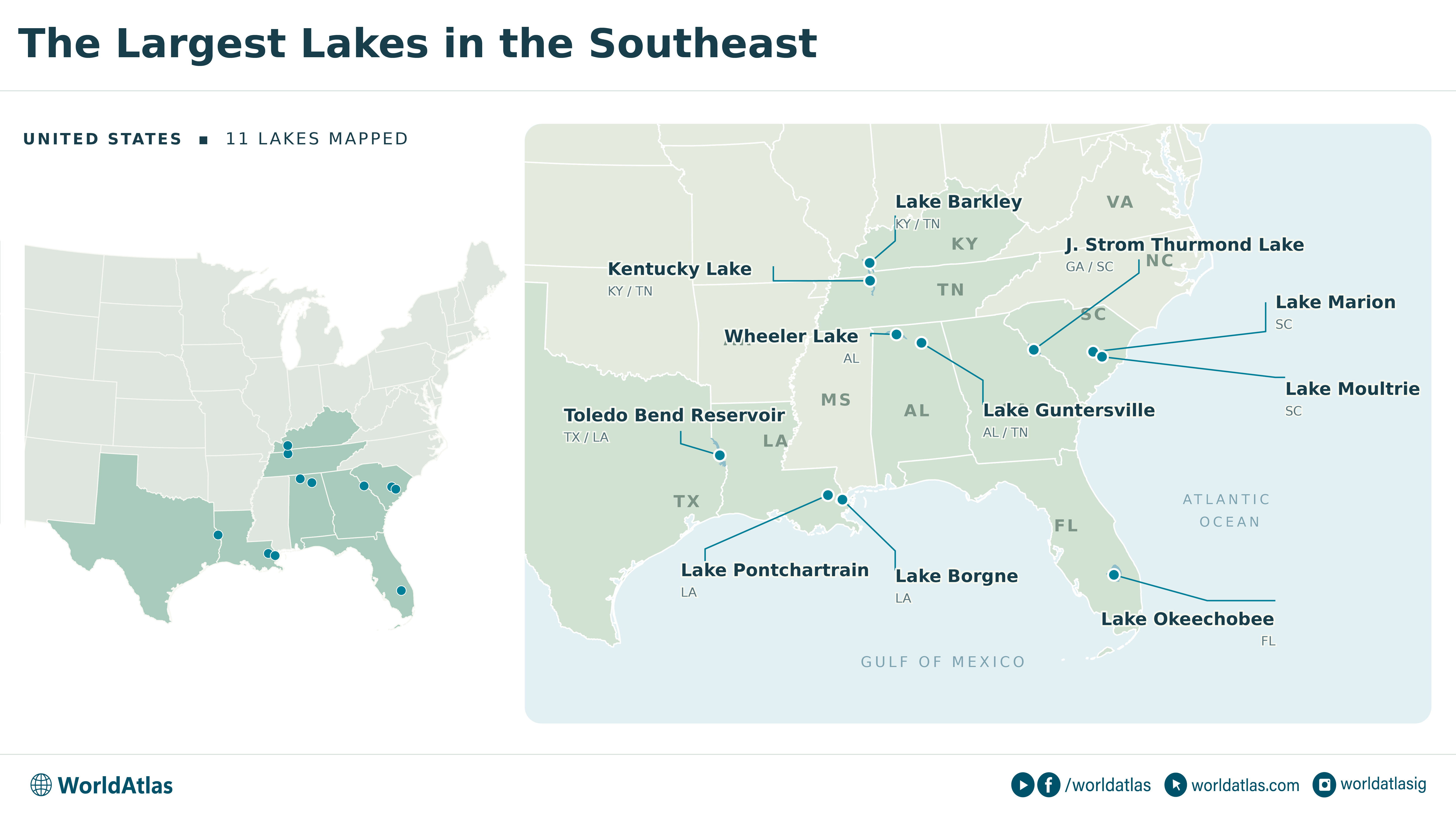
Florida's Lake Okeechobee covers about 730 square miles, making it the largest lake in the Southeast by surface area. Its average depth is only about nine feet. That enormous, shallow basin supplies water to South Florida and supports wetlands used by wading birds. Elsewhere, the region's biggest lakes occupy flooded river valleys or sit beside the coast. Lake Pontchartrain is a brackish estuary north of New Orleans; Kentucky Lake stretches along 184 miles of the Tennessee River. On South Carolina's Lake Marion, trees left standing when the dam closed still provide fish habitat and obstruct boats outside marked channels. Below are the 11 largest lakes in the region.
Lake Okeechobee, Florida

At roughly 467,200 acres, Okeechobee is so wide that the opposite shore disappears beyond the water's edge. Wetlands around its shallow margins provide habitat for fish and wading birds. The lake lies within the Greater Everglades watershed, receiving water principally through the Kissimmee River and supplying water for farms and communities farther south.
Excessively high or low levels can damage the lake's ecosystem, and nutrient runoff has contributed to its water-quality problems. Along the perimeter, the Lake Okeechobee Scenic Trail follows the Herbert Hoover Dike. Walkers and cyclists can look over the water from a structure built for flood protection. The roughly 110-mile route circles a lake that extends into five Florida counties.
Lake Pontchartrain, Louisiana

The drive across Lake Pontchartrain takes nearly 24 miles of bridge. The Causeway connects Metairie with Mandeville across water covering about 630 square miles, or 403,200 acres. Its parallel bridges carry roughly 40,000 vehicles daily.
Pontchartrain is a brackish estuary, with freshwater entering a system connected to the Gulf through waterways on its eastern side. Its average depth is only about 12 to 14 feet. Farther east, Lake Borgne is an open coastal lagoon, despite the lake in its name.
On Pontchartrain's north shore, Fontainebleau State Park gives visitors access to a sandy beach and trails through the surrounding landscape. The park also preserves the brick remains of an 1829 sugar mill, near the town founded by its owner, Bernard de Marigny de Mandeville.
Toledo Bend Reservoir, Louisiana And Texas

Standing timber remains a major fish habitat in Toledo Bend, a 181,600-acre reservoir along the Louisiana-Texas border. The Sabine River was impounded here beginning in 1966, flooding a landscape that still influences where anglers look for fish. Submerged wood and vegetation provide cover, and old creek channels remain beneath the reservoir.
At about 284 square miles at conservation pool, Toledo Bend is larger than Kentucky Lake. Its deepest water reaches about 110 feet. Largemouth bass are its most popular game fish. In the clearer lower reservoir, anglers target vegetation edges and underwater humps. Striped bass have been supported by stocking because conditions generally do not allow successful natural spawning.
Kentucky Lake, Kentucky And Tennessee

Kentucky Lake follows the Tennessee River for 184 miles, occupying about 160,300 acres, or 250 square miles. Its long channel carries commercial traffic through a reservoir lined with recreation areas. Kentucky Dam, completed in 1944, helped open the Tennessee River to year-round navigation when the reservoir filled the following year. The lake also has enough storage to help reduce flood crests on the Ohio and Mississippi rivers downstream. Along its shore, Land Between the Lakes National Recreation Area provides access to a large tract between Kentucky Lake and neighboring Lake Barkley. The Tennessee National Wildlife Refuge protects other stretches of the reservoir. Seasonal changes remain visible at the water's edge: the usual summer target elevation is 359 feet above sea level, compared with a minimum winter elevation of 354 feet.
Lake Marion, South Carolina

Lake Marion filled before crews finished clearing the trees. The dam closed in November 1941 as the wartime construction schedule accelerated, leaving standing trunks and thousands of stumps in the new reservoir. South Carolina's largest lake has about 90,000 acres of surface water, roughly 141 square miles, within a broader 110,600-acre footprint.
Submerged wood provides fish habitat and creates obstacles for boats outside marked routes. Live cypress trees also remain, and the upper lake extends toward Sparkleberry Swamp near the meeting of the Wateree and Congaree rivers. Striped bass trapped by the dam established a population that demonstrated the species could complete its entire life cycle in freshwater. A diversion canal connects Marion to Lake Moultrie.
At Santee State Park, a viewfinder on the fishing pier lets visitors examine cypress trees standing out in the lake. Pontoon boat tours travel through the flooded cypress forest.
J. Strom Thurmond Lake, Georgia And South Carolina

Thurmond's roughly 111 square miles of water have about 1,200 miles of shoreline. Long coves extend into the land around this 71,100-acre reservoir on the Georgia-South Carolina border. Also called Clarks Hill Lake, it occupies part of the Savannah River system upstream of Augusta.
Mistletoe State Park occupies part of the Georgia shore, where the campground sits on a peninsula with open-water views in both directions. The park has lakeside cottages and boat ramps for access to the reservoir. Below the surface, Thurmond differs sharply from shallow Okeechobee: its average depth is about 37 feet. The Corps of Engineers built the project between 1946 and 1954, creating the first of its major reservoirs in the Savannah River basin.
Lake Guntersville, Alabama And Tennessee

Guntersville's waterfront includes commercial terminals as well as fishing access. Dams and locks made the town a port on the Tennessee River, allowing businesses to move bulk goods through northeast Alabama. The reservoir extends 76 miles upstream into Tennessee and covers about 67,900 acres, or 106 square miles.
Crappie and bass occupy the reservoir, while the water below Guntersville Dam draws anglers for sauger during autumn and winter. The dam was completed in 1939, and its larger navigation lock followed in 1965 as river traffic grew. Water levels are managed within a relatively narrow range for navigation, with a typical summer elevation of 594 to 595 feet above sea level.
Wheeler Lake, Alabama

Winter brings thousands of sandhill cranes to Wheeler National Wildlife Refuge, alongside a small number of endangered whooping cranes. The refuge borders the 67,070-acre Wheeler Lake near Decatur. The lake occupies roughly 105 square miles along the Tennessee River, immediately downstream of Guntersville.
The refuge's observation building lets visitors watch the cranes near their winter feeding grounds. Beyond the refuge, Decatur is a significant inland port. Wheeler's navigation locks lift or lower barges as much as 52 feet between Wheeler and Wilson reservoirs. The lake also helped submerge portions of the rocky Muscle Shoals that once obstructed river travel. Its dam was completed in 1936, when the Tennessee Valley's navigation system was still being constructed.
Lake Moultrie, South Carolina

Lake Moultrie spreads about 14 miles across at its widest point, with approximately 60,400 acres, or 94 square miles, of surface water. Much of its basin was cleared before flooding, giving the open lake a different appearance from tree-filled Lake Marion upstream. Submerged stumps remain around the shallow shoreline. More than half the shoreline is contained by dams and dikes, and much of the open water is 10 to 30 feet deep. In the sheltered Hatchery area, remnants of an old dike help protect aquatic vegetation that provides fish habitat. The St. Stephen fish lift, on the rediversion route toward the Santee River, allows migrating American shad and blueback herring to move upstream. At Pinopolis Dam, a navigation lock connects boat traffic with the Cooper River below.
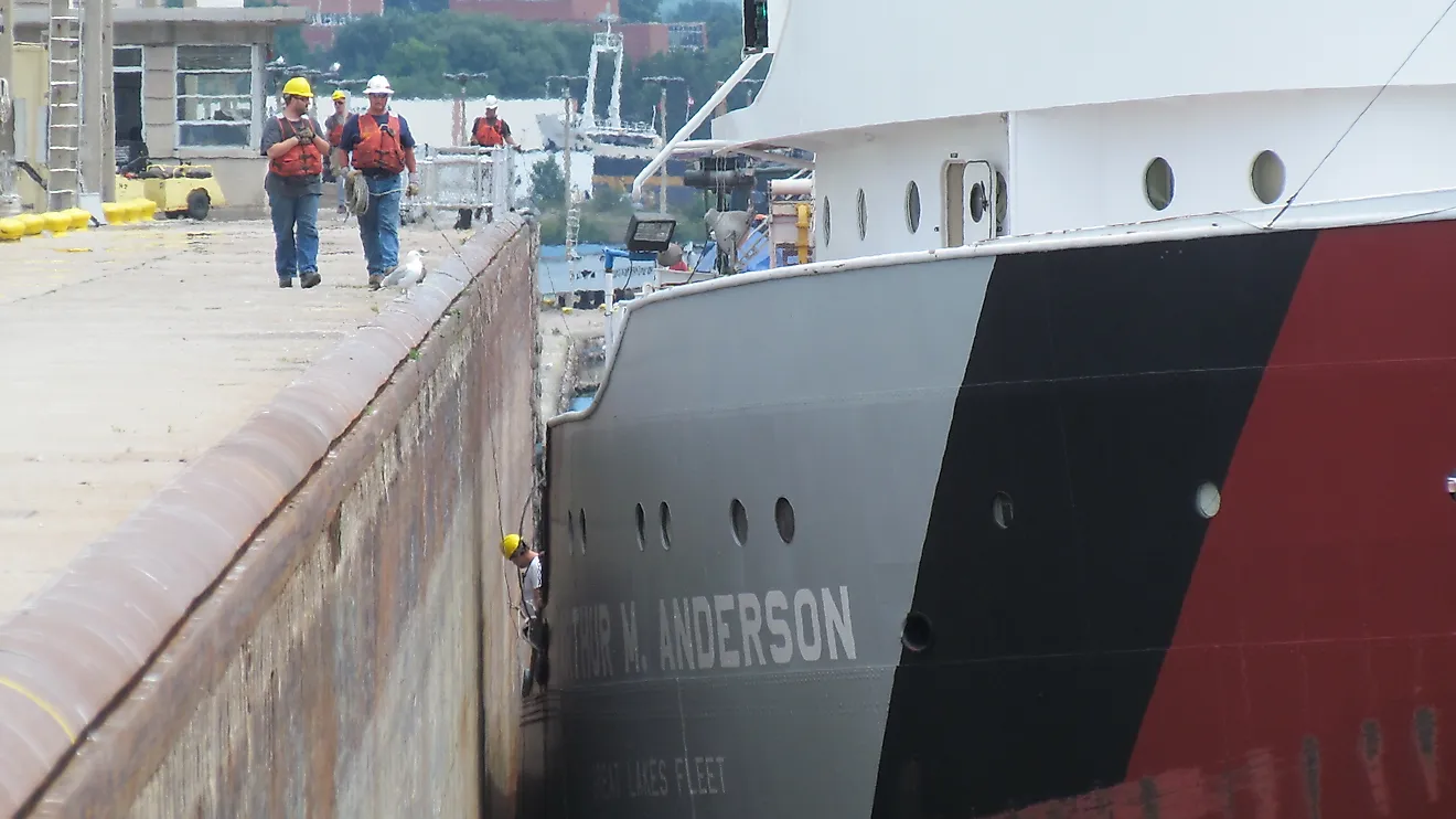
A marked navigation route crosses Marion and Moultrie, continuing to the lock at Pinopolis Dam. It follows a project originally intended to link Columbia and Charleston by inland waterway. On Marion, markers guide boats through water that still contains submerged trees. At Moultrie's southern end, the lock lowers boats about 75 feet to the Tailrace Canal, which leads toward the Cooper River. The chamber admits motorized boats measuring 10 to 150 feet long. Usually, about a dozen 16-foot boats can make the journey together. Gates hold them inside while the water level changes. The locking procedure takes about 20 to 45 minutes.
How The Region's Largest Lakes Compare
Only Okeechobee and Pontchartrain are natural. The rest are reservoirs built between the 1930s and the 1960s, when federal agencies and power authorities dammed the Tennessee, Savannah, Sabine, and Santee rivers for navigation, flood control, and hydroelectricity. That origin shows in the water itself. Okeechobee spreads wide and shallow over its basin, while the river-valley reservoirs run far deeper against their dams, reaching about 110 feet at Toledo Bend. Where crews left trees standing before the water rose, as at Lake Marion and Toledo Bend, the submerged timber still shapes where fish hold and where boats can safely travel. Several of the largest, including Kentucky Lake, Wheeler, and Guntersville, remain working links in the inland waterway, lifting barges past dams that also drowned rapids such as the Muscle Shoals.