Which Provinces Border British Columbia?
Canada is divided into 13 sub-national governments known as provinces and territories. Over the years, Canada’s international borders have changed and the country now has 10 provinces and three territories. Together, the territories and provinces comprise the second-largest country in the world by area. One of the ten Canadian provinces is British Columbia, located between the Rocky Mountains and the Pacific Ocean. It is the third largest province by population, with about 5 million residents. The province was named by Queen Victoria when it became a British colony in 1858. The name was derived from Columbia District, a British name of a territory drained by the Columbia River. Its capital, Victoria, was also named after Queen Victoria and is the 15th largest metropolitan region in Canada. British Columbia is bordered by one Canadian province, two Canadian territories, and four American states.
Brief Geography of British Columbia
The province of British Columbia shares its western border with the Pacific Ocean and the US state of Alaska. It also shares its southern border with three other American states which are Washington, Idaho, and Montana. Interestingly, British Columbia is bordered by more US states than Canadian provinces. This is because part of the province’s border acts as an international border between Canada and the United States. British Columbia is bordered to the north by two Canadian territories; Yukon and the Northwest Territories. It is also bordered to the east by the province of Alberta. British Columbia has a total land area of approximately 364,800 square miles (5th largest province by area) and a rugged coastline stretching for more than 17,000 miles. Its capital, Victoria, is situated on the southern tip of Vancouver Island.
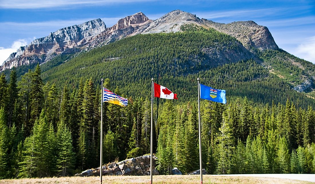
British Columbia-Alberta Border
Alberta is the only province in Canada that shares its borders with British Columbia. It is located to the east of British Columbia. The two provinces and are separated from each other by the Great Divide, a geographical boundary determining whether running water flows west to the Pacific Ocean or east to Hudson Bay. The boundary line between these western provinces is approximately 1,842 kilometer, the longest in Canada, and consist of two distinct parts; the northern section which follows the 120th meridian of longitude and the southern part which follows the continental divide, commonly referred to as the Great Divide. The Alberta-British Columbia border features a number of physical features including Mount Assiniboine, Aurora Mountain, Mount Ball, Beatrice Peak, Bush Pass, and Popes Peak among other features.
When British Columbia became a province in 1871, it had no money to conduct a boundary survey. However, at the beginning of the 20th century, the provincial government wanted to know its precise boundary in order to control and regulate lumbering and mining. In April 1912, the government committed to surveying the eastern boundary. BC and Alberta agreed to jointly fund the boundary survey. Each province also appointed commissioners with BC choosing Arthur Oliver Wheeler while Bill Cautley was picked by Alberta. Wheeler surveyed the Great Divide while Cautley surveyed the 120th meridian.
British Columbia-Yukon Territory Border
Yukon Territory is one of the two Canadian territories bordering the Province of British Columbia. The territory and the province share a border to the north of British Columbia. The northern border of British Columbia is located on the 60th parallel north which also forms the mainland boundary between British Columbia and the Northwest Territories. The northern part of the province has close ties with the Yukon Territory, with the Alaska Highway beginning at Dawson Creek and meandering through to Yukon. Spanning the border between the Yukon and British Columbia is the Teslin Lake. This lake is part of a group of lakes known in Yukon as the Southern Lakes.
British Columbia-Northwest Territories Border
British Columbia is also bordered by the Northwest Territories on the north. British Columbia’s northern boundary is located on the 60th parallel. The northern border with both Yukon and Northwest Territories is considered the northernmost point of the province of British Columbia. The Northwest Territories is bordered to the south by the northeastern corner of British Columbia. The two regions of Canada are connected by the Liard Highway, known as Highway 7 in NWT and Highway 77 in BC. This highway begins at a point on the Alaska Highway and runs approximately 86 miles northeast to the border of BC and NWT, beyond which it continues as a graveled road for about 158 miles and terminates at a junction with Highway 1.
British Columbia’s International Border
British Columbia and the United States share two international borders to the west and south of British Columbia.
The western international border is shared with Alaska while the southern border is shared with northwestern continental US. The western international border begins from Alaska-Yukon border and proceeds through Saint Elias Mountain and Mount Fairweather then heads northwards towards Coastal Mountain. From the latter mountain, the border reaches Portland Canal and runs through the canal to Dixon Entrance and proceeds to the Pacific Ocean and only ends at the international waters.
The southern international boundary begins from the point where the western boundary ends at the Pacific Ocean and runs along the Strait of Juan de Fuca towards the east and enters Haro Strait. It follows the strait northwards and then turns eastwards through Boundary Pass. From the Strait of Georgia, the line turns northwards then northwestward, bisecting the strait up to the 49th parallel north. From here the boundary line makes a sharp turn eastwards and follows the parallel across Tsawwassen Peninsula and proceeds into Alberta. The southern international boundary is shared with the US states of Idaho, Washington, and Montana.


