Which Provinces Border Manitoba?
Manitoba is one of the three prairie provinces of Canada, the other two being Saskatchewan and Alberta. It is located at Canada’s longitudinal center and stretches from the northern oceanic coastline at Hudson Bay to the southern border with the United States. Manitoba has a total surface area of approximately 250,900 square miles, making it the 8th largest sub-division in Canada and accounts for 6.5% of the country’s total area. With a population of approximately 1.3 million people, this province is the 5th most populous. Its capital and largest city is Winnipeg which is also the 8th largest metropolitan area in Canada. Manitoba is bordered by both Canadian provinces and territories and the US states. It is bordered by the provinces of Ontario and Saskatchewan to the east and west it respectively, to the northwest by Northwest Territories, to the north by Nunavut, and to the south by the US states of Minnesota and North Dakota.
Overview of the Boundaries of Manitoba
The southwestern corner is the most easily accessible corner of Manitoba. From this corner, one can is able to easily access Saskatchewan in the west and North Dakota in the south. On the contrary, the northern corner is located very far for average tourists to access. Manitoba was admitted to the Canadian Confederation on July 15, 1870, as the fifth province. Its addition to the Confederation resulted from negotiations between the Government of Canada and Louis Riel of the Red River Metis when the Red River Resistance ended. In 1870, the Manitoba Act was passed and the new province of Manitoba was admitted into the confederation. At the time of admission, the province was only one-eighteenth the size it is today. Manitoba was often called the “postage stamp” because it had a square shape. In the following years, several settlers migrated to the province and past it into Northwest Territories. The borders of Manitoba were enlarged in 1881 to control and accommodate the incoming settlement. The province was increased to the north and west, increasing the size almost five times. The boundaries of Manitoba as they are today were set in 1912.
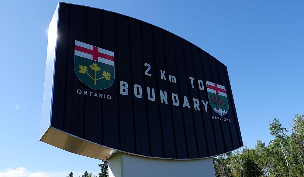
Settling the Manitoba-Ontario Border Dispute
Ontario is one of the two provinces that share borders with Manitoba, with the two provinces sharing a border to the east of Manitoba. Ontario was the first province to be added to the Confederacy along with Nova Scotia, Quebec, and New Brunswick. When the decision to enlarge Manitoba was made, the neighboring provinces and territories were set to be affected since its boundaries were to be moved in all direction except to the south. However, no one was quite certain how far the eastern boundary would be moved. It would take 74 years from 1881 to finally settle the Manitoba-Ontario border dispute. One of the sources of dispute between the two provinces was the location of Rat Portage (Kenora). Both provinces proclaimed laws in force of the district and each also built their jail and courthouses. Prisoners jailed by the one province were released by the other and constables who made arrest were in turn arrested by constables from the other province. Rat Portage became one of the worst places to live in. However, in 1884, the Canadian Government gave the district to Ontario. In 1912, the Canadian legislators extended Manitoba’s eastern boundary to the northeast to the Hudson Bay where the 89th meridian intersects the southern shore. In 1955, the governments of the two provinces received and accepted the survey report as the final word, finally settling the Manitoba-Ontario border dispute.
Manitoba-Saskatchewan Boundary
Saskatchewan is the only prairie province bordering Manitoba and is the only province in Canada without a natural border. Thus, the Manitoba-Saskatchewan border, also known as Manitoba’s western border, is strictly defined by a near-perfect imaginary boundary line. Saskatchewan joined the confederation simultaneously with Alberta in 1905 as the 8th and 9th provinces in no particular order. Although the boundary line separating the two provinces appear as a straight line, it actually contains a series of small jogs that resulted from the land survey grid for Western Canada. As settlements were being established in the west, the Dominion government undertook to projects to ensure that these settlements were orderly. To achieve this, the government turned to the Dominion Land Survey in which the basic mapping unit is a square tract of land known as a township. On the DSL grid, both latitude and longitude lines are used and since the Earth is a globe, the vertical lines get closer until they converge at the North Pole. Thus if the lines are not corrected, they would give inaccurate and undefined boundary line. Correcting the lines cause a series of jogs which increase in size as they progress westwards. The jog on the Manitoba-Saskatchewan border is about 1.25 miles.
Manitoba-Nunavut Border
Manitoba shares its northern boundary with the territory of Nunavut. The northern boundary runs along the 60th parallel while the northeastern part of the province was enlarged to border Hudson Bay. Nunavut is the largest territory in Canada, covering about one-fifth of the country and was officially separated from Northwest Territories in 1999. However, its boundaries were drawn in 1993. At the time of creating the territory, Manitoba’s northern boundary had been surveyed and defined. Nunavut and Manitoba share more than a border. The two have established a close trading, transportation, and cultural relationship in the past 26 years. For instance, in April 2002, the two signed a Memorandum of Intent on Northern Energy Strategy with the purpose of improving energy supply for both regions.
Northwest Territories and Manitoba at Four Corners
There is no boundary line defining the border between Northwest Territories and Manitoba. However, the two, alongside Nunavut and Saskatchewan meet at a point known as the Four Corners. At this point, the northwestern corner of Manitoba meets the southeastern corner of Northwest Territories. This corner is situated between Hasbala Lake and Kasba Lake to the south and north respectively and is hundreds of miles away from any railway or road.


