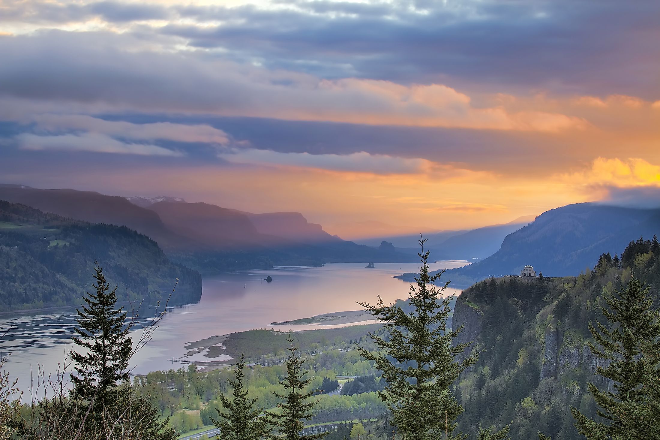
Columbia River
The Columbia River is the seventh-longest river in the United States and the largest river in North America’s Pacific Northwest region. The river originates in the Rocky Mountains of the Canadian province of British Columbia and then flows for 2,000km through the US states of Washington and Oregon, eventually draining into the Pacific Ocean. The Columbia River drainage basin extends into seven US states and one Canadian province, covering an area of 670,000 sq. km.
Geography

The Columbia River originates from its source in Columbia Lake, which is located at an elevation of 820m, in the Canadian province of British Columbia, close to the Rocky Mountain Trench. For the first 320km, the river flows in the northwest direction along the trench and passes through Lake Windermere and the town of Invermere, and then flows to the town of Golden into the Kinbasket Lake. The river then flows northeast of the Selkirk Mountains and turns sharply south along the international border between the United States and Canada, and enters the northeastern Washington region in the US State of Washington. The river traverses east-central Washington in a curve known as the “Big Bend”. At the boundary between Washington and Oregon, the river makes a sharp bend to the west. While flowing between the cities of Portland and The Dalles, the river cuts through the Cascade Range where it forms the dramatic Columbia River Gorge. The river then continues westwards and ultimately drains into the Pacific Ocean just to the west of the port city of Astoria in Oregon, United States.

More than 60 significant tributaries feed into the Columbia River. Some of the major tributaries of the Columbia River include the Snake River, Pend Oreille River, Willamette River, Kootenay River, John Day River, Deschutes River, Kettle River, Yakima River, Lewis River, Cowlitz River, etc. With an average flow of 7,500m3/s at its mouth, the Columbia River is the largest river by discharge volume among all the rivers that flow into the Pacific Ocean from the Americas and the fourth largest river by volume in the United States. The Columbia River drains an area of 670,000 sq. km and has the sixth-largest drainage basin in the United States. The Columbia River drainage basin covers parts of the US States of Idaho, Montana, Wyoming, Utah, Nevada, Oregon, Washington, and the Canadian province of British Columbia.
Climate
The climate of the Columbia River basin is strongly influenced by orographic influences and therefore experiences partly marine and partly continental climate. The Rocky Mountains on the eastern side blocks the severe winter storms of the interior, while the Cascade Range in the west blocks the moist Pacific Ocean air from reaching the Columbia River basin. The river basin faces typically hot and dry summers with occasional thunderstorms and moderately cold and dry winters with occasional rain and snowfall. Both the temperatures and the amount of precipitation greatly vary according to the elevation. During January, the temperatures in the central part of the river basin vary between -4° and -1°C, while during July, the temperatures vary between 21° and 24°C. The lower elevations receive average annual precipitation of less than 200mm, whereas the higher elevations receive average annual precipitation between 380mm to 1,000mm.
Ecology
The Columbia River supports several species of anadromous fishes that migrate between the Pacific Ocean and the tributaries of the Columbia River. Some of the notable fishes include the Coho and Chinook salmon, the sockeye salmon, Pacific salmon, Pacific trout, steelhead, white sturgeon, etc. However, the salmon and sturgeon populations in the river have declined drastically. The construction of dams along the river has interrupted the migration of anadromous fishes and has led to a decline in their populations. The Columbia River once produced the largest salmon runs on the planet with returns often more than 30 million salmon per year. However, today, only a fraction of the salmon returns to spawn in the river.
Brief History

Archaeological studies have revealed that humans have lived in the Columbia River basin for more than 15,000 years. Several different Native Americans and First Nations people have lived here including the Shoshone Bannock tribes, Shuswap people, Colville, Yakama, Spokane, Cayuse, the Confederated Tribes of Warm Springs, the Palouse, the Sinixt people, the Sinkiuse-Columbia people, Okanagan people, etc. These communities interacted among themselves and their livelihoods were highly influenced by the flow of the river and the seasonal variations of fish. Some of the major fisheries that were located along the river included the Celilo Falls, Willamette Falls, Kettle Falls, Cascades Rapids, and Priest Rapids.
As per the oral histories, a land bridge known as the Bridge of the Gods formed a significant connection between the Oregon and Washington sides of the river. The bridge also formed a link between the northern and southern communities and it was through the bridge, the horses that were acquired from Spanish New Mexico were introduced here. The first recorded European discovery of the Columbia River was by the Spanish explorer Bruno de Heceta in 1775. During the 18th and 19th centuries, the arrival of Euro-American explorers marked the beginning of a period of change that had a great impact on the entire Columbia River basin. The coming of the explorers and later colonialists led to the loss of fishing rights of the natives, and this triggered many violent conflicts such as the Whitman Massacre and the Yakima War. In 1866, the white settlers established several salmon canneries, which resulted in a strong negative impact on the salmon population. The industrial and technological developments led to the further development of the Columbia River for irrigation, hydropower generation, flood control, and navigation. Currently, there are more than 400 dams in the entire Columbia River system of which there are 14 dams on the main stem of the Columbia River. However, in recent times, pollution has greatly affected the health and water quality of the Columbia River.


