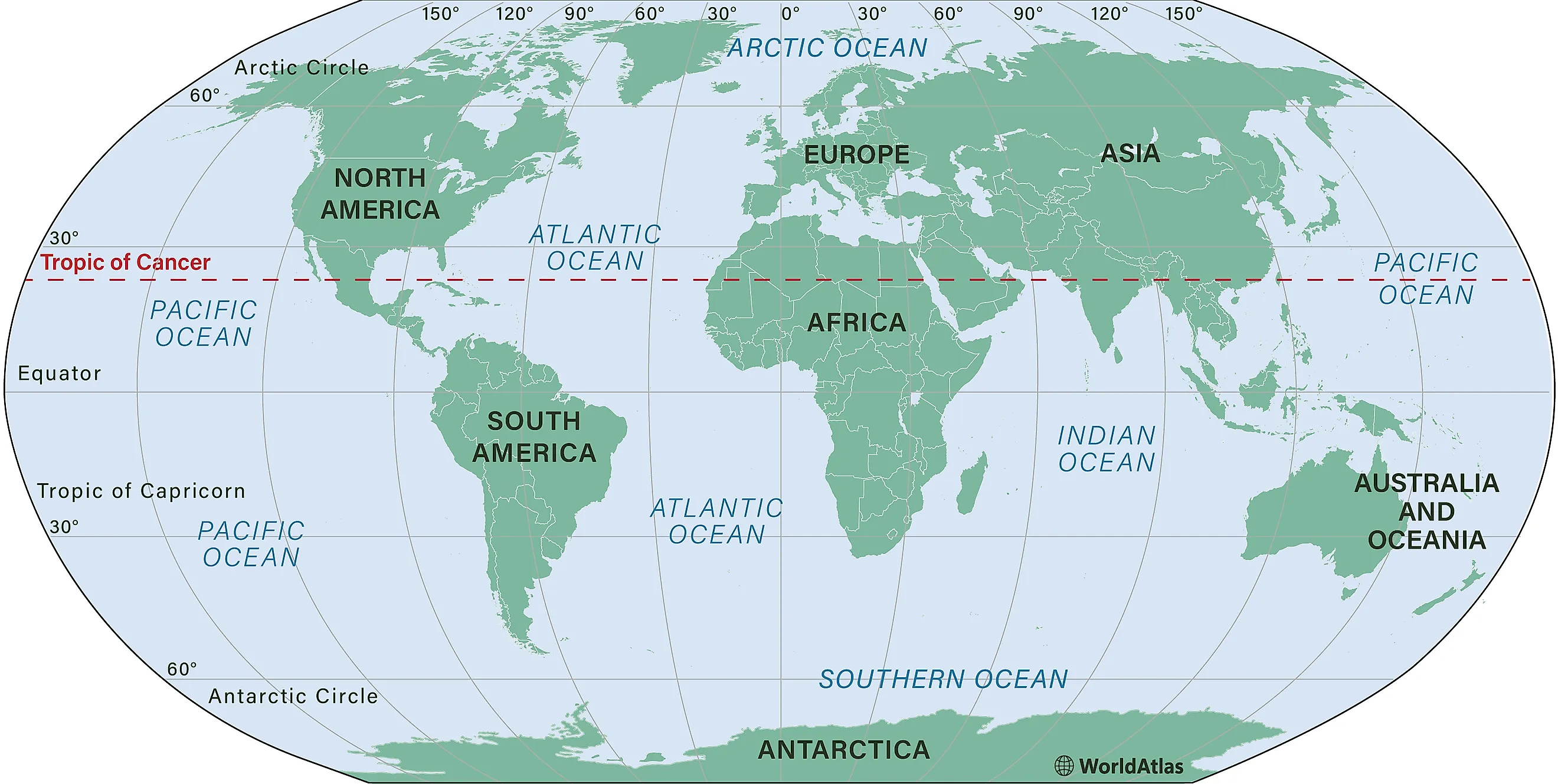
Tropic of Cancer
The Tropic of Cancer is also known as the Northern Tropic and is one of the Earth's five major circles of latitude. It is the northernmost point on Earth where the Sun can appear directly overhead at 12:00 pm, otherwise known as noon. This phenomenon occurs during the June solstice; during the solstice, the Northern Hemisphere tilts toward the Sun at its most direct angle during its wavering movements. Currently, the latitude of the Tropic of Cancer is approximately 23°26′10.0″ (or 23.43611°) north of the Equator. This latitude is not fixed; it shifts slightly due to changes in Earth's axial tilt.
The Tropic of Cancer serves as a crucial geographical marker, dividing the Earth into the tropics and subtropics. More specifically, between the Tropic of Cancer and the Tropic of Capricorn (its counterpart in the southern hemisphere) is a region that is known as "the tropics." This region is characterized by a relatively consistent climate— temperature does not tend to vary significantly throughout the year. Regarding importance and impact, the Tropic of Cancer passes through numerous countries, influencing climates and ecosystems.
The Origin Of The Name "Tropic Of Cancer"
The Tropic of Cancer derives its name from the zodiac sign Cancer. When the term was coined in the last centuries BCE, the Sun was positioned in the constellation Cancer during the June solstice. Due to the precession of the equinoxes, which is due to a gradual shift in Earth's rotational axis, the Sun is now in the constellation Taurus during the June solstice. Despite this shift, the name Tropic of Cancer has remained unchanged.
The word "tropic" comes from the Greek "trope" (τροπή), meaning "turn" or "change." This refers to the fact that the Sun appears to "turn back" at the solstices, reversing its apparent motion along the horizon. The Tropic of Cancer marks the point, and can be defined as, where the direction of the Sun's rays reach their northernmost extent on Earth before beginning their journey back southward.
The Position Constantly Changes
The position of the Tropic of Cancer is not fixed and changes continuously due to a phenomenon known as axial precession. This is caused by the gravitational forces exerted by the Sun and the Moon on the Earth's equatorial bulge, which results in a slow wobble of the Earth's axis. The Earth's axial tilt, which currently stands at about 23.4 degrees, fluctuates between 22.1 and 24.5 degrees over a 41,000-year cycle.
As of the year 2000, the Tropic of Cancer is drifting southward at a rate of approximately 0.468 arcseconds per year, equivalent to about 15 meters annually. This gradual movement means that the exact latitude of the Tropic of Cancer will change over time. For example, it was at precisely 23° 27′N in 1917 and is projected to be at 23° 26′N by 2045. Despite this drift, the relative positions of the Tropic of Cancer and the Tropic of Capricorn remain constant in relation to each other.
Geography
The Tropic of Cancer occupies roughly 17 countries and territories (depending on whether one recognizes certain states as distinct countries), spanning three continents: Africa, Asia, and North America. Starting at the prime meridian and moving eastward, it crosses the following locations:
- Algeria
- Niger
- Libya
- Egypt
- Saudi Arabia
- United Arab Emirates
- Oman
- India
- Bangladesh
- Myanmar
- China
- Taiwan
- Mexico
- Bahamas
- Western Sahara
- Mauritania
- Mali
In these regions, the Tropic of Cancer plays a significant role in defining climate zones and ecological patterns. Areas north of the Tropics are considered subtropical, while regions to the south fall within the tropical zone. The exact coordinates of the Tropic of Cancer can be marked and observed, such as at Carretera 83 (Vía Corta) Zaragoza-Victoria in Mexico, where its drift from 2005 to 2010 is visibly documented.
Climate
Regions located on the Tropic of Cancer experience a wide range of climate conditions, largely depending on their altitude and proximity to oceans or other large water bodies. Generally, these regions have a hot, desert or semi-arid climate. For example, the Sahara Desert in Africa and the Arabian Desert in the Middle East are arid regions with extreme temperatures and minimal rainfall.
Conversely, the Indian subcontinent and parts of Southeast Asia, also located along the Tropic of Cancer, experience a tropical monsoon climate with high temperatures and significant seasonal rainfall. This rainfall is crucial for agriculture in these densely populated regions. In China and Mexico, areas along the Tropic have a more temperate climate, with consistent wet and dry seasons.
Use In Circumnavigation
The Tropic of Cancer holds a significant place in the rules governing round-the-world travel and speed records. According to the Fédération Aéronautique Internationale (FAI), a flight aiming for a round-the-world speed record must cover a distance equal to or greater than the length of the Tropic of Cancer. This distance, which crosses all meridians, is approximately 36,788 kilometers (22,859 miles).
For practical purposes, circumnavigation rules require the journey to cover at least 36,770 kilometers (22,850 miles). This stipulation ensures that any attempt at a round-the-world record includes a comprehensive traversal of the Earth's surface. The Tropic of Cancer thus serves as a benchmark for such endeavors, providing a measurable and standardized distance for record-setting attempts.


