Maps of Bangladesh

Bangladesh, a South Asian country, has a total land area of approximately 148,460 km2 (approximately 57,320 mi2). On its west, north, and east, it shares borders with India, encompassing a lengthy stretch of 4,096 kilometers. To the southeast, it interfaces with Myanmar along a shorter boundary of 27 kilometers. Along the south, the country meets the Bay of Bengal.The country is divisible into approximately four geographic regions: the Ganges-Brahmaputra Delta, the Chittagong Hill Tracts, the Sylhet Division, and the Barind and Madhupur Tracts.
The Ganges-Brahmaputra Delta: The land of Bangladesh is primarily composed of the Ganges-Brahmaputra Delta, the largest delta on Earth, which displays a pronounced flatness and is predominantly composed of fertile alluvial soil. This sprawling region, born from the sediments of the mighty Himalayas and deposited by the Ganges, Brahmaputra, and Meghna rivers, offers the country its primarily agricultural character. In contrast to the overall flatness, the deltaic region possesses intricately crisscrossing rivers, streams, and canals, creating a network of waterways that facilitate transportation and irrigation.
The Chittagong Hill Tracts in the southeast present a stark contrast to the expansive delta. This region spans approximately 10 percent of the country's total land area and one of its highest points, Keokradong, which rises 986 meters (about 3,235 feet) above sea level. Here, the geography shifts to hilly and forested landscapes, and the climate is slightly cooler than the rest of the country. The Hill Tracts serve as an important source of timber and bamboo.
The Sylhet Division: Moving towards the northeast, the Sylhet Division showcases another facet of Bangladesh's geography. Here rugged hills intersect with tea gardens. This region also contains extensive wetlands, called haors, that are the result of seasonal monsoonal flooding. These haors are vital for rice cultivation and support a significant portion of the country's biodiversity.
The Barind and Madhupur Tracts form a slightly elevated region in the northwestern and central parts of the country. The Barind Tract, composed of hard, reddish clay, presents a more arid environment than the typically humid climate of Bangladesh. The Madhupur Tract, on the other hand, is known for its sal forests and is an important site for the extraction of timber and bamboo.
Bodies of Water: The Bay of Bengal plays a key role in Bangladesh, particularly in determining the coastal areas' climate and biodiversity. The coastal region, spanning approximately 580 kilometers, is endowed with the world's longest natural sandy sea beach in Cox's Bazar. The Sundarbans, the world's largest mangrove forest, located at the delta of the Ganges and Brahmaputra rivers, forms a natural buffer against cyclones and storm surges.
Rivers: Bangladesh's river systems are essential to its geography and socio-economic fabric. The three major rivers, Ganges, Brahmaputra, and Meghna, along with their tributaries and distributaries, form a dense network across the country. They function as crucial channels for transportation, irrigation, and fishing, besides contributing to the overall fertility of the land.
Islands: Lastly, Bangladesh possesses numerous islands that add to its geographical diversity. Among these, Bhola Island is the largest, situated amongst the Meghna river by the Bay of Bengal. Further south, Saint Martin's Island serves as the country's only coral island.
Bibhags of Bangladesh Map

Bangladesh (officially, The People’s Republic of Bangladesh) is divided into 8 administrative divisions (Bibhag). In alphabetical order, these divisions are: Barisal, Chittagong, Dhaka, Khulna, Mymensingh, Rajshahi, Rangpur and Sylhet. The administrative divisions are further divided into 64 districts and a number of smaller subdivisions.
Located in central Bangladesh is Dhaka – the capital and largest city of Bangladesh. Dhaka is the administrative, cultural, commercial and economic center of Bangladesh. With a population of more than 7 million people, Dhaka is the most populous city in Bangladesh. With an area of 148,460 sq. km, Bangladesh is the eighth most populous country as well as one of the most densely populated countries in the world. Chittagong – is the second-largest city of Bangladesh. A major sea port and a coastal city, it serves as the largest sea port, thus playing a vital role in the economy of Bangladesh.
Where is Bangladesh?

Bangladesh is a riverine South Asian country. It is situated both in the Northern and Eastern hemispheres of the Earth. Geographically, major portion of Bangladesh is located on the fertile Ganges-Brahmaputra Delta at the confluence of the Ganges (Padma), Brahmaputra and Meghna Rivers and their tributaries. Bangladesh is bordered by the Indian states: by West Bengal in the north and west; Assam in the north; Meghalaya in the north and northeast; Tripura and Mizoram in the east. To the southeast, it shares a small border with Myanmar (Burma) and the southern part of Bangladesh opens into the Bay of Bengal. Bangladesh is separated from Nepal and Bhutan by the Siliguri Corridor and from China by Sikkim in the north.
Bangladesh Bordering Countries: India, Myanmar.
Regional Maps: Map of Asia
Outline Map of Bangladesh

The blank outline map above represents Bangladesh, a South Asian country. The map can be downloaded, printed, and used for educational purpose or coloring.

The above map is of Bangladesh in South Asia. The borders of the country were established in August 1947 but the territory then became East Pakistan. In 1971, the free national of Bangladesh was established following the Liberation War.
Key Facts
| Legal Name | People's Republic of Bangladesh |
|---|---|
| Flag |
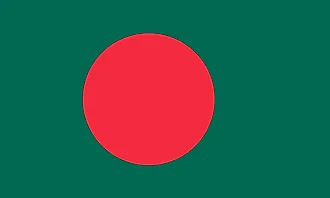
|
| Capital City | Dhaka |
| 23 43 N, 90 24 E | |
| Total Area | 148,460.00 km2 |
| Land Area | 130,170.00 km2 |
| Water Area | 18,290.00 km2 |
| Population | 163,046,161 |
| Major Cities |
|
| Currency | Taka (BDT) |
| GDP | $302.57 Billion |
| GDP Per Capita | $1,855.74 |
This page was last updated on August 3, 2023