Maps of Western Sahara

The Western Sahara is a disputed territory located in North Africa. The area is officially under the control of Morocco but remains de facto independent and its day-to-day life is largely dictated by the indigenous Sahrawis people. The Western Sahara borders the nations of Morocco, Algeria, and Mauritania. The entire nation is blanketed by the vast Sahara Desert and is considered to be one of the most inhospitable places on Earth. Aside from the rainfall that drifts in from the Atlantic Coast, Western Sahara receives little to no precipitation all year round.
Wadis or dry river beds that sometimes have intermittent flowing rivers dot the landscape in many parts. This can be found throughout the endless expanse of the Saharah but can be hard to find. Water is incredibly rare further inland which is why so many of the nation's towns and cities can be found along its coastline.
The Atlantic Ocean runs along the west side of the country and has a coastline of 1,110 kilometers. Here the land is at its lowest and many natural bays and ports can be found here. The largest city of Laayoune is located only a short distance from the ocean and is connected to the coast through a series of roads and highways.
The Sahara Desert is of course the most dominating feature of Western Sahara. With such intense heat and little access to water, only small bands of nomads and tribal peoples live out past the coastline. Considering its harsh climate it should be no shock that Western Sahara is one of the most sparsely populated nations on the planet.
Political Map of Western Sahara

Western Sahara is a disputed territory and as such, does not have any official administrative divisions of its own. The political status of Western Sahara is considered undetermined by the US Government. 80% of the territory is controlled and administered by Morocco. Portions of the regions Guelmim-Es Smara and Laayoune-Boujdour-Sakia El Hamra, as claimed by Morocco, lie within Western Sahara; Morocco also claims Oued Eddahab-Lagouira, another region that falls entirely within Western Sahara.
The remaining 20% is under the control of the self-proclaimed Sahrawi Arab Democratic Republic.
Western Sahara does not have an official national capital. Laayoune (El Aaiún) is the largest city.
Where is Western Sahara?

As observed on the location map of Western Sahara (a disputed territory), it is located on the Atlantic Ocean coast in northwest Africa. It is part of the Maghreb region of North and West Africa. It is located in the Northern and Western Hemisphere regions of the Earth. Western Sahara shares its land borders with Morocco and Algeria to the north and northeast respectively, and Mauritania to the east and south. The Atlantic Ocean borders it to the west and northwest.
Western Sahara Bordering Countries: Morocco, Algeria, Mauritania.
Regional Maps: Map of Africa
Outline Map of Western Sahara

The blank outline map respresents Western Sahara. The above map can be downloaded for free, and used for educational purposes like map-pointing activities.

The outline map of Western Sahara represents the disputed territory of Western Sahara. The land borders of the territory appear quite well-defined and straight while the Atlantic coast is undulated. Given its long history of conflict, some might even view its shape to resemble that of a pistol.
Key Facts
| Legal Name | Western Sahara |
|---|---|
| Flag |
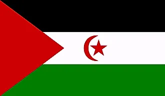
|
| Total Area | 266,000.00 km2 |
| Land Area | 266,000.00 km2 |
| Water Area | N/A |
| Population | 619,551 |
| Currency | Moroccan dirhams (MAD) |
This page was last updated on December 26, 2023